 Block
Lewisville, Indiana
11 topographic sheets cover this place, the earliest surveyed in 1948 and the latest in 1986. It stands in Franklin Township. It lies in ZIP code area 47352. It stands on Applebutter Creek. The Survey maps it on the Lewisville quadrangle. 337 people lived here at the 2020 count. It stands 1,053 feet above sea level.
On record in Lewisville
Buildings and businesses the archive holds for this place. Each opens its own page, with the source record it came from.
On the National Register 2 records
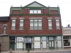 Guyer Opera Houselisted 1979
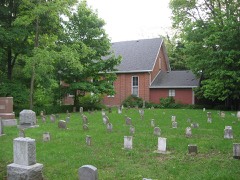 Richsquare Friends Meetinghouse and Cemeterylisted 2006
Population over time
2 figuresLewisville fell from 366 to 337 between 2010 and 2020. These are the recorded population figures Wikidata holds for this place, reached through the Geographic Names Information System number this page is keyed on rather than by name, so they belong to this place and not to another of the same name. Most are census counts, but not all are: an early figure may be a founding or settlement estimate, and an estimate published within five years of a census is left out. The change column is computed, and is left blank where more than 20 years separate a figure from the one before it, because a gap that long is not a change between two counts.
| Year | People | Change |
|---|---|---|
| 2010 | 366 | |
| 2020 | 337 | -29 (-8%) |
Topographic sheets covering this place
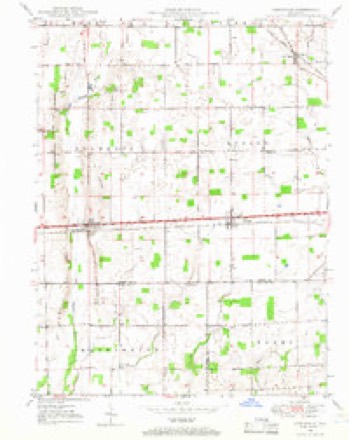
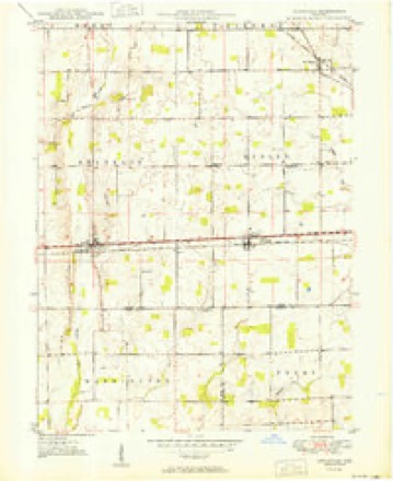
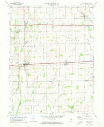
6 surveys from 11 printed sheetsMatched by testing this settlement's coordinate against the published boundary of every sheet in the United States Geological Survey's historical collection. Each opens the scanned sheet at the Survey.
- 1948 USGS Lewisville quadrangle1:24000
- 1950 USGS Lewisville quadrangle1:24000, 2 printings
- 1953 USGS Cincinnati quadrangle1:250000, 3 printings
- 1957 USGS Cincinnati quadrangle1:250000
- 1970 USGS Lewisville quadrangle1:24000, 2 printings
- 1986 USGS New Castle quadrangle1:100000, 2 printings



In the county-history sources
11,338 words on this townshipHistory of Henry County, Indiana : Together with Sketches of Its Cities, Villages, and Towns ... Also a Condensed History of Indiana, Embracing Accounts of Pre-historic Races, Aborigines, Winnebago and Black Hawk Wars, and a Brief Review of Its Civil and Political History., published 1884 names this settlement in its chapter on Franklin Township. These are the passages that mention it, exactly as the scans read.
Franklin Township was formed by the county commissioners, Jan. 5, 1830, from fractions of Dudley and Wayne. It then included nearly all of its present territory, all of Spiceland, and a small portion both of Wayne and Greensboro. In 1831 the western boundary was changed, giving a tier of sections from Franklin to Wayne. In 1838 a small portion was added to Greensboro and the land is generally fertile and the farms and improvements excellent. The enterprising town of Lewisville is the only village in the township. The Chicago, St. Louis & Pittsburg Eailroad crosses the southern part of the township from east to west.
Passage source: History of Henry County, Indiana : Together with Sketches of Its Cities, Villages, and Towns ... Also a Condensed History of Indiana, Embracing Accounts of Pre-historic Races, Aborigines, Winnebago and Black Hawk Wars, and a Brief Review of Its Civil and Political History., published 1884.
Along Flatrock Creek the first settlements in the township were made as early as 1822 - probably some came the year before. Achilles Morris, George See, Charles See and Moses Keen were among the first to begin improvements. Other early settlers up to 1833 were: Joseph Paul, Isaiah Hosier, Christopher Hedrick, Stanton Butler, John, James and Patton Ball, Daniel Johnson, Wm. and Robert Smith, Joseph Van Buskirk, James Butler, Isaac Parker, Wm. C. Goar, Matthew and Joseph Farley, Joseph White, Herman Herr, David Hedrick, Mark Wilson, John and Enos Heacock, Wm. Brown, Cyrus Coffin, T. W. Smith, Mahlon Pickering, John Russell, Martin Vickery, Philo Southwick and others. Moman Ballard, from West Virginia, came to Dudley Township in 1830, and to his present farm in Franklin in 1833. Joseph Fletcher, still living, came to the vicinity of Lewisville in 1822. Garnet Hayden was another early settler in the southern part of the township.
Passage source: History of Henry County, Indiana : Together with Sketches of Its Cities, Villages, and Towns ... Also a Condensed History of Indiana, Embracing Accounts of Pre-historic Races, Aborigines, Winnebago and Black Hawk Wars, and a Brief Review of Its Civil and Political History., published 1884.
A postoflSce, named Garnet, with Garnet Hayden, Postmaster, was established in the southern part of the township before Lewisville came into being. Soon after the town was founded Garnet was discontinued and Lewisville made a postoffice with Lewis C. Freeman, Postmaster. His successors in that oflice have been as follows: John Widows, Wm. L. Houston, T. J. Smith, Samuel Hopper, A. B. Guerin, A. I. McMeans, A. B. Guerin, J. 0. Howe andWm. L. Houston. The eastern portion of the town was laid out about 1837 by Wm. D. Westerfield and Roswell Spencer.
Passage source: History of Henry County, Indiana : Together with Sketches of Its Cities, Villages, and Towns ... Also a Condensed History of Indiana, Embracing Accounts of Pre-historic Races, Aborigines, Winnebago and Black Hawk Wars, and a Brief Review of Its Civil and Political History., published 1884.
Machine-read from a century-old scan, so expect the errors a machine makes: misspelled names, dropped words, stray characters.
Read the whole chapter on Franklin Township - it names this place 16 more 16 times.
Storms near this place
4 since 1995Regional context, not property-specific evidence. The National Weather Service names Lewisville in 4 storm reports between 1995 and 2018: 3 thunderstorm wind, 1 hail. No death or injury is recorded in these reports. Each account below is quoted exactly as the forecast office filed it, from the NOAA Storm Events Database, and each date opens the federal record of that event.
| When | Event | Place named | Harm | What the report says |
|---|---|---|---|---|
| May 1999 | Thunderstorm Wind | Lewisville | $5,000 | no account filed |
| May 2018 | Thunderstorm Wind | Lewisville | $1,000 | A dead tree, of unknown size, was blown across State Road 103 due to strong thunderstorm wind gusts. |
| May 1995 | Thunderstorm Wind | Lewisville | - | A 90-foot tower collapsed. |
| May 2005 | Hail | Lewisville | - | no account filed |
Nearest settlements
The eight closest, with where each one stands in the county. Distances are straight-line, computed from the Geographic Names Information System coordinates.
| Map | Place | Distance | Sheets |
|---|---|---|---|
| Straughn | 3.3 miles | 11 | |
| Dunreith | 4.6 miles | 10 | |
| Spiceland | 5.1 miles | 10 | |
| New Lisbon | 6.2 miles | 11 | |
| Ogden | 6.2 miles | 10 | |
| Corwin | 6.3 miles | 11 | |
| Pierson Station | 6.8 miles | 11 | |
| Stone Quarry Mills | 7.4 miles | 10 |
Elsewhere
Matched on this settlement's Geographic Names Information System number rather than its name, so it cannot be a different place of the same name in another state.
| Wikipedia article on Lewisville | An encyclopaedic summary. Its text is share-alike, so it is linked here rather than copied. |
| Wikidata item Q2562435 | The structured record the population and elevation above come from. Public domain (CC0). |
Provenance
This settlement is recorded in the Geographic Names Information System as feature 437809. The sheet list is computed by point-in-boundary test against the United States Geological Survey's historical topographic inventory. Both are works of the United States government and carry no copyright under 17 U.S.C. 105.
Storms. NOAA National Centers for Environmental Information, Storm Events Database https://www.ncei.noaa.gov/stormevents/ A work of the United States government, no copyright under 17 U.S.C. 105. Narratives are quoted verbatim from the National Weather Service report and are not edited or summarised.