 Block
Spiceland, Indiana
10 topographic sheets cover this place, the earliest surveyed in 1950 and the latest in 1986. It stands in Spiceland Township. It lies in ZIP code area 47385. The Survey maps it on the Dunreith quadrangle. 958 people lived here at the 2020 count. It stands 1,050 feet above sea level.
Population over time
2 figuresSpiceland grew from 890 to 958 between 2010 and 2020. These are the recorded population figures Wikidata holds for this place, reached through the Geographic Names Information System number this page is keyed on rather than by name, so they belong to this place and not to another of the same name. Most are census counts, but not all are: an early figure may be a founding or settlement estimate, and an estimate published within five years of a census is left out. The change column is computed, and is left blank where more than 20 years separate a figure from the one before it, because a gap that long is not a change between two counts.
| Year | People | Change |
|---|---|---|
| 2010 | 890 | |
| 2020 | 958 | +68 (+8%) |
Topographic sheets covering this place
5 surveys from 10 printed sheetsMatched by testing this settlement's coordinate against the published boundary of every sheet in the United States Geological Survey's historical collection. Each opens the scanned sheet at the Survey.
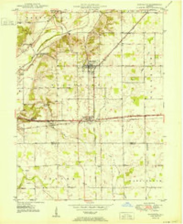
- 1950 USGS Dunreith quadrangle1:24000
- 1953 USGS Cincinnati quadrangle1:250000, 3 printings
- 1957 USGS Cincinnati quadrangle1:250000
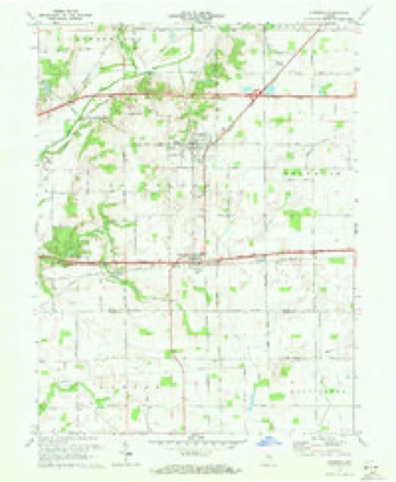
- 1970 USGS Dunreith quadrangle1:24000, 3 printings
- 1986 USGS New Castle quadrangle1:100000, 2 printings



In the county-history sources
20,592 words on this townshipHistory of Henry County, Indiana : Together with Sketches of Its Cities, Villages, and Towns ... Also a Condensed History of Indiana, Embracing Accounts of Pre-historic Races, Aborigines, Winnebago and Black Hawk Wars, and a Brief Review of Its Civil and Political History., published 1884 names this settlement in its chapter on Spiceland Township. These are the passages that mention it, exactly as the scans read.
Among those who were residents of the township prior to 1830 may be mentioned: John Sheridan, east of Spiceland Village; Josiah Small, George Evans, Hugh Mills. Josiah Pennington, Benjamin Ball, Driver Boon and James Archer. Snlomon lVla.ey, now living in Spiceland, came to the county in 1826 and settled in 1830. Others came to the county at the dates given: Jeremiah Griffin, 1824; Joseph Griffin, 1825; Josiah Pennington, 1823; Christian Font, 1820; Jesse_HQiid, 1825; Eli Ratcliff, Hathan Scoville, 1825; Jesse B. Jessup, Isaac Hodson, 1827; Daniel C. Jackson, 1824; Aaron Stanley, Wm. B. Un thank, Walter Edgerton, Wm. Edgerton, 1830.
Passage source: History of Henry County, Indiana : Together with Sketches of Its Cities, Villages, and Towns ... Also a Condensed History of Indiana, Embracing Accounts of Pre-historic Races, Aborigines, Winnebago and Black Hawk Wars, and a Brief Review of Its Civil and Political History., published 1884.
Spiceland Township contains a valuable stone quarry. The villages of Spiceland. Ogden and Dunreith are all railroad stations having business interests of importance. The township officers for 1884-'5areJ. T. Unthank, Trustee; David Wickers^m and C. A. Swaim, Justices.
Passage source: History of Henry County, Indiana : Together with Sketches of Its Cities, Villages, and Towns ... Also a Condensed History of Indiana, Embracing Accounts of Pre-historic Races, Aborigines, Winnebago and Black Hawk Wars, and a Brief Review of Its Civil and Political History., published 1884.
The village was incorporated in 1870, and then had a population of 375. From that time forward improvements have progressed rapidly. The building of the Hew Castle & Rushville Railroad in 1881 has added much to the prosperity of the town. The population was 527 in 1880, and in 1883, 662 according to the school census. Spiceland is the home of morality, culture and refinement.
Passage source: History of Henry County, Indiana : Together with Sketches of Its Cities, Villages, and Towns ... Also a Condensed History of Indiana, Embracing Accounts of Pre-historic Races, Aborigines, Winnebago and Black Hawk Wars, and a Brief Review of Its Civil and Political History., published 1884.
Machine-read from a century-old scan, so expect the errors a machine makes: misspelled names, dropped words, stray characters.
Read the whole chapter on Spiceland Township - it names this place 52 more 52 times.
Mines and quarries near this place
3 within 5 milesRegional context, not property-specific evidence. The federal mineral resources record lists 3 workings within 5 miles of Spiceland: 3 past producers. None of them still produces. What was taken out: Sand and Gravel, Construction. Distance is straight-line from the map coordinates, so a quarry counted here may appear on a neighbouring settlement's page as well.
| Where | Site | Commodity | Status | Recorded |
|---|---|---|---|---|
| Fred Goodier Gravel Pit | Sand and Gravel, Construction | Past Producer | ||
| James L. Craig Pit | Sand and Gravel, Construction | Past Producer | ||
| Omar V. Davis Pit | Sand and Gravel, Construction | Past Producer |
Storms near this place
7 since 2005Regional context, not property-specific evidence. The National Weather Service names Spiceland in 7 storm reports between 2005 and 2026: 5 thunderstorm wind, 2 hail. No death or injury is recorded in these reports. Each account below is quoted exactly as the forecast office filed it, from the NOAA Storm Events Database, and each date opens the federal record of that event.
| When | Event | Place named | Harm | What the report says |
|---|---|---|---|---|
| June 2009 | Hail | Spiceland | $25,000 | Golf ball sized hail caused damage to a number of vehicles parked at a Flying J truck stop just off of the Interstate 70-Spiceland exit. Damage to the vehicles included dents, broken windshields, and broken plastic rain guards. |
| July 2023 | Thunderstorm Wind | Spiceland | $2,000 | Large tree limbs downed by thunderstorm wind gusts. |
| September 2005 | Thunderstorm Wind | Spiceland | $2,000 | A power pole was snapped off ten feet above ground. |
| February 2026 | Thunderstorm Wind | Spiceland | $1,000 | Thunderstorm wind gusts downed a large tree. |
| July 2017 | Thunderstorm Wind | Spiceland | $1,000 | A tree was downed on Broad Street due to damaging thunderstorm wind gusts. |
| July 2011 | Thunderstorm Wind | Spiceland | $1,000 | An 18 to 24-inch diameter tree was downed across County Road 375 West due to damaging thunderstorm wind gusts. Also, dime to quarter sized hail was observed. |
| July 2006 | Hail | Spiceland | - | no account filed |
Nearest settlements
The eight closest, with where each one stands in the county. Distances are straight-line, computed from the Geographic Names Information System coordinates.
| Map | Place | Distance | Sheets |
|---|---|---|---|
| Stone Quarry Mills | 2.4 miles | 10 | |
| Dunreith | 2.4 miles | 10 | |
| Greensboro | 2.9 miles | 11 | |
| Ogden | 3.1 miles | 10 | |
| Raysville | 4.9 miles | 9 | |
| Lewisville | 5.1 miles | 11 | |
| Mount Lawn | 5.2 miles | 11 | |
| Knightstown | 5.5 miles | 9 |
Elsewhere
Matched on this settlement's Geographic Names Information System number rather than its name, so it cannot be a different place of the same name in another state.
| Wikipedia article on Spiceland | An encyclopaedic summary. Its text is share-alike, so it is linked here rather than copied. |
| Wikidata item Q2217797 | The structured record the population and elevation above come from. Public domain (CC0). |
Provenance
This settlement is recorded in the Geographic Names Information System as feature 443945. The sheet list is computed by point-in-boundary test against the United States Geological Survey's historical topographic inventory. Both are works of the United States government and carry no copyright under 17 U.S.C. 105.
Mines and quarries. USGS Mineral Resources Data System (MRDS) https://mrdata.usgs.gov/mrds/ A work of the United States government, no copyright under 17 U.S.C. 105.
Storms. NOAA National Centers for Environmental Information, Storm Events Database https://www.ncei.noaa.gov/stormevents/ A work of the United States government, no copyright under 17 U.S.C. 105. Narratives are quoted verbatim from the National Weather Service report and are not edited or summarised.