 Block
Luray, Indiana
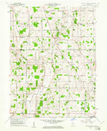
13 topographic sheets cover this place, the earliest surveyed in 1953 and the latest in 1986. It stands in Prairie Township. It lies in ZIP code area 47302. It stands on Little Buck Creek. The Survey maps it on the Mount Pleasant quadrangle. It stands 1,001 feet above sea level.
Topographic sheets covering this place
4 surveys from 13 printed sheetsMatched by testing this settlement's coordinate against the published boundary of every sheet in the United States Geological Survey's historical collection. Each opens the scanned sheet at the Survey.
- 1953 USGS Muncie quadrangle1:250000, 5 printings
- 1956 USGS Muncie quadrangle1:250000
- 1960 USGS Mount Pleasant quadrangle1:24000, 4 printings
- 1986 USGS Muncie quadrangle1:100000, 3 printings



In the county-history sources
18,112 words on this townshipHistory of Henry County, Indiana : Together with Sketches of Its Cities, Villages, and Towns ... Also a Condensed History of Indiana, Embracing Accounts of Pre-historic Races, Aborigines, Winnebago and Black Hawk Wars, and a Brief Review of Its Civil and Political History., published 1884 names this settlement in its chapter on Prairie Township. These are the passages that mention it, exactly as the scans read.
Hillshoro^ although one of the oldest villages in the county, is yet one of the smallest. It is situated in the southeastern part of Prairie Township, and in 1880 had a population of ninety. The village was laid out in 1830 by Thomas Maston and Samuel Rinehart. A postoffice named ''Dan Webster" was established here several years ago but was afterward discontinued.
Passage source: History of Henry County, Indiana : Together with Sketches of Its Cities, Villages, and Towns ... Also a Condensed History of Indiana, Embracing Accounts of Pre-historic Races, Aborigines, Winnebago and Black Hawk Wars, and a Brief Review of Its Civil and Political History., published 1884.
Charles E. Hall^ merchant, Springport, Ind., is a native of Henry County, born April IJ, 1860, a son of James and Mary (Ball) Hall. His father was a native of Clark County, Ohio, and came to Henry County, Ind., with his parents when ten years of age. He now owns a fine farm near Knightstown. Charles was reared on a farm, but when twenty years of age began clerking for J. M. Hickman. In Feburary, 1881, he purchased Mr. Hickman's stock and is now carrying on the business. He has a fine stock of goods, and commands a good trade. He is an energetic young man, and is universally, esteemed, both in business and social circles.
Passage source: History of Henry County, Indiana : Together with Sketches of Its Cities, Villages, and Towns ... Also a Condensed History of Indiana, Embracing Accounts of Pre-historic Races, Aborigines, Winnebago and Black Hawk Wars, and a Brief Review of Its Civil and Political History., published 1884.
Roderick D. Norviel^ M. is a native of Madison County, Ohio, born Aug. 2, 1836, the youngest of ten children of Nathaniel and Elizabeth (Tharp) Norviel, natives of Connecticut, of Scotch descent. His parents were married in their native State, and in 1833 moved to Ohio, and settled in Copley, and subsequently moved to Madison County, and from there to Hnion County in 1842, where the Doctor was reared and received liis early education. He then attended Marysville Academy and |he Delaware College, and after leaving school taught in Ohio tert years. In 1863 he went to Mahaska County, Iowa, and taught in Prairie College a year. In 1864 he returned to Ohio and enlisted as First Sergeant of Company K, One Hundred and Thirty-second Ohio Infantry, and participated in the battles of Richmond and Petersburg. After leaving the army he began the study of medicine with Prof. William T. Sharp, of West Middleburg. In the fall of 1866 he came to Indi- ana and located in Farmland, Randolph County, and began the practice of his profession. The next winter he taught school, and in the spring resumed his practice. In 1878 he moved to Mt. Summit, Henry County, where he has built up a large practice. Mr. Norviel was married in 1852 to Rachel, daughter of Jesse and Elizabeth Downs. She died in Mahaska County, Iowa, Dec. 17, 1863, leaving three children - Sarah C., now Mrs. Richard Kirel; Frank D., in the office of the Cincinnati, Indianapolis & Louisville Railroad, married Mary Hildebrand, of Indianapolis, and Oliver D., an attorney of Knoxville, Iowa, In March, 1867, Dr. Korviel married Ella Spillers, daughter of George and Mary M. Spillers, of Randolph County, Ind.
Passage source: History of Henry County, Indiana : Together with Sketches of Its Cities, Villages, and Towns ... Also a Condensed History of Indiana, Embracing Accounts of Pre-historic Races, Aborigines, Winnebago and Black Hawk Wars, and a Brief Review of Its Civil and Political History., published 1884.
Machine-read from a century-old scan, so expect the errors a machine makes: misspelled names, dropped words, stray characters.
Read the whole chapter on Prairie Township - it names this place 4 more 4 times.
Mines and quarries near this place
3 within 5 milesRegional context, not property-specific evidence. The federal mineral resources record lists 3 workings within 5 miles of Luray: 2 past producers, 1 producer. 1 still produces. What was taken out: Sand and Gravel, Construction. Distance is straight-line from the map coordinates, so a quarry counted here may appear on a neighbouring settlement's page as well.
| Where | Site | Commodity | Status | Recorded |
|---|---|---|---|---|
| Luray Pit | Sand and Gravel, Construction | Producer | ||
| Mt. Summit Pit | Sand and Gravel, Construction | Past Producer | ||
| Springport Plant | Sand and Gravel, Construction | Past Producer |
Storms near this place
1 since 2026Regional context, not property-specific evidence. The National Weather Service names Luray in 1 storm report in 2026: 1 thunderstorm wind. No death or injury is recorded in these reports. Each account below is quoted exactly as the forecast office filed it, from the NOAA Storm Events Database, and each date opens the federal record of that event.
| When | Event | Place named | Harm | What the report says |
|---|---|---|---|---|
| April 2026 | Thunderstorm Wind | Luray | $2,000 | Tree downed by thunderstorm wind gusts. |
Nearest settlements
The eight closest, with where each one stands in the county. Distances are straight-line, computed from the Geographic Names Information System coordinates.
| Map | Place | Distance | Sheets |
|---|---|---|---|
| Springport | 2.2 miles | 13 | |
| Rogersville | 3.2 miles | 13 | |
| Mount Summit | 4.7 miles | 13 | |
| Sulphur Springs | 6.1 miles | 13 | |
| Fayne Siding | 6.7 miles | 11 | |
| Blountsville | 6.8 miles | 11 | |
| Honey Creek | 6.8 miles | 13 | |
| Foley | 7.3 miles | 11 |
Elsewhere
Matched on this settlement's Geographic Names Information System number rather than its name, so it cannot be a different place of the same name in another state.
| Wikipedia article on Luray | An encyclopaedic summary. Its text is share-alike, so it is linked here rather than copied. |
| Wikidata item Q6704898 | The structured record the population and elevation above come from. Public domain (CC0). |
Provenance
This settlement is recorded in the Geographic Names Information System as feature 438410. The sheet list is computed by point-in-boundary test against the United States Geological Survey's historical topographic inventory. Both are works of the United States government and carry no copyright under 17 U.S.C. 105.
Mines and quarries. USGS Mineral Resources Data System (MRDS) https://mrdata.usgs.gov/mrds/ A work of the United States government, no copyright under 17 U.S.C. 105.
Storms. NOAA National Centers for Environmental Information, Storm Events Database https://www.ncei.noaa.gov/stormevents/ A work of the United States government, no copyright under 17 U.S.C. 105. Narratives are quoted verbatim from the National Weather Service report and are not edited or summarised.