 Block
Rogersville, Indiana
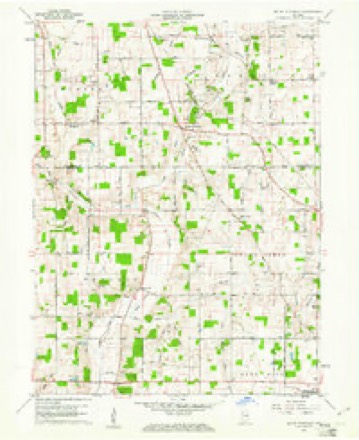
13 topographic sheets cover this place, the earliest surveyed in 1953 and the latest in 1986. It stands in Prairie Township. It lies in ZIP code area 47360. It stands on Moon Brook. The Survey maps it on the Mount Pleasant quadrangle. It stands 1,024 feet above sea level.
Topographic sheets covering this place
4 surveys from 13 printed sheetsMatched by testing this settlement's coordinate against the published boundary of every sheet in the United States Geological Survey's historical collection. Each opens the scanned sheet at the Survey.
- 1953 USGS Muncie quadrangle1:250000, 5 printings
- 1956 USGS Muncie quadrangle1:250000
- 1960 USGS Mount Pleasant quadrangle1:24000, 4 printings
- 1986 USGS Muncie quadrangle1:100000, 3 printings



In the county-history sources
18,112 words on this townshipHistory of Henry County, Indiana : Together with Sketches of Its Cities, Villages, and Towns ... Also a Condensed History of Indiana, Embracing Accounts of Pre-historic Races, Aborigines, Winnebago and Black Hawk Wars, and a Brief Review of Its Civil and Political History., published 1884 names this settlement in its chapter on Prairie Township. These are the passages that mention it, exactly as the scans read.
born May 10, 1790, and his mother a native of Delaware', born in October, 1800. His parents were among the first settlers of Henry County, coming here in October, 1831. They were married in X824, and to them were born three children - Elizabeth, afterward l,\,'iMrs. Milton T. H^s; John and Wm. T. The father died in 1872 and the mother in 1876. His father was a soldier in the war of 1812. William T. has always been engaged in farming and stockraising and now owns a farm of 265 acres, a mile and a quarter from Mount Summit. He was married May 12, 1854, to Rebecca- W., daughter of John Rutledge, of Delaware County. She died Sept. 14, 1855. July 26, 1856, Mr. Shively married Mildred H. daughter of William and Sarah Ann (Finks) House. They have had four children - James Milton, born May 30, 1857, died Dec. 26, 1857; William Franklin, born Oct. 28, 1858, died Dec. 8 1858; Margaret, born May 21, 1861; and Ella, born Oct. 22,1864! Mr. and Mrs. Shively are members of the Christian church. Politically he is a Republican,
Passage source: History of Henry County, Indiana : Together with Sketches of Its Cities, Villages, and Towns ... Also a Condensed History of Indiana, Embracing Accounts of Pre-historic Races, Aborigines, Winnebago and Black Hawk Wars, and a Brief Review of Its Civil and Political History., published 1884.
Machine-read from a century-old scan, so expect the errors a machine makes: misspelled names, dropped words, stray characters.
Read the whole chapter on Prairie Township - it names this place 1 more 1 time.
Mines and quarries near this place
3 within 5 milesRegional context, not property-specific evidence. The federal mineral resources record lists 3 workings within 5 miles of Rogersville: 2 past producers, 1 producer. 1 still produces. What was taken out: Sand and Gravel, Construction. Distance is straight-line from the map coordinates, so a quarry counted here may appear on a neighbouring settlement's page as well.
| Where | Site | Commodity | Status | Recorded |
|---|---|---|---|---|
| Luray Pit | Sand and Gravel, Construction | Producer | ||
| Mt. Summit Pit | Sand and Gravel, Construction | Past Producer | ||
| Springport Plant | Sand and Gravel, Construction | Past Producer |
Nearest settlements
The eight closest, with where each one stands in the county. Distances are straight-line, computed from the Geographic Names Information System coordinates.
| Map | Place | Distance | Sheets |
|---|---|---|---|
| Luray | 3.2 miles | 13 | |
| Springport | 3.5 miles | 13 | |
| Mount Summit | 3.6 miles | 13 | |
| Messick | 4.4 miles | 11 | |
| Hillsboro | 4.7 miles | 11 | |
| Mooreland | 4.9 miles | 11 | |
| Blountsville | 5.0 miles | 11 | |
| Fayne Siding | 5.2 miles | 11 |
Elsewhere
Matched on this settlement's Geographic Names Information System number rather than its name, so it cannot be a different place of the same name in another state.
| Wikipedia article on Rogersville | An encyclopaedic summary. Its text is share-alike, so it is linked here rather than copied. |
| Wikidata item Q16899419 | The structured record the population and elevation above come from. Public domain (CC0). |
Provenance
This settlement is recorded in the Geographic Names Information System as feature 442256. The sheet list is computed by point-in-boundary test against the United States Geological Survey's historical topographic inventory. Both are works of the United States government and carry no copyright under 17 U.S.C. 105.
Mines and quarries. USGS Mineral Resources Data System (MRDS) https://mrdata.usgs.gov/mrds/ A work of the United States government, no copyright under 17 U.S.C. 105.