 Block
Middletown, Indiana
13 topographic sheets cover this place, the earliest surveyed in 1953 and the latest in 1986. It stands in Fall Creek Township. It lies in ZIP code area 47356. It stands on Sugar Creek. The Survey maps it on the Middletown quadrangle. 2,253 people lived here at the 2020 count. It stands 978 feet above sea level.
On record in Middletown
Buildings and businesses the archive holds for this place. Each opens its own page, with the source record it came from.
On the National Register 2 records
 John W. Hedrick Houselisted 1984
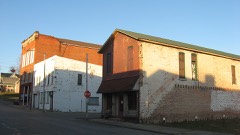 Middletown Commercial Historic Districtlisted 2010
Population over time
2 figuresMiddletown fell from 2,322 to 2,253 between 2010 and 2020. These are the recorded population figures Wikidata holds for this place, reached through the Geographic Names Information System number this page is keyed on rather than by name, so they belong to this place and not to another of the same name. Most are census counts, but not all are: an early figure may be a founding or settlement estimate, and an estimate published within five years of a census is left out. The change column is computed, and is left blank where more than 20 years separate a figure from the one before it, because a gap that long is not a change between two counts.
| Year | People | Change |
|---|---|---|
| 2010 | 2,322 | |
| 2020 | 2,253 | -69 (-3%) |
Topographic sheets covering this place
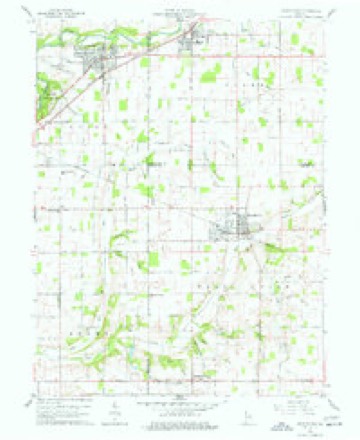
4 surveys from 13 printed sheetsMatched by testing this settlement's coordinate against the published boundary of every sheet in the United States Geological Survey's historical collection. Each opens the scanned sheet at the Survey.
- 1953 USGS Muncie quadrangle1:250000, 5 printings
- 1956 USGS Muncie quadrangle1:250000
- 1960 USGS Middletown quadrangle1:24000, 4 printings
- 1986 USGS Muncie quadrangle1:100000, 3 printings



In the county-history sources
14,386 words on this townshipHistory of Henry County, Indiana : Together with Sketches of Its Cities, Villages, and Towns ... Also a Condensed History of Indiana, Embracing Accounts of Pre-historic Races, Aborigines, Winnebago and Black Hawk Wars, and a Brief Review of Its Civil and Political History., published 1884 names this settlement in its chapter on Fall Creek Township. These are the passages that mention it, exactly as the scans read.
Fall Creek Township was formed in August, 1829. It was then eight miles from north to south and seven miles from east to west. Two rows of sections on the east and two on the south have since became parts of Jefferson and Harrison townships respectively.
Passage source: History of Henry County, Indiana : Together with Sketches of Its Cities, Villages, and Towns ... Also a Condensed History of Indiana, Embracing Accounts of Pre-historic Races, Aborigines, Winnebago and Black Hawk Wars, and a Brief Review of Its Civil and Political History., published 1884.
The township is drained by the stream from which it derives its name and the tributaries thereof. The surface is undulating though but little broken. The soil is of good quality and the farms and improvements as good as the average in the county. A large part of the present inhabitants are either Virginians or descendants of natives of that State. Fall Creek Township is situated in the northwestern part of the county and is crossed from southeast to northwest by the Chicago, St. Louis & Pittsburg Railroad. It contains the thriving town of Middletown and the villages of Meehan icsburg and Honey Creek.
Passage source: History of Henry County, Indiana : Together with Sketches of Its Cities, Villages, and Towns ... Also a Condensed History of Indiana, Embracing Accounts of Pre-historic Races, Aborigines, Winnebago and Black Hawk Wars, and a Brief Review of Its Civil and Political History., published 1884.
Three persons only made entries of land in Fall Creek Township in 1822 : Benj. G. Bristol, James W. Weir and Reuben Bristol. They did not settle until later. The first settlements seem to have been made on Fall Creek. The Keesling neighborhood, near Me- chanicsbnrg, was one of the first settlements. It began about 1824. In that vicinity lived Jacob, Peter, George, Daniel and John Keesling. William Stewart, John Hart, Jacob Koontz, Calvin Franklin, Abraham Thomas and John Swain came among the first settlers, about 1824 and 1825. Among those who settled in various parts of the township from 1824 to 1832 were David Davis, Absalom and Alexander Painter, Jacob Stanley, Asa Warnick, David C. Sherman, Wm. Berner, Joseph Bowman, Daniel and David Warner, the Fadelys, - John, Michael and Henry, - Abraham Showal er, Woodson and James Cummings, Jesse Clark, Hudson Hall, Andrew Barton, Abraham Devoye, Sr., Abraham Devoye, Jr., John Fessler and others.
Passage source: History of Henry County, Indiana : Together with Sketches of Its Cities, Villages, and Towns ... Also a Condensed History of Indiana, Embracing Accounts of Pre-historic Races, Aborigines, Winnebago and Black Hawk Wars, and a Brief Review of Its Civil and Political History., published 1884.
Machine-read from a century-old scan, so expect the errors a machine makes: misspelled names, dropped words, stray characters.
Read the whole chapter on Fall Creek Township - it names this place 44 more 44 times.
Mines and quarries near this place
1 within 5 milesRegional context, not property-specific evidence. The federal mineral resources record lists 1 working within 5 miles of Middletown: 1 producer. All of them still produce. What was taken out: Sand and Gravel, Construction. Distance is straight-line from the map coordinates, so a quarry counted here may appear on a neighbouring settlement's page as well.
| Where | Site | Commodity | Status | Recorded |
|---|---|---|---|---|
| Chesterfield Pit | Sand and Gravel, Construction | Producer |
Storms near this place
20 since 1996Regional context, not property-specific evidence. The National Weather Service names Middletown in 20 storm reports between 1996 and 2019: 9 thunderstorm wind, 7 hail, 2 tornado, 1 flash flood. The reports record 2 injuries. Each account below is quoted exactly as the forecast office filed it, from the NOAA Storm Events Database, and each date opens the federal record of that event.
| When | Event | Place named | Harm | What the report says |
|---|---|---|---|---|
| July 2011 | Lightning | Middletown | 2 hurt | Police say two 11-year-old boys hurt by a lightning strike in central Indiana were attending a family reunion when the storm rolled in. Officials say one child of Cambridge, Md., was in critical but stable condition at Riley Hospital for Children in Indianapolis, while the other of Indianapolis was hospitalized in fair condition. The Henry County Sheriff's Department says the boys were shocked on Saturday near Middletown's Miller Cemetery. The Star Press of Muncie reports that emergency workers performed CPR on one of the boys at the scene and that he began breathing on his own again after he was taken to the Indianapolis hospital. |
| May 2000 | Hail | Middletown | $5,000,000 | no account filed |
| August 1998 | Thunderstorm Wind | Middletown | $25,000 | Thunderstorm winds blew down barn in Blountsville and tree in Middletown. |
| May 2019 | Tornado (EF1) | Middletown | $20,000 | NWS Indianapolis found tornado damage 2 miles south of Middletown. The EF-1 rated tornado, with max wind speeds of 110 mph, brought down numerous branches and large tree trunks were snapped and lying in all directions. There was also a second hand report of someone who says they saw the tornado. |
| May 2019 | Thunderstorm Wind | Middletown | $7,000 | Several 3-foot trees were downed due to damaging thunderstorm wind gusts. |
| June 2008 | Flash Flood | Middletown | $2,000 | Widespread flash flooding occurred across Henry county, flooding many roads. |
| July 1998 | Thunderstorm Wind | Middletown | $500 | Two foot diameter tree blown down. |
| June 2008 | Thunderstorm Wind | Middletown | - | Trees were blown down due to damaging thunderstorm winds. |
| July 1999 | Thunderstorm Wind | Middletown | - | 2 trees blown down between Middletown and HoneyCreek. A farm wagon was also blown around. |
| May 2005 | Hail | Middletown | - | no account filed |
| March 2003 | Hail | Middletown | - | no account filed |
| April 2003 | Thunderstorm Wind | Middletown | - | no account filed |
| October 2001 | Hail | Middletown | - | no account filed |
| May 2000 | Hail | Middletown | - | no account filed |
| June 2000 | Thunderstorm Wind | Middletown | - | no account filed |
| June 2000 | Tornado (F0) | Middletown | - | no account filed |
| August 2000 | Thunderstorm Wind | Middletown | - | no account filed |
| September 2000 | Thunderstorm Wind | Middletown | - | no account filed |
| July 1997 | Hail | Middletown | - | no account filed |
| June 1996 | Hail | Middletown | - | no account filed |
Nearest settlements
The eight closest, with where each one stands in the county. Distances are straight-line, computed from the Geographic Names Information System coordinates.
| Map | Place | Distance | Sheets |
|---|---|---|---|
| Honey Creek | 3.2 miles | 13 | |
| Mechanicsburg | 3.8 miles | 13 | |
| Sulphur Springs | 6.2 miles | 13 | |
| Springport | 7.6 miles | 13 | |
| Cadiz | 7.8 miles | 11 | |
| Mount Summit | 8.9 miles | 13 | |
| Luray | 9.1 miles | 13 | |
| Fayne Siding | 9.7 miles | 11 |
Elsewhere
Matched on this settlement's Geographic Names Information System number rather than its name, so it cannot be a different place of the same name in another state.
| Wikipedia article on Middletown | An encyclopaedic summary. Its text is share-alike, so it is linked here rather than copied. |
| Wikidata item Q2680789 | The structured record the population and elevation above come from. Public domain (CC0). |
Provenance
This settlement is recorded in the Geographic Names Information System as feature 439117. The sheet list is computed by point-in-boundary test against the United States Geological Survey's historical topographic inventory. Both are works of the United States government and carry no copyright under 17 U.S.C. 105.
Mines and quarries. USGS Mineral Resources Data System (MRDS) https://mrdata.usgs.gov/mrds/ A work of the United States government, no copyright under 17 U.S.C. 105.
Storms. NOAA National Centers for Environmental Information, Storm Events Database https://www.ncei.noaa.gov/stormevents/ A work of the United States government, no copyright under 17 U.S.C. 105. Narratives are quoted verbatim from the National Weather Service report and are not edited or summarised.