 Block
Mount Vernon, Indiana
19 topographic sheets cover this place, the earliest surveyed in 1917 and the latest in 1991. It stands in Black Township. It lies in ZIP code area 47620. It stands on McFadden Creek. The Survey maps it on the Mount Vernon quadrangle. 6,493 people lived here at the 2020 count. It stands 400 feet above sea level.
On record in Mount Vernon
Buildings and businesses the archive holds for this place. Each opens its own page, with the source record it came from.
On the National Register 3 records
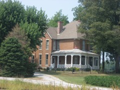 Frederick and Augusta Hagemann Farmlisted 1993
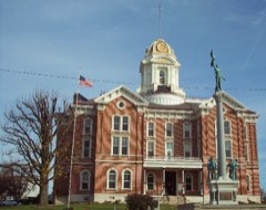 Posey County Courthouse Squarelisted 1989
- Mount Vernon Downtown Historic Districtlisted 2003
Population over time
2 figuresMount Vernon fell from 6,687 to 6,493 between 2010 and 2020. These are the recorded population figures Wikidata holds for this place, reached through the Geographic Names Information System number this page is keyed on rather than by name, so they belong to this place and not to another of the same name. Most are census counts, but not all are: an early figure may be a founding or settlement estimate, and an estimate published within five years of a census is left out. The change column is computed, and is left blank where more than 20 years separate a figure from the one before it, because a gap that long is not a change between two counts.
| Year | People | Change |
|---|---|---|
| 2010 | 6,687 | |
| 2020 | 6,493 | -194 (-3%) |
Topographic sheets covering this place
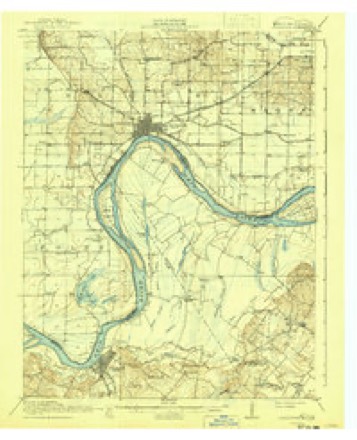
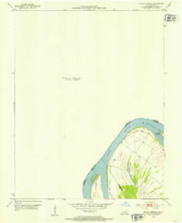
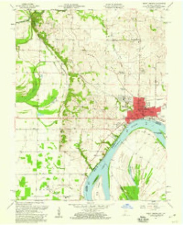
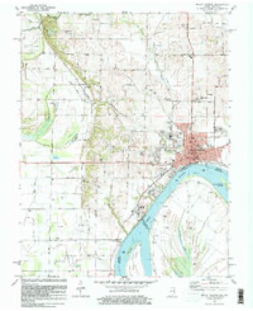
9 surveys from 19 printed sheetsMatched by testing this settlement's coordinate against the published boundary of every sheet in the United States Geological Survey's historical collection. Each opens the scanned sheet at the Survey.
- 1917 USGS Uniontown quadrangle1:62500, 6 printings
- 1952 USGS Mount Vernon quadrangle1:24000, 2 printings
- 1954 USGS Evansville quadrangle1:250000
- 1957 USGS Evansville quadrangle1:250000, 3 printings
- 1957 USGS Mount Vernon quadrangle1:24000, 2 printings
- 1961 USGS Evansville quadrangle1:250000, 2 printings
- 1981 USGS Mount Vernon quadrangle1:24000
- 1986 USGS Evansville quadrangle1:100000
- 1991 USGS Evansville quadrangle1:100000
In the county-history sources
35,592 words on this townshipHistory and Directory of Posey County [Indiana] : Containing an Account of the Early Settlement and Organization of the County ... : Also a Complete List of the Tax-payers, Their Post-office Addresses and Places of Residence, Together with a Business Directory of Mt. Vernon and New Harmony ... Also Biographical Sketches of Prominent Citizens of the County, published 1882; History of Posey County, Indiana : from the Earliest Times to the Present, with Biographical Sketches, Reminiscences, Notes, Etc. : Together with an Extended History of the Northwest, the Indiana Territory, and the State of Indiana, published 1886 names this settlement in its chapter on Black Township. These are the passages that mention it, exactly as the scans read.
Was named after Hugh. William and Thomas Black, three brothers, who were among the very earliest settlers, and who were highly respected by their acquaintances. On March 24, 1817, when the township was organized its territory included what is now known as Point, which, from August 14, 182 1, until May 13, 1822, was called Daniel township, named in honor of John Daniel, the first permanent settler there. The first election held in this township was at the house of Thomas Givens, in Mt. Vernon. It is the wealthiest township in the County, and, in 1880, had under cultivation 43,007 acres of land, the yield of wheat and corn per acre averaging respectively fifteen and thirty-five bushels. Its surface is gently undulating, its soil is very fertile and its inhabitants, as a class, are frugal, industrious and enterprising. It contained, according to the census report of 1880, 7,000 inhabitants. Its educational facilities are superior, its standard of morality is high and its sanitary condition is excellent. Among the earliest settlers of this township were Win. Curtis, father of Thomas, Joshua and Wm. B. (who is the father of George W., the incumbent of the County Clerk's office), and his cousin, Kel Curtis. They came to the County in 181 1. -'Aunt Becky" McFaddin, who died at Mt. Vernon, February 3, 1873, in the eighty-seventh year of her age, and who was the widow of Andrew McFaddin, was a resident of this
This township was not reduced to its present limits with its present name until March 13, 1822. It was named in honor of the Black family who came fi-om North Carolina in 1806 and settled a short distance northwest of Mount Vernon.
Passage source: History of Posey County, Indiana : from the Earliest Times to the Present, with Biographical Sketches, Reminiscences, Notes, Etc. : Together with an Extended History of the Northwest, the Indiana Territory, and the State of Indiana, published 1886.
Adam Albright squatted in the county in 1807 in the Albright settlement. The sons of Adam Albright were William, John and Adam. They were from North Carolina. The Aldridge family settled in the township in 1810; they, too, were from North Carolina. Of the older ones were Samuel, Elijah, Eeuben, Henry (who was a gunsmith), William and Aaron. The father of these was John Aldridge, who was something of a blacksmith. The family are now quite numerous. Other early settlers were Joseph Holleman, Thomas Kussell, John and Aaron Burlison, and the Todd family, who came from Charlottesville, N. C. The elder ones were Hugh and William Todd. They both were at Tippecanoe, but the former, like the New York soldier at Bull Kun, being ordered to retreat and not ordered to halt, went on home. William Todd was something of a wheelwright. Of the younger Todds there were Samuel, John, William and Darius. Thomas Jones and sons, Nathan and Milton, are also numbered among the first settlers.
Passage source: History of Posey County, Indiana : from the Earliest Times to the Present, with Biographical Sketches, Reminiscences, Notes, Etc. : Together with an Extended History of the Northwest, the Indiana Territory, and the State of Indiana, published 1886.
Machine-read from a century-old scan, so expect the errors a machine makes: misspelled names, dropped words, stray characters.
Read the whole chapter on Black Township - it names this place 109 more 109 times.
Fires near this place
1 since 2010Regional context, not property-specific evidence. The federal wildfire occurrence database lists 1 fire within 5 miles of Mount Vernon in 2010, burning about 6 acres in total. None started naturally. None was recorded as arson. Distance is straight-line from the map coordinates, so a fire counted here may appear on a neighbouring settlement's page as well.
| Reported cause | Fires |
|---|---|
| Missing data/not specified/undetermined | 1 |
The most recent of them, most recent first, with the day each was reported and the service that recorded it.
| Date | Cause | Size | Reported by | Name on the report |
|---|---|---|---|---|
| 24 October 2010 | Missing data/not specified/undetermined | 6.0 acres | Kentucky Division of Forestry | EGYPT FIRE |
Settlements close enough to share some of these fires:
Mines and quarries near this place
1 within 5 milesRegional context, not property-specific evidence. The federal mineral resources record lists 1 working within 5 miles of Mount Vernon: 1 producer. All of them still produce. What was taken out: Stone. Distance is straight-line from the map coordinates, so a quarry counted here may appear on a neighbouring settlement's page as well.
| Where | Site | Commodity | Status | Recorded |
|---|---|---|---|---|
| Posey Co. Hwy. Dept. | Stone | Producer |
Nearest settlements
The eight closest, with where each one stands in the county. Distances are straight-line, computed from the Geographic Names Information System coordinates.
| Map | Place | Distance | Sheets |
|---|---|---|---|
| Dead Mans Crossing | 1.9 miles | 19 | |
| Farmersville | 3.3 miles | 19 | |
| Erwin | 3.5 miles | 19 | |
| Hovey | 3.7 miles | 19 | |
| Upton | 4.2 miles | 19 | |
| Bufkin | 4.6 miles | 18 | |
| Prairie | 4.7 miles | 19 | |
| Solitude | 5.7 miles | 21 |
Elsewhere
Matched on this settlement's Geographic Names Information System number rather than its name, so it cannot be a different place of the same name in another state.
| Wikipedia article on Mount Vernon | An encyclopaedic summary. Its text is share-alike, so it is linked here rather than copied. |
| Wikidata item Q2074305 | The structured record the population and elevation above come from. Public domain (CC0). |
Provenance
This settlement is recorded in the Geographic Names Information System as feature 439718. The sheet list is computed by point-in-boundary test against the United States Geological Survey's historical topographic inventory. Both are works of the United States government and carry no copyright under 17 U.S.C. 105.
Wildfire. Short, Karen C. 2022. Spatial wildfire occurrence data for the United States, 1992-2020 [FPA_FOD_20221014]. 6th Edition. Fort Collins, CO: Forest Service Research Data Archive. https://doi.org/10.2737/RDS-2013-0009.6 Collected with United States Government funding and usable without additional permissions or fees.
Mines and quarries. USGS Mineral Resources Data System (MRDS) https://mrdata.usgs.gov/mrds/ A work of the United States government, no copyright under 17 U.S.C. 105.