 Block
Ridgeville, Indiana
12 topographic sheets cover this place, the earliest surveyed in 1953 and the latest in 1986. It stands in Franklin Township. It lies in ZIP code area 47380. It stands on Fetid Creek. The Survey maps it on the Ridgeville quadrangle. 688 people lived here at the 2020 count. It stands 997 feet above sea level.
Population over time
3 figuresRidgeville fell from 716 to 688 between 1870 and 2020. These are the recorded population figures Wikidata holds for this place, reached through the Geographic Names Information System number this page is keyed on rather than by name, so they belong to this place and not to another of the same name. Most are census counts, but not all are: an early figure may be a founding or settlement estimate, and an estimate published within five years of a census is left out. The change column is computed, and is left blank where more than 20 years separate a figure from the one before it, because a gap that long is not a change between two counts.
| Year | People | Change |
|---|---|---|
| 1870 | 716 | |
| 2010 | 803 | |
| 2020 | 688 | -115 (-14%) |
Topographic sheets covering this place
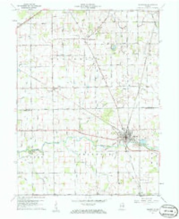
4 surveys from 12 printed sheetsMatched by testing this settlement's coordinate against the published boundary of every sheet in the United States Geological Survey's historical collection. Each opens the scanned sheet at the Survey.
- 1953 USGS Muncie quadrangle1:250000, 5 printings
- 1956 USGS Muncie quadrangle1:250000
- 1960 USGS Ridgeville quadrangle1:24000, 3 printings
- 1986 USGS Muncie quadrangle1:100000, 3 printings



In the county-history sources
39,141 words on this townshipHistory of Randolph County, Indiana with Illustrations and Biographical Sketches of Some of Its Prominent Men and Pioneers : to Which Are Appended Maps of Its Several Townships, published 1882 names this settlement in its chapter on Franklin Township. These are the passages that mention it, exactly as the scans read.
The mineriil advantages are found in its beds of liino rock, which between Doerlicld and Eidgevillo have beon utilized for borning lime, and its banks of gravel which have, however, been saflfared sti'angely enough to be useless till within a yeiir or two past. The people are now waking up to the mine of value that lies in their gravel banks, and are rapidly constructing pikes in various directions; and in a few more j'ears the citizens will wonder how they could have beon content to drag through the impassable seas and oceans of mud in which for forty years ]iast they had beon helplessly floundering and hopelessly engulfed. Franklin is so small, and Ridgeville is so central, that there Seems til have been no call for any other town to grow ui) within its limits. At any rate, no other has ever found place in that -neighborhood.
Passage source: History of Randolph County, Indiana with Illustrations and Biographical Sketches of Some of Its Prominent Men and Pioneers : to Which Are Appended Maps of Its Several Townships, published 1882.
The roads through E'ranklin are chiefly the route from Wincheter to Ridgeville and northward, and the route from Greenville via Deerfield and Ridgeville into Delaware County. The rail roads are the Richmond & Grand Rapids Road and the Union City & Logansport Road, crossing at Ridgeville, thus making that towu an important center of trade, and furnishing to the township a good market and abundant commercial facilities.
Passage source: History of Randolph County, Indiana with Illustrations and Biographical Sketches of Some of Its Prominent Men and Pioneers : to Which Are Appended Maps of Its Several Townships, published 1882.
Some twelve or fourteen years ago, the Free- Will Baptists, in connection with leading citizens oE the place and region, established Ridgeville College, which has over since been maintaining a heroic, and moreover a successful struggle for existence. Arthur McKew, Esq., of Ridgeville, not to mention others, is understood to have given at various times $11,001) to its funds. Ezekiel Clough, of Jackson Township, has contributed many thousand dollars to the same excellent purpose.
Passage source: History of Randolph County, Indiana with Illustrations and Biographical Sketches of Some of Its Prominent Men and Pioneers : to Which Are Appended Maps of Its Several Townships, published 1882.
Machine-read from a century-old scan, so expect the errors a machine makes: misspelled names, dropped words, stray characters.
Read the whole chapter on Franklin Township - it names this place 40 more 40 times.
Mines and quarries near this place
2 within 5 milesRegional context, not property-specific evidence. The federal mineral resources record lists 2 workings within 5 miles of Ridgeville: 1 past producer, 1 producer. 1 still produces. What was taken out: Stone, Crushed/Broken. Distance is straight-line from the map coordinates, so a quarry counted here may appear on a neighbouring settlement's page as well.
| Where | Site | Commodity | Status | Recorded |
|---|---|---|---|---|
| H&R Stone Corp Limestone Quarry | Stone, Crushed/Broken | Past Producer | ||
| Ridgeville, Meshberger Bros. S | Stone, Crushed/Broken | Producer |
Storms near this place
7 since 2001Regional context, not property-specific evidence. The National Weather Service names Ridgeville in 7 storm reports between 2001 and 2025: 4 thunderstorm wind, 1 hail, 1 tornado, 1 flood. No death or injury is recorded in these reports. Each account below is quoted exactly as the forecast office filed it, from the NOAA Storm Events Database, and each date opens the federal record of that event.
| When | Event | Place named | Harm | What the report says |
|---|---|---|---|---|
| March 2006 | Flood | Ridgeville | $20,000 | Two separate water rescues were required when vehicles drove into high water near the Mississinewa River. |
| September 2003 | Thunderstorm Wind | Ridgeville | $10,000 | no account filed |
| May 2019 | Thunderstorm Wind | Ridgeville | $5,000 | Numerous trees were downed at a homestead east of Ridgeville due to damaging thunderstorm wind gusts. |
| August 2007 | Thunderstorm Wind | Ridgeville | $5,000 | Part of an enclosed porch was blown off of a house due to a damaging thunderstorm wind gust. |
| April 2025 | Thunderstorm Wind | Ridgeville | $4,000 | Multiple trees downed by thunderstorm wind gusts. |
| August 2003 | Tornado (F0) | Ridgeville | - | Second tornado was formed from parent supercell. This one was again an F0 and touched down 9 miles west of Ridgeville in northwest Randolph county. The tornado traveled 1 mile and damaged only trees and power lines. |
| April 2001 | Hail | Ridgeville | - | no account filed |
Nearest settlements
The eight closest, with where each one stands in the county. Distances are straight-line, computed from the Geographic Names Information System coordinates.
| Map | Place | Distance | Sheets |
|---|---|---|---|
| Deerfield | 2.9 miles | 14 | |
| Randolph | 3.2 miles | 14 | |
| Stone | 3.8 miles | 13 | |
| Shedville | 5.5 miles | 11 | |
| Mull | 6.1 miles | 13 | |
| Saratoga | 6.9 miles | 18 | |
| New Pittsburg | 7.0 miles | 14 | |
| Winchester | 8.5 miles | 18 |
Elsewhere
Matched on this settlement's Geographic Names Information System number rather than its name, so it cannot be a different place of the same name in another state.
| Wikipedia article on Ridgeville | An encyclopaedic summary. Its text is share-alike, so it is linked here rather than copied. |
| Wikidata item Q2805012 | The structured record the population and elevation above come from. Public domain (CC0). |
Provenance
This settlement is recorded in the Geographic Names Information System as feature 442000. The sheet list is computed by point-in-boundary test against the United States Geological Survey's historical topographic inventory. Both are works of the United States government and carry no copyright under 17 U.S.C. 105.
Mines and quarries. USGS Mineral Resources Data System (MRDS) https://mrdata.usgs.gov/mrds/ A work of the United States government, no copyright under 17 U.S.C. 105.
Storms. NOAA National Centers for Environmental Information, Storm Events Database https://www.ncei.noaa.gov/stormevents/ A work of the United States government, no copyright under 17 U.S.C. 105. Narratives are quoted verbatim from the National Weather Service report and are not edited or summarised.