 Block
Nappanee, Indiana
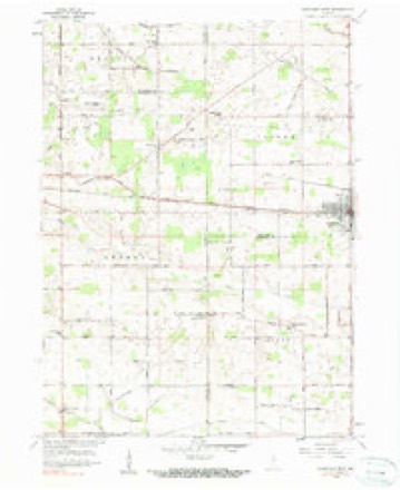
11 topographic sheets cover this place, the earliest surveyed in 1953 and the latest in 1984. It stands in Union Township. It lies in ZIP code area 46550. The Survey maps it on the Nappanee West quadrangle.
On record in Nappanee
Buildings and businesses the archive holds for this place. Each opens its own page, with the source record it came from.
On the National Register 7 records
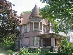 Frank and Katharine Coppes Houselisted 1990
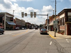 Downtown Nappanee Historic Districtlisted 1990
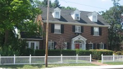 Arthur Miller Houselisted 1992
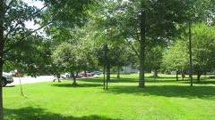 Nappanee West Park and Pavilionlisted 1994
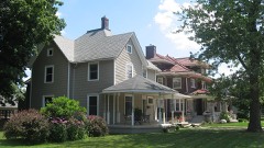 Nappaness Eastside Historic Districtlisted 2003
- Richard and Susan Pletcher Houselisted 2020
- Stahly-Nissley-Kuhns Farmlisted 1990
Topographic sheets covering this place
4 surveys from 11 printed sheetsMatched by testing this settlement's coordinate against the published boundary of every sheet in the United States Geological Survey's historical collection. Each opens the scanned sheet at the Survey.
- 1953 USGS Chicago quadrangle1:250000, 5 printings
- 1957 USGS Chicago quadrangle1:250000
- 1958 USGS Nappanee West quadrangle1:24000, 3 printings
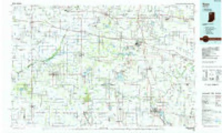
- 1984 USGS Knox quadrangle1:100000, 2 printings


In the county-history sources
28,158 words on this townshipHistory of Elkhart County, Indiana : Together with Sketches of Its Cities ... and Biographies of Representative Citizens : History of Indiana, Embracing Accounts of the Pre-historic Races .., published 1881 names this settlement in its chapter on Union Township. These are the passages that mention it, exactly as the scans read.
Daniel Bainter was the first to settle in Union township. He came in April, 1834, and built the first cabin in the township. It was 16 feet square and of split logs; no lumber was used. The floor was made of puncheons. It had but one door and window. Mr. B. split the board out for the door and had sufficient nails with him to nail it together. It was then hung on wooden hinges. This cabin stood near where his home now stands, on his farm in section 15. Mr. Bainter is still living on the farm which he entered. He was one of the first men in Elkhart county, having passed throngh here as early as 1827, going with his father to where South Bend now stands.
Passage source: History of Elkhart County, Indiana : Together with Sketches of Its Cities ... and Biographies of Representative Citizens : History of Indiana, Embracing Accounts of the Pre-historic Races .., published 1881.
A few years after Mr. Bainter settled here John Walburn moved into the township. He had come with a wagon from Ohio, driving his stock with him. He had to cut his road for some miles to get to his land. He reached his destination on the corner near where the school-house now stands, about sundown. He had hired his brother-in-law, William Albin, who lived at Waterford, to haul a load of lumber from that place for him. He cut a couple of forks and a pole, and setting- them up by some trees, made a shed which served for a house until he got his cabin up.
Passage source: History of Elkhart County, Indiana : Together with Sketches of Its Cities ... and Biographies of Representative Citizens : History of Indiana, Embracing Accounts of the Pre-historic Races .., published 1881.
The first ministers who preached through this section were the German Baptist, the Methodist, United Brethren, Mennonites and Regular Baptist. At present there are but three Church organizations in the township outside of the village of Nappanee. The first church was built by the Keformed a little east of Union Center, and was called "The Temple." The members have all left or died, and the building is long since gone. Tlie Regular Baptists were the next to erect a building. They have a very good house, on section 17. They have a good society here at present. The Mennonites have one church in the township, on section 19. Mr. Wisler is the pastor.
Passage source: History of Elkhart County, Indiana : Together with Sketches of Its Cities ... and Biographies of Representative Citizens : History of Indiana, Embracing Accounts of the Pre-historic Races .., published 1881.
Machine-read from a century-old scan, so expect the errors a machine makes: misspelled names, dropped words, stray characters.
Read the whole chapter on Union Township - it names this place 20 more 20 times.
Storms near this place
18 since 1994Regional context, not property-specific evidence. The National Weather Service names Nappanee in 18 storm reports between 1994 and 2024: 12 thunderstorm wind, 4 hail, 2 tornado. The reports record 1 injury. Each account below is quoted exactly as the forecast office filed it, from the NOAA Storm Events Database, and each date opens the federal record of that event.
| When | Event | Place named | Harm | What the report says |
|---|---|---|---|---|
| November 1998 | Thunderstorm Wind | Nappanee | 1 hurt, $5,000 | ONE MAN WHILE DRIVING ALONG U.S. HIGHWAY 6 WAS SLIGHTLY INJURED WHEN A LARGE TREE LIMB FELL ONTO HIS CAR. THE VEHICLE SUSTAINED EXTENSIVE DAMAGE. |
| October 2007 | Tornado (EF3) | Nappanee | $11,000,000 | The tornado continued northeast out of Kosciusko County into the southeast side of Nappanee where the most extensive damage occurred. The width of the tornado decreased to one quarter mile and intensified just south of US-6 and County Road 7 as wind speeds increased to around 165 mph, in the upper range of the EF3 rating. The tornado went through an area populated by homes, restaurants, convenience stores and 3 RV plants, all of which sustained varying degrees of damage. Local officials reported that 459 buildings were damaged. Of these, 352 were homes with 52 of those being destroyed or uninhabitable. 81 businesses were damaged and 26 destroyed. A few minor injuries were also reported, mainly from people trapped in some of the houses and a few businesses. The tornado continued into the Blackstone subdivision where numerous homes were damaged or destroyed. The tornado continued to west of New Paris near the intersection of County Roads 46 and 17 where it lifted. Numerous vehicles of all varieties sustained severe damage. Damage is estimated around $11 million. |
| July 2024 | Thunderstorm Wind | Nappanee | $25,000 | Large tree down onto a home in Nappanee. |
| September 2011 | Tornado (EF0) | Nappanee | $10,000 | A NWS survey of damage and eyewitness reports of a possible tornado was performed near Nappanee. Four different eyewitnesses reported a tornado touch down at a business on the south side of US 6 and quickly track north across US 6, ending near County Road 54. Minor shingle and soffit damage was observed to 2 businesses. Small branches were also broken in the area. Eyewitnesses reported that branches and leaves were being bent upwards into the circulation but remained generally intact. Wind speed are estimated in the 70 to 75 mph range. |
| June 2021 | Thunderstorm Wind | Nappanee | $5,000 | Several tree limbs were blown down that caused some damage to the side of a residence. Also tree damage at the McCormick Creek Golf Course. |
| June 1994 | Thunderstorm Wind | Nappanee | $5,000 | Power lines were downed. |
| July 2022 | Thunderstorm Wind | Nappanee | - | Widespread wind damage across Nappanee. |
| August 2020 | Thunderstorm Wind | Nappanee | - | The public reported several large trees were blown down in Nappanee. |
| July 2018 | Thunderstorm Wind | Nappanee | - | Local media reported a barn suffered mainly roof damage. |
| March 2017 | Thunderstorm Wind | Nappanee | - | The public estimated wind gusts to 60 mph. |
| July 2014 | Hail | Nappanee | - | The public posted pictures of hail slightly larger than the size of quarters on the office Facebook page. |
| June 2012 | Thunderstorm Wind | Nappanee | - | A trained spotter reported a large tree down across the road, with power lines down in the area. |
| June 2009 | Thunderstorm Wind | Nappanee | - | Pictures submitted to a South Bend television station indicated several large tree limbs being blown down in Nappanee. |
| July 2005 | Thunderstorm Wind | Nappanee | - | Trees and tree limbs were blown down in and around Nappanee. |
| August 2000 | Thunderstorm Wind | Nappanee | - | Large trees down. |
| June 2006 | Hail | Nappanee | - | no account filed |
| June 1997 | Hail | Nappanee | - | no account filed |
| April 1996 | Hail | Nappanee | - | no account filed |
Nearest settlements
The eight closest, with where each one stands in the county. Distances are straight-line, computed from the Geographic Names Information System coordinates.
| Map | Place | Distance | Sheets |
|---|---|---|---|
| Locke | 2.1 miles | 11 | |
| Foraker | 6.5 miles | 12 | |
| Wakarusa | 6.5 miles | 11 | |
| Southwest | 7.2 miles | 12 | |
| New Paris | 10.0 miles | 12 | |
| Bainter Town | 11.0 miles | 12 | |
| Waterford Mills | 11.4 miles | 12 | |
| Goshen | 13.1 miles | 12 |
Provenance
This settlement is recorded in the Geographic Names Information System as feature 439936. The sheet list is computed by point-in-boundary test against the United States Geological Survey's historical topographic inventory. Both are works of the United States government and carry no copyright under 17 U.S.C. 105.
Storms. NOAA National Centers for Environmental Information, Storm Events Database https://www.ncei.noaa.gov/stormevents/ A work of the United States government, no copyright under 17 U.S.C. 105. Narratives are quoted verbatim from the National Weather Service report and are not edited or summarised.