 Block
Albert Lea, Minnesota
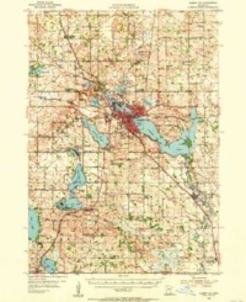
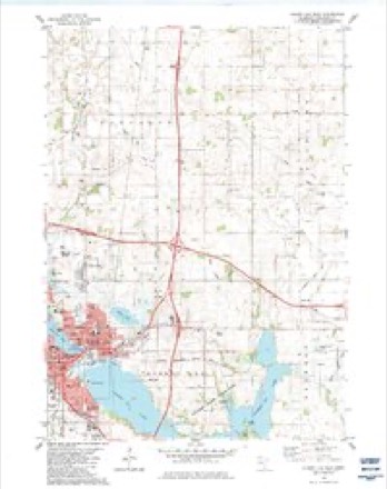
10 topographic sheets cover this place, the earliest surveyed in 1954 and the latest in 1985. It stands in Albert Lea City. It lies in ZIP code area 56007. It lies near Katherine Island. The Survey maps it on the Albert Lea East quadrangle. 18,492 people lived here at the 2020 count. It stands 1,243 feet above sea level.
Research this city
On record in Albert Lea
Buildings and businesses the archive holds for this place. Each opens its own page, with the source record it came from.
On the National Register 6 records
- Albert Lea City Halllisted 1984
- Albert Lea Commercial Historic Districtlisted 1987
- Albert Lea Commercial Historic District (Boundary Increase and Decrease)listed 2003
- Milwaukee Chicago St. Paul and Pacific Railroad Depotlisted 1982
- H. A. Paine Houselisted 1986
- Dr. Albert C. Wedge Houselisted 1986
Population over time
2 figuresAlbert Lea grew from 18,016 to 18,492 between 2010 and 2020. These are the recorded population figures Wikidata holds for this place, reached through the Geographic Names Information System number this page is keyed on rather than by name, so they belong to this place and not to another of the same name. Most are census counts, but not all are: an early figure may be a founding or settlement estimate, and an estimate published within five years of a census is left out. The change column is computed, and is left blank where more than 20 years separate a figure from the one before it, because a gap that long is not a change between two counts.
| Year | People | Change |
|---|---|---|
| 2010 | 18,016 | |
| 2020 | 18,492 | +476 (+3%) |
Topographic sheets covering this place
6 surveys from 10 printed sheetsMatched by testing this settlement's coordinate against the published boundary of every sheet in the United States Geological Survey's historical collection. Each opens the scanned sheet at the Survey.
- 1954 USGS Albert Lea quadrangle1:62500, 3 printings
- 1954 USGS Mason City quadrangle1:250000, 2 printings
- 1957 USGS Mason City quadrangle1:250000
- 1958 USGS Mason City quadrangle1:250000
- 1982 USGS Albert Lea East quadrangle1:24000
- 1985 USGS Albert Lea quadrangle1:100000, 2 printings




In the county-history sources
2,820 words on this townshipHistory of Freeborn County, published 1882 names this settlement in its chapter on Albert Lea Township. These are the passages that mention it, exactly as the scans read.
The township bearing this name is the southern of the two center towns of the county, Bancroft being its comrade on the north, with Kiceland impinging on the northeast, Hayward on the east, Shell Rook to the southeast, Freeman on the south, Nunda to the southwest. Pickerel Lake on the west, and Manchester to the northwest. It coincides with the original government survey, having thirty-sis sections.
Passage source: History of Freeborn County, published 1882.
The principal river is the Shell Eock, which flows in an average direction toward the southeast, diagonally through the township. Lake Albert Lea is the largest body of water in town, and is a magnificent sheet, with its irregular but gently curving outline and undulating surrounding meadows and hillside. Most of it lays in the town, but its length is about eight miles. Pickerel Lake also laps over into its territory, as does White's Lake, which Col. Lea at first called Lake Ohapeau. Goose Lake, a compact little body of water, may be found in section three. Fountain Lake is an artificial pond created by the mill dam erected by Mr. Kuble on his first coming here. It hugs around the northern side of the city in a curviUnear way, and with its graceful foliage, at various points coming down to the water's edge, presents one of the most pleasing views to be found in all Southern Minnesota.
Passage source: History of Freeborn County, published 1882.
Mr. and Mrs. Blaekmer were early settlers, but both are dead. Two sons, Loren and Heman, live on the homestead, and other sons reside in Albert Lea and vicinity. Dr. F. Blaekmer, residing in the city, is a son.
Passage source: History of Freeborn County, published 1882.
Machine-read from a century-old scan, so expect the errors a machine makes: misspelled names, dropped words, stray characters.
Read the whole chapter on Albert Lea Township - it names this place 12 more 12 times.
Fires near this place
2 since 2000Regional context, not property-specific evidence. The federal wildfire occurrence database lists 2 fires within 5 miles of Albert Lea between 2000 and 2017, burning about 179 acres in total. None started naturally. 1 was recorded as arson. Distance is straight-line from the map coordinates, so a fire counted here may appear on a neighbouring settlement's page as well.
| Reported cause | Fires |
|---|---|
| Arson/incendiarism | 1 |
| Debris and open burning | 1 |
The most recent of them, most recent first, with the day each was reported and the service that recorded it.
| Date | Cause | Size | Reported by | Name on the report |
|---|---|---|---|---|
| 12 September 2017 | Arson/incendiarism | 2.4 acres | Minnesota Department of Natural Resources | not named |
| 25 April 2000 | Debris and open burning | 177 acres | Windom Wetland Management District | TWO ISLAND (RX/WF) |
Settlements close enough to share some of these fires:
Mines and quarries near this place
1 within 5 milesRegional context, not property-specific evidence. The federal mineral resources record lists 1 working within 5 miles of Albert Lea: 1 occurrence. None of them still produces. What was taken out: Limestone, General. Distance is straight-line from the map coordinates, so a quarry counted here may appear on a neighbouring settlement's page as well.
| Where | Site | Commodity | Status | Recorded |
|---|---|---|---|---|
| Freeborn County Marl Bed | Limestone, General | Occurrence |
Storms near this place
60 of 70 shownRegional context, not property-specific evidence. The National Weather Service names Albert Lea in 70 storm reports between 1994 and 2026: 30 thunderstorm wind, 27 hail, 4 flash flood, 3 flood. The reports record 1 death and 4 injuries. Each account below is quoted exactly as the forecast office filed it, from the NOAA Storm Events Database, and each date opens the federal record of that event.
| When | Event | Place named | Harm | What the report says |
|---|---|---|---|---|
| June 2008 | Flash Flood | Albert Lea | 1 killed, 2 hurt, $500,000 | Approximately three to five inches of heavy rain in three hours resulted in flash flooding. Water was reported over Highway 65 three miles southeast of Albert Lea, and over Interstate 90 five miles east and one mile north of Hayward. Heavy rain washed out a section of County Road 34 between County Roads 19 and 21, or about three miles south of Oakland. One man died when he drove into the washed out roadbed and the vehicle submerged. The first call to 911 came at 0005 CST June 12, alerting law enforcement that the road had washed out. Shortly thereafter, another call to 911 was placed when a vehicle with two occupants drove into the washed out roadbed. The two occupants were rescued but informed their rescuers that they had landed on a vehicle, which turned out to be the vehicle with the deceased 52 year old male. Two people died indirect deaths when, at night on June 29, at the same washed out location three miles south of Oakland, they either drove around a barricade or somebody had moved the barricade. The vehicle plunged into the cavernous hole. One woman died June 29 and a man died July 3. |
| June 1994 | Thunderstorm Wind | Albert Lea | 2 hurt, $5,000 | Severe thunderstorm winds blew over a semi trailer , while also knocking numerous large trees down in the city of Albert Lea. The observing site in Albert Lea clocked winds at 68 miles an hour. There were two people injured by falling trees. |
| June 2013 | Flash Flood | Albert Lea | $100,000 | The City of Albert Lea had many streets barricaded due to water over the road. The streets in town was basically ponding due to saturated ground. Many stalled vehicles were reported. In the county there were several roads, including County Road 61 and County Road 27, near Freeborn, which had water over the road. The intersection of County Roads 14 and 74, north of Emmons, needed significant repairs. |
| July 2019 | Thunderstorm Wind | Albert Lea | $50,000 | There was widespread tree damage, and some roof damage to commercial buildings around Albert Lea, and then eastward toward Hayward, and Glenville. |
| June 2010 | Thunderstorm Wind | Albert Lea | $50,000 | Numerous trees and power lines were blown down. |
| July 2016 | Thunderstorm Wind | Albert Lea | $25,000 | Numerous trees and power lines were blown down across the city of Albert Lea. Some of the worst areas were near the fairgrounds where barn doors were damaged and a vehicle was damaged due to a fallen tree. |
| May 2015 | Thunderstorm Wind | Albert Lea | $10,000 | Several reports were received from state officials of windows blown out, trees and power lines knocked down around Albert Lea. |
| June 2001 | Flash Flood | Albert Lea | $10,000 | Numerous streets and basements flooded. |
| August 2014 | Thunderstorm Wind | Albert Lea | $5,000 | A large tree blew down on a vehicle. |
| May 1994 | Hail | Albert Lea | $50 | A severe thunderstorm dumped dime-size hail across much of southern Freeborn County. |
| May 1994 | Hail | Albert Lea | $50 | A severe thunderstorm dumped dime-size hail across much of southern Freeborn County. |
| May 2024 | Thunderstorm Wind | Albert Lea | - | Trees and power lines were knocked down in Albert Lea. |
| June 2020 | Thunderstorm Wind | Albert Lea | - | A large tree was blown down in Albert Lea. |
| July 2020 | Thunderstorm Wind | Albert Lea | - | A large tree limb fell on a parked car in Albert Lea. |
| July 2020 | Thunderstorm Wind | Albert Lea | - | Several large tree limbs were snapped off, some as large as 8 inches in diameter. |
| June 2017 | Thunderstorm Wind | Albert Lea | - | A large tree limb was blown down in the city of Albert Lea. |
| June 2015 | Thunderstorm Wind | Albert Lea | - | A tree was blown down in Albert Lea. |
| June 2014 | Thunderstorm Wind | Albert Lea | - | Numerous trees and power lines were blown down in Albert Lea. |
| June 2014 | Heavy Rain | Albert Lea | - | A measured 12 hour rainfall total of 3.33 inches near Albert Lea. |
| March 2011 | Flood | Albert Lea | - | U.S. Highway 65 in Albert Lea was closed for a part of March due to Spring snow melt and the runoff associated with it. |
| March 2010 | Flood | Albert Lea | - | County Road 101 was closed between Highway 13 and West Edgewater Drive due to flooding. In addition, East Main Street was closed at Garfield due to water over the road. |
| August 2010 | Heavy Rain | Albert Lea | - | A local observer reported ponding of water along city streets in north Albert Lea, Minnesota. |
| August 2010 | Heavy Rain | Albert Lea | - | An observer measured 2.15 inches of rainfall in less than one hour. |
| July 2008 | Thunderstorm Wind | Albert Lea | - | Two foot diameter tree toppled. |
| June 2008 | Thunderstorm Wind | Albert Lea | - | Ten inch tree snapped. |
| August 2007 | Thunderstorm Wind | Albert Lea | - | Three to six inch tree limbs downed. |
| August 2007 | Hail | Albert Lea | - | Reported on west side of town. |
| August 2007 | Thunderstorm Wind | Albert Lea | - | As measured by KATE radio. |
| July 2007 | Thunderstorm Wind | Albert Lea | - | Large tree limbs down, store window blown in. |
| September 2006 | Thunderstorm Wind | Albert Lea | - | Tree branches down near Bridge Street. |
| May 2005 | Thunderstorm Wind | Albert Lea | - | A MNDOT road weather sensor recorded a wind gust of 68 MPH. |
| June 2005 | Thunderstorm Wind | Albert Lea | - | A few trees were downed. A large branch was downed onto a power line. |
| August 2005 | Thunderstorm Wind | Albert Lea | - | Trees and power lines were downed. Some downed trees damaged homes and vehicles. A wind gust of 62 MPH was measured by a local radio station. |
| August 2004 | Thunderstorm Wind | Albert Lea | - | Power lines were blown down. |
| September 2004 | Funnel Cloud | Albert Lea | - | A trained spotter reported a funnel cloud just northeast of Albert Lea. |
| July 2002 | Flash Flood | Albert Lea | - | Heavy rain produced street flooding with water two to three feet deep. Several streets barricaded. |
| July 1999 | Thunderstorm Wind | Albert Lea | - | Trees toppled. Winds estimated. |
| June 1998 | Thunderstorm Wind | Albert Lea | - | Portion of Ventura Foods roof destroyed. Trees blown down. Estimated windspeed. |
| June 1998 | Hail | Albert Lea | - | Considerable hail damage to county vehicles. Windows and skylights broken at county buildings and schools. |
| June 1998 | Tornado (F0) | Albert Lea | - | Remained in rural areas. |
| August 1998 | Flood | Albert Lea | - | Automobiles inundated. |
| July 1997 | Hail | Albert Lea | - | Large tree branches also blown down. |
| June 1995 | Thunderstorm Wind | Albert Lea | - | Numerous trees and power lines down. |
| August 1995 | Thunderstorm Wind | Albert Lea | - | There was roof damage to a pumphouse and also tree damage. |
| April 2026 | Hail | Albert Lea | - | no account filed |
| August 2023 | Hail | Albert Lea | - | no account filed |
| August 2023 | Hail | Albert Lea | - | no account filed |
| May 2017 | Hail | Albert Lea | - | no account filed |
| May 2017 | Hail | Albert Lea | - | no account filed |
| June 2014 | Hail | Albert Lea | - | no account filed |
| June 2014 | Hail | Albert Lea | - | no account filed |
| June 2010 | Hail | Albert Lea | - | no account filed |
| May 2008 | Thunderstorm Wind | Albert Lea | - | no account filed |
| June 2008 | Hail | Albert Lea | - | no account filed |
| May 2007 | Hail | Albert Lea | - | no account filed |
| August 2006 | Hail | Albert Lea | - | no account filed |
| April 2005 | Hail | Albert Lea | - | no account filed |
| October 2005 | Hail | Albert Lea | - | no account filed |
| April 2004 | Funnel Cloud | Albert Lea | - | no account filed |
| May 2004 | Hail | Albert Lea | - | no account filed |
Nearest settlements
The eight closest, with where each one stands in the county. Distances are straight-line, computed from the Geographic Names Information System coordinates.
| Map | Place | Distance | Sheets |
|---|---|---|---|
| Stoney Creek Estates | 2.3 miles | 10 | |
| Bancroft | 3.8 miles | 10 | |
| Murtaugh | 3.9 miles | 10 | |
| Armstrong | 5.4 miles | 10 | |
| Hayward | 6.6 miles | 9 | |
| Twin Lakes | 6.7 miles | 10 | |
| Manchester | 6.9 miles | 10 | |
| Glenville | 7.0 miles | 10 |
Elsewhere
Matched on this settlement's Geographic Names Information System number rather than its name, so it cannot be a different place of the same name in another state.
| Wikipedia article on Albert Lea | An encyclopaedic summary. Its text is share-alike, so it is linked here rather than copied. |
| Wikidata item Q913476 | The structured record the population and elevation above come from. Public domain (CC0). |
Provenance
This settlement is recorded in the Geographic Names Information System as feature 639247. The sheet list is computed by point-in-boundary test against the United States Geological Survey's historical topographic inventory. Both are works of the United States government and carry no copyright under 17 U.S.C. 105.
Wildfire. Short, Karen C. 2022. Spatial wildfire occurrence data for the United States, 1992-2020 [FPA_FOD_20221014]. 6th Edition. Fort Collins, CO: Forest Service Research Data Archive. https://doi.org/10.2737/RDS-2013-0009.6 Collected with United States Government funding and usable without additional permissions or fees.
Mines and quarries. USGS Mineral Resources Data System (MRDS) https://mrdata.usgs.gov/mrds/ A work of the United States government, no copyright under 17 U.S.C. 105.
Storms. NOAA National Centers for Environmental Information, Storm Events Database https://www.ncei.noaa.gov/stormevents/ A work of the United States government, no copyright under 17 U.S.C. 105. Narratives are quoted verbatim from the National Weather Service report and are not edited or summarised.