 Block
Armstrong, Minnesota
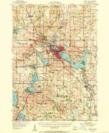
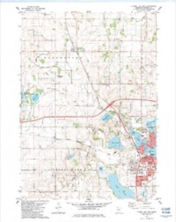
10 topographic sheets cover this place, the earliest surveyed in 1954 and the latest in 1985. It stands in Pickerel Lake Township. It lies in ZIP code area 56007. The Survey maps it on the Albert Lea West quadrangle.
Topographic sheets covering this place
6 surveys from 10 printed sheetsMatched by testing this settlement's coordinate against the published boundary of every sheet in the United States Geological Survey's historical collection. Each opens the scanned sheet at the Survey.
- 1954 USGS Albert Lea quadrangle1:62500, 3 printings
- 1954 USGS Mason City quadrangle1:250000, 2 printings
- 1957 USGS Mason City quadrangle1:250000
- 1958 USGS Mason City quadrangle1:250000
- 1982 USGS Albert Lea West quadrangle1:24000
- 1985 USGS Albert Lea quadrangle1:100000, 2 printings




In the county-history sources
5,611 words on this townshipHistory of Freeborn County, published 1882 names this settlement in its chapter on Pickerel Lake Township. These are the passages that mention it, exactly as the scans read.
F. D. Babcock, is a native of Iowa, born in Bradford, Chickasaw county. He attended school there until eighteen years old,then removed to Herseyville, Wisconsin, and completed his education, residing with his grand-parents for a year and a half. He returned to his native State, but in a year returned to ^Visconsin and remained six years. He then came to Minnesota, resided in Hokah, Houston county, Hayward, and Armstrong, in this county, returned to Whalen, Houston county, and in July, 1882, came again to Armstrong, where he now resides. He is station agent and telegraph operator, having learned telegraphy in Wisconsin. He was married in the latter State, in Herseyville, in December, 1880, to Miss Frankie C. Palmer, a native of Virginia, in thiit State. Her fatber was killod iu the army and her mother still resides iti Wisconsin. Mr. Babcock's father died in South Carolina in 1881, aged fifty years, and his mother resides in Wisconsin, aged forty-nine. He and his wife are members of the M, E. Church.
Passage source: History of Freeborn County, published 1882.
G. H. Kenekson was born in New Hampshire in 1841, and lived in his native State, attending school until seven years old. He then removed with his parents to Troy, New York, and six years after to Galesville, Washington county, in both of which places he attended school. In 1859, he came to Fall Kiver, Columbia county, Wisconsin, and completed his education. In the fall of 1860 he removed to Mower county, Minnesota, and followed farming until 1875, then engaged in the grain business, buying and shipping. He was married on the Ist of January, 1868, to Martha Williams. She was born in Branch county, Michigan, and when fourteen years of age removed with her parents to Mower county, where she was married. Mr. and Mrs. Kenerson have had five children, of whom three are living; Era A., aged thirteen years; Roy and Ray, twins, aged seven years; Jessie died in infancy, and Daniel at the age of two years and five months. Mr. Kenerson's mother died in Troy, New York, at the age of thirty, and his father in Rochester, in this State, in 1878, when seventy-five years old. Mrs Kenerson's parents reside in Dexter, Mower county, and she is the eldest of their ten children. Mr. Kenerson came to Armstrong in the fall of 1881, and is engaged in the grain business, and also owns a grocery store. He was appointed Postmaster in June, 1882.
Passage source: History of Freeborn County, published 1882.
Machine-read from a century-old scan, so expect the errors a machine makes: misspelled names, dropped words, stray characters.
Fires near this place
4 since 2000Regional context, not property-specific evidence. The federal wildfire occurrence database lists 4 fires within 5 miles of Armstrong between 2000 and 2017, burning about 190 acres in total. None started naturally. 1 was recorded as arson. Distance is straight-line from the map coordinates, so a fire counted here may appear on a neighbouring settlement's page as well.
| Reported cause | Fires |
|---|---|
| Debris and open burning | 2 |
| Missing data/not specified/undetermined | 1 |
| Arson/incendiarism | 1 |
The most recent of them, most recent first, with the day each was reported and the service that recorded it.
| Date | Cause | Size | Reported by | Name on the report |
|---|---|---|---|---|
| 12 September 2017 | Arson/incendiarism | 2.4 acres | Minnesota Department of Natural Resources | not named |
| 1 May 2015 | Missing data/not specified/undetermined | 1.2 acres | Windom Wetland Management District | IOWA CHICAGO & EASTERN |
| 25 April 2000 | Debris and open burning | 177 acres | Windom Wetland Management District | TWO ISLAND (RX/WF) |
| 16 April 2007 | Debris and open burning | 9.0 acres | Windom Wetland Management District | HALLS LAKE |
Settlements close enough to share some of these fires:
Storms near this place
4 since 2010Regional context, not property-specific evidence. The National Weather Service names Armstrong in 4 storm reports between 2010 and 2014: 2 hail, 1 tornado, 1 thunderstorm wind. No death or injury is recorded in these reports. Each account below is quoted exactly as the forecast office filed it, from the NOAA Storm Events Database, and each date opens the federal record of that event.
| When | Event | Place named | Harm | What the report says |
|---|---|---|---|---|
| September 2012 | Thunderstorm Wind | Armstrong | $100,000 | A large tree fell on a house in Albert Lea. In addition, there were reports of widespread tree damage across parts of Freeborn County, along with power outages. |
| June 2010 | Tornado (EF1) | Armstrong | - | This was a satellite tornado to the Conger EF-4. It damaged trees, several grain bins and structures. |
| June 2014 | Hail | Armstrong | - | no account filed |
| June 2013 | Hail | Armstrong | - | no account filed |
Nearest settlements
The eight closest, with where each one stands in the county. Distances are straight-line, computed from the Geographic Names Information System coordinates.
| Map | Place | Distance | Sheets |
|---|---|---|---|
| Manchester | 4.3 miles | 10 | |
| Conger | 4.7 miles | 8 | |
| Albert Lea | 5.4 miles | 10 | |
| Alden | 5.7 miles | 8 | |
| Bancroft | 6.5 miles | 10 | |
| Stoney Creek Estates | 7.0 miles | 10 | |
| Twin Lakes | 7.6 miles | 10 | |
| Freeborn | 8.6 miles | 8 |
Provenance
This settlement is recorded in the Geographic Names Information System as feature 639442. The sheet list is computed by point-in-boundary test against the United States Geological Survey's historical topographic inventory. Both are works of the United States government and carry no copyright under 17 U.S.C. 105.
Wildfire. Short, Karen C. 2022. Spatial wildfire occurrence data for the United States, 1992-2020 [FPA_FOD_20221014]. 6th Edition. Fort Collins, CO: Forest Service Research Data Archive. https://doi.org/10.2737/RDS-2013-0009.6 Collected with United States Government funding and usable without additional permissions or fees.
Storms. NOAA National Centers for Environmental Information, Storm Events Database https://www.ncei.noaa.gov/stormevents/ A work of the United States government, no copyright under 17 U.S.C. 105. Narratives are quoted verbatim from the National Weather Service report and are not edited or summarised.