 Block
Bancroft, Minnesota
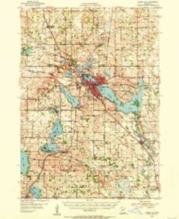
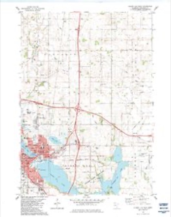
10 topographic sheets cover this place, the earliest surveyed in 1954 and the latest in 1985. It stands in Bancroft Township. It lies in ZIP code area 56007. The Survey maps it on the Albert Lea East quadrangle.
Topographic sheets covering this place
6 surveys from 10 printed sheetsMatched by testing this settlement's coordinate against the published boundary of every sheet in the United States Geological Survey's historical collection. Each opens the scanned sheet at the Survey.
- 1954 USGS Albert Lea quadrangle1:62500, 3 printings
- 1954 USGS Mason City quadrangle1:250000, 2 printings
- 1957 USGS Mason City quadrangle1:250000
- 1958 USGS Mason City quadrangle1:250000
- 1982 USGS Albert Lea East quadrangle1:24000
- 1985 USGS Albert Lea quadrangle1:100000, 2 printings




In the county-history sources
1,747 words on this townshipHistory of Freeborn County, Minnesota, published 1911 names this settlement in its chapter on Bancroft Township. These are the passages that mention it, exactly as the scans read.
Bancroft township is one of the center subdivisions of Free¬ born county, being separated by one tier from the north, and an equal distance from east and west county lines. Its contiguous neighbors are Bath township on the north, Riceland on the .east, Albert Lea on the south, and Manchester on the west, embracing the territory of town 103, range 21, containing thirty-six sections, or 23,040 acres, of which there are very few unsuitable for agri¬ cultural purposes, and the greater part is already under a high state of cultivation. The township has no lakes and no streams of importance. Bancroft creek is the principal one ; rising in the northwestern part of the town, it takes a southerly course and finally enters Fountain lake. A small body of water, known as Itasca lake, covers a few acres of land in the southwestern portion of section 31. The general makeup of the locality would be called prairie and oak openings. The early settlers say that originally at least three-fourths of the area of the town was covered with a growth of burr and jack oak and other timber of the smaller varieties, interspersed with natural meadows and prairie. The greater part of the former growth of timber has been removed, and the rich country transformed into beautiful and productive farms. There are, however, a number of groves left which mark the remains of former miniature forests. A strip' of valuable prairie, known as the Paradise or Itasca prairie, enters the town in the southwestern corner and extends north¬ easterly almost across the entire town, gradually disappearing towards Clark's grove. The locality known as Oak Hill is the most elevated tract of land in the township, taking its name from the variety of timber with which it was formerly covered. It makes itself visible on the surface in the northwestern extrem¬ ity of the town, and extends easterly across the entire township, embracing the northern tier of sections. The soil on the prairie is mostly a rich dark loam underlain with a rich sub-soil of clay ; while in the timber, or oak opening, it is of a lighter nature, with a marked tendency to clay and a sub-soil of sand and gravel.
Passage source: History of Freeborn County, Minnesota, published 1911.
Bancroft township has a Norwegian Lutheran Church and cemetery in the central part of section 20, and another Nor¬ wegian Lutheran Church and cemetery in the northern part of section 25. Itasca and Bancroft villages, now extinct, were located in this township, as is the county alms house and poor farm at
Passage source: History of Freeborn County, Minnesota, published 1911.
In 1856, Benjamin Frost and a large family settled in section 19, Bancroft township, and Chas. B. Matthews located just over the line from Albert Lea. In the meantine the northern part of the town began to receive the attention of the early comers; but claims were getting scarce, and in the same ratio that they were scarce, so they became valuable. The settlement north of the center of the town was more universally known as the ''Oak Hill" neighborhood. A. C. Hall, a native of Maine, was the first to make his appearance, and he selected his domain in sections 5 and 8, in the middle of September, 1856, where he put up a shanty and made some improvements; but was not really an actual settler, as he soon sold out and removed to Iowa. Andrew Barlow was the next to arrive, making his appearance in Sep¬ tember. He walked from McGregor, Iowa, and took a claim on Pickerel Lake. While he was in Albert Lea after supplies his claim was jumped and he came to Bancroft. In the winter he went back to Iowa, but this claim also was jumped, and when he finally returned with his family, in the spring of 1857, he purchased the farm back for $20. H. R, Loomis, from Erie county, Pennsylvania, came by stage from Dubuque to near Merry s Ford, on the Cedar river, Iowa, and from there he walked to Bancroft, arriving and selecting his place on the first day of November, 1856. He erected a small shanty and made some improvements and bought a yoke of oxen. December 26 he started with his oxen to Delaware county, Iowa, and remained there until February, 1857, when he returned, bringing with him his sister, Louisa Loomis, and Oscar and Fannie Ward. The last two named were aged twenty and fifteen years, respectively. The entire party came in a sleigh, camping out on the way, finally arriving at Benjamin Frost's house, in the southeastern part of town, where the manager of the party, Mr. Loomis, left them and proceeded to his selected home in section 8, where he made a fire and prepared to entertain his guests. The balance of the party, whom he had left at Frost's, followed on foot, on the top af the snow, there being a heavy crust. They arrived in safety, and William Oscar Ward selected a farm for his father, a most prom¬ inent and popular man. Early in the fall of 1857, Jeremiah Ward, a native of New York, father of Oscar and Fannie, arrived and located upon the place selected for him, and lived upon it until 1879, when he passed aAvay. About this time Ole Hanson came to the township. Early in the spring of 1857, Albert Loomis, from Erie county, Pennsylvania, came to the home of H. R. Loomis and immediately took a claim adjoining in section 9, where he made his home for about ten years, when he went back to Pennsylvania. About a week later, Cyrus Prescott, a native of Maine, who had made his home from childhood in Ohio, made his appearance in the town, coming by way of Hastings ; and making a claim in section 5, he took up his abode with H. R, Loomis' people while he improved his property. Later in the season] Cyrus' father, Daniel, joined his son, and made him a home in section 4. In June, 1857, the next pioneer drifted in, in the person of William H. Long, a native of Newark, N. J., who located on a farm in sections 5 and 8. In the spring of 1882 he removed to the city of Albert Lea. Nicholas J. Sandburg also came in 1857, as well as Ole I. Ellingson, Andrew J. Luther and Ole 0. Styve.
Passage source: History of Freeborn County, Minnesota, published 1911.
Machine-read from a century-old scan, so expect the errors a machine makes: misspelled names, dropped words, stray characters.
Read the whole chapter on Bancroft Township - it names this place 4 more 4 times.
Fires near this place
2 since 2000Regional context, not property-specific evidence. The federal wildfire occurrence database lists 2 fires within 5 miles of Bancroft between 2000 and 2017, burning about 179 acres in total. None started naturally. 1 was recorded as arson. Distance is straight-line from the map coordinates, so a fire counted here may appear on a neighbouring settlement's page as well.
| Reported cause | Fires |
|---|---|
| Arson/incendiarism | 1 |
| Debris and open burning | 1 |
The most recent of them, most recent first, with the day each was reported and the service that recorded it.
| Date | Cause | Size | Reported by | Name on the report |
|---|---|---|---|---|
| 12 September 2017 | Arson/incendiarism | 2.4 acres | Minnesota Department of Natural Resources | not named |
| 25 April 2000 | Debris and open burning | 177 acres | Windom Wetland Management District | TWO ISLAND (RX/WF) |
Settlements close enough to share some of these fires:
Mines and quarries near this place
3 within 5 milesRegional context, not property-specific evidence. The federal mineral resources record lists 3 workings within 5 miles of Bancroft: 2 producers, 1 occurrence. 2 still produce. What was taken out: Sand and Gravel, Construction, Limestone, General. Distance is straight-line from the map coordinates, so a quarry counted here may appear on a neighbouring settlement's page as well.
| Where | Site | Commodity | Status | Recorded |
|---|---|---|---|---|
| Freeborn County Marl Bed | Limestone, General | Occurrence | ||
| Don Wayne | Sand and Gravel, Construction | Producer | ||
| Don Wayne Pit | Sand and Gravel, Construction | Producer |
Storms near this place
3 since 2011Regional context, not property-specific evidence. The National Weather Service names Bancroft in 3 storm reports between 2011 and 2017: 2 hail, 1 tornado. No death or injury is recorded in these reports. Each account below is quoted exactly as the forecast office filed it, from the NOAA Storm Events Database, and each date opens the federal record of that event.
| When | Event | Place named | Harm | What the report says |
|---|---|---|---|---|
| March 2017 | Tornado (EF1) | Bancroft | - | A NWS storm survey concluded that an EF-1 tornado started in Freeborn County, MN and traveled 9.7 miles through the towns of Clarks Grove and Geneva before crossing the Steele County line (where it would produce EF-0 damage). It first moved north-northeast, and then about one mile north of Clarks Grove, it turned more to the northeast and hit the southern and eastern sides of Geneva. Peak winds were estimated at about 100 mph, which caused damage to homes, buildings, and trees. |
| June 2015 | Hail | Bancroft | - | no account filed |
| September 2011 | Hail | Bancroft | - | no account filed |
Nearest settlements
The eight closest, with where each one stands in the county. Distances are straight-line, computed from the Geographic Names Information System coordinates.
| Map | Place | Distance | Sheets |
|---|---|---|---|
| Albert Lea | 3.8 miles | 10 | |
| Clarks Grove | 4.5 miles | 7 | |
| Lerdal | 4.8 miles | 10 | |
| Manchester | 5.4 miles | 10 | |
| Stoney Creek Estates | 5.9 miles | 10 | |
| Armstrong | 6.5 miles | 10 | |
| Hayward | 6.9 miles | 9 | |
| Murtaugh | 7.2 miles | 10 |
Provenance
This settlement is recorded in the Geographic Names Information System as feature 654584. The sheet list is computed by point-in-boundary test against the United States Geological Survey's historical topographic inventory. Both are works of the United States government and carry no copyright under 17 U.S.C. 105.
Wildfire. Short, Karen C. 2022. Spatial wildfire occurrence data for the United States, 1992-2020 [FPA_FOD_20221014]. 6th Edition. Fort Collins, CO: Forest Service Research Data Archive. https://doi.org/10.2737/RDS-2013-0009.6 Collected with United States Government funding and usable without additional permissions or fees.
Mines and quarries. USGS Mineral Resources Data System (MRDS) https://mrdata.usgs.gov/mrds/ A work of the United States government, no copyright under 17 U.S.C. 105.
Storms. NOAA National Centers for Environmental Information, Storm Events Database https://www.ncei.noaa.gov/stormevents/ A work of the United States government, no copyright under 17 U.S.C. 105. Narratives are quoted verbatim from the National Weather Service report and are not edited or summarised.