 Block
Manchester, Minnesota
10 topographic sheets cover this place, the earliest surveyed in 1954 and the latest in 1985. It stands in Manchester City. It lies in ZIP code area 56007. The Survey maps it on the Albert Lea West quadrangle. 52 people lived here at the 2020 count. It stands 1,289 feet above sea level.
Population over time
2 figuresManchester fell from 57 to 52 between 2010 and 2020. These are the recorded population figures Wikidata holds for this place, reached through the Geographic Names Information System number this page is keyed on rather than by name, so they belong to this place and not to another of the same name. Most are census counts, but not all are: an early figure may be a founding or settlement estimate, and an estimate published within five years of a census is left out. The change column is computed, and is left blank where more than 20 years separate a figure from the one before it, because a gap that long is not a change between two counts.
| Year | People | Change |
|---|---|---|
| 2010 | 57 | |
| 2020 | 52 | -5 (-9%) |
Topographic sheets covering this place
6 surveys from 10 printed sheetsMatched by testing this settlement's coordinate against the published boundary of every sheet in the United States Geological Survey's historical collection. Each opens the scanned sheet at the Survey.
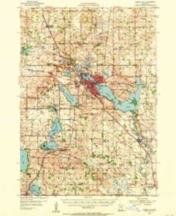
- 1954 USGS Albert Lea quadrangle1:62500, 3 printings
- 1954 USGS Mason City quadrangle1:250000, 2 printings
- 1957 USGS Mason City quadrangle1:250000
- 1958 USGS Mason City quadrangle1:250000
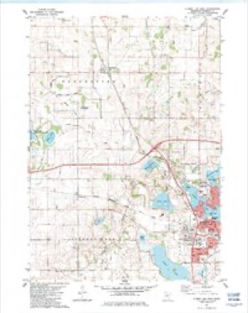
- 1982 USGS Albert Lea West quadrangle1:24000
- 1985 USGS Albert Lea quadrangle1:100000, 2 printings




In the county-history sources
1,712 words on this townshipHistory of Freeborn County, Minnesota, published 1911 names this settlement in its chapter on Manchester City. These are the passages that mention it, exactly as the scans read.
Lake Peterson, from which a small stream taking a southeasterly course finally leaves the town via section 36 and enters Bancroft township. South of this cluster of lakes, in section 32, Spring Lake infringes upon and covers a few acres of land. A small body of water known as Gun lake is located in the eastern part of section 9. School Section lake is located in the southeastern por¬ tion of the town, in section 36. There is but one village in the township, Manchester, located in section 15. The surface of the town is rolling, and although in places inclined to be rather abrupt in its modulations, is not hilly or in any place broken suf¬ ficiently to be detrimental to agriculture. The town is well adapted to agricultural purposes and has a large cultivated area yielding good crops of the cereals.
Passage source: History of Freeborn County, Minnesota, published 1911.
Early Events. Mikkel Mikkelson was born in September, 1856, this being the first birth in the township. In December, 1858, occurred the first wedding, Mads Madson, who died in 1880, being the groom. Previous to this Manchester Norwegians had gone back to Iowa to be married. The first death was that of Peter Johnson, in August, 1858. The first religious services in the town were held in June, 1858, at the residence of Ole Peterson, in section 15, by a Lutheran clergyman. The church organization was not effected until 1876. The first house in the township was erected in June, 1856, by Gunder Thykeson. on section 9. It was a log building, 12x14 feet, and was afterward used as a stable. Stiner Mikkelson in July, 1856, the following month, erected the second house of the same material, and this was subsequently used as a blacksmith shop. At an early day a number of the pioneers in a rude way manufactured sorghum by Using three wooden home-made rollers, propelled by a yoke of oxen, for a press ; but this crude machinery has long since been supplanted by the pat¬ ent process and new machinery. It is claimed that Mathias Anderson, who came from the town of Manchester, Boone county, Illinois, gave to this township its present name. Originally town meetings were held in private houses and anywhere that shelter could be found, and later in the schoolhouse of district 18, in sec¬ tion 22. The first blacksmith shop was erected in 1856 and oper¬ ated by Mr. Mikkelson on the northwest quarter of section 15. In 18b4 and 65 he sold out and went to Blue Earth county. In 1858 the next shop was erected in section 13, size 12x14 feet, and put in operation by Lewis Olson. It was of logs, with a log and sod roof, and was operated by him until about 1873, when it changed hands.
Passage source: History of Freeborn County, Minnesota, published 1911.
did its full share during the war of the rebellion. Of those wTio volunteered and went into the service, nine never returned, find¬ ing graves in Southern soil. S. Benson was the only married man of the departed heroes ; he left a wife and two children to mourn his loss. The rest were all single men and most of their parents resided in the town at the time. Manchester voted bonds to the amount of $4,000 for the purpose of securing volunteers to fill the quota assigned the town, which amount was duly paid and recruits secured. The Jensons (Johnson) had five sons in the war, three being killed.
Passage source: History of Freeborn County, Minnesota, published 1911.
Machine-read from a century-old scan, so expect the errors a machine makes: misspelled names, dropped words, stray characters.
Read the whole chapter on Manchester City - it names this place 2 more 2 times.
Fires near this place
3 since 2000Regional context, not property-specific evidence. The federal wildfire occurrence database lists 3 fires within 5 miles of Manchester between 2000 and 2017, burning about 188 acres in total. None started naturally. 1 was recorded as arson. Distance is straight-line from the map coordinates, so a fire counted here may appear on a neighbouring settlement's page as well.
| Reported cause | Fires |
|---|---|
| Debris and open burning | 2 |
| Arson/incendiarism | 1 |
The most recent of them, most recent first, with the day each was reported and the service that recorded it.
| Date | Cause | Size | Reported by | Name on the report |
|---|---|---|---|---|
| 12 September 2017 | Arson/incendiarism | 2.4 acres | Minnesota Department of Natural Resources | not named |
| 25 April 2000 | Debris and open burning | 177 acres | Windom Wetland Management District | TWO ISLAND (RX/WF) |
| 16 April 2007 | Debris and open burning | 9.0 acres | Windom Wetland Management District | HALLS LAKE |
Settlements close enough to share some of these fires:
Storms near this place
18 since 1994Regional context, not property-specific evidence. The National Weather Service names Manchester in 18 storm reports between 1994 and 2022: 10 hail, 6 thunderstorm wind, 1 tornado, 1 funnel cloud. No death or injury is recorded in these reports. Each account below is quoted exactly as the forecast office filed it, from the NOAA Storm Events Database, and each date opens the federal record of that event.
| When | Event | Place named | Harm | What the report says |
|---|---|---|---|---|
| June 2010 | Thunderstorm Wind | Manchester | $25,000 | Several large trees were blown down, plus a garage door was damaged. This damage was associated with the rear flank downdraft associated with the EF-4 tornado that began near Mansfield. |
| August 2019 | Thunderstorm Wind | Manchester | $10,000 | A barn was damaged due to severe straight-line winds near Manchester. |
| June 2018 | Hail | Manchester | - | A swath of large hail, up to golf ball size, occurred northeast of Manchester, and west of Clarks Grove. |
| June 2014 | Thunderstorm Wind | Manchester | - | Large branches were downed, causing power outages around the town of Manchester. |
| June 2014 | Thunderstorm Wind | Manchester | - | Several large trees were blown down, with a shed's roof torn off east of Manchester. |
| June 2009 | Funnel Cloud | Manchester | - | Funnel was filmed about 80% of the way to the ground by a storm chaser. |
| July 2008 | Thunderstorm Wind | Manchester | - | Eight inch diameter tree branched downed. |
| June 1998 | Thunderstorm Wind | Manchester | - | Marble size hail along with strong winds. |
| June 1994 | Tornado (F0) | Manchester | - | A short and narrow tornado briefly touched down in Manchester and no damage occurred. |
| May 2022 | Hail | Manchester | - | no account filed |
| June 2019 | Hail | Manchester | - | no account filed |
| June 2019 | Hail | Manchester | - | no account filed |
| June 2015 | Hail | Manchester | - | no account filed |
| July 2012 | Hail | Manchester | - | no account filed |
| June 2003 | Hail | Manchester | - | no account filed |
| June 2001 | Hail | Manchester | - | no account filed |
| June 1998 | Hail | Manchester | - | no account filed |
| June 1998 | Hail | Manchester | - | no account filed |
Nearest settlements
The eight closest, with where each one stands in the county. Distances are straight-line, computed from the Geographic Names Information System coordinates.
| Map | Place | Distance | Sheets |
|---|---|---|---|
| Armstrong | 4.3 miles | 10 | |
| Bancroft | 5.4 miles | 10 | |
| Hartland | 5.7 miles | 7 | |
| Freeborn | 6.6 miles | 8 | |
| Albert Lea | 6.9 miles | 10 | |
| Clarks Grove | 7.0 miles | 7 | |
| Alden | 7.6 miles | 8 | |
| Bath | 7.6 miles | 7 |
Elsewhere
Matched on this settlement's Geographic Names Information System number rather than its name, so it cannot be a different place of the same name in another state.
| Wikipedia article on Manchester | An encyclopaedic summary. Its text is share-alike, so it is linked here rather than copied. |
| Wikidata item Q2074582 | The structured record the population and elevation above come from. Public domain (CC0). |
Provenance
This settlement is recorded in the Geographic Names Information System as feature 647432. The sheet list is computed by point-in-boundary test against the United States Geological Survey's historical topographic inventory. Both are works of the United States government and carry no copyright under 17 U.S.C. 105.
Wildfire. Short, Karen C. 2022. Spatial wildfire occurrence data for the United States, 1992-2020 [FPA_FOD_20221014]. 6th Edition. Fort Collins, CO: Forest Service Research Data Archive. https://doi.org/10.2737/RDS-2013-0009.6 Collected with United States Government funding and usable without additional permissions or fees.
Storms. NOAA National Centers for Environmental Information, Storm Events Database https://www.ncei.noaa.gov/stormevents/ A work of the United States government, no copyright under 17 U.S.C. 105. Narratives are quoted verbatim from the National Weather Service report and are not edited or summarised.