 Block
Elgin, Minnesota
15 topographic sheets cover this place, the earliest surveyed in 1935 and the latest in 1989. It stands in Elgin City. It lies in ZIP code area 55932. It stands on Dry Creek. The Survey maps it on the Millville quadrangle. 1,115 people lived here at the 2020 count. It stands 1,060 feet above sea level.
Population over time
2 figuresElgin grew from 1,089 to 1,115 between 2010 and 2020. These are the recorded population figures Wikidata holds for this place, reached through the Geographic Names Information System number this page is keyed on rather than by name, so they belong to this place and not to another of the same name. Most are census counts, but not all are: an early figure may be a founding or settlement estimate, and an estimate published within five years of a census is left out. The change column is computed, and is left blank where more than 20 years separate a figure from the one before it, because a gap that long is not a change between two counts.
| Year | People | Change |
|---|---|---|
| 2010 | 1,089 | |
| 2020 | 1,115 | +26 (+2%) |
Topographic sheets covering this place
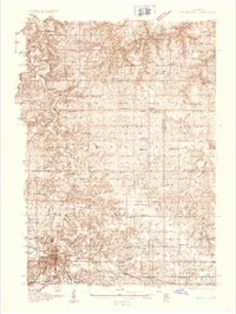
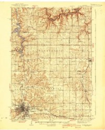
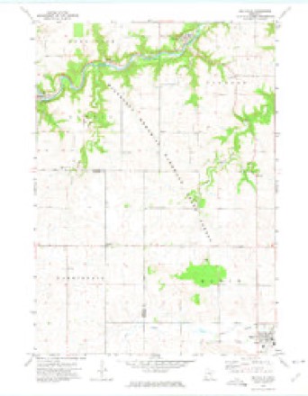
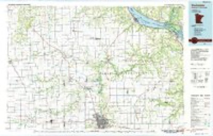
9 surveys from 15 printed sheetsMatched by testing this settlement's coordinate against the published boundary of every sheet in the United States Geological Survey's historical collection. Each opens the scanned sheet at the Survey.
- 1935 USGS Rochester quadrangle1:48000
- 1939 USGS Rochester quadrangle1:62500, 4 printings
- 1953 USGS Saint Paul quadrangle1:250000, 3 printings
- 1953 USGS St. Paul quadrangle1:250000
- 1959 USGS Saint Paul quadrangle1:250000
- 1959 USGS St. Paul quadrangle1:250000
- 1972 USGS Millville quadrangle1:24000
- 1985 USGS Rochester quadrangle1:100000
- 1989 USGS Rochester quadrangle1:100000, 2 printings




In the county-history sources
10,138 words on this townshipHistory of Wabasha County : Together with Biographical Matter, Statistics, Etc. : Gathered from Matter Furnished by Interviews with Old Settlers, County, Township, and Other Records, and Extracts from Files of Papers, Pamphlets, and Such Other Sources As Have Been Available : Also a History of Winona County, published 1884 names this settlement in its chapter on Elgin City. These are the passages that mention it, exactly as the scans read.
The town of Elgin, which occupies a central position in that portion ot southeastern Minnesota known as Greenwood Prairie is, with the exception of the town of Plainview, the only one in the southern tier of towns in Wabasha county ; being bounded by the town of Oakwood and a part of Zumbro on the north, Plainview on the east, and Olmstead county on the west and south. Elgin is described on the government survey as T. 108 N., R. 12 W., and is a town of thirty-six sections, which come very near containing 640 full acres each, and thereby making the town exactly six miles square ; but the survey of H. Amerland, Jr., made in 1875, which is doubtless correct, shows that both the northern and western tiers of quarter-sections fall short by 278. 1-i acres of containing the requisite number for making a full township ; being an average deficiency of about 5.92 acres to each of these quarter-sections. This deficiency, when taken as a whole, is but a slight one, and has been little noticed by the average resident, who generally describes Elgin as a " full government township, six miles square," and for all ordinary purposes we agree with him in saying that this description is near enough correct.
Its productive soil and pleasant location, with a surface sufficiently undulating to secure excellent natural drainage, renders Elgin's agricultural advantages second to none in the county. The north branch of the Whitewater river enters the town from Olmsted county at section 33, and flows in about a northeasterly direction through section 33, and across the northwest corner of section 34 into section 27, south of the village of Elgin, when it takes an easterly course throngli sections 27, 26 and 25, into the town of Plainview. This stream, together with Dry creek, which empties into tlie north branch of the Whitewater on section 27, drains the southern part of the town, while the streams in the northern part are tributai-y to the Zumbro.
Dm-ing the first part of April, 1855, George Bryant, Henry H. Atherton, Curtis Bryant and Gfeorge Farrar, four hardy sons of the Green Mountain state, set out from St. Charles, where they had been stopping a few days, to find a suitable place to locate farmsites and establish homes for themselves on some of the land so generously olfered by " Uncle Sam.'' When these energetic pioneei's reached tlie ])ortion of Greenwood Prairie where the town of Elgin now stands, they were struck with the great natural advantages the country alibrded, and determined to seek no further, but to take all the necessary precautions toward securing their rights of preemption then and there ; and after camping out for the night they commenced bright and early with the dawn of the next day to get out logs for a house, in the construction of which George Farrar acted as "boss carpenter." This took place about April 8, 1855, and was the first settlement made in the town. The log house referred to, being the first erected in the town, was shingled with elm bark, and put up on the claim of Henry H. Atherton, and not only served as a dwelling-place for the pioneers who built it, but also was the shelter of other early settlers and their families, who came later. The place wliere it stood is between the present residence of John Q. Eichardson and the Whitewater, but no vestige of the old house now remains.
Machine-read from a century-old scan, so expect the errors a machine makes: misspelled names, dropped words, stray characters.
Read the whole chapter on Elgin City - it names this place 33 more 33 times.
Fires near this place
8 since 1994Regional context, not property-specific evidence. The federal wildfire occurrence database lists 8 fires within 5 miles of Elgin between 1994 and 2011, burning about 4 acres in total. None started naturally. None was recorded as arson. Distance is straight-line from the map coordinates, so a fire counted here may appear on a neighbouring settlement's page as well.
| Reported cause | Fires |
|---|---|
| Smoking | 4 |
| Missing data/not specified/undetermined | 2 |
| Debris and open burning | 1 |
| Equipment and vehicle use | 1 |
The most recent of them, most recent first, with the day each was reported and the service that recorded it.
| Date | Cause | Size | Reported by | Name on the report |
|---|---|---|---|---|
| 7 May 2000 | Missing data/not specified/undetermined | under an acre | Minnesota Department of Natural Resources | not named |
| 5 April 2000 | Smoking | under an acre | Minnesota Department of Natural Resources | not named |
| 4 April 2005 | Missing data/not specified/undetermined | 1.0 acres | Minnesota Department of Natural Resources | not named |
| 14 April 2000 | Smoking | under an acre | Minnesota Department of Natural Resources | not named |
| 1 April 1994 | Smoking | under an acre | Minnesota Department of Natural Resources | not named |
| 8 November 1999 | Smoking | under an acre | Minnesota Department of Natural Resources | not named |
| 16 November 2011 | Equipment and vehicle use | 1.0 acres | Minnesota Department of Natural Resources | not named |
| 21 October 2011 | Debris and open burning | under an acre | Minnesota Department of Natural Resources | not named |
Settlements close enough to share some of these fires:
Mines and quarries near this place
1 within 5 milesRegional context, not property-specific evidence. The federal mineral resources record lists 1 working within 5 miles of Elgin: 1 producer. All of them still produce. What was taken out: Stone, Crushed/Broken. Distance is straight-line from the map coordinates, so a quarry counted here may appear on a neighbouring settlement's page as well.
| Where | Site | Commodity | Status | Recorded |
|---|---|---|---|---|
| Thiel Quarry | Stone, Crushed/Broken | Producer |
Storms near this place
37 since 1997Regional context, not property-specific evidence. The National Weather Service names Elgin in 37 storm reports between 1997 and 2026: 17 thunderstorm wind, 14 hail, 3 flash flood, 3 tornado. No death or injury is recorded in these reports. Each account below is quoted exactly as the forecast office filed it, from the NOAA Storm Events Database, and each date opens the federal record of that event.
| When | Event | Place named | Harm | What the report says |
|---|---|---|---|---|
| August 2007 | Flash Flood | Elgin | $1,200,000 | Flash flooding quickly hit area creeks, even into the Millville, Plainview, and Zumbro Falls area. Several roads were closed as flood waters peaked overnight including damage to some businesses and homes. A few mudslides hit County Roads 2 and 11, among other areas, including a huge boulder that washed on to a road at the start of the flooding. At least 44 families were impacted in Elgin with lower numbers in other communities. |
| August 2007 | Flash Flood | Elgin | $400,000 | County Highways 2 and 25 were closed near the Wabasha/Olmsted county line. |
| April 2026 | Tornado (EF1) | Elgin | $90,000 | This tornado moved into Wabasha County from Olmsted County and damaged outbuildings and one residence along its path before dissipating near the intersection of County Road 2 and 550th Street. |
| April 2026 | Tornado (EF2) | Elgin | $90,000 | This tornado continued into Wabasha County from Olmsted County where it damaged one residence, some farm outbuildings, power poles, and trees before dissipating near 230th avenue. |
| June 1999 | Thunderstorm Wind | Elgin | $60,000 | no account filed |
| December 2021 | Thunderstorm Wind | Elgin | $40,000 | A barn was destroyed northeast of Elgin. |
| June 1999 | Thunderstorm Wind | Elgin | $40,000 | no account filed |
| July 2024 | Thunderstorm Wind | Elgin | $15,000 | The public reported a tree down on a house and a vehicle southwest of Elgin. |
| August 2000 | Hail | Elgin | $15,000 | no account filed |
| June 1999 | Thunderstorm Wind | Elgin | $15,000 | no account filed |
| May 1998 | Thunderstorm Wind | Elgin | $15,000 | no account filed |
| July 2024 | Thunderstorm Wind | Elgin | $11,000 | A baseball dugout was completely destroyed in Elgin. |
| May 2017 | Tornado (EF0) | Elgin | $10,000 | An EF-0 tornado briefly touched down in Elgin. It produced a short path of tree and roof shingle damage. |
| July 1999 | Thunderstorm Wind | Elgin | $8,000 | no account filed |
| March 2005 | Thunderstorm Wind | Elgin | $5,000 | no account filed |
| July 2018 | Thunderstorm Wind | Elgin | $3,000 | Trees and power lines were blown down near Elgin. |
| July 1999 | Hail | Elgin | $3,000 | no account filed |
| May 2002 | Hail | Elgin | $2,500 | no account filed |
| May 2020 | Thunderstorm Wind | Elgin | $2,000 | A large tree was uprooted in Elgin. |
| June 2012 | Thunderstorm Wind | Elgin | $1,500 | Several large tree branches were blown down in Elgin. |
| June 2005 | Hail | Elgin | $1,000 | no account filed |
| March 2025 | Hail | Elgin | - | The public reported half dollar sized hail near Elgin, Minnesota. |
| July 2024 | Flash Flood | Elgin | - | Trained spotters reported flooding of ditches near residences in Elgin. |
| July 2024 | Hail | Elgin | - | Numerous sources reported penny to quarter sized hail in Elgin. |
| June 2024 | Thunderstorm Wind | Elgin | - | The public reported trees down in Elgin. |
| August 2019 | Hail | Elgin | - | Quarter sized hail was reported near Elgin. |
| July 2011 | Thunderstorm Wind | Elgin | - | Amateur radio operators measured a wind gust of 66 miles per hour three miles southwest of Plainview. |
| July 2011 | Thunderstorm Wind | Elgin | - | Amateur radio operators measured a wind gust of 60 miles per hour in Elgin. |
| March 2005 | Hail | Elgin | - | no account filed |
| May 2004 | Hail | Elgin | - | no account filed |
| June 2003 | Hail | Elgin | - | no account filed |
| April 2002 | Hail | Elgin | - | no account filed |
| April 2002 | Thunderstorm Wind | Elgin | - | no account filed |
| June 1999 | Thunderstorm Wind | Elgin | - | no account filed |
| May 1998 | Hail | Elgin | - | no account filed |
| June 1998 | Hail | Elgin | - | no account filed |
| June 1997 | Hail | Elgin | - | no account filed |
Nearest settlements
The eight closest, with where each one stands in the county. Distances are straight-line, computed from the Geographic Names Information System coordinates.
| Map | Place | Distance | Sheets |
|---|---|---|---|
| Plainview | 4.9 miles | 13 | |
| Bremen | 6.2 miles | 15 | |
| Millville | 8.2 miles | 15 | |
| Jarrett | 8.7 miles | 15 | |
| Hammond | 9.1 miles | 15 | |
| South Troy | 10.9 miles | 16 | |
| Theilman | 11.4 miles | 15 | |
| West Albany | 11.9 miles | 13 |
Elsewhere
Matched on this settlement's Geographic Names Information System number rather than its name, so it cannot be a different place of the same name in another state.
| Wikipedia article on Elgin | An encyclopaedic summary. Its text is share-alike, so it is linked here rather than copied. |
| Wikidata item Q2230786 | The structured record the population and elevation above come from. Public domain (CC0). |
Provenance
This settlement is recorded in the Geographic Names Information System as feature 643242. The sheet list is computed by point-in-boundary test against the United States Geological Survey's historical topographic inventory. Both are works of the United States government and carry no copyright under 17 U.S.C. 105.
Wildfire. Short, Karen C. 2022. Spatial wildfire occurrence data for the United States, 1992-2020 [FPA_FOD_20221014]. 6th Edition. Fort Collins, CO: Forest Service Research Data Archive. https://doi.org/10.2737/RDS-2013-0009.6 Collected with United States Government funding and usable without additional permissions or fees.
Mines and quarries. USGS Mineral Resources Data System (MRDS) https://mrdata.usgs.gov/mrds/ A work of the United States government, no copyright under 17 U.S.C. 105.
Storms. NOAA National Centers for Environmental Information, Storm Events Database https://www.ncei.noaa.gov/stormevents/ A work of the United States government, no copyright under 17 U.S.C. 105. Narratives are quoted verbatim from the National Weather Service report and are not edited or summarised.