 Block
Kiester, Minnesota
8 topographic sheets cover this place, the earliest surveyed in 1954 and the latest in 1985. It stands in Kiester Township. It lies in ZIP code area 56051. The Survey maps it on the Kiester quadrangle. 488 people lived here at the 2020 count. It stands 1,253 feet above sea level.
Population over time
2 figuresKiester fell from 501 to 488 between 2010 and 2020. These are the recorded population figures Wikidata holds for this place, reached through the Geographic Names Information System number this page is keyed on rather than by name, so they belong to this place and not to another of the same name. Most are census counts, but not all are: an early figure may be a founding or settlement estimate, and an estimate published within five years of a census is left out. The change column is computed, and is left blank where more than 20 years separate a figure from the one before it, because a gap that long is not a change between two counts.
| Year | People | Change |
|---|---|---|
| 2010 | 501 | |
| 2020 | 488 | -13 (-3%) |
Topographic sheets covering this place
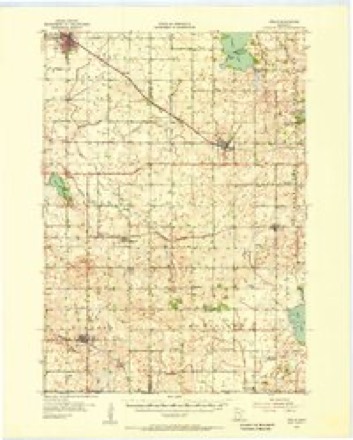
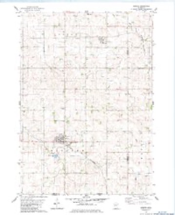
6 surveys from 8 printed sheetsMatched by testing this settlement's coordinate against the published boundary of every sheet in the United States Geological Survey's historical collection. Each opens the scanned sheet at the Survey.
- 1954 USGS Mason City quadrangle1:250000, 2 printings
- 1955 USGS Wells quadrangle1:62500
- 1957 USGS Mason City quadrangle1:250000
- 1958 USGS Mason City quadrangle1:250000
- 1982 USGS Kiester quadrangle1:24000
- 1985 USGS Albert Lea quadrangle1:100000, 2 printings




In the county-history sources
30,544 words on this townshipThe History of Faribault County, Minnesota : from Its First Settlement to the Close of the Year 1879 : the Story of the Pioneers, published 1896 names this settlement in its chapter on Kiester Township. These are the passages that mention it, exactly as the scans read.
The average elevation, above sea level, of this town is, twelve hundred and fifty feet, but there is one elevation, or point of land which is fourteen hundred feet. There is a range of morainic or drift hills in this town designated by the State geologist, as the "Kiester Hills," and which extend, in a northwestern direction, - some twenty miles to the southwest part of Lura township. We quote here from Vol. I, "Geology of Minnesota:"
Passage source: The History of Faribault County, Minnesota : from Its First Settlement to the Close of the Year 1879 : the Story of the Pioneers, published 1896.
It appearing subsequently that there was another town in the State of this name, the State Auditor directed the name to be changed, and accordingly on the fourth day of January, 1859. the board of county supervisors named the town "Kiester," after one J. A. Kiester, of Blue Earth City, whose name appears occasionally in this history of the county.
Passage source: The History of Faribault County, Minnesota : from Its First Settlement to the Close of the Year 1879 : the Story of the Pioneers, published 1896.
Mr. Kiester was born in Pennsylvania in 1832. He received his education in the common schools and at Mount Pleasant and Dickinson colleges, in that state. He served an apprenticeship of four years in learning the mercantile business and book-keeping. He subsequently studied law, and was admitted to the bar in 1855.
Passage source: The History of Faribault County, Minnesota : from Its First Settlement to the Close of the Year 1879 : the Story of the Pioneers, published 1896.
Machine-read from a century-old scan, so expect the errors a machine makes: misspelled names, dropped words, stray characters.
Read the whole chapter on Kiester Township - it names this place 15 more 15 times.
Mines and quarries near this place
2 within 5 milesRegional context, not property-specific evidence. The federal mineral resources record lists 2 workings within 5 miles of Kiester: 2 producers. All of them still produce. What was taken out: Sand and Gravel, Construction. Distance is straight-line from the map coordinates, so a quarry counted here may appear on a neighbouring settlement's page as well.
| Where | Site | Commodity | Status | Recorded |
|---|---|---|---|---|
| Baker Pit & Mill | Sand and Gravel, Construction | Producer | ||
| Olman Pit & Mill | Sand and Gravel, Construction | Producer |
Storms near this place
22 since 1994Regional context, not property-specific evidence. The National Weather Service names Kiester in 22 storm reports between 1994 and 2021: 9 hail, 6 thunderstorm wind, 6 tornado, 1 funnel cloud. No death or injury is recorded in these reports. Each account below is quoted exactly as the forecast office filed it, from the NOAA Storm Events Database, and each date opens the federal record of that event.
| When | Event | Place named | Harm | What the report says |
|---|---|---|---|---|
| May 2012 | Tornado (EF0) | Kiester | $250,000 | The emergency manager of Faribault County survey damage associated with a tornado that touched down in the southeast part of the county on May 4th. ||The survey indicated that the tornado touchdown approximately 1.7 miles east of Kiester, and tracked east-northeast along County Road 2, and then turned northeast, to 2.4 miles northeast of Kiester before dissipating. The tornado was rated an EF0, with winds of 75 mph. It damaged trees, took down three barns, and destroyed a number of sheds and other outbuildings. In addition, a few windows were blown out, along with several power poles blown down. |
| December 2021 | Tornado (EF0) | Kiester | - | A barn lost its roof. Large tree limbs were also downed. This tornado began in Winnebago County, Iowa (see entry from NWS Des Moines). |
| June 2010 | Tornado (EF0) | Kiester | - | A brief tornado moved across open fields. Tornado was recorded on video. |
| June 2010 | Tornado (EF2) | Kiester | - | A damage survey, plus photo and video evidence from chasers, showed this tornado developed just west of Kiester, moved north and struck the northwestern edge of Kiester, producing widespread tree damage and rated EF-1 at this point. It continued north as a multiple vortex tornado, doing EF-2 damage to a grove of trees. Farther north, several trees and grave stones were knocked over in a cemetery. It then turned and moved north-northeast before dissipating to the northeast of Kiester.||It should be noted that another tornado which developed south-southwest of Kiester (see entry for 1710 to 1716 CST) wrapped around this tornado and dissipated west of Kiester. |
| June 2010 | Tornado (EF2) | Kiester | - | A damage survey, plus photo and video evidence from storm chasers, showed that this tornado formed south-southwest of Kiester, near the intersection of 20th Street and 570th Avenue, then wrapped around another tornado (which developed about one mile west of Kiester) and dissipated. While southwest of Kiester, it did EF-2 damage to a couple farmsteads, including tree damage and destruction of several grain bins. |
| June 2009 | Funnel Cloud | Kiester | - | Photographed by citizen; reported by numerous spotters. |
| October 2006 | Thunderstorm Wind | Kiester | - | A second floor deck on an area home on Kiester's Main Street was damaged when tree limbs caused by strong winds fell over it. Several reports of large branches on area homes. |
| October 2006 | Hail | Kiester | - | Some windows broken in town from the hail. Scattered farms between Kiester and Bricelyn incurred severe damage to corn crops. Some plants which stood twelve feet high were hammered down to only three feet in height. Corn stalks were stripped in many areas and soybean plants were broken open. As reported by Courier Sentinel newspaper. |
| April 2004 | Thunderstorm Wind | Kiester | - | A barn was heavily damaged. |
| August 2004 | Thunderstorm Wind | Kiester | - | A tree was downed. The time was estimated. |
| May 2003 | Hail | Kiester | - | Hail covered road. |
| June 2001 | Thunderstorm Wind | Kiester | - | Several trees down in Northwest side of town. Shingles blown off roof. |
| August 1999 | Tornado (F0) | Kiester | - | Brief touchdown in open field. |
| May 1998 | Thunderstorm Wind | Kiester | - | Windmill destroyed. Trees blown over. Estimated windspeed. |
| August 1995 | Thunderstorm Wind | Kiester | - | Trees down. A mobile home rolled one and one half times before exploding. Windows were sucked out of homes. |
| August 1994 | Hail | Kiester | - | Baseball size hail pelted Kiester. |
| May 2003 | Hail | Kiester | - | no account filed |
| May 2002 | Hail | Kiester | - | no account filed |
| May 2001 | Hail | Kiester | - | no account filed |
| September 2001 | Hail | Kiester | - | no account filed |
| September 1996 | Hail | Kiester | - | no account filed |
| May 1994 | Hail | Kiester | - | no account filed |
Nearest settlements
The eight closest, with where each one stands in the county. Distances are straight-line, computed from the Geographic Names Information System coordinates.
Elsewhere
Matched on this settlement's Geographic Names Information System number rather than its name, so it cannot be a different place of the same name in another state.
| Wikipedia article on Kiester | An encyclopaedic summary. Its text is share-alike, so it is linked here rather than copied. |
| Wikidata item Q915207 | The structured record the population and elevation above come from. Public domain (CC0). |
Provenance
This settlement is recorded in the Geographic Names Information System as feature 646138. The sheet list is computed by point-in-boundary test against the United States Geological Survey's historical topographic inventory. Both are works of the United States government and carry no copyright under 17 U.S.C. 105.
Mines and quarries. USGS Mineral Resources Data System (MRDS) https://mrdata.usgs.gov/mrds/ A work of the United States government, no copyright under 17 U.S.C. 105.
Storms. NOAA National Centers for Environmental Information, Storm Events Database https://www.ncei.noaa.gov/stormevents/ A work of the United States government, no copyright under 17 U.S.C. 105. Narratives are quoted verbatim from the National Weather Service report and are not edited or summarised.