 Block
Minneapolis, Minnesota
26 topographic sheets cover this place, the earliest surveyed in 1896 and the latest in 1985. It stands in Minneapolis City. It lies in ZIP code area 55401. It lies near Nicollet Island. The Survey maps it on the Minneapolis South quadrangle. 429,954 people lived here at the 2020 count. It stands 866 feet above sea level.
On record in Minneapolis
Buildings and businesses the archive holds for this place. Each opens its own page, with the source record it came from.
On the National Register 12 of 152 shown
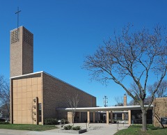 Christ Church LutheranNational Historic Landmark · listed 2001
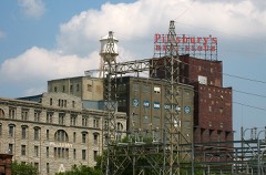 Pillsbury A MillNational Historic Landmark · listed 1966
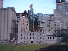 Washburn A Mill ComplexNational Historic Landmark · listed 1983
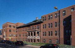 Abbott Hospitallisted 2011
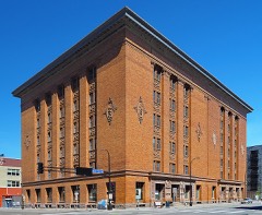 Advance Thresher/Emerson-Newton Implement Companylisted 1977
 Architects and Engineers Buildinglisted 1984
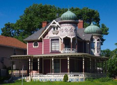 Bardwell-Ferrant Houselisted 1984
 Basilica of St. Mary-Catholiclisted 1975
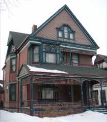 Bennett-McBride Houselisted 1977
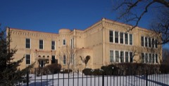 Fredrika Bremer Intermediate Schoollisted 1978
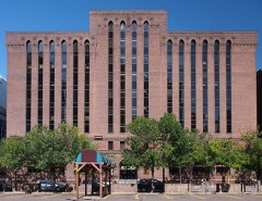 Butler Brothers Companylisted 1971
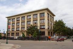 Buzza Company Buildinglisted 2012
Population over time
6 figuresMinneapolis fell from 434,400 to 429,954 between 1970 and 2020. These are the recorded population figures Wikidata holds for this place, reached through the Geographic Names Information System number this page is keyed on rather than by name, so they belong to this place and not to another of the same name. Most are census counts, but not all are: an early figure may be a founding or settlement estimate, and an estimate published within five years of a census is left out. The change column is computed, and is left blank where more than 20 years separate a figure from the one before it, because a gap that long is not a change between two counts.
| Year | People | Change |
|---|---|---|
| 1970 | 434,400 | |
| 1980 | 370,951 | -63,449 (-15%) |
| 1990 | 368,383 | -2,568 (-1%) |
| 2000 | 382,618 | +14,235 (+4%) |
| 2010 | 382,578 | -40 (-0%) |
| 2020 | 429,954 | +47,376 (+12%) |
Topographic sheets covering this place
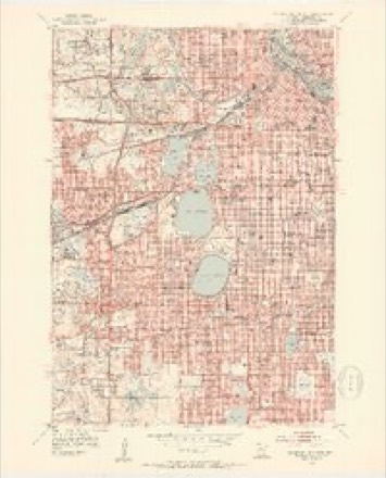
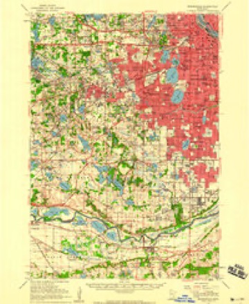
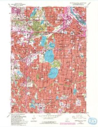
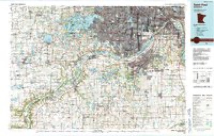
10 surveys from 26 printed sheetsMatched by testing this settlement's coordinate against the published boundary of every sheet in the United States Geological Survey's historical collection. Each opens the scanned sheet at the Survey.
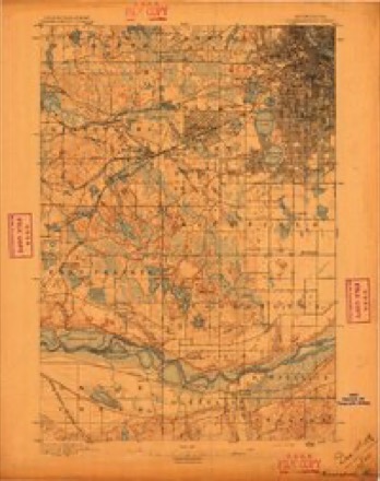
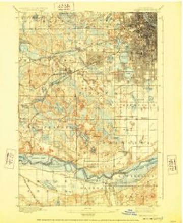
- 1896 USGS Minneapolis quadrangle1:62500
- 1901 USGS Minneapolis quadrangle1:62500, 8 printings
- 1952 USGS Minneapolis South quadrangle1:24000, 2 printings
- 1953 USGS Saint Paul quadrangle1:250000, 3 printings
- 1953 USGS St. Paul quadrangle1:250000
- 1954 USGS Minneapolis quadrangle1:62500
- 1959 USGS Saint Paul quadrangle1:250000
- 1959 USGS St. Paul quadrangle1:250000
- 1967 USGS Minneapolis South quadrangle1:24000, 6 printings
- 1985 USGS Saint Paul quadrangle1:100000, 2 printings




What happened here
An account from the chapter on Minneapolis city. The inset identifies its exact source book and publication year.
Chapter Lii
Hassan heavily timbered. - Marshes. - Settled since 1854. - Irish settlers. - Sawmill built. - Progress of settlement. - First town meeting held in 1869. - Officers chosen. - School. - First marriage. - Territorial road. - Post office. - Episcopal Church. - Grass¬ hoppers. - Indian massacre. - Beauty of landscape characterizing Greenwood.
In the county-history sources
1,259,960 words on this townshipThe county-history sources names this settlement in its chapter on Minneapolis City. These are the passages that mention it, exactly as the scans read.
Machine-read from a century-old scan, so expect the errors a machine makes: misspelled names, dropped words, stray characters.
Read the whole chapter on Minneapolis City - it names this place 3 more 3 times.
Fires near this place
1 since 1999Regional context, not property-specific evidence. The federal wildfire occurrence database lists 1 fire within 5 miles of Minneapolis in 1999, burning about 2 acres in total. None started naturally. None was recorded as arson. Distance is straight-line from the map coordinates, so a fire counted here may appear on a neighbouring settlement's page as well.
| Reported cause | Fires |
|---|---|
| Railroad operations and maintenance | 1 |
The most recent of them, most recent first, with the day each was reported and the service that recorded it.
| Date | Cause | Size | Reported by | Name on the report |
|---|---|---|---|---|
| 3 May 1999 | Railroad operations and maintenance | 1.5 acres | Minnesota Department of Natural Resources | not named |
Settlements close enough to share some of these fires:
Mines and quarries near this place
3 within 5 milesRegional context, not property-specific evidence. The federal mineral resources record lists 3 workings within 5 miles of Minneapolis: 2 producers, 1 past producer. 2 still produce. What was taken out: Silica, Bentonite. Distance is straight-line from the map coordinates, so a quarry counted here may appear on a neighbouring settlement's page as well.
| Where | Site | Commodity | Status | Recorded |
|---|---|---|---|---|
| North Central Aggregate Pit | Bentonite | Producer | ||
| Minn Silica Sand Pit | Silica | Past Producer | ||
| Minnesota Silica Sand Pit | Silica | Producer | Sandstone |
Storms near this place
60 of 136 shownRegional context, not property-specific evidence. The National Weather Service names Minneapolis in 136 storm reports between 1993 and 2026: 79 hail, 40 thunderstorm wind, 11 flash flood, 5 heavy rain. No death or injury is recorded in these reports. Each account below is quoted exactly as the forecast office filed it, from the NOAA Storm Events Database, and each date opens the federal record of that event.
| When | Event | Place named | Harm | What the report says |
|---|---|---|---|---|
| May 2001 | Hail | Minneapolis | $10,000,000 | Reported at 60th and Penn. Ave. Damage estimate pertains to all of the hail reports across Hennepin County. Numerous buildings and vehicles damaged. |
| August 2023 | Hail | Minneapolis | $5,000,000 | In the Bryn Mawr nieghborhood the hail was mostly golf ball size, with a few 2.5 to 3 inch stones. |
| August 2023 | Hail | Minneapolis | $5,000,000 | A picture was shared on social media of hail next to a baseball. The hail was slightly smaller than the baseball. |
| August 2023 | Hail | Minneapolis | $2,000,000 | A picture on social media showed the hail slightly larger than 2 inches. |
| August 2011 | Thunderstorm Wind | Minneapolis | $25,000 | A large 18 diameter tree was blown down at the corner of University and Central Avenue. In addition, wind swept debris damaged cars in the parking lot at the corner of Broadway Street and Hoover in northeast Minneapolis. |
| May 2022 | Thunderstorm Wind | Minneapolis | $20,000 | A large tree fell on a car in South Minneapolis. |
| June 2021 | Thunderstorm Wind | Minneapolis | $3,000 | Several large tree branches were blown down around the Loring Park area of Minneapolis. |
| June 2021 | Thunderstorm Wind | Minneapolis | $3,000 | Several large tree branches were blown down near downtown Minneapolis. |
| July 2025 | Heavy Rain | Minneapolis | - | A thunderstorm produced very heavy rainfall in 30 minutes nearing 4 p/hour rainfall rates. Urban street flooding was reported near the intersection of NE Broadway St. and NE Industrial Blvd. Approximately one mile east, a CoCoRaHS observer recorded 2.07 of storm total rainfall. |
| June 2025 | Thunderstorm Wind | Minneapolis | - | Thunderstorm wind gust estimated at 65 mph downed a large tree, blocking a road in north Minneapolis. |
| June 2025 | Flash Flood | Minneapolis | - | Emergency Manager reported roadways flooded between East Hennepin Av and SE Como Av. |
| June 2025 | Flash Flood | Minneapolis | - | Flooded roadways in northeast Minneapolis, near the Anoka County line, between I-94 and MN 47. Stranded motorists were rescued by Fire Dept. |
| July 2024 | Thunderstorm Wind | Minneapolis | - | Photo on social media of uprooted 1621-inch diameter tree at Minneapolis College of Art and Design. |
| July 2024 | Hail | Minneapolis | - | Relayed from Metro Skywarn. |
| August 2024 | Thunderstorm Wind | Minneapolis | - | Delayed report of two-foot diameter tree down, time estimated from radar. |
| August 2023 | Hail | Minneapolis | - | A picture was shared on social media of 1.75 inch hail. |
| August 2023 | Hail | Minneapolis | - | A picture was shared on social media of 2 inch hail. |
| May 2022 | Thunderstorm Wind | Minneapolis | - | A large tree fell on a house in Minneapolis. |
| July 2019 | Flash Flood | Minneapolis | - | Flash flooding occurred on the westbound lane of I-394, near Penn Avenue. Flood waters were up to 2 feet deep. |
| July 2019 | Flash Flood | Minneapolis | - | Flash flooding, with water up to two feet deep, occurred near I-94, and I-35W. |
| June 2017 | Thunderstorm Wind | Minneapolis | - | A 12 to 14 inch diameter tree was blown down on a vehicle. |
| June 2017 | Thunderstorm Wind | Minneapolis | - | Large trees were blown down across the road and on a car at NE Main Street and NE 16th Ave in northeast Minneapolis. |
| July 2016 | Thunderstorm Wind | Minneapolis | - | A 2 to 3 foot diameter tree was blown down near Pierce and West Broadway Avenue in Minneapolis. |
| July 2016 | Heavy Rain | Minneapolis | - | Heavy rain of 2 to 3 inches resulted in ponding of water at intersections and viaducts in northeast Minneapolis and St Anthony. |
| May 2015 | Thunderstorm Wind | Minneapolis | - | A trained spotter measured a wind gust of 60 mph in north Minneapolis. There were reports just north of downtown Minneapolis of several large tree limbs blown down and a few windows blown out. |
| May 2014 | Thunderstorm Wind | Minneapolis | - | A large tree limb, 10 to 12 inches in diameter, was blown off and landed on a power line. |
| June 2013 | Thunderstorm Wind | Minneapolis | - | Two, 12 inch diameter trees were blown down near Victory Memorial Park in Minneapolis. |
| June 2013 | Thunderstorm Wind | Minneapolis | - | Several trees came down on vehicles and houses in northeast Minneapolis, near Pierce St and 22nd. |
| June 2013 | Flash Flood | Minneapolis | - | Flood waters caused numerous roadways in downtown Minneapolis to close or become impassable for a short period of time during the evening of Friday, June 21st. The 900 block of Elliot Avenue in Minneapolis had rapidly flowing flood waters over the roadway. Flood waters were up to cars headlights along Broadway Avenue, north of downtown Minneapolis. In addition, parts of Loring Park had up to two feet of water in the parking lot. |
| June 2013 | Thunderstorm Wind | Minneapolis | - | Scattered trees and power lines were blown down on the University of Minnesota, Minneapolis Campus. |
| May 2013 | Hail | Minneapolis | - | Penny size hail was reported at 6th Street and Marquette in Minneapolis. |
| May 2013 | Hail | Minneapolis | - | Penny size hail was reported in South Minneapolis at 24th Street, and Lyndale. |
| May 2012 | Heavy Rain | Minneapolis | - | A local observer measured 3.05 inches in the last 24 hours. |
| August 2012 | Thunderstorm Wind | Minneapolis | - | A 10-inch diameter tree branch was blown down in downtown Minneapolis, near the intersection of 2nd Street, and 11th Avenue South. |
| May 2011 | Hail | Minneapolis | - | Hail fell at the intersection of Interstates 94 and 394. |
| May 2011 | Hail | Minneapolis | - | Hail fell at Loring Park, just south of downtown Minneapolis. |
| August 2011 | Heavy Rain | Minneapolis | - | Minor ponding of water was observed on the Minnesota Department of Transportation Webcam at Interstate 94 and Broadway. |
| August 2010 | Flash Flood | Minneapolis | - | A few buses and police cars were stuck in water near Central Ave and 20th Street, north of downtown Minneapolis, Minnesota. Several observers across Hennepin County, especially near the downtown area, had between two and locally five inches of rainfall between 8 and 11 pm. |
| May 2008 | Hail | South Minneapolis | - | Occurred near Loring Park on the edge of downtown. |
| May 2008 | Thunderstorm Wind | South Minneapolis | - | Outflow from thunderstorms in northern Hennepin County caused large trees and branches to go down just south of Powderhorn Park in the southern portion of Minneapolis. |
| June 2008 | Thunderstorm Wind | South Minneapolis | - | Two foot diameter trees downed at 43rd and Xerxes Avenue, and six to eight inch branches were downed at Cedar Avenue and Nokomis. |
| August 2007 | Thunderstorm Wind | South Minneapolis | - | Twenty inch diameter elm tree toppled at 60th and Chicago. Near 61st and Portland, 8 to 10 inch tree limbs were down. |
| August 2007 | Hail | Minneapolis | - | Occurred on south side of city relayed by broadcast media. |
| August 2007 | Thunderstorm Wind | Minneapolis | - | Tree toppled onto a house in the southern part of Minneapolis. Many neighborhood trees also lost limbs or were toppled, with some on vehicles. |
| September 2007 | Hail | Minneapolis | - | Hail occurred at intersection of I-35W and 35th Street South. |
| August 2007 | Hail | Minneapolis | - | Near lake Harriet. |
| September 2007 | Hail | Minneapolis | - | Occurred at Franklin and Lyndale. |
| August 2007 | Flash Flood | Minneapolis | - | Water up to the car doors at intersection of 34th and Penn ave. S. |
| July 2007 | Thunderstorm Wind | Minneapolis | - | Large branches and power lines down near Lake Harriet and Lake Calhoun. Waves reached two feet, where sailing schools were being held. Five sailboats were tipped, tossing 16 children and adults into the two lakes. Nobody was injured. All were wearing life jackets. Most swam back to shore, while others were picked up by other boaters. |
| June 2006 | Hail | Minneapolis | - | Large hail fell in a swath from Lake Calhoun to downtown Minneapolis, to northeast Minneapolis. |
| July 2006 | Hail | Minneapolis | - | Reported at the University of Minnesota campus. |
| July 2006 | Hail | Minneapolis | - | Reported near Broadway and Marshall in northeastern Minneapolis. |
| June 2006 | Heavy Rain | Minneapolis | - | Three to four inches of rain in several hours resulted in ponding of water at numerous intersections and low lying spots. Several manhole covers in downtown Minneapolis were blown out, including one at 9th and Marquette, where minor damage was incurred due to one manhole cover hitting the overhead skyway. |
| July 2006 | Hail | Minneapolis | - | Reported near the Metrodome. |
| June 2005 | Thunderstorm Wind | Minneapolis | - | Trees up to 5 inches in diameter were downed around Lake of the Isles and Lake Calhoun. A large oak tree was downed in south Minneapolis. A trained spotter recorded a wind gust of 65 MPH on an anemometer. |
| June 2005 | Thunderstorm Wind | Minneapolis | - | Between 15 and 20 sailboats anchored to buoys were overturned on Lake Calhoun. Tree limbs up to 5 inches in diameter were downed. A wooden fence was blown over. |
| June 2005 | Thunderstorm Wind | Minneapolis | - | A tree was downed onto a house in north Minneapolis. |
| April 2004 | Thunderstorm Wind | Minneapolis | - | A tree fell onto a house and collapsed the roof. |
| May 2004 | Hail | Minneapolis | - | Penny sized hail fell in St. Anthony and at Lake Nokomis. |
| May 2004 | Thunderstorm Wind | Minneapolis | - | A wind gust of 66 MPH was recorded by an automated weather sensor. Trees were downed at the intersection of Portland and 5th avenues and on a house in the northeast portion of town. |
Nearest settlements
The eight closest, with where each one stands in the county. Distances are straight-line, computed from the Geographic Names Information System coordinates.
| Map | Place | Distance | Sheets |
|---|---|---|---|
| Kenwood Gables | 1.6 miles | 26 | |
| Calhoun Beach | 3.4 miles | 26 | |
| Glenwood Junction | 3.7 miles | 26 | |
| Saint Anthony | 3.7 miles | 22 | |
| Golden Valley | 5.0 miles | 21 | |
| Saint Louis Park | 5.0 miles | 26 | |
| Robbinsdale | 5.4 miles | 21 | |
| Crystal | 6.3 miles | 21 |
Elsewhere
Matched on this settlement's Geographic Names Information System number rather than its name, so it cannot be a different place of the same name in another state.
| Wikipedia article on Minneapolis | An encyclopaedic summary. Its text is share-alike, so it is linked here rather than copied. |
| Wikidata item Q36091 | The structured record the population and elevation above come from. Public domain (CC0). |
Provenance
This settlement is recorded in the Geographic Names Information System as feature 655030. The sheet list is computed by point-in-boundary test against the United States Geological Survey's historical topographic inventory. Both are works of the United States government and carry no copyright under 17 U.S.C. 105.
Wildfire. Short, Karen C. 2022. Spatial wildfire occurrence data for the United States, 1992-2020 [FPA_FOD_20221014]. 6th Edition. Fort Collins, CO: Forest Service Research Data Archive. https://doi.org/10.2737/RDS-2013-0009.6 Collected with United States Government funding and usable without additional permissions or fees.
Mines and quarries. USGS Mineral Resources Data System (MRDS) https://mrdata.usgs.gov/mrds/ A work of the United States government, no copyright under 17 U.S.C. 105.
Storms. NOAA National Centers for Environmental Information, Storm Events Database https://www.ncei.noaa.gov/stormevents/ A work of the United States government, no copyright under 17 U.S.C. 105. Narratives are quoted verbatim from the National Weather Service report and are not edited or summarised.