 Block
Alma, Missouri
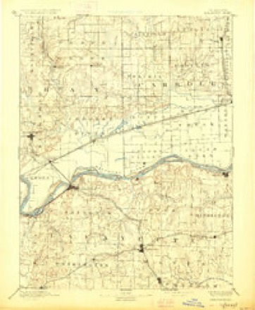
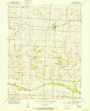
16 topographic sheets cover this place, the earliest surveyed in 1889 and the latest in 1982. It stands in Middleton Township. It lies in ZIP code area 64001. The Survey maps it on the Alma quadrangle. 400 people lived here at the 2020 count. It stands 801 feet above sea level.
Population over time
2 figuresAlma fell from 402 to 400 between 2010 and 2020. These are the recorded population figures Wikidata holds for this place, reached through the Geographic Names Information System number this page is keyed on rather than by name, so they belong to this place and not to another of the same name. Most are census counts, but not all are: an early figure may be a founding or settlement estimate, and an estimate published within five years of a census is left out. The change column is computed, and is left blank where more than 20 years separate a figure from the one before it, because a gap that long is not a change between two counts.
| Year | People | Change |
|---|---|---|
| 2010 | 402 | |
| 2020 | 400 | -2 (-0%) |
Topographic sheets covering this place
7 surveys from 16 printed sheetsMatched by testing this settlement's coordinate against the published boundary of every sheet in the United States Geological Survey's historical collection. Each opens the scanned sheet at the Survey.
- 1889 USGS Lexington quadrangle1:125000, 6 printings
- 1951 USGS Alma quadrangle1:24000, 3 printings
- 1953 USGS Moberly quadrangle1:250000
- 1954 USGS Moberly quadrangle1:250000, 3 printings
- 1957 USGS Moberly quadrangle1:250000
- 1960 USGS Moberly quadrangle1:250000
- 1982 USGS Marshall quadrangle1:100000




In the county-history sources
11,815 words on this townshipHistory of Lafayette County, Mo. , Carefully Written and Compiled from the Most Authentic Official and Private Sources, Including a History of Its Townships, Cities, Towns, and Villages, Together with a Condensed History of Missouri; the Constitution of the United States, and State of Missouri; a Military Record of Volunteers in Either Army of the Great Civil War .., published 1881 names this settlement in its chapter on Middleton Township. These are the passages that mention it, exactly as the scans read.
The town of Alma was founded by Captain Lysing and Jno. W. Woodson, on completion of the C. & A. Extension railroad in 1879, and incorporated in 1880. The first mayor was Dr. Thomas Field. The postoffice was established in 1879, the first postmaster being Perry Catron. Dr. Field built the first house and owned the first store. The first schoolhouse was built in the summer of 1880, at a cost of $750. The first school was taught by Miss Cassie Bascom, the number of pupils being thirtyfive, at a compensation of $45 per month. The first marriage was that of H. C. Clay to Miss Milburn, and was performed at Thomas Luke's, and by Thomas Luke, who was the first justice of the peace. The first male child born in the town of Alma was Mitchell, son of Geo Weston, and the first female child was Katie, daughter of William and Martha Buck, born in June 1879. Dr. Thomas Field was the first regular physician in Alma - since moved to Sedalia. The present town officers are: Stark, mayor; Martin Buck, Wm. Doblie, and Charles Mayviers, town board. The town is about equally divided between orignal Piatt & Corder's addition andjording's addition.
Three Groves Church was organized about the year 1871. The original members were Mrs. Boyd, Mrs. Hoard, Geo. Nethercutt, and some others. The church building was erected in 1880-81 ; it is of frame and cost $1,500. It was dedicated the first Sunday in May, 1881, by Rev. W. B. McFarland. Their pastors have been R. A. Shaffer, W. I. Brown, and W. B. McFarland. The present membership numbers forty. In connection with the church they have a fine Sunday-school.
The subject of this sketch, a highly respected citizen and honored physician of Waverly, is the son of Wm. F. and Sarah E. Wood, who were among the early settlers of Lafayette county, formerly of Tennessee. The doctor was born in Lafayette county, Feb. 25, 1839. He received his education at Lexington and Chapel Hill College. Commenced the study of medicine when sixteen years old under Dr. S. W Brown. Afterwards attended St. Louis medical college where he graduated in class of 1859-60. Began practice of medicine in Waverly. When the war came on, he enlisted in the southern cause, and left Waverly with Gen. Shelby's company, as assistant surgeon of his regiment, and afterwards was promoted to surgeon. He was with Shelby through the entire war. Was in the battles of Lexington, Newtonia, Prairie Grove Springfield, Harstville, Helena, Little Rock, Jenkins Ferry and every raid made in Missouri. After the surrender of Shreveport, he returned to his home in Waverly and to the practice of his profession in partnership with Dr
Machine-read from a century-old scan, so expect the errors a machine makes: misspelled names, dropped words, stray characters.
Read the whole chapter on Middleton Township - it names this place 10 more 10 times.
Fires near this place
1 since 2020Regional context, not property-specific evidence. The federal wildfire occurrence database lists 1 fire within 5 miles of Alma in 2020, burning about 1 acre in total. None started naturally. None was recorded as arson. Distance is straight-line from the map coordinates, so a fire counted here may appear on a neighbouring settlement's page as well.
| Reported cause | Fires |
|---|---|
| Equipment and vehicle use | 1 |
The most recent of them, most recent first, with the day each was reported and the service that recorded it.
| Date | Cause | Size | Reported by | Name on the report |
|---|---|---|---|---|
| 17 October 2020 | Equipment and vehicle use | under an acre | Missouri Department of Conservation | 230903-05421-10172020-1435 |
Settlements close enough to share some of these fires:
Mines and quarries near this place
2 within 5 milesRegional context, not property-specific evidence. The federal mineral resources record lists 2 workings within 5 miles of Alma: 2 past producers. None of them still produces. What was taken out: Stone, Crushed/Broken. Distance is straight-line from the map coordinates, so a quarry counted here may appear on a neighbouring settlement's page as well.
| Where | Site | Commodity | Status | Recorded |
|---|---|---|---|---|
| Unknown | Stone, Crushed/Broken | Past Producer | ||
| Unknown - Ls | Stone, Crushed/Broken | Past Producer |
Storms near this place
11 since 2000Regional context, not property-specific evidence. The National Weather Service names Alma in 11 storm reports between 2000 and 2023: 8 thunderstorm wind, 2 hail, 1 tornado. No death or injury is recorded in these reports. Each account below is quoted exactly as the forecast office filed it, from the NOAA Storm Events Database, and each date opens the federal record of that event.
| When | Event | Place named | Harm | What the report says |
|---|---|---|---|---|
| May 2000 | Thunderstorm Wind | Alma | $10,000 | Power lines were downed near Alma. |
| April 2002 | Thunderstorm Wind | Alma | $5,000 | Poles and power lines down. |
| June 2008 | Tornado (EF0) | Alma | $500 | A brief EF0 tornado touched down at 2323CST and moved northeast, before lifting at 2325CST. The only damage outside of broken tree limbs, was to a porch at a residence just south of Alma. |
| February 2023 | Thunderstorm Wind | Alma | - | A squall line produced a measured wind gust of 59 mph as well as a tree downed on a house in Alma. |
| February 2023 | Thunderstorm Wind | Alma | - | Barn destroyed just south of Alma. |
| June 2017 | Thunderstorm Wind | Alma | - | A foot and a half diameter hollowed out tree fell near Alma. |
| June 2017 | Thunderstorm Wind | Alma | - | A 70 mph wind caused some structural damage to school and some crops. |
| May 2015 | Thunderstorm Wind | Alma | - | Ten to fifteen inch diameter tree limbs snapped, power lines down and a power pole snapped. |
| August 2011 | Thunderstorm Wind | Alma | - | Thunderstorm wind gusts were estimated up to 65 mph. Several large tree limbs were reported down. |
| May 2017 | Hail | Alma | - | no account filed |
| December 2017 | Hail | Alma | - | no account filed |
Nearest settlements
The eight closest, with where each one stands in the county. Distances are straight-line, computed from the Geographic Names Information System coordinates.
| Map | Place | Distance | Sheets |
|---|---|---|---|
| Corder | 5.1 miles | 15 | |
| Concordia | 7.8 miles | 23 | |
| Waverly | 8.0 miles | 17 | |
| Aullville | 8.8 miles | 15 | |
| Cuba (historical) | 9.1 miles | 17 | |
| Higginsville | 9.2 miles | 15 | |
| Hodge | 9.9 miles | 17 | |
| Page City | 10.1 miles | 17 |
Elsewhere
Matched on this settlement's Geographic Names Information System number rather than its name, so it cannot be a different place of the same name in another state.
| Wikipedia article on Alma | An encyclopaedic summary. Its text is share-alike, so it is linked here rather than copied. |
| Wikidata item Q964626 | The structured record the population and elevation above come from. Public domain (CC0). |
Provenance
This settlement is recorded in the Geographic Names Information System as feature 713242. The sheet list is computed by point-in-boundary test against the United States Geological Survey's historical topographic inventory. Both are works of the United States government and carry no copyright under 17 U.S.C. 105.
Wildfire. Short, Karen C. 2022. Spatial wildfire occurrence data for the United States, 1992-2020 [FPA_FOD_20221014]. 6th Edition. Fort Collins, CO: Forest Service Research Data Archive. https://doi.org/10.2737/RDS-2013-0009.6 Collected with United States Government funding and usable without additional permissions or fees.
Mines and quarries. USGS Mineral Resources Data System (MRDS) https://mrdata.usgs.gov/mrds/ A work of the United States government, no copyright under 17 U.S.C. 105.
Storms. NOAA National Centers for Environmental Information, Storm Events Database https://www.ncei.noaa.gov/stormevents/ A work of the United States government, no copyright under 17 U.S.C. 105. Narratives are quoted verbatim from the National Weather Service report and are not edited or summarised.