 Block
Holden, Missouri
18 topographic sheets cover this place, the earliest surveyed in 1885 and the latest in 1983. It stands in Madison Township. It lies in ZIP code area 64040. The Survey maps it on the Holden quadrangle. 2,210 people lived here at the 2020 count. It stands 853 feet above sea level.
On record in Holden
Buildings and businesses the archive holds for this place. Each opens its own page, with the source record it came from.
On the National Register 1 record
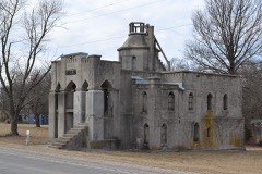 Joseph M. Miller Mausoleumlisted 2018
Population over time
2 figuresHolden fell from 2,252 to 2,210 between 2010 and 2020. These are the recorded population figures Wikidata holds for this place, reached through the Geographic Names Information System number this page is keyed on rather than by name, so they belong to this place and not to another of the same name. Most are census counts, but not all are: an early figure may be a founding or settlement estimate, and an estimate published within five years of a census is left out. The change column is computed, and is left blank where more than 20 years separate a figure from the one before it, because a gap that long is not a change between two counts.
| Year | People | Change |
|---|---|---|
| 2010 | 2,252 | |
| 2020 | 2,210 | -42 (-2%) |
Topographic sheets covering this place
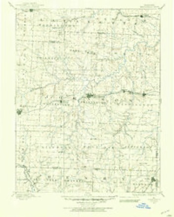
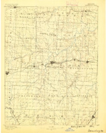
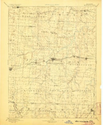
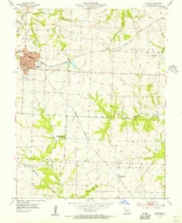
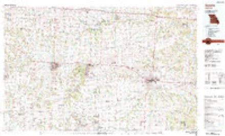
10 surveys from 18 printed sheetsMatched by testing this settlement's coordinate against the published boundary of every sheet in the United States Geological Survey's historical collection. Each opens the scanned sheet at the Survey.
- 1885 USGS Warrensburg quadrangle1:125000
- 1887 USGS Warrensburg quadrangle1:125000
- 1894 USGS Warrensburg quadrangle1:125000, 5 printings
- 1947 USGS Jefferson City quadrangle1:250000
- 1954 USGS Holden quadrangle1:24000
- 1954 USGS Jefferson City quadrangle1:250000, 2 printings
- 1955 USGS Jefferson City quadrangle1:250000, 4 printings
- 1958 USGS Jefferson City quadrangle1:250000
- 1959 USGS Jefferson City quadrangle1:250000
- 1983 USGS Sedalia quadrangle1:100000





In the county-history sources
16,581 words on this townshipThe History of Johnson County, Missouri : Including a Reliable History of the Townships, Cities, and Towns, Together with a Map of the County; a Condensed History of Missouri; the State Constitution; an Abstract of the Most Important Laws; the Physical Features of the County; the Early Settlers and Pioneers; the Political and War History; the Religious and Educational History...statistics and Miscellaneous Matters, Etc., Etc, published 1881 names this settlement in its chapter on Madison Township. These are the passages that mention it, exactly as the scans read.
In 1855 there were no settlements between the present site of Holden and Isaac Hanna's, which latter place is about fifty or a hundred yards south of the southern township line. Most of the settlers lived north of the present site of Holden and a few west. These settlers lived near the two branches of Pin Oak and were very few in number.
The population of this township in 1876, according to census, was 2,1.70, and in 1881 it had increased to 2,931. Since then the population has increased still more rapidly, especially in Holden, giving to this town a population nearly equal to the whole town in 1880.
The Missouri Pacific railroad passes very nearly through the center of the township. After crossing the township line it passes in a southwestern direction, until it gets to the suburbs of Holden, when it turns and passes through this place, a little north of west, and thence continues in its general course, unchanged, till it runs into Kingsville township.
Machine-read from a century-old scan, so expect the errors a machine makes: misspelled names, dropped words, stray characters.
Read the whole chapter on Madison Township - it names this place 55 more 55 times.
Fires near this place
24 since 2003Regional context, not property-specific evidence. The federal wildfire occurrence database lists 24 fires within 5 miles of Holden between 2003 and 2018, burning about 512 acres in total. None started naturally. None was recorded as arson. Distance is straight-line from the map coordinates, so a fire counted here may appear on a neighbouring settlement's page as well.
| Reported cause | Fires |
|---|---|
| Missing data/not specified/undetermined | 18 |
| Debris and open burning | 4 |
| Recreation and ceremony | 1 |
| Smoking | 1 |
The most recent of them, most recent first, with the day each was reported and the service that recorded it.
| Date | Cause | Size | Reported by | Name on the report |
|---|---|---|---|---|
| 23 April 2015 | Smoking | 1.0 acres | Missouri Department of Conservation | 124390-05161-04232015-1423 |
| 5 March 2015 | Missing data/not specified/undetermined | 2.0 acres | Missouri Department of Conservation | 119944-05161-03052015-1354 |
| 22 March 2015 | Missing data/not specified/undetermined | 3.0 acres | Missouri Department of Conservation | 121333-05161-03222015-1311 |
| 22 March 2015 | Missing data/not specified/undetermined | 2.0 acres | Missouri Department of Conservation | 121331-05161-03222015-1659 |
| 20 March 2017 | Missing data/not specified/undetermined | 5.0 acres | Missouri Department of Conservation | not named |
| 16 March 2015 | Missing data/not specified/undetermined | 40 acres | Missouri Department of Conservation | 121310-05161-03162015-1753 |
| 15 March 2015 | Missing data/not specified/undetermined | 300 acres | Missouri Department of Conservation | 121675-05161-03152015-1400 |
| 15 March 2015 | Missing data/not specified/undetermined | 2.0 acres | Missouri Department of Conservation | 121309-05161-03152015-1514 |
Settlements close enough to share some of these fires:
Mines and quarries near this place
5 within 5 milesRegional context, not property-specific evidence. The federal mineral resources record lists 5 workings within 5 miles of Holden: 5 past producers. None of them still produces. What was taken out: Stone, Crushed/Broken. Distance is straight-line from the map coordinates, so a quarry counted here may appear on a neighbouring settlement's page as well.
| Where | Site | Commodity | Status | Recorded |
|---|---|---|---|---|
| Unknown - Ls. | Stone, Crushed/Broken | Past Producer | ||
| Unknown - Ls. | Stone, Crushed/Broken | Past Producer | ||
| Unknown - Ls. | Stone, Crushed/Broken | Past Producer | ||
| Unknown - Ls. | Stone, Crushed/Broken | Past Producer | ||
| Unknown - Ls. | Stone, Crushed/Broken | Past Producer |
Storms near this place
60 since 1994Regional context, not property-specific evidence. The National Weather Service names Holden in 60 storm reports between 1994 and 2024: 23 thunderstorm wind, 22 hail, 8 flash flood, 4 tornado. The reports record 2 deaths and 3 injuries. Each account below is quoted exactly as the forecast office filed it, from the NOAA Storm Events Database, and each date opens the federal record of that event.
| When | Event | Place named | Harm | What the report says |
|---|---|---|---|---|
| June 2024 | Lightning | Holden | 1 killed, 1 hurt | A 53 year old man was struck by lightning in the parking lot at the conclusion of the Holden, MO Rodeo. The lightning strike was fatal. |
| June 2024 | Lightning | Holden | 1 killed | A 53 year old man was killed when struck by lightning in the parking lot outside of the Holden Chamber of Commerce Rodeo around 11 pm CDT on Friday, June 28th, 2024. |
| June 2005 | Tornado (F1) | Holden | 2 hurt, $1,100,000 | F1 tornado touched down 5 miles southwest of Holden and then moved northeast across Route 131 before skipping to and then lifting 3 miles west southwest of Centerview. The biggest impact was at the Miller Training Stables on Route 131. Two women received minor injuries when their house was lifted off the foundation. Six horses were killed and 42 were injured. Three barns, the residence, and 3 cars were heavily damaged or destroyed. There were also several other homes and barns damaged by the tornado before it lifted. |
| February 2007 | Tornado (EF1) | Holden | $200,000 | EF1 tornado touched down 5 miles south of Holden at 5:18 PM CST and moved north-northeast 2 miles, before lifting 3 miles south of Holden at 5:21 PM CST. The tornado damaged two homes, one business, and several farm buildings. Power lines and trees were also downed. |
| June 1999 | Thunderstorm Wind | Holden | $50,000 | A trailer was destroyed, and another home sustained roof damage. |
| April 2007 | Thunderstorm Wind | Holden | $25,000 | Several barns destroyed and numerous trees down. Also minor damage to homes. |
| May 1999 | Thunderstorm Wind | Holden | $10,000 | A barn was severely damaged by thunderstorm winds southwest of Holden. |
| August 2008 | Thunderstorm Wind | Holden | $5,000 | Numerous reports of trees and power lines down. |
| May 2000 | Tornado (F1) | Holden | $5,000 | A storm spotter with the Holden Fire Department observed a tornado 7 miles south of Holden that remained on the ground for two minutes, moving northeast. Several trees and power lines were downed by the storm. |
| October 2004 | Thunderstorm Wind | Holden | $2,000 | Damage to several buildings. |
| July 1995 | Thunderstorm Wind | Holden | $2,000 | A severe thunderstorm moved through Central Johnson County producing wind gusts up to 60 mph three miles north of Centerview knocking down large tree limbs. Numerous trees and power lines were reported down in Holden. |
| June 2004 | Thunderstorm Wind | Holden | $1,000 | Trees and power lines down. |
| May 2024 | Thunderstorm Wind | Holden | - | Downed wires and power outages near County Road U. |
| September 2023 | Hail | Holden | - | Mping report of quarter sized hail in Holden. |
| September 2023 | Hail | Holden | - | Quarter sized hail reported in Holden. |
| July 2020 | Flood | Holden | - | NWS employee reported water over Highway 58 just west of Holden. |
| August 2020 | Thunderstorm Wind | Holden | - | Powerlines were down in the city of Holden. |
| August 2020 | Thunderstorm Wind | Holden | - | NWS Employee reported 60 mph winds. |
| April 2019 | Flash Flood | Holden | - | Water covered Highway 58 half mile east of Holden. |
| April 2019 | Flash Flood | Holden | - | Water covered Highway 58, a half mile east of Holden. |
| June 2019 | Flash Flood | Holden | - | Mud and debris covered a segment of road along Road U along the creek, just east of Holden. |
| June 2018 | Thunderstorm Wind | Holden | - | An outbuilding was destroyed near Holden. |
| June 2018 | Thunderstorm Wind | Holden | - | Large tree limbs were down near Holden. |
| August 2017 | Flash Flood | Holden | - | Water was over the road on HWY 58, about a mile and a half east of Holden. |
| August 2017 | Flash Flood | Holden | - | Water was over the road in Holden at the 300 block of E 10th St, near S Clay St. |
| March 2017 | Thunderstorm Wind | Holden | - | A tree fell on top of a mobile home with three people trapped inside. There were no known injuries from this event. |
| May 2016 | Thunderstorm Wind | Holden | - | A few small tree limbs around 2 to 3 inches were snapped near Holden. |
| May 2015 | Thunderstorm Wind | Holden | - | Trees were damaged near Highway 58 and 1001st street. |
| March 2014 | Hail | Holden | - | Hail was measured after the storm ended and stored in a Casey's Gas station. |
| April 2014 | Thunderstorm Wind | Holden | - | Severe thunderstorms produced 70 to 80 mph straight line winds, lifting several outbuildings from their foundations, snappomg power poles and several 18 to 24 inch trees. One of the trees fell on to a house and damaged the house. |
| June 2010 | Flash Flood | Holden | - | Water was reported to be flowing over the road, one mile west of Holden. |
| June 2008 | Flash Flood | Holden | - | One lane of Highway 58 closed due to high water. |
| November 2006 | Hail | Holden | - | Nickel sized hail at the intersection of Highway 131 and Highway 2. |
| May 2004 | Flash Flood | Holden | - | Flooding on Southwest 100th and Southwest 200th roads near Pin Oak Creek. |
| April 2001 | Thunderstorm Wind | Holden | - | Law enforcement reported one inch hail and wind gusts estimated to 60 mph. |
| August 2001 | Thunderstorm Wind | Holden | - | Thunderstorm winds knocked a roof off a building. Trees and power poles down. No power or telephone service to town. |
| September 2000 | Thunderstorm Wind | Holden | - | Law enforcement officials reported downed trees and power lines. |
| June 1998 | Hail | Holden | - | A television meteorologist from Kansas City reported dime-size hail at the intersection of Route 2 and Route O 8 miles southeast of Holden. |
| July 1994 | Thunderstorm Wind | Holden | - | Numerous large trees were knocked down. |
| March 2020 | Hail | Holden | - | no account filed |
| March 2020 | Hail | Holden | - | no account filed |
| March 2015 | Hail | Holden | - | no account filed |
| April 2014 | Hail | Holden | - | no account filed |
| May 2013 | Hail | Holden | - | no account filed |
| June 2009 | Hail | Holden | - | no account filed |
| March 2006 | Hail | Holden | - | no account filed |
| May 2006 | Hail | Holden | - | no account filed |
| May 2006 | Hail | Holden | - | no account filed |
| April 2006 | Hail | Holden | - | no account filed |
| May 2003 | Hail | Holden | - | no account filed |
| April 2001 | Hail | Holden | - | no account filed |
| April 2001 | Hail | Holden | - | no account filed |
| April 2001 | Hail | Holden | - | no account filed |
| June 2001 | Thunderstorm Wind | Holden | - | no account filed |
| February 2000 | Thunderstorm Wind | Holden | - | no account filed |
| March 2000 | Hail | Holden | - | no account filed |
| March 2000 | Hail | Holden | - | no account filed |
| May 1996 | Tornado (F1) | Holden | - | no account filed |
| April 1995 | Hail | Holden | - | no account filed |
| May 1995 | Thunderstorm Wind | Holden | - | no account filed |
Nearest settlements
The eight closest, with where each one stands in the county. Distances are straight-line, computed from the Geographic Names Information System coordinates.
| Map | Place | Distance | Sheets |
|---|---|---|---|
| Medford | 4.4 miles | 14 | |
| Kingsville | 4.6 miles | 14 | |
| Magnolia | 6.6 miles | 18 | |
| Fenwick | 6.8 miles | 14 | |
| Rose Hill | 7.0 miles | 14 | |
| Denton | 7.7 miles | 18 | |
| Centerview | 8.0 miles | 19 | |
| Latour | 8.0 miles | 14 |
Elsewhere
Matched on this settlement's Geographic Names Information System number rather than its name, so it cannot be a different place of the same name in another state.
| Wikipedia article on Holden | An encyclopaedic summary. Its text is share-alike, so it is linked here rather than copied. |
| Wikidata item Q962507 | The structured record the population and elevation above come from. Public domain (CC0). |
Provenance
This settlement is recorded in the Geographic Names Information System as feature 719697. The sheet list is computed by point-in-boundary test against the United States Geological Survey's historical topographic inventory. Both are works of the United States government and carry no copyright under 17 U.S.C. 105.
Wildfire. Short, Karen C. 2022. Spatial wildfire occurrence data for the United States, 1992-2020 [FPA_FOD_20221014]. 6th Edition. Fort Collins, CO: Forest Service Research Data Archive. https://doi.org/10.2737/RDS-2013-0009.6 Collected with United States Government funding and usable without additional permissions or fees.
Mines and quarries. USGS Mineral Resources Data System (MRDS) https://mrdata.usgs.gov/mrds/ A work of the United States government, no copyright under 17 U.S.C. 105.
Storms. NOAA National Centers for Environmental Information, Storm Events Database https://www.ncei.noaa.gov/stormevents/ A work of the United States government, no copyright under 17 U.S.C. 105. Narratives are quoted verbatim from the National Weather Service report and are not edited or summarised.