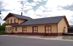
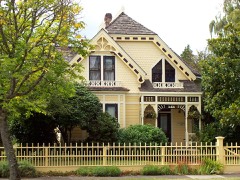
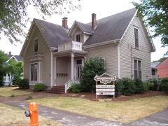
Block
From the record
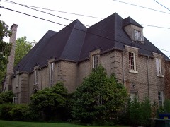
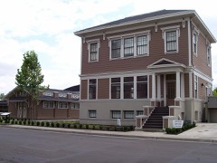
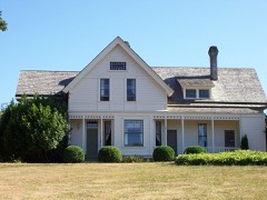
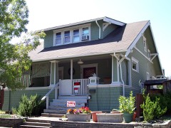
56 National Register listings published here.
Sources: the county history on the Internet Archive · the National Register database, National Park Service
66 topographic sheets cover 23 settlements here, and 56 properties are on the National Register of Historic Places.
56 National Register listings published here.
Sources: the county history on the Internet Archive · the National Register database, National Park Service
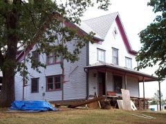
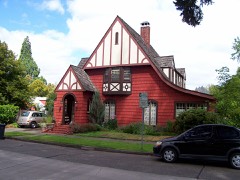
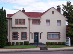
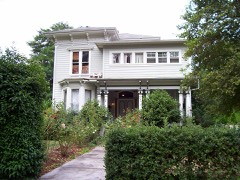
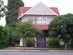
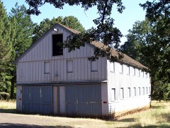
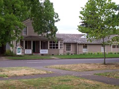
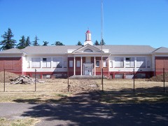
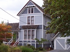
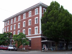
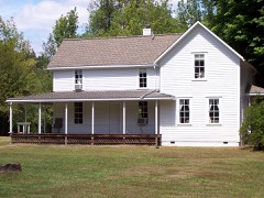
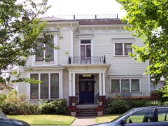
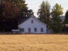
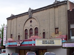
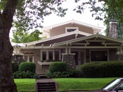
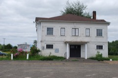
Every property in this county listed on the National Register of Historic Places, with the year it was listed and the federal nomination document.
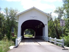
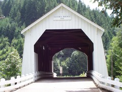
Benton County has 1 covered bridge on the National Register. Each is a listed structure with a federal nomination on file.
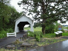 | Irish Bend Covered Bridge No. 14169 | Listed 2013 |
Every wildfire the federal occurrence database records inside this county: 326 of them, burning about 962 acres. 34 started naturally and 9 were recorded as arson. Each settlement page carries the fires within five miles of it.
| Reported cause | Fires |
|---|---|
| Debris and open burning | 81 |
| Equipment and vehicle use | 73 |
| Recreation and ceremony | 41 |
| Natural | 34 |
| Smoking | 27 |
| Power generation/transmission/distribution | 19 |
| Missing data/not specified/undetermined | 15 |
| Arson/incendiarism | 9 |
| Fireworks | 7 |
| Railroad operations and maintenance | 7 |
| Misuse of fire by a minor | 6 |
| Other causes | 6 |
| Firearms and explosives use | 1 |
The five largest, by the area the report gives. One of them was set deliberately.
| Date | Cause | Size | Reported by | Name on the report |
|---|---|---|---|---|
| 12 August 2015 | Debris and open burning | 135 acres | William L. Finley National Wildlife Refuge | FINLEY |
| 1 October 2014 | Debris and open burning | 97 acres | William L. Finley National Wildlife Refuge | M DIKES |
| 5 September 2014 | Misuse of fire by a minor | 86 acres | Oregon Department of Forestry Salem Headquarters | CHIP ROSS FIRE |
| 12 June 2002 | Debris and open burning | 69 acres | Philomath Unit | FULLER CREEK |
| 15 August 1996 | Debris and open burning | 67 acres | William L. Finley National Wildlife Refuge | WARDEN64 |
| 22 March 2001 | Debris and open burning | 65 acres | Philomath Unit | LASKEY CREEK |
| 4 November 2002 | Arson/incendiarism | 40 acres | Siuslaw National Forest | DENZER BRIDGE |
| 24 July 2009 | Equipment and vehicle use | 34 acres | Philomath Unit | TUM TUM CENTRAL |
Every settlement page carries the fires within five miles of it - see the settlement index below.
The NOAA Storm Events Database holds 49 reports for this county, causing no deaths, no injuries and about $3,026,000 in recorded property damage. Each settlement page carries the reports that name it.
| Kind of event | Reports |
|---|---|
| Flood | 25 |
| Heavy Rain | 10 |
| Thunderstorm Wind | 7 |
| Funnel Cloud | 4 |
| Tornado | 2 |
| Lightning | 1 |
The most serious of them, by death, then injury, then recorded damage. The accounts are quoted exactly as the forecast office filed them.
| When | Event | Place named | Harm | What the report says |
|---|---|---|---|---|
| January 2012 | Flood | Conroy | $3,000,000 | Heavy rain caused the Marys River near Philomath to overflow its banks and cause record flooding to surrounding areas. The Marys River crested at 21.5 feet on January 19th at 1 pm PST, 1.5 feet above flood stage. |
| July 2014 | Lightning | Corvallis | $11,000 | Abundant lightning resulted in around 1000 PGE customers without power in the Albany and Corvallis area. A public caller reported that a large tree struck from lightning fell onto a home. |
| December 2015 | Flood | Alsea | $10,000 | Heavy rain resulted in flooding of the Mary River near Philomath. There was also a landslide that closed westbound highway 34 near Alsea. |
| May 1998 | Thunderstorm Wind | Adair Vlg | $5,000 | no account filed |
| August 2025 | Tornado (EFU) | Bruce | - | A landspout was photographed and briefly recorded to the west-northwest of Central Linn High School in the fields around Halsey, OR. No damage was reported. A small condensation funnel was observed above the ground circulation by the observer even though the photographs and video did not show the condensation funnel. The ground circulation and condensation funnel were not visibly connected. Time is based on the public report. Location and path width are roughly estimated based on video footage. |
| November 2024 | Funnel Cloud | Monroe | - | Received a report and image of a funnel cloud via a social media post. No reports of damage. |
| October 2024 | Funnel Cloud | Conroy | - | Multiple reports, from various public sources, reported observing at least a funnel cloud in-between Corvallis,OR and Philomath,OR. Radar did show possible rotation around this time. Location point used is a best estimate based on information from the public. |
| January 2022 | Flood | Flynn | - | The gauge on the Marys River near Philomath rose above flood stage of 20 feet around 0920PST, crested at major flood stage of 21.0 feet at 1500 PST, then dropped below flood stage on the 5th at 0340PST. |
| January 2021 | Flood | Flynn | - | The Marys River near Philomath (PHIO3) rose above flood stage around 2130PST, crested at 21.23 feet, then fell below flood stage at 0430PST on the 14th. Flood stage is 20.0 feet. |
| December 2021 | Flood | Flynn | - | Measured rainfall of 2 to 4 inches. Minor flooding along the Marys River. No Damages reported. |
| December 2020 | Flood | Conroy | - | The Marys River near Philomath (PHIO3) crested at 20.4 feet. Flood stage is 20.0 feet. No damage was reported. |
| April 2019 | Flood | Corvallis | - | The Willamette River near Corvallis crested at 32.8 feet around 9 AM on April 10th, which is 2.8 feet above flood stage. |
| April 2019 | Flood | Monroe | - | The Long Tom River near Monroe crested at 9.1 feet around 4 PM on April 8th, which is 0.1 foot above flood stage. |
| February 2017 | Flood | Conroy | - | Heavy rain caused the Marys River near Philomath to flood. The river crested at 20.54 feet, which is 0.54 feet above flood stage. |
| October 2017 | Flood | Summit | - | Heavy rain caused the Siletz River at Siletz to flood. The river crested at 19.07 feet, which is 3.07 feet above flood stage. |
| November 2016 | Flood | Conroy | - | Heavy rain resulted in flooding of the Marys River near Philomath. The Marys River reached flood stage at 205 AM on November 25th, and crested at 21.2 feet at 1030 AM on November 25th. The river dropped below flood stage at 800 AM on November 26. |
| December 2014 | Flood | Philomath | - | The Mary's River near Philomath reached flood stage of 20 feet at 830 AM PST on December 21st. The river crested at 20.45 feet, just 0.5 feet below the major flood category around 530 AM PST on December 22nd. |
| June 2013 | Funnel Cloud | Greenberry | - | A funnel cloud was observed near Finley NWR. It lasted nearly 3 minutes. |
| September 2013 | Heavy Rain | Kopplein | - | Around 7 inches of rain fell for the North Oregon Coast from September 28, 2013 to September 30, 2013 resulting in the Wilson River near Tillamook to exceed Flood Stage. |
| March 2012 | Flood | Conroy | - | Heavy rain caused the Marys River near Philomath to overflow its banks and cause flooding to surrounding areas. The Marys River crested at 20.1 feet on March 16th at 5 pm PST, 0.1 feet above flood stage. |
| March 2012 | Flood | Conroy | - | Heavy rain caused the Marys River near Philomath to overflow its banks and cause flooding to surrounding areas. The Marys River crested at 20.6 feet on March 31st at 11 am PST, 0.6 feet above flood stage. |
| November 2012 | Flood | Conroy | - | Heavy rain caused the Marys River near Philomath to overflow its banks and cause flooding to surrounding areas. The Marys River crested at 20.6 feet on January 19th at 11 pm PST, 0.6 feet above flood stage. |
| January 2011 | Flood | Wellsdale | - | Heavy rain combined with snowmelt runoff to produce flooding on the Clackamas River. The Clackamas River at Oregon City crested at 42.5 feet on January 16th at 23:14 PST. |
| January 2009 | Flood | Philomath | - | Heavy rain combined with snowmelt runoff from the Coast Range caused the Marys River to overflow its banks and flood the lowlands. |
| December 2007 | Flood | Flynn | - | The Marys River flooded near Philomath, causing extensive flooding and flood damage in the city of Philomath and surrounding areas. |
| December 2006 | Flood | Philomath | - | The Marys River near Philomath crested at 20.4 feet on the 15th; flood stage for this river is 20.0 feet. |
| November 2006 | Heavy Rain | Summit | - | Recorded a 5-day total of 7.8 inches. |
| June 1997 | Tornado (F0) | Albany | - | A tornado was seen skipping along an unpopulated rural area 15 miles west of Albany by a pilot. No other information is available. |
| June 2009 | Thunderstorm Wind | Corvallis | - | no account filed |
| January 2006 | Flood | Monroe | - | no account filed |
| January 2006 | Flood | Philomath | - | no account filed |
| January 2006 | Flood | Philomath | - | no account filed |
| January 2006 | Flood | Corvallis | - | no account filed |
| January 2006 | Flood | Monroe | - | no account filed |
| December 2005 | Flood | Philomath | - | no account filed |
| January 2004 | Heavy Rain | Countywide | - | no account filed |
| August 2004 | Heavy Rain | Countywide | - | no account filed |
| December 2003 | Heavy Rain | Countywide | - | no account filed |
| December 2003 | Heavy Rain | Countywide | - | no account filed |
| January 2003 | Heavy Rain | Countywide | - | no account filed |
| March 2003 | Heavy Rain | Countywide | - | no account filed |
| March 2003 | Heavy Rain | Countywide | - | no account filed |
| April 2001 | Thunderstorm Wind | Albany | - | no account filed |
| April 2001 | Thunderstorm Wind | Corvallis | - | no account filed |
| August 2001 | Heavy Rain | Countywide | - | no account filed |
| May 1996 | Funnel Cloud | Corvallis | - | no account filed |
| August 1982 | Thunderstorm Wind | not stated | - | no account filed |
| August 1982 | Thunderstorm Wind | not stated | - | no account filed |
| August 1982 | Thunderstorm Wind | not stated | - | no account filed |
The Survey's mineral resources record lists 128 workings inside this county. 27 still produce and 101 are closed or unrecorded. Each settlement page carries the workings within five miles of it.
| Commodity | Workings |
|---|---|
| Sand and Gravel, Construction | 44 |
| Stone | 43 |
| Stone, Crushed/Broken | 27 |
| Clay | 12 |
| Platinum, Gold, Silver | 1 |
| Flagstone | 1 |
| Calcium | 1 |
The least common of them first, because a county's hundredth gravel pit says nothing its first ten did not.
| Where | Site | Commodity | Status | Recorded |
|---|---|---|---|---|
| Ag-Lime Plant | Calcium | Past Producer | ||
| Monroe Sandstone Quarry | Flagstone | Past Producer | ||
| Transtion Metals Corp | Platinum, Gold, Silver | Occurrence | ||
| Bellfountain Clay | Clay | Past Producer | ||
| Bellfountian Clay | Clay | Past Producer | ||
| Clay Mine | Clay | Past Producer | ||
| Corvallis Brick & Tile | Clay | Past Producer | ||
| Corvallis Brick & Tile Pit | Clay | Producer | ||
| Corvallis Brick & Tile Works | Clay | Past Producer | ||
| Lucas Clay Pit | Clay | Past Producer | ||
| Lucas Clay Pit | Clay | Past Producer | ||
| Monroe Brick & Tile | Clay | Past Producer | ||
| Monroe Brick & Tile Pit | Clay | Producer | ||
| Monroe Clay Mine | Clay | Past Producer | ||
| Monroe Clay Mine | Clay | Past Producer | ||
| Alder Creek Pit | Stone, Crushed/Broken | Producer | ||
| Alsea Rock Pit | Stone, Crushed/Broken | Producer | ||
| Basalt Quarry | Stone, Crushed/Broken | Producer | ||
| Clemons | Stone, Crushed/Broken | Past Producer | ||
| Coffin Butte Pit | Stone, Crushed/Broken | Past Producer | ||
| Coffin Butte Quarry | Stone, Crushed/Broken | Past Producer | ||
| Evans Products Pit | Stone, Crushed/Broken | Producer | ||
| Fisher Island Plant | Stone, Crushed/Broken | Producer | ||
| Griffin Pit | Stone, Crushed/Broken | Producer | ||
| Hardrock Quarry | Stone, Crushed/Broken | Producer | ||
| La Ro Lumber Co | Stone, Crushed/Broken | Past Producer | ||
| Neuman Quarry | Stone, Crushed/Broken | Past Producer | ||
| Oregon State Highway Division | Stone, Crushed/Broken | Past Producer | ||
| Oregon State Highway Division | Stone, Crushed/Broken | Past Producer | ||
| Oregon State University | Stone, Crushed/Broken | Past Producer | ||
| Oregon State University | Stone, Crushed/Broken | Past Producer | ||
| Oregon State University | Stone, Crushed/Broken | Producer | ||
| Oregon State University | Stone, Crushed/Broken | Past Producer | ||
| Point West Quarry | Stone, Crushed/Broken | Past Producer | ||
| Publishers Paper | Stone, Crushed/Broken | Past Producer | ||
| Reed Creek Quarry | Stone, Crushed/Broken | Producer | ||
| Tobe Creek Quarry | Stone, Crushed/Broken | Producer | ||
| Tri-County Pit | Stone, Crushed/Broken | Past Producer | ||
| Unnamed Quarry | Stone, Crushed/Broken | Past Producer | ||
| Von Sild Quarry | Stone, Crushed/Broken | Past Producer | ||
| Wren Pit No. 1 | Stone, Crushed/Broken | Producer | ||
| Wren Pit No. 2 | Sand and Gravel, Construction, Stone, Crushed/Broken | Producer | ||
| Alder Creek | Stone | Past Producer | ||
| Basalt Quarry | Stone | Past Producer | ||
| Clemons | Stone | Past Producer | ||
| Coffin Butte | Stone | Past Producer | ||
| Evans Products | Stone | Past Producer | ||
| Fisher Island Plant | Stone | Past Producer | ||
| Griffin | Stone | Past Producer | ||
| Hard Rock Quarry | Stone | Past Producer | ||
| Hard Rock Quarry | Stone | Producer | ||
| Hardrock Quarry | Stone | Past Producer | ||
| La Ro Lumber Co | Stone | Past Producer | ||
| Monroe Sandstone Quarry | Stone | Past Producer | ||
| Old State Quarry | Stone | Past Producer | ||
| Old State Quarry | Stone | Producer | ||
| Oregon State Highway Division | Stone | Past Producer | ||
| Oregon State Highway Division | Stone | Past Producer | ||
| Oregon State University | Stone | Past Producer | ||
| Oregon State University | Stone | Past Producer | ||
| Oregon State University | Stone | Past Producer | ||
| Oregon State University | Stone | Past Producer | ||
| Point West | Stone | Past Producer | ||
| Publishers Paper | Stone | Past Producer | ||
| Quarry | Stone | Past Producer | ||
| Quarry | Stone | Past Producer | ||
| Quarry | Stone | Past Producer | ||
| Quarry | Stone | Past Producer | ||
| Quarry | Stone | Past Producer | ||
| Quarry | Stone | Past Producer | ||
| Quarry | Stone | Past Producer | ||
| Quarry | Stone | Past Producer | ||
| Quarry | Stone | Past Producer | ||
| Reed Creek Quarry | Stone | Past Producer | ||
| Tobe Creek Quarry | Stone | Past Producer | ||
| Tri-County | Stone | Past Producer | ||
| Unnamed Operation | Stone | Unknown | ||
| Unnamed Pit | Stone | Producer | ||
| Unnamed Quarry | Stone | Past Producer | ||
| Unnamed Quarry | Stone | Past Producer | ||
| Unnamed Quarry | Stone | Past Producer | ||
| Unnamed Quarry | Stone | Past Producer | ||
| Von Sild Quarry | Stone | Past Producer | ||
| Wicks Pit | Stone | Past Producer | ||
| Wren Pit # 2 | Stone | Past Producer | ||
| Albany Rock Products 1 | Sand and Gravel, Construction | Past Producer | ||
| Albany Rock Products 1 | Sand and Gravel, Construction | Past Producer | ||
| Alsea Rock Pit | Sand and Gravel, Construction | Past Producer | ||
| Builder Supply | Sand and Gravel, Construction | Past Producer | ||
| Builders Supply Pit | Sand and Gravel, Construction | Past Producer | ||
| C.E. Jones Pit | Sand and Gravel, Construction | Past Producer | ||
| C.E. Jones Pit & Plant | Sand and Gravel, Construction | Producer | ||
| C.E. Jones Plant | Sand and Gravel, Construction | Past Producer | ||
| Coffin Butte | Sand and Gravel, Construction | Past Producer | ||
| Conser Pit | Sand and Gravel, Construction | Past Producer | ||
| Conser Pit | Sand and Gravel, Construction | Producer | ||
| Endicott Pit | Sand and Gravel, Construction | Past Producer | ||
| Endicott Pit | Sand and Gravel, Construction | Past Producer | ||
| Gellatly,Andrew L | Sand and Gravel, Construction | Past Producer | ||
| Gellatly,Andrew L | Sand and Gravel, Construction | Past Producer | ||
| Gravel Pit | Sand and Gravel, Construction | Past Producer | ||
| Gravel Pit | Sand and Gravel, Construction | Past Producer | ||
| Gravel Pit | Sand and Gravel, Construction | Past Producer | ||
| Gravel Pit | Sand and Gravel, Construction | Past Producer | ||
| Gravel Pit | Sand and Gravel, Construction | Past Producer | ||
| H G Chichering Jr | Sand and Gravel, Construction | Past Producer | ||
| H G Chichering, Jr. Pit | Sand and Gravel, Construction | Past Producer | ||
| Herb Brown Site | Sand and Gravel, Construction | Past Producer | ||
| Herb Brown Site | Sand and Gravel, Construction | Producer | ||
| Holmes Pit | Sand and Gravel, Construction | Past Producer | ||
| Holmes Pit | Sand and Gravel, Construction | Past Producer | ||
| Kent's Pit | Sand and Gravel, Construction | Past Producer | ||
| Melvin Becker | Sand and Gravel, Construction | Past Producer | ||
| Melvin Becker Pit | Sand and Gravel, Construction | Past Producer | ||
| Neuman Quarry | Sand and Gravel, Construction | Past Producer | ||
| Rex Pit | Sand and Gravel, Construction | Past Producer | ||
| Rex Pit | Sand and Gravel, Construction | Producer | ||
| Robinson Pit | Sand and Gravel, Construction | Past Producer | ||
| Robinson Pit | Sand and Gravel, Construction | Producer | ||
| Traux Bros | Sand and Gravel, Construction | Past Producer | ||
| Traux Bros. Pit | Sand and Gravel, Construction | Past Producer | ||
| Tremaine Pit and Plant | Sand and Gravel, Construction | Past Producer | ||
| Tremaine Pit and Plant | Sand and Gravel, Construction | Past Producer | ||
| Unnamed Pit | Sand and Gravel, Construction | Producer | ||
| Unnamed Pit | Sand and Gravel, Construction | Producer | ||
| Unnamed Pit | Sand and Gravel, Construction | Producer | ||
| Unnamed Pit | Sand and Gravel, Construction | Producer | ||
| Unnamed Pit | Sand and Gravel, Construction | Producer |
The part of each published history that is about one town: 3 chapters, each reproduced complete.
One book written about this county, cut here where the book itself is cut, at its printed chapters: 49 chapters in all. Every chapter is public domain, machine-read from the scan and reproduced complete. A chapter already given under one of the county's towns is not repeated in this list.
Named settlements recorded in the Geographic Names Information System, each with the topographic sheets covering it. Villages, hamlets and abandoned places alike. Each is shown with the nearest named watercourse or landform and the survey quadrangle it falls on.
North Benton census division · 97330 · Near Hospital Hill · Lewisburg quadrangle
18 sheets, 1913 to 1980
North Benton census division · 97370 · On Norton Creek · Marys Peak quadrangle
13 sheets, 1939 to 1984
Southeast Benton census division · 97456 · On Hawley Creek · Monroe quadrangle
19 sheets, 1911 to 1992
Southwest Benton census division · 97324 · On Kiger Creek · Alsea quadrangle
12 sheets, 1942 to 1992
Southeast Benton census division · 97456 · On Larsen Creek · Monroe quadrangle
19 sheets, 1911 to 1992
North Benton census division · 97326 · On Norton Creek · Marys Peak quadrangle
13 sheets, 1939 to 1984
North Benton census division · 97330 · On Arbor Creek · Lewisburg quadrangle
18 sheets, 1913 to 1980
No longer a settlement
Corvallis census division · 97333 · On Marys River · Corvallis quadrangle
23 sheets, 1913 to 1980
Southeast Benton census division · 97333 · On Dry Creek · Corvallis quadrangle
23 sheets, 1913 to 1980
Southwest Benton census division · 97370 · On Greasy Creek · Wren quadrangle
19 sheets, 1921 to 1984
Southeast Benton census division · 97456 · On Weaver Creek · Glenbrook quadrangle
17 sheets, 1922 to 1992
North Benton census division · 97370 · On Miller Creek · Wren quadrangle
19 sheets, 1921 to 1984
North Benton census division · 97370 · On Bonner Creek · Kings Valley quadrangle
19 sheets, 1921 to 1984
North Benton census division · 97361 · On Maxfield Creek · Kings Valley quadrangle
19 sheets, 1921 to 1984
Corvallis census division · 97330 · On Jackson Creek · Lewisburg quadrangle
18 sheets, 1913 to 1980
Southeast Benton census division · 97456 · On Shafer Creek · Monroe quadrangle
19 sheets, 1911 to 1992
Southwest Benton census division · 97370 · On Woods Creek · Wren quadrangle
19 sheets, 1921 to 1984
North Benton census division · 97370 · On Chintimini Creek · Marys Peak quadrangle
13 sheets, 1939 to 1984
No longer a settlement
Corvallis census division · 97370 · On Buttermilk Creek · Corvallis quadrangle
23 sheets, 1913 to 1980
North Benton census division · 97326 · Near Happy Hollow · Summit quadrangle
12 sheets, 1939 to 1984
North Benton census division · 97370 · On La Bare Creek · Wren quadrangle
19 sheets, 1921 to 1984
The vanished settlements of Benton County: the places named above that are no longer on the map.