 Block
Block
Carey, Ohio
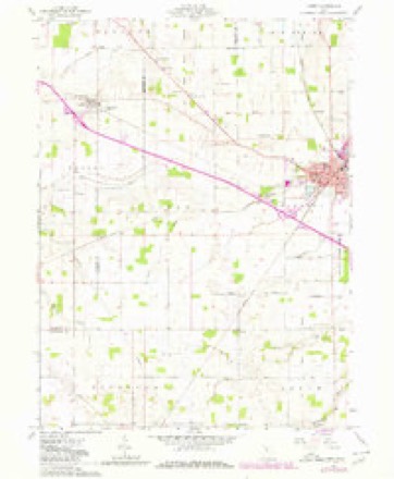
11 topographic sheets cover this place, the earliest surveyed in 1907 and the latest in 1986. It stands in Crawford Township. It lies in ZIP code area 43316. The Survey maps it on the Carey quadrangle. 3,565 people lived here at the 2020 count. It stands 820 feet above sea level.
Population over time
2 figuresCarey fell from 3,674 to 3,565 between 2010 and 2020. These are the recorded population figures Wikidata holds for this place, reached through the Geographic Names Information System number this page is keyed on rather than by name, so they belong to this place and not to another of the same name. Most are census counts, but not all are: an early figure may be a founding or settlement estimate. The change column is computed, and is left blank where more than 20 years separate a figure from the one before it, because a gap that long is not a change between two counts.
| Year | People | Change |
|---|---|---|
| 2010 | 3,674 | |
| 2020 | 3,565 | -109 (-3%) |
Then and now
1907 to 1986The same ground, surveyed 79 years apart. Drag the handle to wipe between them. Both sheets are United States Geological Survey originals; neither has been altered.

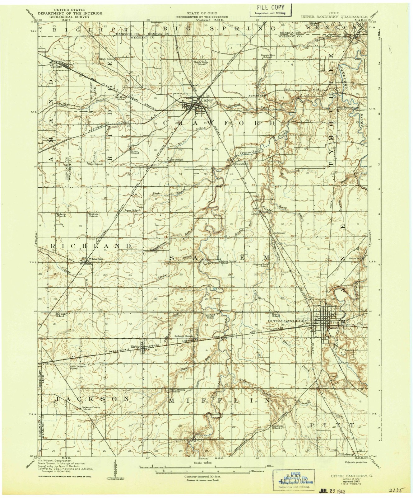
Topographic sheets covering this place
11 sheetsMatched by testing this settlement's coordinate against the published boundary of every sheet in the United States Geological Survey's historical collection. Each opens the scanned sheet at the Survey.
- 1907 USGS Upper Sandusky quadrangle1:62500
- 1950 USGS Marion quadrangle1:250000
- 1961 USGS Carey quadrangle1:24000
- 1961 USGS Carey quadrangle1:24000
- 1961 USGS Carey quadrangle1:24000
- 1962 USGS Marion quadrangle1:250000
- 1966 USGS Marion quadrangle1:250000
- 1966 USGS Marion quadrangle1:250000
- 1966 USGS Marion quadrangle1:250000
- 1986 USGS Marion quadrangle1:100000
- 1986 USGS Marion quadrangle1:100000







In the county-history sources
1,621 words on this townshipPast and Present of Wyandot County Ohio, published 1913 names this settlement in its chapter on Crawford Township. These are the passages that mention it, exactly as the scans read.
As has already been stated, Asa Lake was first to locate in this township, and in 1819, he erected the first abode that graced the primeval solitudes of this locality. It was a double log cabin, about 18x20 feet, and was located on Section 26. About two years later, Daniel Hodges founded a home near the village of Crawfordsville, and in 1823 John Carey built a hewed-log house on the south bank of the Tymochtee, nearly opposite the old Delaware village of Captain Pipe. William Brown erected his cabin in the same year, but probably after Mr. Carey had built his. However, this is uncertain, as we arrive at this conclusion by the fact that Carey was already in the vicinity at the time of Brown's arrival.
Passage source: Past and Present of Wyandot County Ohio, published 1913.
The first regular thoroughfare constructed in the township extended from T'ymochtee to Carey's mill. It passed through sections 25 and 26, and in Tymochtee extended through section 16 and 20. The early settlers went to Delaware for supplies usually, though as early as 1823, John Carey, and Elijah Brayton erected a saw and grist mill on lands owned by Mr. Carey, in what is now Tymochtee township. <A carding machine was also operated in connection with this mill. At present the township can boast of five mills - one saw mill' at Crawford, two.saw mills at Carey and two grist mills at the latter place. The first store of this territory was kept at Crawfordsville, by William M. Buell, who was also the first merchant of Carey.
Passage source: Past and Present of Wyandot County Ohio, published 1913.
The first settlers of Crawford township were not blind to the necessities of education, and, as early as 1828, erected a schoolhouse on what is now the southeast quarter of section 26. Among the first teachers were William Hackney and Adeline Potterfield. Others were James Heron, John A. Morrison, Jane Coddington, Mrs. Maynard, Laura Starr, Erastus Ranger, Clem Allen, J. Newman, Miss Eliza Ingram, S. Johnson, Dr. Kirkham, Hiram J. Starr, Jesse Wilson, Eliza Lewis, Emma Carey and McD. M. Carey. As the population of the township increased, other districts were formed and school rooms were erected.
Passage source: Past and Present of Wyandot County Ohio, published 1913.
Machine-read from a century-old scan, so expect the errors a machine makes: misspelled names, dropped words, stray characters.
Read the whole chapter on Crawford Township - it names this place 4 more 4 times.
Specimens collected near this place
12 of 195 shownRegional context, not property-specific evidence. Museums hold 195 specimens collected within 10 miles of Carey between 1885 and 1975: 164 Animalia, 28 Fungi, 3 Plantae. 12 distinct Species records are shown. Collected by Allen, J. M., Blyth & Katz, Blyth, D. (David) & Katz, D. (David) and others. Each is a physical object with a catalogue number, and each entry opens the museum's record. This is what was collected and kept, not a survey of what lives here - nothing can be concluded from a species being absent.
| Image | Species | Year | Collected by | Where, as recorded |
|---|---|---|---|---|
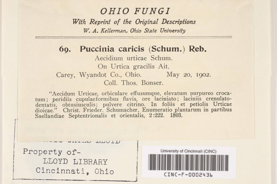 | Puccinia P.Micheli ex Haller, 1768 | 1902 | Bonser, T. | Carey |
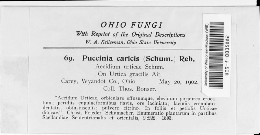 | Puccinia caricina DC. | 1902 | T. Bonser | |
 | Hister abbreviatus Fabricius, 1775 | 1885 | not recorded | Crane |
 | Margarinotus faedatus (J.E.LeConte, 1845) | 1885 | not recorded | Crane |
 | Cambarus rusticus Girard, 1852 | 1893 | United States Fish Commission | McCutchenville, Sandusky River |
 | Notropis cornutus (Mitchill, 1817) | 1893 | not recorded | Sandusky River, Mccutchenville, Ohio |
 | Notropis rubellus (Agassiz, 1850) | 1893 | not recorded | Sandusky River, Mccutchenville, Ohio |
 | Campylium stellatum (Hedw.) Lange & C.E.O.Jensen | 1899 | W. A. Kellerman | |
 | Phyllachora graminis (Pers.) Fuckel | 1900 | Bonser Thos. | Wyandot Co. |
| Phyllachora vulgata Theiss. & Syd. | 1900 | Thos. Bouser | Big Spring Prairie | |
 | Corvus brachyrhynchos brachyrhynchos C.L.Brehm, 1822 | 1901 | Thos A. Bonser | Carey, S. of |
 | Lepidium campestre (L.) W.T.Aiton | 1901 | Bonser, T.A. | Carey |
All 195 specimens within 10 miles, at the Global Biodiversity Information Facility.
Mines and quarries near this place
2 within 5 milesRegional context, not property-specific evidence. The federal mineral resources record lists 2 workings within 5 miles of Carey: 1 plant, 1 producer. All of them still produce. What was taken out: Stone, Crushed/Broken. Distance is straight-line from the map coordinates, so a quarry counted here may appear on a neighbouring settlement's page as well.
| Where | Site | Commodity | Status | Recorded |
|---|---|---|---|---|
| Carey Plant & Quarry | Stone, Crushed/Broken | Plant | ||
| Wyandot Dolomite, Inc. | Stone, Crushed/Broken | Producer |
Storms near this place
40 since 1994Regional context, not property-specific evidence. The National Weather Service names Carey in 40 storm reports between 1994 and 2025: 20 thunderstorm wind, 11 hail, 5 flash flood, 2 flood. No death or injury is recorded in these reports. Each account below is quoted exactly as the forecast office filed it, from the NOAA Storm Events Database, and each date opens the federal record of that event.
| When | Event | Place named | Harm | What the report says |
|---|---|---|---|---|
| June 1998 | Lightning | Carey | $2,000,000 | A lightning strike ignited a fire that completely destroyed two apartment buildings. |
| July 2017 | Flood | Carey | $650,000 | Heavy rainfall on the morning of July 13th caused the Spring Run to over-top its levees around 1045 am. By 11 am State Route 103 and 23 north were shut down. By 1140 am water started to inundate downtown Carey. Major flooding into homes and businesses in Carey occurred around 5 pm when water was at its deepest up to 6 deep. Sixty homes were affected, many from backups of storm drainage. Six to seven homes had water on West Ogg Street mainly from Spring Run. Dozens of businesses directly impacted, mostly with basement flooding. The water receded by 3 am Friday morning. The Tymochee Creek washed out some cross roads near ST RT 103 and RT 106. The waste water plant measured 3.8 in the southeast part of town, while unofficial reports of 5.5 in northern part of town. Radar estimates rainfall amounts between 4 and 6 inches of rain fell between 4 and 7 inches of rainfall during the same time period. |
| May 2008 | Thunderstorm Wind | Carey | $250,000 | Thunderstorm downbust winds destroyed four barns at a farm west of Carey. Six cows in one of the buildings were killed. |
| May 2011 | Hail | Carey | $100,000 | Thunderstorms produced golf ball size hail. Several vehicles were damaged as a result of the severe hail. |
| August 2007 | Tornado (EF0) | Carey | $75,000 | A tornado touched down along County Road 25A just south of Carey. A storm survey was conducted and this tornado was determined to be an EF0. This tornado damaged a couple of homes and destroyed at least two barns. The damage path was about three quarters of a mile long and about 10 yards in width. The tornado lifted near the intesection of County Road 25A and County Road 98B. |
| May 2006 | Thunderstorm Wind | Carey | $75,000 | Numerous trees were reported down across the area. A building in downtown Carey had its roof stripped off of it, and a barn suffered severe structural damage. |
| July 2005 | Thunderstorm Wind | Carey | $60,000 | A semi-truck was blown over as a result of severe thunderstorm winds. Numerous trees and large limbs were reported down. |
| August 2024 | Thunderstorm Wind | Carey | $50,000 | The awning of a gas station's pumping area collapsed in Carey. |
| May 2011 | Hail | Carey | $50,000 | Thunderstorms produced quarter to golf ball size hail. Many vehicles were damaged by the hail. |
| August 2009 | Thunderstorm Wind | Carey | $40,000 | A few large trees were reported down. One tree fell onto a house causing damage. |
| August 2007 | Flash Flood | Carey | $35,000 | Heavy rain producing thunderstorms affected Wyandot County during the late evening hours of August 20th and early morning hours of August 21st. Rainfall rates with the strongest storms exceeded three inches per hour. Up to six inches of rain was reported in the Upper Sandusky area by 4 am. A Cooperative Observer in Upper Sandusky reported a 24 hour rainfall total of 9.35 inches at 7 am with most of this rain falling between 11 pm and 4 am. An automated gauge at Kildeer Plain State Park recorded 4.10 inches. Runoff from this rain combined with ground already saturated from earlier rains led to catastrophic flooding across portions of Wyandot County. The Carey area was especially hard hit as flooding destroyed or heavily damaged several dozen homes. A total of 176 homes and 42 businesses in the town were damaged. 9 of 15 homes along West South Street were destroyed. By 3 am the flood waters were over knee deep in many locations and many streets were closed. Significant flooding was also reported in the Upper Sandusky and Sycamore areas. Near Sycamore, two teenagers had to be rescued after they were swept into Sycamore Creek by surging flood waters. Hundreds of people had to be evacuated from their homes in the county, including several dozen from a nursing home in Carey. A total of 159 homes are believed to have been destroyed or sustained more than 50 percent losses in the county. Over 500 additional homes and businesses sustained lesser damages from the flooding. At the peak of the flooding, around daybreak on the 21st, nearly every federal, state and county road in the county was closed because of flooding. Damage to roads, bridges and culverts was extensive. Cleanup and overtime costs incurred by local government agencies was substantial. In the City of Carey alone, nearly 600 tons of flood debris had to be removed. Finally, standing water and erosion from the runoff caused damage to agricultural interests in the county. | |
| July 1997 | Flash Flood | Carey | $25,000 | no account filed |
| May 1997 | Flash Flood | Carey | $20,000 | no account filed |
| December 2013 | Flash Flood | Carey | $15,000 | Red Cross reports downtown Carey Ohio was flooded by heavy rain on the night of December 21st into 22nd. One home was flooded as a result of 1.5-2 of rain falling within a 6 hour time frame that evening before. The main street in Carey, U.S. 23, was closed by the flooding. |
| July 2003 | Thunderstorm Wind | Carey | $15,000 | Thunderstorm winds downed several trees. |
| May 2011 | Hail | Carey | $10,000 | Quarter inch hail was reported with this thunderstorm. |
| May 2006 | Thunderstorm Wind | Carey | $10,000 | Several trees were reported down, along with power lines. |
| July 2005 | Thunderstorm Wind | Carey | $10,000 | Several trees and large limbs were reported down. |
| July 1999 | Thunderstorm Wind | Carey | $10,000 | Many trees and powers lines downed. |
| June 2008 | Thunderstorm Wind | Carey | $8,000 | Several large tree limbs were reported down from Carey to Upper Sandusky. |
| July 2011 | Thunderstorm Wind | Carey | $7,000 | Thunderstorm winds downed several large trees. |
| May 2004 | Thunderstorm Wind | Carey | $6,000 | Thunderstorm winds downed three trees. |
| April 2003 | Thunderstorm Wind | Carey | $5,000 | A 58 mph thunderstorm wind gust was measured. The strong winds downed two trees near Carey. |
| July 1997 | Thunderstorm Wind | Carey | $5,000 | no account filed |
| July 1996 | Thunderstorm Wind | Carey | $5,000 | no account filed |
| August 2015 | Hail | Carey | $2,000 | The public reported quarter size hail from the thunderstorm in Carey. Telephone lines were also brought down by gusty thunderstorm winds along with a trampoline that blew away. |
| June 2008 | Thunderstorm Wind | Carey | $2,000 | Thunderstorm winds downed several large tree limbs. |
| June 1998 | Thunderstorm Wind | Carey | $2,000 | Trees were downed. |
| June 1995 | Thunderstorm Wind | Carey | $2,000 | Trees were downed, some on power lines. |
| July 1997 | Thunderstorm Wind | Carey | $2,000 | no account filed |
| June 2025 | Thunderstorm Wind | Carey | - | Several trees downed in Carey. |
| October 2016 | Hail | Carey | - | Nickel to quarter sized hail fell for four minutes. |
| May 2010 | Hail | Carey | - | Penny to quarter size hail was observed. |
| August 2007 | Flood | Carey | - | Flash flooding across the area during the morning hours of the 21st turned into flooding conditions during the late morning hours as floodwaters affected homes, businesses, and closed many roads across the area. By midday, shelters were opened to accomodate people flooded out of their homes. The shelters remained opened for the next few days as people across the area coped with the flooding. By the afternoon of the 22nd, water began receding across the county and some roads started to open. By the 23rd, much of the water receded enough across the county for roads to reopen, and many people were able to return to their homes. See the flash flood write up for Wyandot County for damage estimates for this event. |
| April 2006 | Hail | Carey | - | Nickel size hail was observed. |
| April 2005 | Hail | Carey | - | Penny size hail was observed. |
| May 2004 | Hail | Carey | - | Penny size hail was observed. |
| July 1996 | Flash Flood | Carey | - | no account filed |
| July 1996 | Hail | Carey | - | no account filed |
| November 1994 | Hail | Carey | - | no account filed |
Nearest settlements
The eight closest, with where each one stands in the county. Distances are straight-line, computed from the Geographic Names Information System coordinates.
| Map | Place | Distance | Sheets |
|---|---|---|---|
| Crawford | 3.1 miles | 10 | |
| Lovell | 5.1 miles | 10 | |
| Tymochtee | 6.0 miles | 10 | |
| McCutchenville | 7.0 miles | 10 | |
| Wharton | 7.6 miles | 10 | |
| Smithville | 8.9 miles | 11 | |
| Belle Vernon | 9.7 miles | 11 | |
| Kirby | 9.8 miles | 10 |
Elsewhere
Matched on this settlement's Geographic Names Information System number rather than its name, so it cannot be a different place of the same name in another state.
| Wikipedia article on Carey | An encyclopaedic summary. Its text is share-alike, so it is linked here rather than copied. |
| Wikidata item Q2666477 | The structured record the population and elevation above come from. Public domain (CC0). |
Provenance
This settlement is recorded in the Geographic Names Information System as feature 1056766. The sheet list is computed by point-in-boundary test against the United States Geological Survey's historical topographic inventory. Both are works of the United States government and carry no copyright under 17 U.S.C. 105.
Specimens. Global Biodiversity Information Facility (GBIF), https://www.gbif.org/. Only records licensed CC0 or CC BY are used. Records licensed CC BY-NC are excluded because this site carries advertising. Images are checked individually and any whose licence is non-commercial, no-derivatives or unreadable is refused.
Mines and quarries. USGS Mineral Resources Data System (MRDS) https://mrdata.usgs.gov/mrds/ A work of the United States government, no copyright under 17 U.S.C. 105.
Storms. NOAA National Centers for Environmental Information, Storm Events Database https://www.ncei.noaa.gov/stormevents/ A work of the United States government, no copyright under 17 U.S.C. 105. Narratives are quoted verbatim from the National Weather Service report and are not edited or summarised.