 Block
Block
Marietta, Ohio
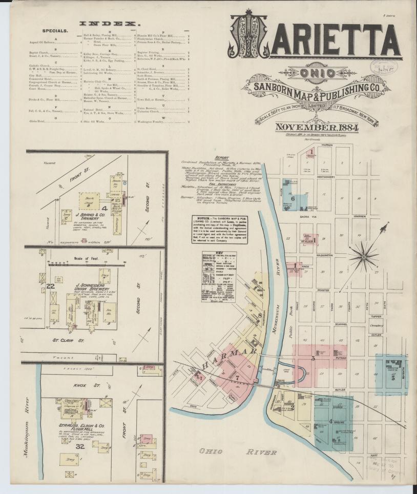
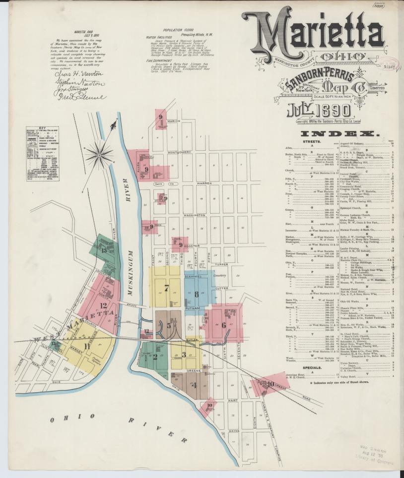
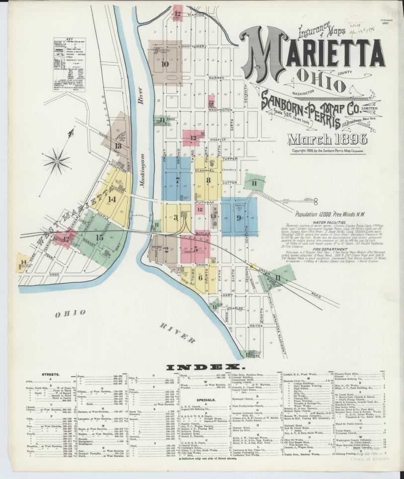
6 topographic sheets, 9 fire insurance atlases, 80 photographs and 2 surveyed structures, dating from 1848 to 1994.
Research this city
This curated hub for Washington County, Ohio brings together the page's documented record links, visible map or image evidence where published, and routes to related local records.
What is documented here?
Use the page's provenance and linked records to distinguish the source material from the site's navigation and summaries.
How should I cite it?
Open the original record, preserve its repository and identifier, then use the citation tool for this page as a path back to the source.
Where should I go next?
Follow the county or state hub for related places and records, then use the guide for a source-aware research sequence.
What the record shows
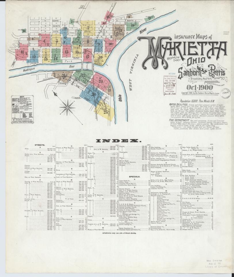
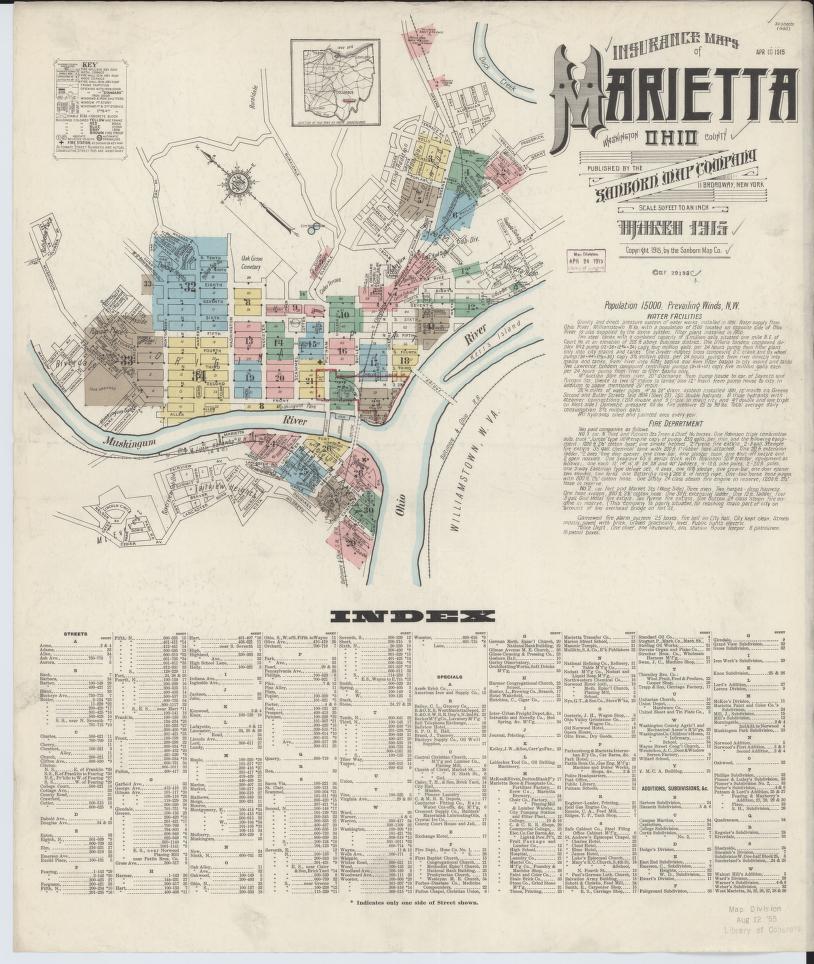
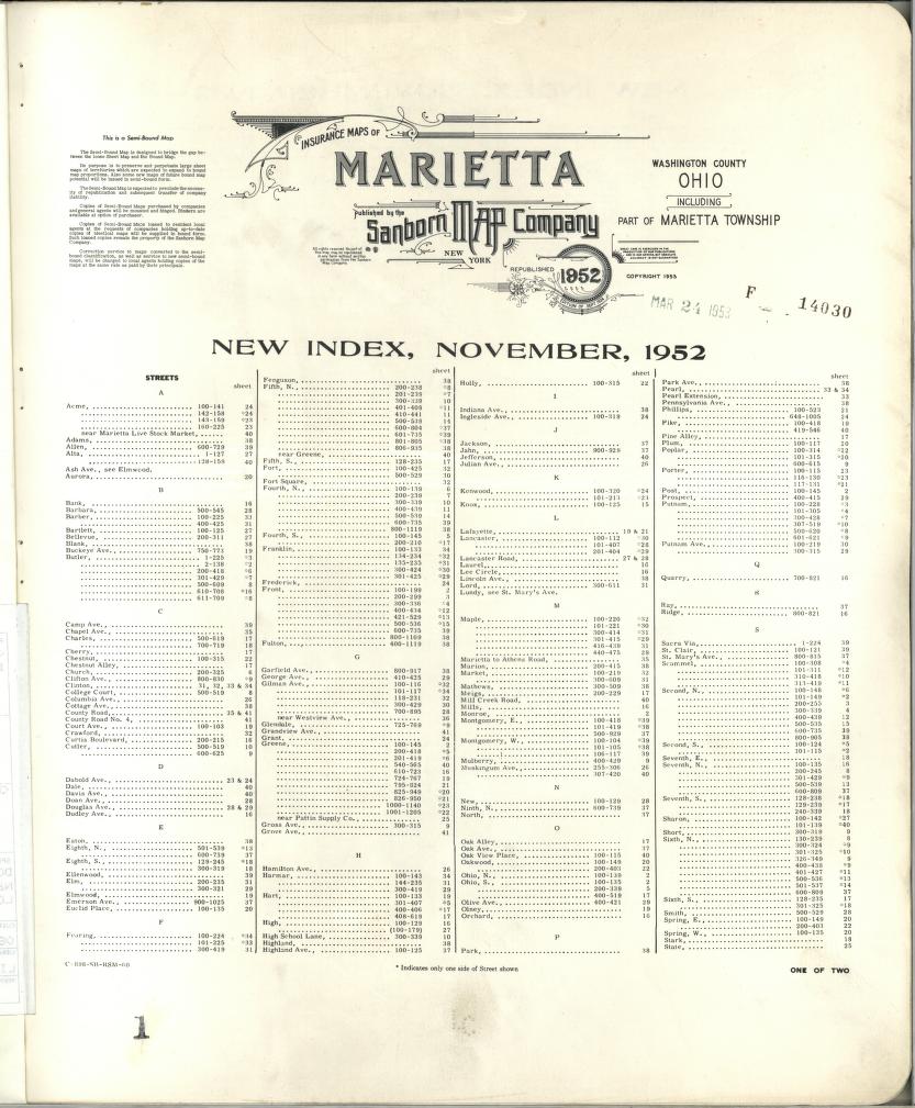
- Sanborn surveyed Marietta 9 times in the 68 years between 1884 and 1952.
- The assembled record spans 146 years, 1848 to 1994, across 4 federal collections.
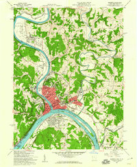
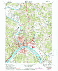
- The longest gap between topographic surveys was 30 years, from 1927 to 1957.
- The printed indexes of these atlases name 61 establishments by proprietor, read directly off the sheets and matched across volumes into 46 distinct businesses.
- 12 of them were still named in a later atlas. German Lutheran Church survived the longest, appearing from 1890 to 1907.
- Across the volumes the index names 13 hotels, 11 churches, 5 tanneries, 5 oil works.
- 5,094 words of written historical documentation accompany the surveyed structures, with 105 photographs.
Then and now
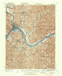
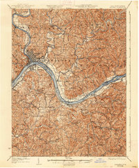
1904 to 1994The same ground, surveyed 90 years apart. Drag the handle to wipe between them. Both sheets are United States Geological Survey originals; neither has been altered.
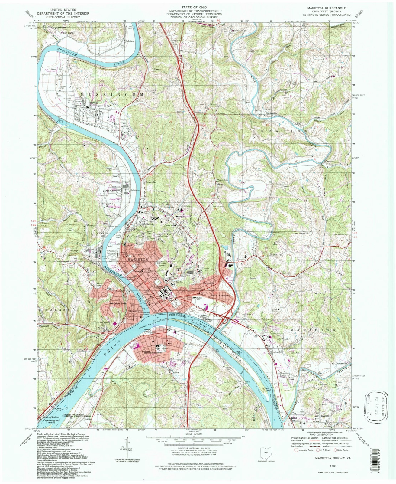
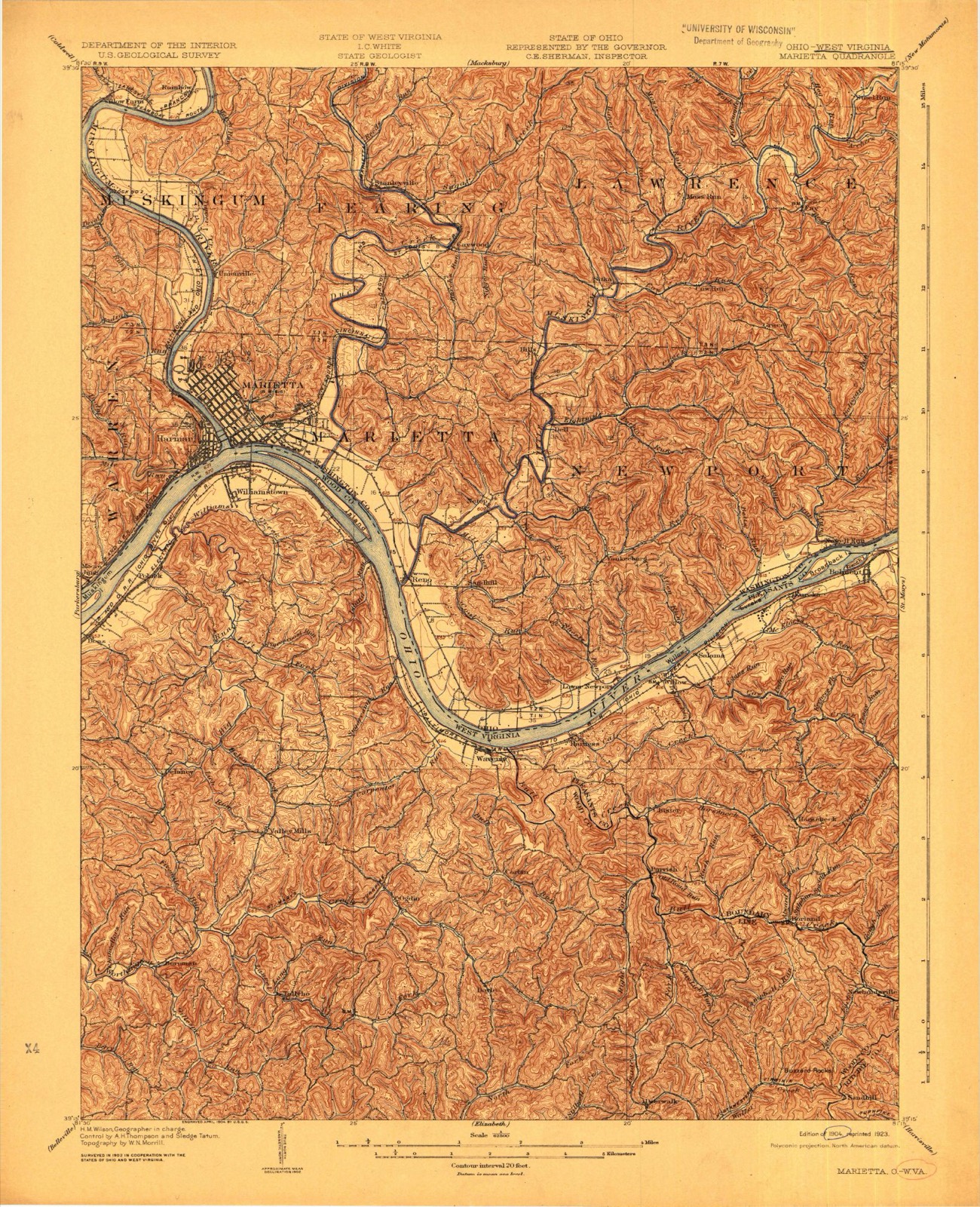
Compare 1904 against another survey:
Photographs
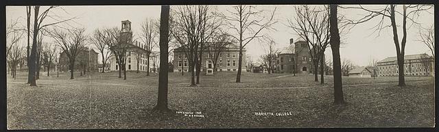
11 photographs, 1942Taken for the Office of War Information and the Farm Security Administration, who photographed the country between 1935 and 1944. Works of United States government photographers, with no known restriction on use. Each opens its catalogue record.
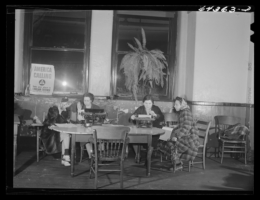
Vachon, John, 1942. Library of Congress
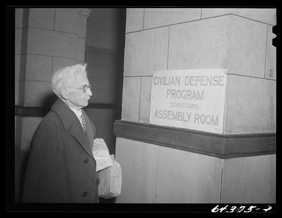
Vachon, John, 1942. Library of Congress
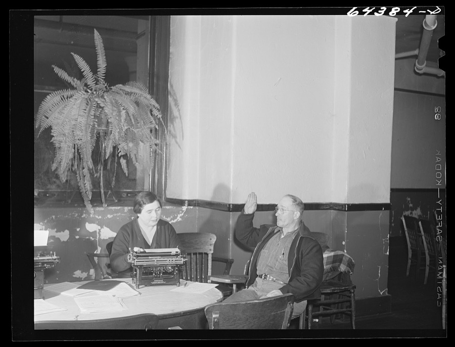
Vachon, John, 1942. Library of Congress
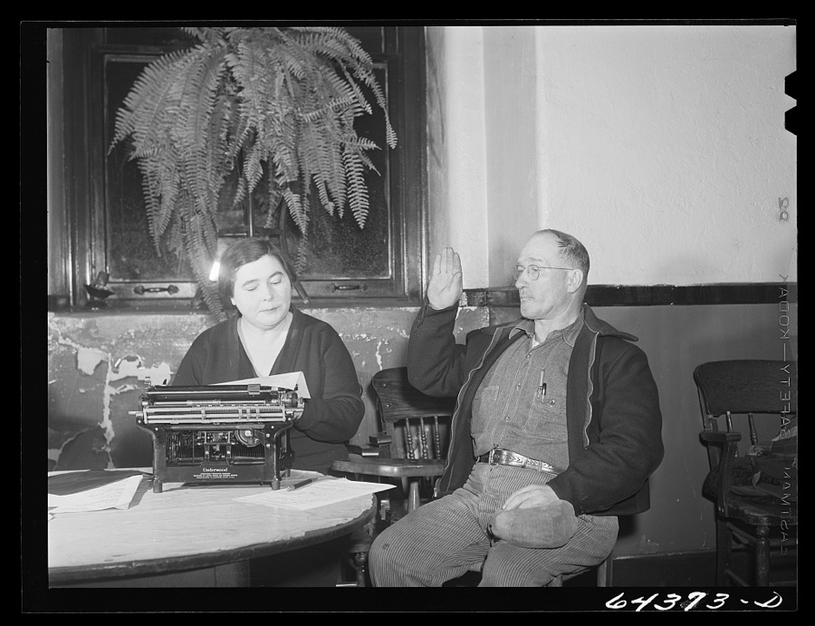
Vachon, John, 1942. Library of Congress

Vachon, John, 1942. Library of Congress
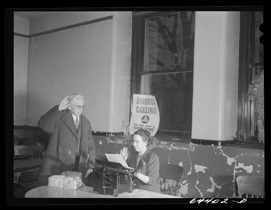
Vachon, John, 1942. Library of Congress
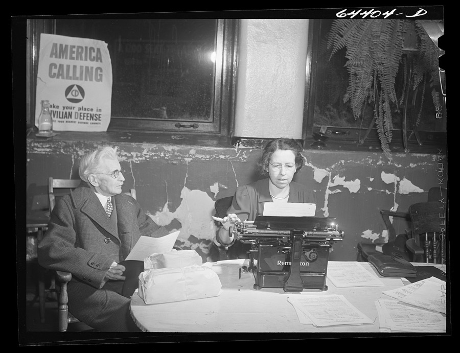
Vachon, John, 1942. Library of Congress
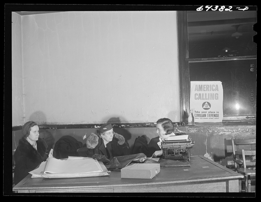
Vachon, John, 1942. Library of Congress
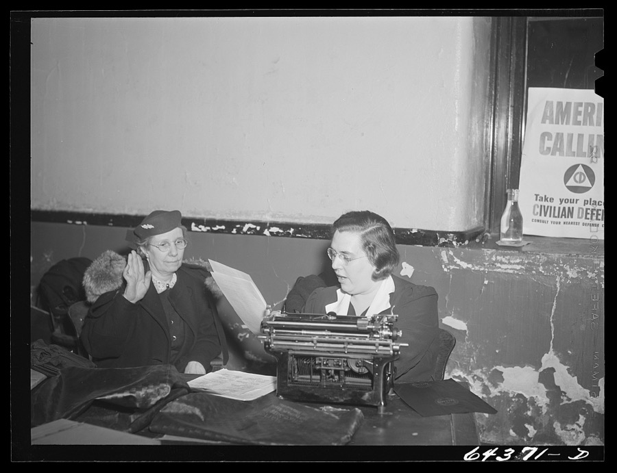
Vachon, John, 1942. Library of Congress
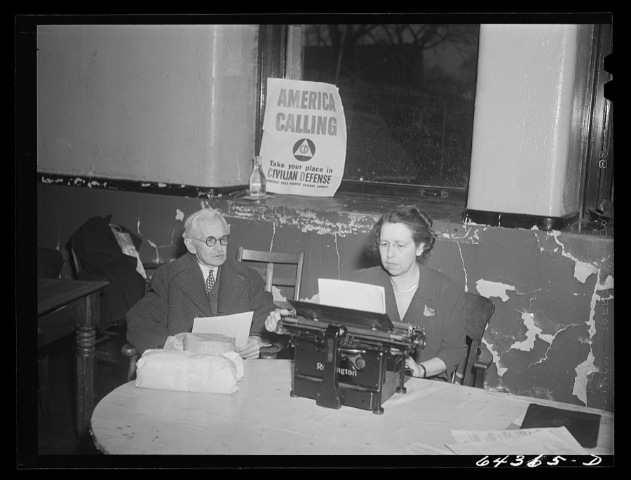
Vachon, John, 1942. Library of Congress
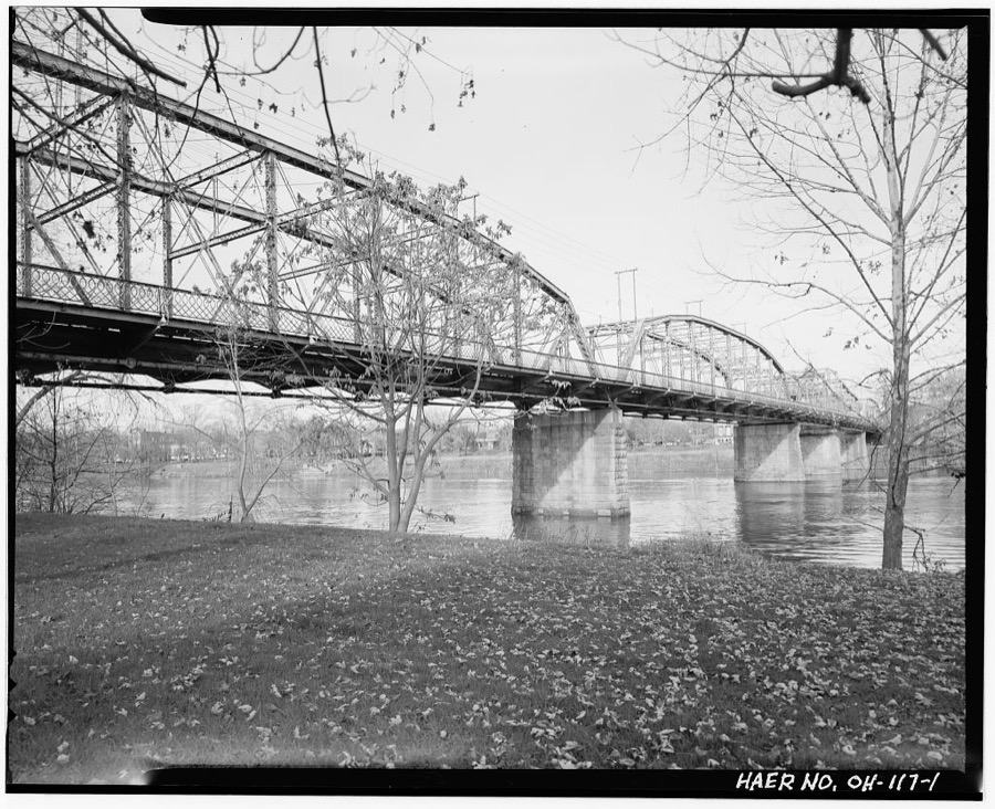
Unattributed, . Library of Congress
What happened here
An account from the Marietta chapters, in the words of 1902.
Thomas Simms And His Captivity
About 1810 a man arrived, of adventurous and eventful history. When Thomas Simms was a boy of some eight years of age, living with his kindred near Wheeling, Virginia, the Indians attacked and massacred his grandfather, and several of the family to which he belonged, but spared his life. They took Thomas to what was called Sandusky plains, where they raised him in the ways of their tribe.
The people the 1902 history describes
48 namedEveryone History of Marietta and Washington County, Ohio, and Representative Citizens stops to write about in its chapters on this town, among them the men who founded it and governed the Northwest Territory. Each name opens the passage itself.
- Rev. Dr. William Addy
- Israel Ward Andrews, Ll. D.
- Harman Blennerhassett
- Rev. Dr. John Boyd
- General Joseph Buell
- Captain Hiram Burch
- Harlow Chapin
- Arthur St. Clair
- Captain Caius Marcus Cole
- Sampson Cole
- Frederick J. Cutter
- John H. Dye
- Mrs. John H. Dye
- Thomas W. Ewart, Ll. D.
- General B. D. Fearing
- Martin Dewey Follett
- Beman Gates
- Rebecca Gilman
- Rev. Dr. T. H. Hawks
- Jonathan Heart
- Joseph Holden
- Mrs. Mary Lake
- Colonel Return Jonathan Meigs
- Governor Return Jonathan Meigs
- Return Jonathan Meigs
- Colonel John Mills
- Hon. Thomas Watson Moore
- Anselm Tupper Nye
- Ichabod Nye
- Colonel Robert Oliver
- Major Jewett Palmer
- Samuel Holden Parsons
- Biographical Sketches General Rufus Putnam
- Douglas Putnam
- Gen. Rufus Putnam
- Daniel H. Buell Edward Rector
- William Slocomb
- Colonel Ebenezer Sproat
- Colonel William Stacey
- Rev. Daniel Story
- Colonel Benjamin Tupper
- Major Anselm Tupper
- James Mitchell Varnum
- G. Washington
- Commodore Abraham Whipple
- Major Haffield White
- Isaac And Rebecca Williams
- The Military Under Captain Zeigler
The 1902 county history on this town
153,996 wordsThis town has 13 chapters to itself in History of Marietta and Washington County, Ohio, and Representative Citizens, each on a different subject. All are public domain and all are reproduced here complete.
| Chapter | Length |
|---|---|
| Early Events - Moral Condition Of The | 8,402 words |
| Educational Matters | 18,989 words in 2 parts |
| Mercantile Business And Manufacturing | 11,326 words |
| Moral And Material Advancement | 63,543 words in 5 parts |
| Municipal Matters | 7,140 words |
| Natural Phenomena | 4,268 words |
| Navigation | 3,291 words |
| Religious History - The Churches | 12,965 words |
| Reminiscences Of Slavery Days | 3,552 words |
| Societies | 6,434 words |
| Some Distinguished Visitors | 2,751 words |
| The Ancient Remains - Burial Places | 6,117 words |
| The Press | 5,218 words |
Newspapers printed here
8,183 digitised pages1 paper published in this town, digitised by the Library of Congress and free to read: 1,733 issues, 8,183 pages. Every page is searchable, so a name or a street can be looked for directly in what the town printed about itself at the time.
| Newspaper | Published |
|---|---|
| Marietta Daily Leader | 1895 to 1906 |
Businesses named in the atlases
46 businessesEvery Sanborn volume opens with a printed index naming the town's mills, tanneries, hotels and works by proprietor. Those indexes were read off the scanned sheets by machine and then matched to each other, so a business surveyed four times appears here once, with the years it survived. 12 of these 46 were named in more than one atlas. Each carries a crop of the line it was read from: the spelling is the recogniser's and the 1880s lithographer's, and the scan behind it is the proof.
-

German Lutheran Church
Church
1890 to 1907, named in 3 atlases
Read elsewhere as Panl's German Lutheran Church.
-

Meuser, W., Tannery
Tannery
1884 to 1896, named in 3 atlases
Read elsewhere as Menser, W., Tannery; Teuser. W., Tannery (formerly).
-

Rice, G, Oil Works
Oil Works
1884 to 1896, named in 3 atlases
Read elsewhere as Rice. G., Oil Works; Rice, G., Oil Works.
-

-

-

-

-

-

-

Presbyterian Church
Church
1884 to 1896, named in 2 atlases
Read elsewhere as First Presbyterian Church.
-

-

-

-

-

-

-

-

-

-

-

-

-

-

-

-

-

-

-

-

-

-

-

-

-

-

-

-

-

-

-

-

Unitarian Church
Church
named once, in the 1884 atlas
Appears in 1884
On the National Register as First Unitarian Church Of Marietta
-

-

-

-



Chronology
1848 to 2019Every surviving record of this place from 6 federal collections, in the order it was made: fire insurance atlas, photograph, storm report, structure survey, topographic sheet, wildfire. Interleaved on one time axis rather than filed separately, so a survey, a photograph and the weather that followed them read as one history.
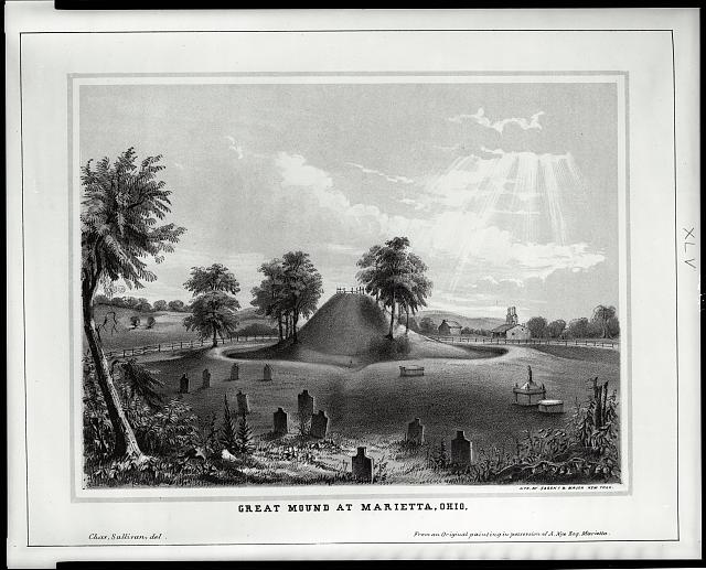
- 1848 Great Mound at Marietta, Ohio Photograph
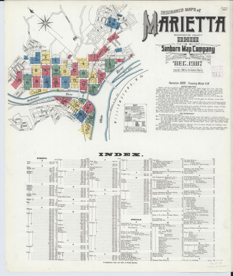
- 1884 Sanborn survey of Marietta Fire insurance atlas
- 1890 Sanborn survey of Marietta Fire insurance atlas
- 1896 Sanborn survey of Marietta Fire insurance atlas
- 1900 Sanborn survey of Marietta Fire insurance atlas
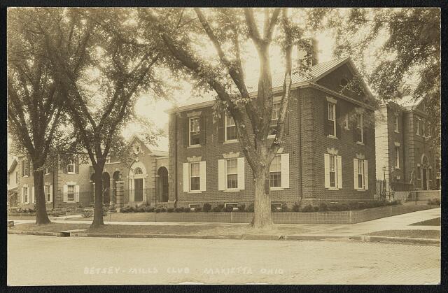
- 1900 Betsey-Mills Club, Marietta, Ohio Photograph
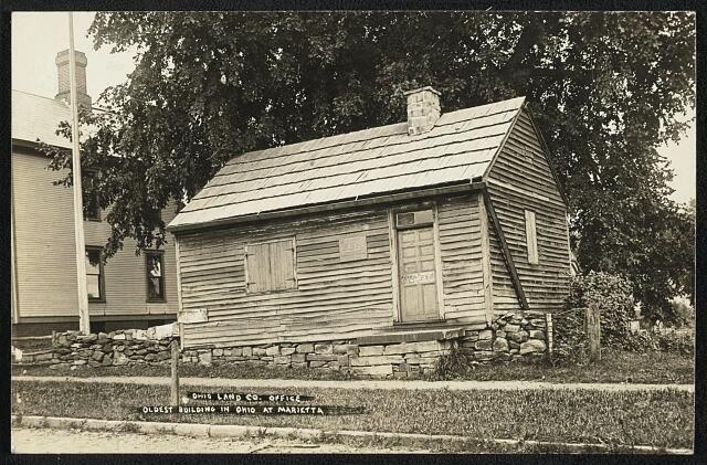
- 1900 Ohio Land Co. office, oldest building in Ohio at Marietta Photograph
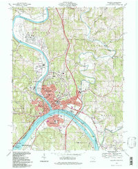
- 1904 USGS Marietta quadrangle, 1:62500 Topographic sheet
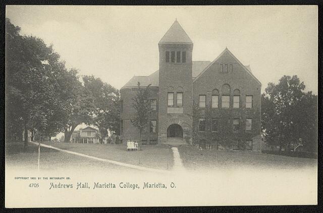
- 1905 Andrews Hall, Marietta College, Marietta, O. Photograph
- 1907 Sanborn survey of Marietta Fire insurance atlas
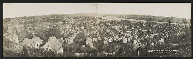
- 1907 Panorama view of Marietta - West Marietta and Williamstown, W. Va. (in distance) Photograph
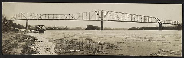
- 1908 View of Ohio River Bridge, Marietta, O. Photograph
- 1908 Marietta College Photograph
- 1915 Sanborn survey of Marietta Fire insurance atlas
- 1924 Sanborn survey of Marietta Fire insurance atlas
- 1924 USGS Marietta quadrangle, 1:62500 Topographic sheet
- 1927 USGS Marietta quadrangle, 1:62500 Topographic sheet
- 1946 Sanborn survey of Marietta Fire insurance atlas
- 1952 Sanborn survey of Marietta Fire insurance atlas
- 1957 USGS Marietta quadrangle, 1:24000 Topographic sheet
- 1968 Williamstown-Marietta Bridge, Spanning Ohio River between Williamstown & Marietta, Williamstown, Wood County, WV Structure survey
- 1968 Putnam Street Bridge, Spanning Muskingum River, Marietta, Washington County, OH Structure survey
- 1969 USGS Marietta quadrangle, 1:24000 Topographic sheet
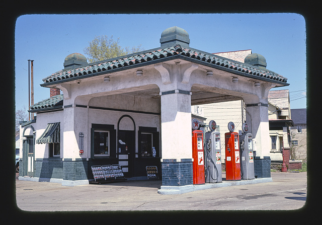
- 1978 Red Star filling station, Marietta, Ohio Photograph
- 1978 Red Star filling station, Marietta, Ohio Photograph
- 1978 Red Star filling station, Marietta, Ohio Photograph
- 1978 Red Star filling station, Marietta, Ohio Photograph
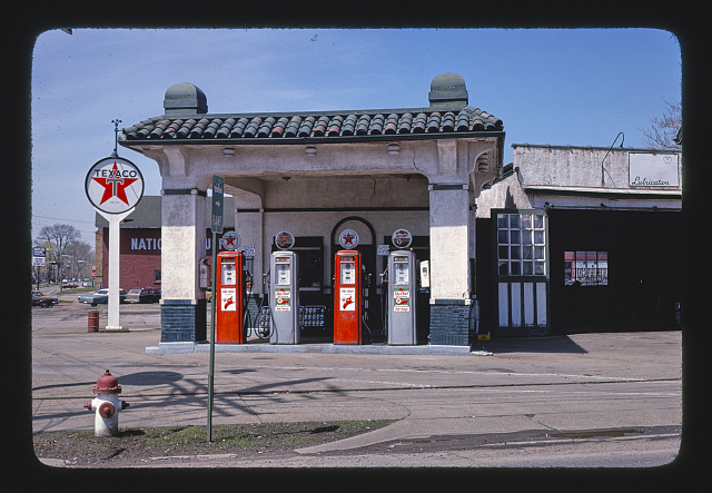
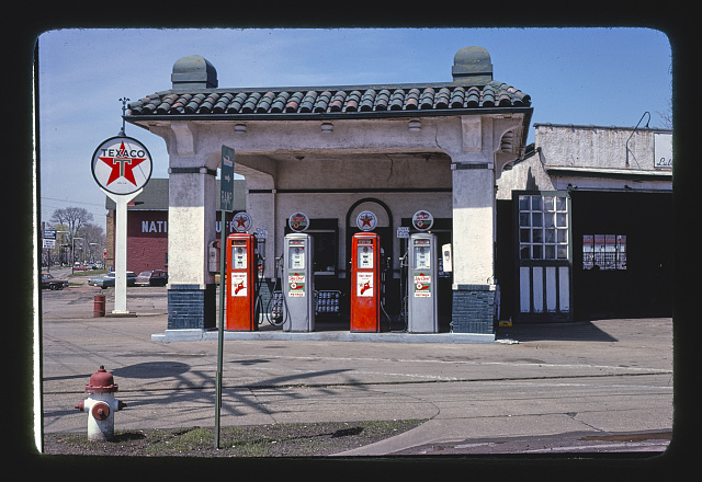
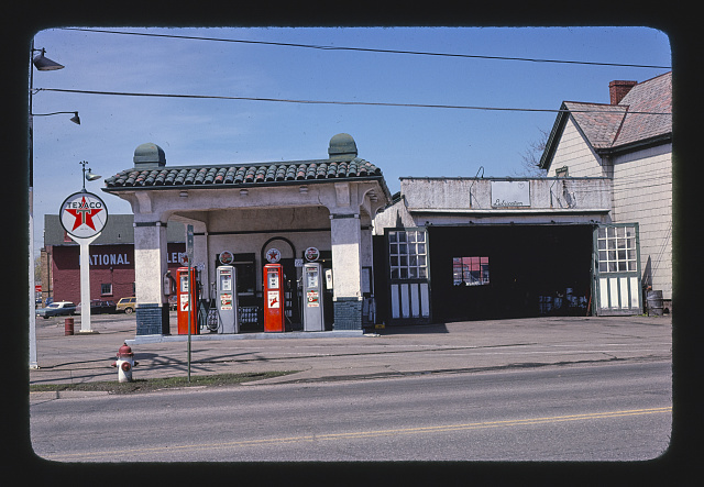
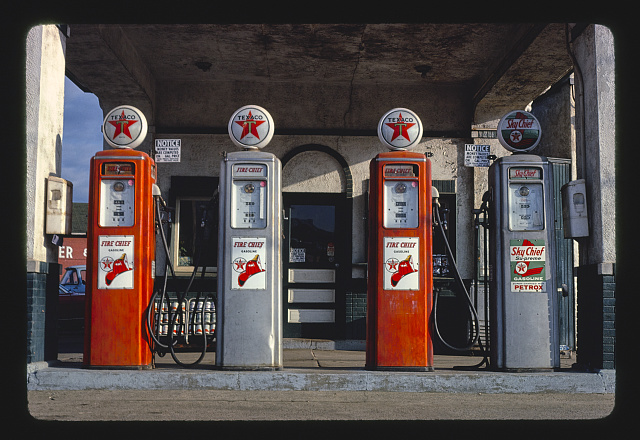
- 1980 Texaco pumps, Marietta, Ohio Photograph
- 1994 USGS Marietta quadrangle, 1:24000 Topographic sheet
- 1995 Thunderstorm Wind - $80,000 Storm report
- 1996 Thunderstorm Wind - $200,000 Storm report
- 1998 Thunderstorm Wind - $750,000 Storm report
- 2000 Thunderstorm Wind - 3 hurt, $45,000 Storm report
- 2001 Debris and open burning, about 2 acres Wildfire
- 2002 Equipment and vehicle use, about 1 acres Wildfire
- 2010 Flash Flood - $150,000 Storm report
- 2010 Missing data/not specified/undetermined, about 0 acres Wildfire
- 2012 Thunderstorm Wind - $500,000 Storm report
- 2019 Debris and open burning, about 1 acres Wildfire
Surveyed structures
Written history
5,094 words on recordFederal surveyors filed written histories with their measured drawings. These describe the place as much as the structure, and are reproduced here rather than summarised.
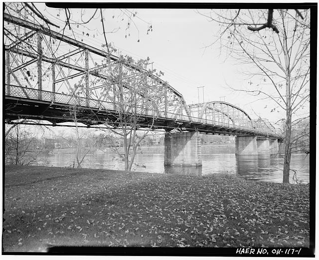
Putnam Street Bridge, Spanning Muskingum River, Marietta, Washington County, OH
Source document Quoted word for word from HAER OHIO,84-MARIE,1-, the 1,691-word written history filed with the survey. Not written, edited or summarised by this site.
HISTORY The City of Marietta is the site of the first inland settlement of the United States outside of the original thirteen colonies. As the first settlement in the Northwest Territory, the city is called the site of the westward settlement of the United States and parks have been established commemorating this aspect on both the east and west banks of the Muskingum River within the central business district. The Harmar District is located along the western bank and Marietta on the eastern bank. Since a bridge has connected these two downtown areas of Marietta. The Putnam Street Bridge, also called the Marietta Bridge, was the first "free" bridge built crossing the Muskingum River in Marietta, Ohio. The present bridge replaced the original bridge which was swept away in the flood.
The replacement structure was built on the piers and abutments of its predecessor. A Swing Span on the east bank, now welded shut, was incorporated to allow large river boat traffic to pass. At present, this bridge is one of only four (4) remaining Swing Bridges in Ohio. The Harmar Historic District, which predates the settlement of the City of Marietta, was entered onto the National Register of Historic Places in The Putnam Street Bridge has been identified as a contributing element to the Harmar National Register Historic District. The Ohio Department of Transportation has identified the Putnam Street Bridge as a Selected Bridge, eligible for listing on the National Register. In I974,the Marietta Historic District was include on the National Register of Historic Places.
Thus the Putnam Street Bridge, though not a National Register Property itself, connects two National Register Historic Districts. Because of the continuing deterioration, the bridge has undergone several repair programs in and again in Due to further deterioration, the low legal load limitations, restricted traffic volume capacity and the high cost of maintenance, the existing structure will be removed and replaced by a new structure maintaining the historic architectural integrity appropriate for this historic area. The new bridge will not replicate the existing structure but has been designed to compliment the visual features of the Marietta and Harmar National Register Historic Districts. Design features and details have been coordinated with the Ohio State Historic Preservation Office.
# Putnam Street Bridge (Marietta Bridge) HAER No. OH- 117 (page 3) li -THE BRIDGE Description The Putnam Street Bridge is 768-ft-long and 44 ft- 7in -wide and carries two 12-ft-wide traffic lanes and two 6-ft-wide sidewalks. Construction of the sidewalks and traffic lanes was of wooden planks.
Read the full 1,691-word report
United States federal work, no copyright under 17 U.S.C. 105. Text is machine-read from a scanned typescript, so spelling and spacing follow the original page, including its errors.
Williamstown-Marietta Bridge, Spanning Ohio River between Williamstown & Marietta, Williamstown, Wood County, WV
Source document Quoted word for word from HAER WVA,54-WILTO,1-, the 3,403-word written history filed with the survey. Not written, edited or summarised by this site.
HISTORY OF THE WILLIAMSTOWN-MARIETTA BRIDGE Williamstown-Marietta Bridge HAER No. (Page 2) Marietta was founded as a colony of the Northwest Territory by General Rufus Putnam in The original town plat contained acres of the 1.5 million acres chartered to the Ohio Company by the U.S. Government for one dollar an acre. Washington County (Ohio) was also created the same year. Williamstown, chartered in was settled from the same pioneering families and developed with Marietta. The two townships developed as the major gateway for westward bound settlers and later for east-west bound commerce along the Ohio River. This development pattern made the area a vital transportation hub which continues today.
Although oil was discovered in and around Marietta in and actual drilling and production did not occur until Land and mineral rights procurements, as well as the formation of drilling companies in Marietta, were established in The local production and refinement of oil allowed for a significant increase in local manufacturing which, in turn, created a demand for laborers, many of which came from Williamstown. Flatboat ferry services, operated by horse-tread power, had been in operation across the Muskingum and Ohio rivers since the earliest days of commerce. The flatboats were replaced by a steam ferry (the "Julia"), operated by Alfred Kinnard at about the beginning of the Civil War. The "Julia" was replaced by the "Emma Uhl" in She was owned by J. R.
McMillen of Marietta and operated until when she was replaced by the "Pioneer City," a light-draught sternwheeler operated by Captain J. W. Ryder from a.m. to daily and owned by M. F. Noll and Charles Muhleman. These ferries operated between Front Street in Williamstown and Ohio Street in Marietta. Early in a group of prominent Marietta businessmen formed the Ohio River Bridge and Ferry Company (ORBFC), with the sole purpose of building a toll bridge across the Ohio River to link Williamstown with Marietta. Notables in the company were Beman G. Dawes, who became its president, and Hoyt, secretary. Others included M. F. Noll, Charles Muhleman, George Best and John Mills. The newly-formed company had a monumental task of building a huge structure with only private funds.
Neither West Virginia nor the State of Ohio participated in the financing. Noted engineer Charles L. Strobel was contracted to design the bridge and oversee its construction. T. M. Ripley was hired as the resident engineer.
Read the full 3,403-word report
United States federal work, no copyright under 17 U.S.C. 105. Text is machine-read from a scanned typescript, so spelling and spacing follow the original page, including its errors.
Fires nearby
14 since 1999The federal wildfire occurrence database lists 14 fires within 5 miles of Marietta between 1999 and 2019, burning about 5 acres in total. 2 started naturally. None was recorded as arson. Distance is straight-line from the map coordinates, so a fire counted here may appear on a neighbouring settlement's page as well.
| Reported cause | Fires |
|---|---|
| Debris and open burning | 8 |
| Equipment and vehicle use | 2 |
| Natural | 2 |
| Missing data/not specified/undetermined | 2 |
The most recent of them, most recent first, with the day each was reported and the service that recorded it.
| Date | Cause | Size | Reported by | Name on the report |
|---|---|---|---|---|
| 12 August 2002 | Equipment and vehicle use | 1.0 acres | West Virginia Division of Forestry | BURNT HILL RD. |
| 28 July 1999 | Natural | under an acre | West Virginia Division of Forestry | SLATE CREEK ROAD |
| 29 April 2001 | Debris and open burning | 2.0 acres | West Virginia Division of Forestry | DRY RUN RD. |
| 21 April 2003 | Debris and open burning | under an acre | West Virginia Division of Forestry | DRY RUN RD. |
| 2 April 2001 | Debris and open burning | under an acre | West Virginia Division of Forestry | DRY RUN RD. |
| 13 April 2018 | Natural | under an acre | Ohio Department of Natural Resources | 14565 |
| 20 March 2010 | Debris and open burning | under an acre | West Virginia Division of Forestry | WILLIAMSTOWN PIKE |
| 19 March 2019 | Debris and open burning | 1.0 acres | West Virginia Division of Forestry | 753 HENRIE LANE |
Settlements close enough to share some of these fires:
Specimens collected nearby
12 of 1,269 shownMuseums hold 1,269 specimens collected within 10 miles of Marietta between 1853 and 1975: 1,182 Animalia, 54 Fungi, 31 Plantae, 1 Unrecorded, 1 Chromista. 12 distinct Species records are shown. Collected by A. D. Selby, A. Drew, A. L. McElhose and others. Each is a physical object with a catalogue number, and each entry opens the museum's record. This is what was collected and kept, not a survey of what lives here - nothing can be concluded from a species being absent.
| Image | Species | Year | Collected by | Where, as recorded |
|---|---|---|---|---|
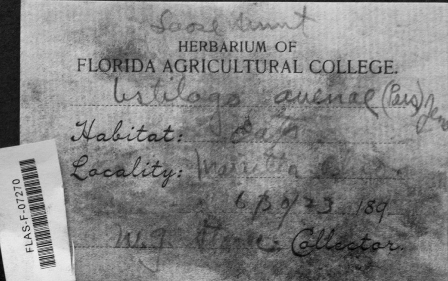 | Ustilago avenae (Pers.) Rostr. | 1923 | W.G. Stoner | Marietta |
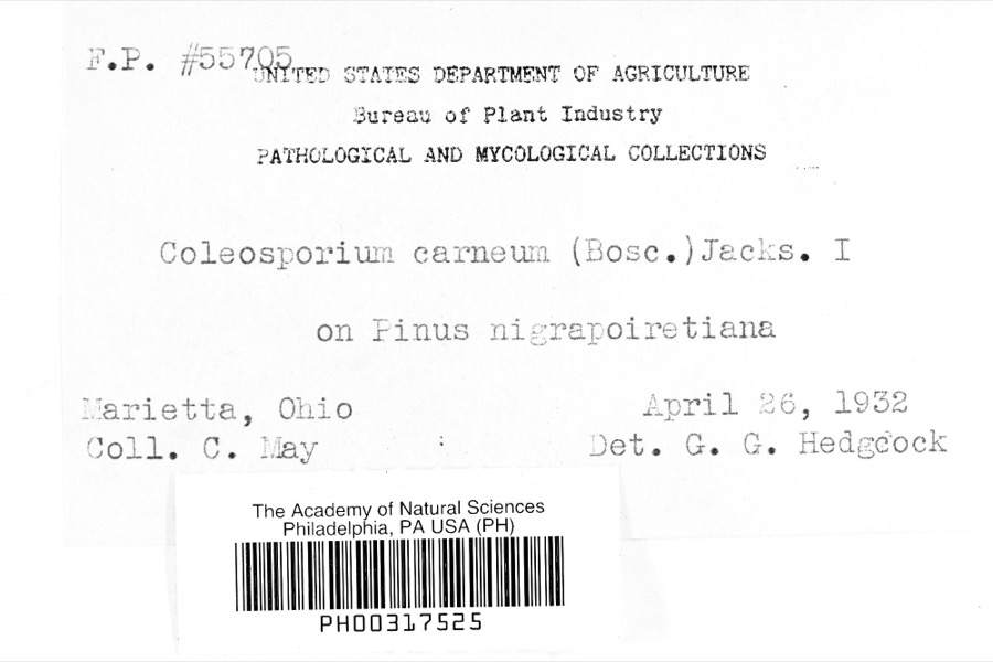 | Coleosporium carneum (Bosc) H.S.Jacks. | 1932 | C. May | Marietta |
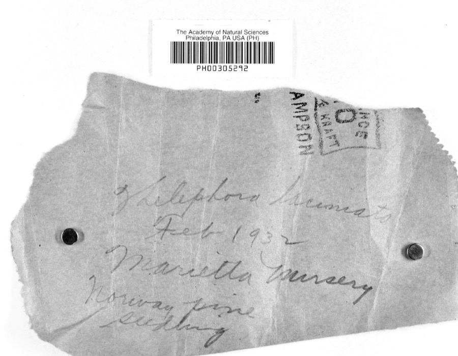 | Thelephora laciniata (Pers.) Pers. | 1932 | L.W.R.J. | Nursery, Marietta |
 | Catostomus commersonii (Lacepède, 1803) | 1853 | E. Andrews | Marietta, Ohio |
 | Actinonaias carinata gibba (C.T.Simpson, 1900) | 1879 | W. Holden | Ohio River, Near Marietta |
 | Necturus maculosus (Rafinesque, 1818) | 1886 | Georg Baur | Marietta |
 | Icteria virens (Linnaeus, 1758) | 1893 | Shufeldt, R. | Marietta |
 | Progne subis (Linnaeus, 1758) | 1893 | Shufeldt, R. | Marietta |
 | Eragrostis hypnoides (Lam.) Britton, Sterns & Poggenb. | 1896 | A. D. Selby | Rainbow. |
 | Plasmopara viticola (Berk. & M.A.Curtis) Berl. & De Toni | 1896 | F.L. Stevens | Marietta |
 | Cyclonaias kleiniana (I.Lea, 1852) | 1897 | Sterki, Victor | Marietta |
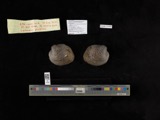 | Cyclonaias pustulosa (I.Lea, 1831) | 1897 | Sterki, Victor | Marietta |
Mines and quarries nearby
7 within 5 milesThe federal mineral resources record lists 7 workings within 5 miles of Marietta: 4 producers, 2 past producers, 1 plant. 5 still produce. What was taken out: Sand and Gravel, Construction, Stone, Crushed/Broken, Manganese, Chromium, Iron. Distance is straight-line from the map coordinates, so a quarry counted here may appear on a neighbouring settlement's page as well.
| Where | Site | Commodity | Status | Recorded |
|---|---|---|---|---|
| (Facility) Marietta Smelter | Manganese, Chromium | Plant | ||
| Union Carbide/ Marietta, Ohio | Iron, Manganese | Producer | ||
| Duckworth Quarry | Stone, Crushed/Broken | Producer | ||
| Stone Co Pit | Stone, Crushed/Broken | Producer | ||
| Muskingum River Plant No 5 & Pit | Sand and Gravel, Construction | Past Producer | ||
| Number 3 Sand and Gravel Pit | Sand and Gravel, Construction | Producer | ||
| Union Slag No. 2 Sand & Gravel Pit | Sand and Gravel, Construction | Past Producer |
Storms nearby
60 of 68 shownThe National Weather Service names Marietta in 68 storm reports between 1993 and 2026: 31 thunderstorm wind, 25 hail, 5 flood, 3 lightning. The reports record 3 injuries. Each account below is quoted exactly as the forecast office filed it, from the NOAA Storm Events Database, and each date opens the federal record of that event.
| When | Event | Place named | Harm | What the report says |
|---|---|---|---|---|
| May 2000 | Thunderstorm Wind | Marietta | 3 hurt, $45,000 | A double wide mobile home was destroyed after its roof was blown off. The home was located on Warren Township Road 277. Seven people were in the home at the time, 3 were taken to the hospital with minor injuries and later released. The National Weather Service survey estimated winds of 60 to 70 mph from the microburst. |
| June 1998 | Thunderstorm Wind | Marietta | $750,000 | Numerous large trees were blown down by strong wind gusts. The wind was associated with a bow echo configuration to the thunderstorms. Wind gusts of around 70 mph likely occurred. Several homes and businesses were hit by fallen trees. Residents described the aftermath in the hardest hit portions of downtown Marietta as looking like a war zone. |
| June 2012 | Thunderstorm Wind | Marietta | $500,000 | Numerous trees and large branches were blown down. One massive tree fell onto a house along Montgomery Street. |
| June 1996 | Thunderstorm Wind | Marietta | $200,000 | no account filed |
| July 2010 | Flash Flood | Marietta | $150,000 | Rains of 2.5 to 4.5 inches fell in less than 3 hours. The 24 hour rain amount from the cooperative observer at Newport was 4.7 inches. The Marietta cooperative observer had 2.94 inches. Streams such as Long Run and Newell Run flooded and forced a few evacuations. Many residents were stuck in their homes. The Newport fire chief said, We couldn't get to them because they couldn't see the bridges. Basically every direction we went there was rushing water, it looked like a whitewater river.||More urban streams such as Goose Run flooded basements around Marietta. |
| June 1995 | Thunderstorm Wind | Marietta | $80,000 | Thunderstorms moved from east to west crossing the Ohio River from West Virginia. The city of Marietta hauled 130 loads of fallen limbs away over a eight day cleanup period. At least two homes were damaged. A dairy barn was heavily damaged in Warren Township. A tree fell onto a car in Belpre. |
| June 1996 | Lightning | Marietta | $50,000 | no account filed |
| July 2012 | Thunderstorm Wind | Marietta | $25,000 | Trees were blown down in the city. |
| July 1997 | Lightning | Marietta | $25,000 | The chimney and roof to the Headstart Center was damaged. The fallen bricks heavily damaged a car parked below. |
| March 2011 | Flood | Marietta | $25,000 | no account filed |
| June 2009 | Heavy Rain | Marietta | $20,000 | Downpours associated with severe thunderstorms overwhelmed the city drainage system, causing brief street flooding. Water got into a few basements. The cooperative observer measured 2.6 inches for its 24 hour rain amount, most of which fell within about 2 hours. |
| June 1995 | Thunderstorm Wind | Marietta | $20,000 | Thunderstorms moved from east to west crossing the Ohio River from West Virginia. The city of Marietta hauled 130 loads of fallen limbs away over a eight day cleanup period. At least two homes were damaged. A dairy barn was heavily damaged in Warren Township. A tree fell onto a car in Belpre. |
| April 2026 | Thunderstorm Wind | Marietta | $12,000 | A tree and numerous branches fell onto a house along 2nd Street in Marietta. Extensive damage to the home occurred as a result. |
| October 2016 | Thunderstorm Wind | Marietta | $10,000 | A large tree fell onto a vehicle along Front Street. |
| April 2003 | Thunderstorm Wind | Marietta | $10,000 | Thunderstorm winds blew a large section of roofing material off a rehabilitation center. Power lines were also blown down in town, causing power outages. |
| June 2002 | Thunderstorm Wind | Marietta | $10,000 | Several trees were blown down. The lightning intensity was also intense. |
| July 2001 | Thunderstorm Wind | Marietta | $10,000 | A few structures sustained roof damage. |
| April 2026 | Thunderstorm Wind | Marietta | $8,000 | In Marietta, portions of a roof were blown off of a nearby house. |
| August 2007 | Thunderstorm Wind | Marietta | $8,000 | A microburst lifted a roof off an outbuilding and damaged a greenhouse. |
| June 2001 | Lightning | Marietta | $8,000 | A two car garage on Lancaster Street was struck, damaging the structure and a nearby car. |
| July 1996 | Flash Flood | Marietta | $8,000 | no account filed |
| April 2026 | Thunderstorm Wind | Marietta | $5,000 | Numerous downed trees were observed in the Marietta area. |
| May 2017 | Thunderstorm Wind | Marietta | $5,000 | Trees and power lines were blown down along Arrends Ridge Road. |
| March 2015 | Flood | Marietta | $5,000 | Duck Creek and the Little Muskingum River had minor overflow and blocked roads during the day on the 11th. |
| March 2004 | Thunderstorm Wind | Marietta | $5,000 | Trees and power lines were blown down in both cities, plus across Warren Township. |
| June 1995 | Hail | Marietta | $5,000 | Thunderstorms moved from east to west crossing the Ohio River from West Virginia. The city of Marietta hauled 130 loads of fallen limbs away over a eight day cleanup period. At least two homes were damaged. A dairy barn was heavily damaged in Warren Township. A tree fell onto a car in Belpre. |
| August 1993 | Thunderstorm Wind | Marietta | $5,000 | Thunderstorm winds downed trees in Marietta and Beverly. |
| July 2005 | Thunderstorm Wind | Marietta | $5,000 | no account filed |
| July 1997 | Thunderstorm Wind | Marietta | $5,000 | no account filed |
| July 2017 | Thunderstorm Wind | Marietta | $2,000 | Multiple large branches were downed by thunderstorms winds. One fell on and damaged a residential fence. |
| March 2011 | Flood | Marietta | $2,000 | A strong rise on the Little Muskingum River occurred. The crest was over 19 feet at the gauge near Bloomfield. Minor overflow along the usual low spots of Route 26 was the result. A few sections of the road were closed. |
| July 2008 | Thunderstorm Wind | Marietta | $2,000 | Trees fell in scattered locations about the town. Two large umbrellas, used to shelter kids from the sun, were ripped from their tables and blew away at the YMCA. |
| September 2000 | Thunderstorm Wind | Marietta | $2,000 | State Routes 821 and 26 were blocked by fallen trees. |
| June 1998 | Thunderstorm Wind | Marietta | $2,000 | An estimated wind gust of 60 mph knocked down trees. |
| August 1999 | Thunderstorm Wind | Marietta | $2,000 | no account filed |
| June 1998 | Hail | Marietta | $2,000 | no account filed |
| April 2026 | Thunderstorm Wind | Marietta | $1,500 | A tree snapped off and fell onto a fence along Cisler Drive. |
| January 2020 | Thunderstorm Wind | Marietta | $1,000 | Winds blew some shingles off a home near Marietta. |
| September 2018 | Flood | Marietta | $1,000 | The stream gage on Duck Creek near Whipple showed the creek rose above its 12 foot flood stage late on the 25th. The creek crested at 12.4 feet just before sunrise on the 26th and had returned to its banks by mid morning. This flooded sections of State Routes 26, 145 and 821. |
| July 2012 | Thunderstorm Wind | Marietta | $1,000 | Large branches were broken off. |
| June 2011 | Thunderstorm Wind | Marietta | $1,000 | A few trees were blown down along 6th street. |
| April 2000 | Thunderstorm Wind | Marietta | $1,000 | Tress fell and blocked State Route 821 and County Route 375. |
| August 2019 | Thunderstorm Wind | Marietta | $500 | A single tree was blown down across State Route 339. |
| April 2026 | Flash Flood | Marietta | - | High water was observed over the road near 2nd and 3rd Streets in Marietta. |
| December 2016 | Flood | Marietta | - | The stream gauge on Duck Creek at Whipple crested just over 12 feet late afternoon on the 18th. Bankfull is 11 feet. Minor flooding occurred along sections of State Routes 26, 146 and 821 in central Washington County. |
| March 2012 | Hail | Marietta | - | The hail was covering the ground along Interstate 77. |
| April 2026 | Hail | Marietta | - | no account filed |
| April 2026 | Hail | Marietta | - | no account filed |
| April 2026 | Hail | Marietta | - | no account filed |
| April 2026 | Hail | Marietta | - | no account filed |
| April 2026 | Hail | Marietta | - | no account filed |
| April 2026 | Hail | Marietta | - | no account filed |
| March 2024 | Hail | Marietta | - | no account filed |
| April 2024 | Hail | Marietta | - | no account filed |
| April 2015 | Hail | Marietta | - | no account filed |
| July 2011 | Hail | Marietta | - | no account filed |
| June 2011 | Hail | Marietta | - | no account filed |
| June 2011 | Hail | Marietta | - | no account filed |
| June 2011 | Hail | Marietta | - | no account filed |
| June 2009 | Hail | Marietta | - | no account filed |
What the paper printed
40,625 wordsFront pages of the local paper, read from the Library of Congress scans: 8 issues spread across its run from 1896 to 1901, 40,625 words in total. Each is reproduced on its own page, exactly as the recogniser returned it.
These pages read less well than anything else here, and the number is worth stating: about three words in four come through cleanly, against nine in ten for the building records. An 1896 broadsheet sets eight-point type in seven columns on microfilm, which is the hardest thing in this archive to read by machine. We tested our own recognisers against the Library's and they were not better, so the Library's text is what appears, with the wholly unreadable columns removed. Read it as a guide to what the paper covered, and follow the link to the scan before quoting anything.
| Issue | Paper | Length |
|---|---|---|
| 1896-01-01 | Marietta Daily Leader | 6,694 words |
| 1896-02-22 | Marietta Daily Leader | 3,022 words |
| 1896-04-15 | Marietta Daily Leader | 3,820 words |
| 1896-06-06 | Marietta Daily Leader | 4,785 words |
| 1896-07-30 | Marietta Daily Leader | 4,011 words |
| 1896-09-22 | Marietta Daily Leader | 6,208 words |
| 1896-11-13 | Marietta Daily Leader | 6,778 words |
| 1901-09-28 | Marietta Daily Leader | 5,307 words |
Provenance
- Written history. Historic American Engineering Record reports, 5,094 words across 2 surveys, quoted verbatim from the filed documents.
- Topographic sheets. USGS Historical Topographic Map Collection, selected by point in bounding box on the GNIS centroid, filtered to 1:62,500 or finer, editions deduplicated.
- Fire insurance maps. Library of Congress Sanborn collection, 9 volumes. Public domain, free to use and reuse.
- Photographs. Library of Congress Prints and Photographs. 80 records matched, 20 sampled, 4 withheld by the per-item rights filter.
- Structures. Historic American Buildings and Engineering Records.
- Images are cached derivatives, never upscaled and never regenerated by an AI model.
- Wildfire. Short, Karen C. 2022. Spatial wildfire occurrence data for the United States, 1992-2020 [FPA_FOD_20221014]. 6th Edition. Fort Collins, CO: Forest Service Research Data Archive. https://doi.org/10.2737/RDS-2013-0009.6 Collected with United States Government funding and usable without additional permissions or fees.
- Specimens. Global Biodiversity Information Facility (GBIF), https://www.gbif.org/. Only records licensed CC0 or CC BY are used. Records licensed CC BY-NC are excluded because this site carries advertising. Images are checked individually and any whose licence is non-commercial, no-derivatives or unreadable is refused.
- Mines and quarries. USGS Mineral Resources Data System (MRDS) https://mrdata.usgs.gov/mrds/ A work of the United States government, no copyright under 17 U.S.C. 105.
- Storms. NOAA National Centers for Environmental Information, Storm Events Database https://www.ncei.noaa.gov/stormevents/ A work of the United States government, no copyright under 17 U.S.C. 105. Narratives are quoted verbatim from the National Weather Service report and are not edited or summarised.