 Block
Block
Somerset, Ohio
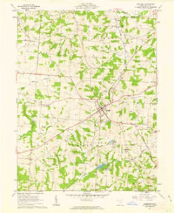
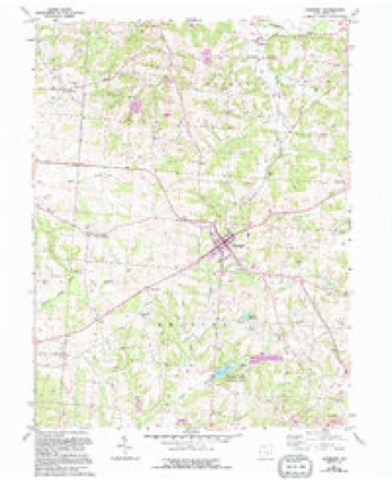
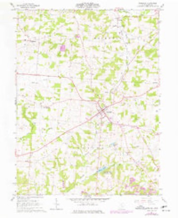
11 topographic sheets cover this place, the earliest surveyed in 1909 and the latest in 1984. It stands in Reading Township. It lies in ZIP code area 43783. The Survey maps it on the Somerset quadrangle. 1,481 people lived here at the 2020 count. It stands 1,083 feet above sea level.
Research this city
This curated hub for Perry County, Ohio brings together the page's documented record links, visible map or image evidence where published, and routes to related local records.
What is documented here?
Use the page's provenance and linked records to distinguish the source material from the site's navigation and summaries.
How should I cite it?
Open the original record, preserve its repository and identifier, then use the citation tool for this page as a path back to the source.
Where should I go next?
Follow the county or state hub for related places and records, then use the guide for a source-aware research sequence.
Population over time
2 figuresSomerset grew from 1,481 to 1,481 between 2010 and 2020. These are the recorded population figures Wikidata holds for this place, reached through the Geographic Names Information System number this page is keyed on rather than by name, so they belong to this place and not to another of the same name. Most are census counts, but not all are: an early figure may be a founding or settlement estimate. The change column is computed, and is left blank where more than 20 years separate a figure from the one before it, because a gap that long is not a change between two counts.
| Year | People | Change |
|---|---|---|
| 2010 | 1,481 | |
| 2020 | 1,481 | 0 (0%) |
Then and now
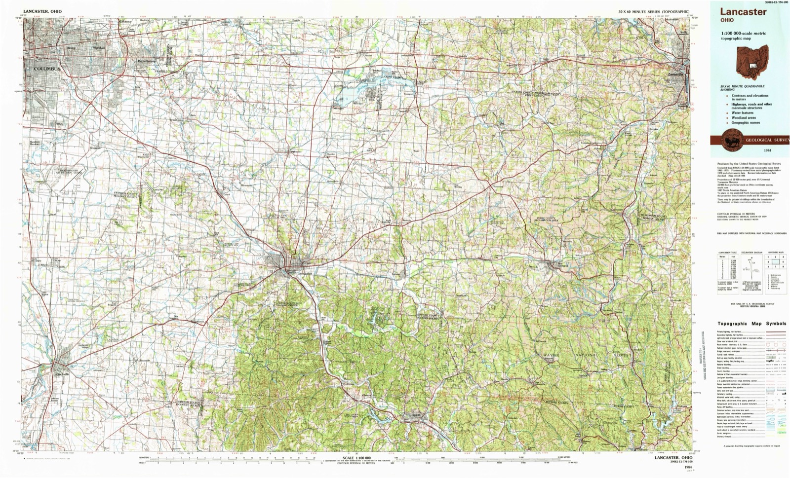
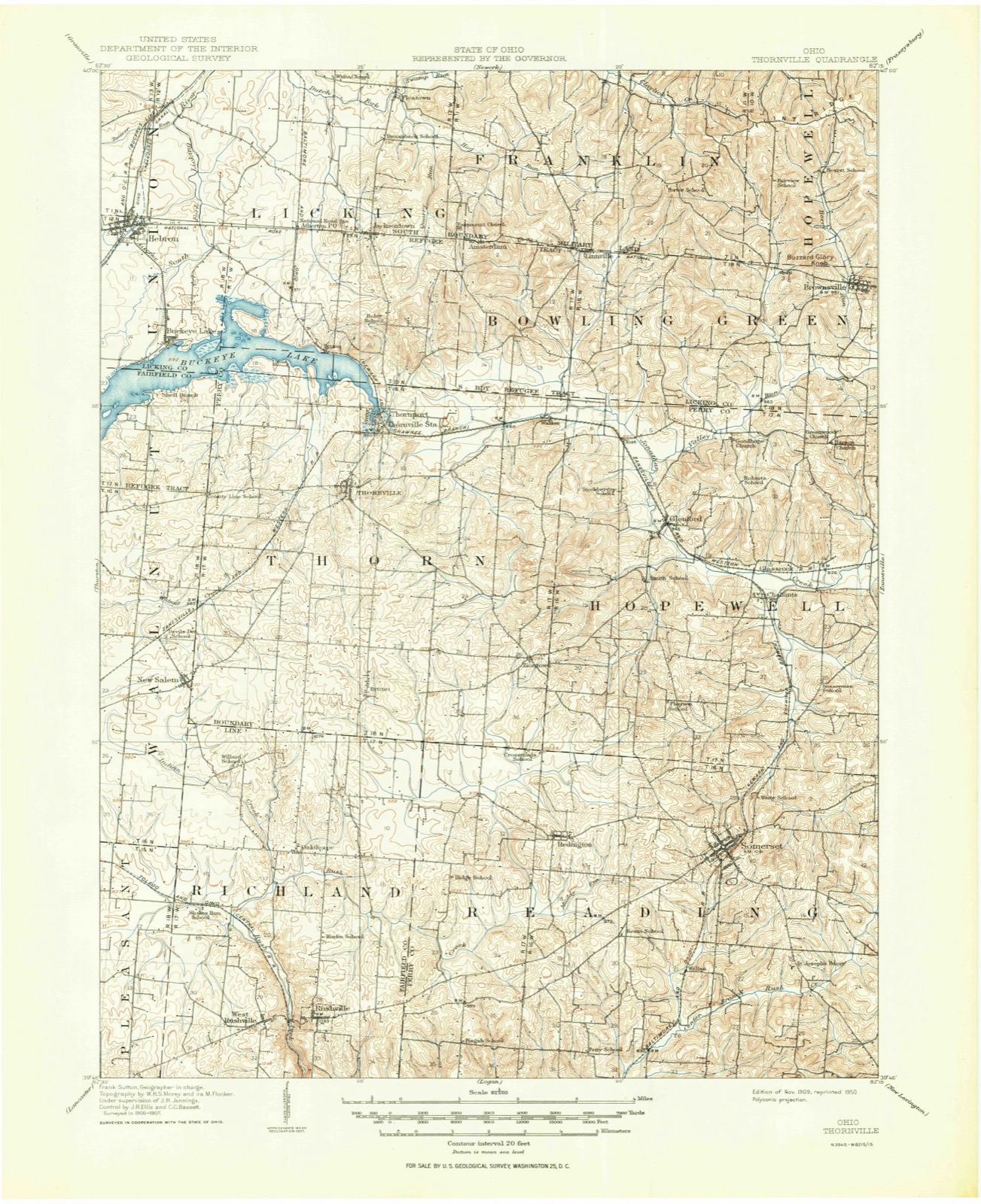
1909 to 1984The same ground, surveyed 75 years apart. Drag the handle to wipe between them. Both sheets are United States Geological Survey originals; neither has been altered.
Topographic sheets covering this place
11 sheetsMatched by testing this settlement's coordinate against the published boundary of every sheet in the United States Geological Survey's historical collection. Each opens the scanned sheet at the Survey.
- 1909 USGS Thornville quadrangle1:62500
- 1909 USGS Thornville quadrangle1:62500
- 1947 USGS Columbus quadrangle1:250000
- 1961 USGS Columbus quadrangle1:250000
- 1961 USGS Somerset quadrangle1:24000
- 1961 USGS Somerset quadrangle1:24000
- 1961 USGS Somerset quadrangle1:24000
- 1962 USGS Columbus quadrangle1:250000
- 1967 USGS Columbus quadrangle1:250000
- 1967 USGS Columbus quadrangle1:250000
- 1984 USGS Lancaster quadrangle1:100000






In the county-history sources
20,608 words on this township1883 History Perry County, Ohio, published 1883 names this settlement in its chapter on Reading Township. These are the passages that mention it, exactly as the scans read.
Reading township was probably authorized and named as early as 1804 or 1805, but the first record evidence of its organization into a Civil township, is early in the year 1807. It derived its name from Reading, Pennsylvania, and was named by Peter Overmyer, who came to the township in 1802. Reading township was originally a part of Fairfield county, comprised thirty-six sections, and was just six miles square ; but when the new county of Perry was organized, two rows of sections were taken from Richland township and attached to Reading, in order to give the new county the necessary number of square miles, and probably to make the western border of the county a little farther from Overmyertown and Somerset, both of which villages aspired to be the seat of justice for the new county. Reading township is now an oblong, six miles from north to south, and eight miles from east to west. iets. in extent of territory, the empire township of the county, and had no rival in population, until within a few years, in which time Pike, Saltlick, Coal and Monroe have become competitors with it in this respect, and two or three of them now surpass it.
Passage source: 1883 History Perry County, Ohio, published 1883.
Reading is, undoubtedly, one of the most desirable townships of land in Ohio, and long years of cultivation and care make the greater part of it show to the best advantage. About nine-tenths of it lies on the Hocking slope, and the remaining one-tenth on the Muskingum slope. That part of it which is on the Hocking side of the divide, is drained by West Rush Creek and tributaries, and by some of the tributaries of East Rush Creek. So much of the township as lies on the Muskingum side of the divide, is drained by Hood's Run, and a few other small tributaries of the north branch of Jonathan's Creek, or Moxahala. 'The land on both sides of the dividing ridge is naturally of excellent drainage, and only a very small percentage of stagnant water is ever known within the township limits. Most of the land is undulating, and a part of the southeast region ot the township is hilly. The land is about all arable, and most of it is very productive. Coal is found in the southeastern part in great abundance and of excellent quality. There are two or three seams in a partof the coal district, all of a good, merchantable quality. [ron ore is also very abundant in many places in the southern part of the township. The ore has been mined and shipped, to a considerable extent, and has been used with success in furnaces at Shawnee, Zanesville, Newark and other points. Some of the first coal mined in the county, was in this coal district, and the first coal miner is said to have been a colored man. The coal of this region found a market in early times at Somerset, Rushville, Lancaster and other points adjacent. at wool-growing receive much attention. 'There are also good orchards and vineyards, and the cultivation of many varieties of fruit has been crowned with considerable success.
Passage source: 1883 History Perry County, Ohio, published 1883.
Many of the early settlers of Reading township were Pennsylvania Germans, but large numbers of persons of Inglish descent, from Pennsylvania and others of the older States, came along soon after, and made permanent habitations. 'The Germans settled principally inthe neighborhood of Overmyertown, while the emigrants of English descent located mostly about Somerset, and in the eastern part of the township. 'There were many exceptions to this, however, and Germans were found near Somerset, and English speaking people in the vicinity of Overmyertown and in the western part of the township. At a little later date, from 1820 to 1830, there was a considerable emigration of
Passage source: 1883 History Perry County, Ohio, published 1883.
Machine-read from a century-old scan, so expect the errors a machine makes: misspelled names, dropped words, stray characters.
Read the whole chapter on Reading Township - it names this place 72 more 72 times.
Photographs
1 photograph,Taken for the Office of War Information and the Farm Security Administration, who photographed the country between 1935 and 1944. Works of United States government photographers, with no known restriction on use. Each opens its catalogue record.
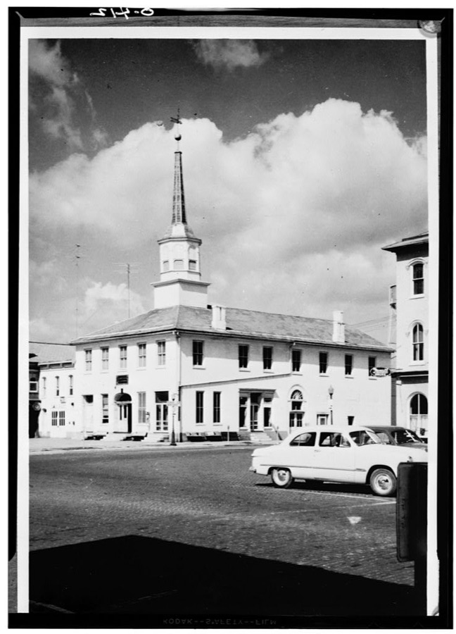
Unattributed, . Library of Congress
Fires near this place
15 since 2014Regional context, not property-specific evidence. The federal wildfire occurrence database lists 15 fires within 5 miles of Somerset between 2014 and 2020, burning about 25 acres in total. None started naturally. None was recorded as arson. Distance is straight-line from the map coordinates, so a fire counted here may appear on a neighbouring settlement's page as well.
| Reported cause | Fires |
|---|---|
| Debris and open burning | 5 |
| Missing data/not specified/undetermined | 5 |
| Recreation and ceremony | 4 |
| Smoking | 1 |
The most recent of them, most recent first, with the day each was reported and the service that recorded it.
| Date | Cause | Size | Reported by | Name on the report |
|---|---|---|---|---|
| 22 September 2015 | Missing data/not specified/undetermined | 1.0 acres | Ohio Department of Natural Resources | 2223 |
| 10 April 2019 | Missing data/not specified/undetermined | under an acre | Ohio Department of Natural Resources | 15132 |
| 10 April 2017 | Smoking | 1.5 acres | Ohio Department of Natural Resources | 7895 |
| 9 March 2020 | Debris and open burning | 1.4 acres | Ohio Department of Natural Resources | 15487 |
| 8 March 2020 | Debris and open burning | 1.0 acres | Ohio Department of Natural Resources | 15486 |
| 22 March 2014 | Missing data/not specified/undetermined | 8.0 acres | Ohio Department of Natural Resources | not named |
| 18 March 2018 | Debris and open burning | under an acre | Ohio Department of Natural Resources | 10429 |
| 18 March 2018 | Debris and open burning | under an acre | Ohio Department of Natural Resources | 10228 |
Settlements close enough to share some of these fires:
Specimens collected near this place
12 of 233 shownRegional context, not property-specific evidence. Museums hold 233 specimens collected within 10 miles of Somerset between 1891 and 1975: 202 Animalia, 18 Fungi, 10 Plantae, 2 Unrecorded, 1 Protozoa. 12 distinct Species records are shown. Collected by Bergstrom, J., Buchanan, J., Buker, W.E. and others. Each is a physical object with a catalogue number, and each entry opens the museum's record. This is what was collected and kept, not a survey of what lives here - nothing can be concluded from a species being absent.
| Image | Species | Year | Collected by | Where, as recorded |
|---|---|---|---|---|
 | Uromyces junci-effusi P.Syd. & Syd. | 1910 | W. A. Kellerman | |
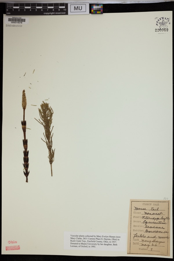 | Equisetum arvense L. | 1937 | Sharps, M.E. | Rush Creek Twp. |
 | Holwaya gigantea (Peck) E.J.Durand | 1891 | W. A. Kellerman | [Specific locality illegible.] |
 | Porella platyphylla (L.) Pfeiff. | 1891 | W. C. Werner | |
 | Fissidens adianthoides Hedw. | 1892 | W. C. Werner | Fultonham |
 | Puccinia schedonnardi Kellerm. & Swingle | 1895 | W. A. Kellerman | |
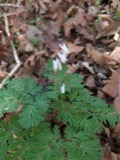 | Dicentra cucullaria (L.) Bernh. | 1900 | Williamson, E.B. | New Salem |
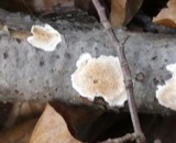 | Uromyces junci Tul. | 1901 | W. A. Kellerman | Junction City |
 | Natrix kirtlandii (Kennicott, 1856) | 1902 | Dilto, C. R. | Perry Co., Ohio |
 | Puccinia muhlenbergiae Arthur & Holw. | 1902 | W. A. Kellerman & J. McOwen Jr. | |
 | Endothia fluens (Sowerby) Shear & N.E.Stevens | 1912 | Nixon E. L. | Perry Co. |
 | Coleosporium carneum (Bosc) H.S.Jacks. | 1915 | G.G. Hedgcock | Gainesville |
All 233 specimens within 10 miles, at the Global Biodiversity Information Facility.
Mines and quarries near this place
3 within 5 milesRegional context, not property-specific evidence. The federal mineral resources record lists 3 workings within 5 miles of Somerset: 1 producer, 1 plant, 1 past producer. 2 still produce. What was taken out: Stone, Crushed/Broken, Limestone, General. Distance is straight-line from the map coordinates, so a quarry counted here may appear on a neighbouring settlement's page as well.
| Where | Site | Commodity | Status | Recorded |
|---|---|---|---|---|
| Busse Quarry | Limestone, General | Past Producer | Sedimentary | |
| Busse Quarry & Mill | Stone, Crushed/Broken | Plant | ||
| Glass Rock Quarry | Stone, Crushed/Broken | Producer |
Storms near this place
44 since 1995Regional context, not property-specific evidence. The National Weather Service names Somerset in 44 storm reports between 1995 and 2026: 31 thunderstorm wind, 11 hail, 1 heavy rain, 1 flash flood. No death or injury is recorded in these reports. Each account below is quoted exactly as the forecast office filed it, from the NOAA Storm Events Database, and each date opens the federal record of that event.
| When | Event | Place named | Harm | What the report says |
|---|---|---|---|---|
| October 2010 | Thunderstorm Wind | Somerset | $8,000 | Trees fell onto power lines causing electrical outages in town. |
| July 2014 | Thunderstorm Wind | Somerset | $5,000 | Trees fell onto electric lines, causing power outages. |
| July 2013 | Thunderstorm Wind | Somerset | $5,000 | Multiple trees were blown down onto power lines along Buckeye Valley Road. |
| May 2011 | Thunderstorm Wind | Somerset | $5,000 | Numerous trees were blown down. |
| August 2010 | Thunderstorm Wind | Somerset | $5,000 | A tree fell onto power lines. Other large branches were blown down. |
| April 2002 | Hail | Somerset | $5,000 | no account filed |
| June 2013 | Thunderstorm Wind | Somerset | $4,000 | Tree branches fell onto power lines and a transformer blew on Wilson Road. |
| May 2022 | Thunderstorm Wind | Somerset | $3,000 | Several trees were downed in the town of Somerset. |
| June 2022 | Thunderstorm Wind | Somerset | $3,000 | Multiple trees were blown down in the Reading Township. |
| June 2020 | Thunderstorm Wind | Somerset | $3,000 | At a residential home in Somerset, a large tree and several large limbs fell onto a metal open air shelter. |
| July 2017 | Thunderstorm Wind | Somerset | $3,000 | Multiple trees and power lines were blown down in Somerset. |
| July 2020 | Thunderstorm Wind | Somerset | $2,000 | Multiple trees were blown down along US Route 22 near Somerset. |
| August 2020 | Thunderstorm Wind | Somerset | $2,000 | Numerous trees were downed in the town of Somerset. |
| November 2013 | Thunderstorm Wind | Somerset | $2,000 | Large branches were blown down. |
| July 2000 | Thunderstorm Wind | Somerset | $2,000 | A few trees and several large branches were fallen. |
| June 2022 | Thunderstorm Wind | Somerset | $1,000 | Multiple trees and a power line were downed in the village of Somerset. |
| June 2022 | Thunderstorm Wind | Somerset | $1,000 | A few trees were downed along State Route 13. |
| July 2013 | Thunderstorm Wind | Somerset | $1,000 | Multiple trees were knocked down at 215 Main Street. |
| July 2013 | Thunderstorm Wind | Somerset | $1,000 | Trees were blown down on East Main Street and Columbus Street. |
| May 2002 | Thunderstorm Wind | Somerset | $1,000 | Trees and large branches were blown down. |
| June 2025 | Thunderstorm Wind | Somerset | $500 | In Somerset, a tree was blown down on State Route 757. Another downed tree was observed blocking a lane of Township Road 45 outside the town limits of Somerset. |
| July 2024 | Thunderstorm Wind | Somerset | $500 | Several trees were blown down in Somerset. |
| June 2024 | Thunderstorm Wind | Somerset | $500 | Trees were blown down along North Columbus Street in downtown Somerset. |
| July 2020 | Thunderstorm Wind | Somerset | $500 | Trees were downed along Reading Township Road. |
| August 2018 | Thunderstorm Wind | Somerset | $500 | Strong winds associated with a passing thunderstorm blew trees down east and west of Somerset along US-22. |
| June 2022 | Flash Flood | Somerset | $250 | High water was observed along Main Street of the Reading Township. |
| April 2023 | Thunderstorm Wind | Somerset | $200 | One tree was blown down across the road at Sheridan Avenue. |
| June 2024 | Thunderstorm Wind | Somerset | $100 | In Somerset, tree limbs were broken down onto South Market Street. |
| April 2023 | Thunderstorm Wind | Somerset | - | A couple of trees were blown down onto Otterbein Road in Somerset. As the storm continued through the township, more trees and power lines were blown down. |
| July 2017 | Heavy Rain | Somerset | - | Three inches of rain were measured near Somerset. This was a total for the day. |
| June 2007 | Thunderstorm Wind | Somerset | - | Trees were blown down along Route 757. |
| August 2004 | Thunderstorm Wind | Somerset | - | Trees were blown down along route 668. |
| July 2003 | Thunderstorm Wind | Somerset | - | Trees and power lines fell along Buckeye Valley Road. |
| June 1995 | Thunderstorm Wind | Somerset | - | Large tree limbs were broken off by the wind. |
| March 2026 | Hail | Somerset | - | no account filed |
| May 2019 | Hail | Somerset | - | no account filed |
| April 2013 | Hail | Somerset | - | no account filed |
| April 2006 | Hail | Somerset | - | no account filed |
| October 2006 | Hail | Somerset | - | no account filed |
| August 2003 | Hail | Somerset | - | no account filed |
| June 2002 | Hail | Somerset | - | no account filed |
| June 2002 | Hail | Somerset | - | no account filed |
| June 2002 | Hail | Somerset | - | no account filed |
| April 1995 | Hail | Somerset | - | no account filed |
Newspapers printed here
0 digitised pages1 paper published in this town, digitised by the Library of Congress and free to read: 0 issues, 0 pages. Every page is searchable, so a name or a street can be looked for directly in what the town printed about itself at the time.
| Newspaper | Published |
|---|---|
| The Somerset Press | 1873 to 1977 |
What the paper printed
19,407 wordsFront pages of the local paper, read from the Library of Congress scans: 2 issues spread across its run from 1873 to 1882, 19,407 words in total. Each is reproduced on its own page, exactly as the recogniser returned it.
These pages read less well than anything else here, and the number is worth stating: about three words in four come through cleanly, against nine in ten for the building records. An 1896 broadsheet sets eight-point type in seven columns on microfilm, which is the hardest thing in this archive to read by machine. We tested our own recognisers against the Library's and they were not better, so the Library's text is what appears, with the wholly unreadable columns removed. Read it as a guide to what the paper covered, and follow the link to the scan before quoting anything.
| Issue | Paper | Length |
|---|---|---|
| 1873-10-10 | The Somerset Press | 9,579 words |
| 1882-06-22 | The Somerset Press | 9,828 words |
Nearest settlements
The eight closest, with where each one stands in the county. Distances are straight-line, computed from the Geographic Names Information System coordinates.
| Map | Place | Distance | Sheets |
|---|---|---|---|
| Wellan (historical) | 2.2 miles | 11 | |
| New Reading | 2.8 miles | 11 | |
| Wesley | 4.3 miles | 12 | |
| Chalfants | 4.3 miles | 11 | |
| Carthon | 4.4 miles | 13 | |
| Ziontown | 4.7 miles | 11 | |
| Glass Rock | 4.9 miles | 12 | |
| Sego | 5.5 miles | 12 |
Elsewhere
Matched on this settlement's Geographic Names Information System number rather than its name, so it cannot be a different place of the same name in another state.
| Wikipedia article on Somerset | An encyclopaedic summary. Its text is share-alike, so it is linked here rather than copied. |
| Wikidata item Q2300861 | The structured record the population and elevation above come from. Public domain (CC0). |
Provenance
This settlement is recorded in the Geographic Names Information System as feature 1065343. The sheet list is computed by point-in-boundary test against the United States Geological Survey's historical topographic inventory. Both are works of the United States government and carry no copyright under 17 U.S.C. 105.
Wildfire. Short, Karen C. 2022. Spatial wildfire occurrence data for the United States, 1992-2020 [FPA_FOD_20221014]. 6th Edition. Fort Collins, CO: Forest Service Research Data Archive. https://doi.org/10.2737/RDS-2013-0009.6 Collected with United States Government funding and usable without additional permissions or fees.
Specimens. Global Biodiversity Information Facility (GBIF), https://www.gbif.org/. Only records licensed CC0 or CC BY are used. Records licensed CC BY-NC are excluded because this site carries advertising. Images are checked individually and any whose licence is non-commercial, no-derivatives or unreadable is refused.
Mines and quarries. USGS Mineral Resources Data System (MRDS) https://mrdata.usgs.gov/mrds/ A work of the United States government, no copyright under 17 U.S.C. 105.
Storms. NOAA National Centers for Environmental Information, Storm Events Database https://www.ncei.noaa.gov/stormevents/ A work of the United States government, no copyright under 17 U.S.C. 105. Narratives are quoted verbatim from the National Weather Service report and are not edited or summarised.