 Block
Block
South Charleston, Ohio
12 topographic sheets cover this place, the earliest surveyed in 1907 and the latest in 1986. It stands in Madison Township. It lies in ZIP code area 45368. The Survey maps it on the South Charleston quadrangle. 1,706 people lived here at the 2020 count. It stands 1,125 feet above sea level.
Population over time
2 figuresSouth Charleston grew from 1,693 to 1,706 between 2010 and 2020. These are the recorded population figures Wikidata holds for this place, reached through the Geographic Names Information System number this page is keyed on rather than by name, so they belong to this place and not to another of the same name. Most are census counts, but not all are: an early figure may be a founding or settlement estimate. The change column is computed, and is left blank where more than 20 years separate a figure from the one before it, because a gap that long is not a change between two counts.
| Year | People | Change |
|---|---|---|
| 2010 | 1,693 | |
| 2020 | 1,706 | +13 (+1%) |
Then and now
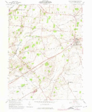
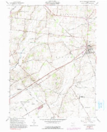
1907 to 1986The same ground, surveyed 79 years apart. Drag the handle to wipe between them. Both sheets are United States Geological Survey originals; neither has been altered.

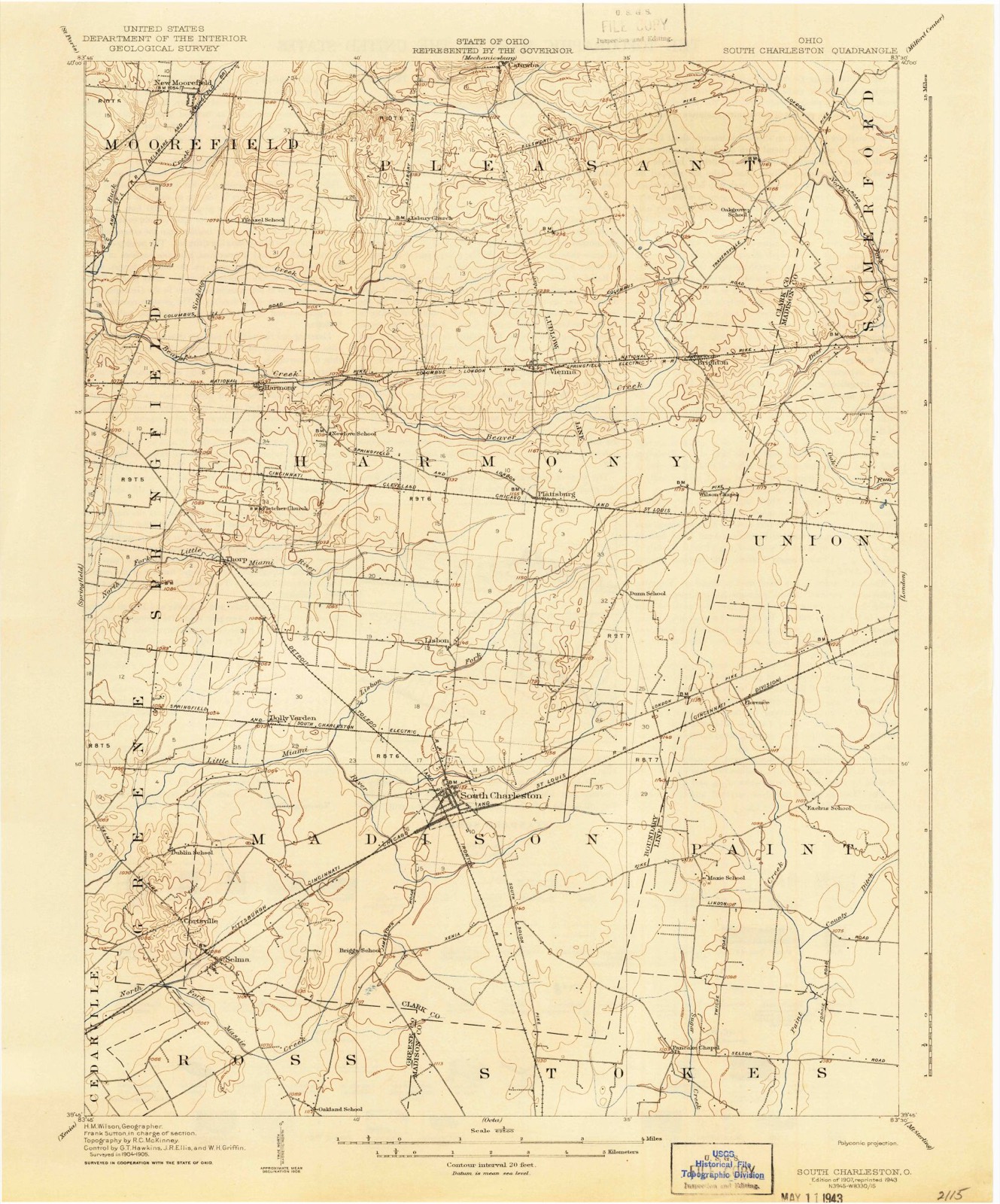
Topographic sheets covering this place
12 sheetsMatched by testing this settlement's coordinate against the published boundary of every sheet in the United States Geological Survey's historical collection. Each opens the scanned sheet at the Survey.
- 1907 USGS South Charleston quadrangle1:62500
- 1907 USGS South Charleston quadrangle1:62500
- 1947 USGS Columbus quadrangle1:250000
- 1961 USGS Columbus quadrangle1:250000
- 1961 USGS South Charleston quadrangle1:24000
- 1961 USGS South Charleston quadrangle1:24000
- 1961 USGS South Charleston quadrangle1:24000
- 1962 USGS Columbus quadrangle1:250000
- 1967 USGS Columbus quadrangle1:250000
- 1967 USGS Columbus quadrangle1:250000
- 1986 USGS Springfield quadrangle1:100000
- 1986 USGS Springfield quadrangle1:100000







What happened here
An account from the chapter on Madison township, The inset identifies its exact source book and publication year.
The Soldiers Of 1 86 1-05
Madison Township soldiers have a record of which her people may well lie proud. From that memorable day in April, 1861, when hostile traitor hands struck tlio old flag, and hostile batteries converged their murderous fires on Sumter, until the day of proud and lasting victory at Appomattox, the sons of Madison Township, with their lives and all they held dear, were at the service of the country and on the side of the Union.
In the county-history sources
79,197 words on this townshipIllustrated Historical Atlas of Clark County, Ohio, published 1875; The History of Clark County, Ohio, Containing a History of the County; Its Cities, Towns, Etc.; General and Local Statistics; Portraits of Early Settlers and Prominent Men; History of the Northwest Territory; History of Ohio; Map of Clark County; Constitution of the United States, Miscellaneous Matters, Etc. .., published 1881 names this settlement in its chapter on Madison Township. These are the passages that mention it, exactly as the scans read.
The first grist-milla were constructed and run by John and James Levels; they are on Mad River, ure known as Tecumseh Mills, and hegan to ran about 1520. The Enon Mills were built in 1842, by [suae Shauk. The tirst tunuery Wag started by William Smith; be used the tan burk aud Wandled all kinds of leather, and began work in 1816. Williams, previously named, was a tanner of deer-skins fur wearing purposes, and many of the setUers got punts-stuff from his hands. In 1525, Judge Layton started w saw-mill. The first postmaster Was Joho R, Miller, appointed in 1937. 'The office was on the old road, uni when Enon was laid out, it was moved there, The muils were curried by stages. D. Miller erected the first frame barn, in 1818, nnd the first brick house, in 1824. J. Layton and A. Crawford were the first distillers; and Jumes Galloway set out the first orchard, in 1800, - though natural fruit, it was highly prized.
Passage source: Illustrated Historical Atlas of Clark County, Ohio, published 1875.
The original roads seem to have been laid out regardless of section lines and cardinal points of the compass. The exceptions to this statement are few, and this fact mars the shape of many of the finest farms of Madison Township.
The West Jefferson, South Charleston A Xenia Turnpike was built by a stock company about the year 1844. The Springfield A South Charleston Pike was finished in I860. The Charleston, West Jefferson A Washington Pike was f - ' ' ;.=! iv. 1868. The average cost of these improved roads is put down at $2,000 per mile. *
Machine-read from a century-old scan, so expect the errors a machine makes: misspelled names, dropped words, stray characters.
Read the whole chapter on Madison Township - it names this place 92 more 92 times.
Specimens collected near this place
12 of 175 shownRegional context, not property-specific evidence. Museums hold 175 specimens collected within 10 miles of South Charleston between 1927 and 1973: 159 Animalia, 16 Fungi. 12 distinct Species records are shown. Collected by A. R. Boone, B. Montgomery, L. Alward & P. Alward, Binkley, L. E. (Lowell) and others. Each is a physical object with a catalogue number, and each entry opens the museum's record. This is what was collected and kept, not a survey of what lives here - nothing can be concluded from a species being absent.
| Image | Species | Year | Collected by | Where, as recorded |
|---|---|---|---|---|
 | Pseudacris crucifer (Wied-Neuwied, 1838) | 1927 | Thomas, E. S. (Edward S.) | Near South Vienna, Clark Co., Ohio |
 | Rana catesbeiana Shaw, 1802 | 1927 | Thomas, E. S. (Edward S.) | Near South Vienna, Clark Co., Ohio |
 | Catostomus commersonnii commersonnii (Lacepède, 1803) | 1930 | MB Trautman | Beaver Creek, trib of Buck Creek, Western Harmony Twp |
 | Cottus bairdii Girard, 1850 | 1930 | MB Trautman | Beaver Creek, trib of Buck Creek, Western Harmony Twp |
 | Etheostoma blennioides Rafinesque, 1819 | 1930 | MB Trautman | Beaver Creek, trib of Buck Creek, Western Harmony Twp |
 | Etheostoma caeruleum Storer, 1845 | 1930 | MB Trautman | Beaver Creek, trib of Buck Creek, Western Harmony Twp |
 | Etheostoma flabellare Rafinesque, 1819 | 1930 | MB Trautman | Beaver Creek, trib of Buck Creek, Western Harmony Twp |
 | Etheostoma nigrum Rafinesque, 1820 | 1930 | MB Trautman | Beaver Creek, trib of Buck Creek, Western Harmony Twp |
 | Hypentelium nigricans (Lesueur, 1817) | 1930 | MB Trautman | Beaver Creek, trib of Buck Creek, Western Harmony Twp |
| Luxilus cornutus (Mitchill, 1817) | 1930 | MB Trautman | Beaver Creek, trib of Buck Creek, Western Harmony Twp | |
| Lythrurus ardens (Cope, 1868) | 1930 | MB Trautman | Beaver Creek, trib of Buck Creek, Western Harmony Twp | |
| Micropterus dolomieu Lacepède, 1802 | 1930 | MB Trautman | Beaver Creek, trib of Buck Creek, Western Harmony Twp |
All 175 specimens within 10 miles, at the Global Biodiversity Information Facility.
Storms near this place
22 since 2000Regional context, not property-specific evidence. The National Weather Service names South Charleston in 22 storm reports between 2000 and 2023: 9 hail, 7 thunderstorm wind, 4 flood, 2 flash flood. No death or injury is recorded in these reports. Each account below is quoted exactly as the forecast office filed it, from the NOAA Storm Events Database, and each date opens the federal record of that event.
| When | Event | Place named | Harm | What the report says |
|---|---|---|---|---|
| March 2020 | Flash Flood | South Charleston | $20,000 | Water was flowing over multiple bridges in southeastern portions of the county. High water was also reported on several roadways throughout the county. |
| May 2011 | Flood | South Charleston | $20,000 | A campground was evacuated due to heavy rainfall that caused flooding of the area. |
| June 2005 | Hail | South Charleston | $10,000 | no account filed |
| April 2006 | Thunderstorm Wind | South Charleston | $5,000 | Numerous trees were downed. |
| July 2003 | Thunderstorm Wind | South Charleston | $3,000 | Several trees were downed. |
| November 2017 | Thunderstorm Wind | South Charleston | $2,000 | A wooden structure was damaged and numerous branches were downed. |
| June 2000 | Thunderstorm Wind | South Charleston | $2,000 | Trees were blown down. |
| June 2000 | Thunderstorm Wind | South Charleston | $2,000 | Trees were blown down. |
| June 2016 | Thunderstorm Wind | South Charleston | $1,000 | A tree was knocked down into an alley. |
| March 2020 | Flood | South Charleston | - | Several roads remained closed due to earlier heavy rainfall. |
| July 2016 | Flood | South Charleston | - | Some high water was reported on a few roads in the South Charleston area. |
| July 2016 | Flood | South Charleston | - | Standing water, about 3 to 4 inches deep, was reported on several roads in South Charleston. |
| June 2009 | Hail | South Charleston | - | One inch hail was reported by amateur radio operators and the fire department. |
| July 2003 | Flash Flood | South Charleston | - | Several roads were flooded. |
| April 2023 | Hail | South Charleston | - | no account filed |
| August 2021 | Hail | South Charleston | - | no account filed |
| May 2011 | Hail | South Charleston | - | no account filed |
| May 2011 | Hail | South Charleston | - | no account filed |
| April 2011 | Hail | South Charleston | - | no account filed |
| April 2003 | Thunderstorm Wind | South Charleston | - | no account filed |
| April 2001 | Hail | South Charleston | - | no account filed |
| May 2000 | Hail | South Charleston | - | no account filed |
Nearest settlements
The eight closest, with where each one stands in the county. Distances are straight-line, computed from the Geographic Names Information System coordinates.
| Map | Place | Distance | Sheets |
|---|---|---|---|
| Lisbon | 2.5 miles | 12 | |
| Dolly Varden | 3.3 miles | 12 | |
| Selma | 4.7 miles | 12 | |
| Cortsville | 5.0 miles | 12 | |
| Plattsburg | 5.0 miles | 12 | |
| Thorps | 5.4 miles | 14 | |
| Oxtoby (historical) | 6.2 miles | 14 | |
| Hollandia View | 6.8 miles | 14 |
Elsewhere
Matched on this settlement's Geographic Names Information System number rather than its name, so it cannot be a different place of the same name in another state.
| Wikipedia article on South Charleston | An encyclopaedic summary. Its text is share-alike, so it is linked here rather than copied. |
| Wikidata item Q2319316 | The structured record the population and elevation above come from. Public domain (CC0). |
Provenance
This settlement is recorded in the Geographic Names Information System as feature 1065347. The sheet list is computed by point-in-boundary test against the United States Geological Survey's historical topographic inventory. Both are works of the United States government and carry no copyright under 17 U.S.C. 105.
Specimens. Global Biodiversity Information Facility (GBIF), https://www.gbif.org/. Only records licensed CC0 or CC BY are used. Records licensed CC BY-NC are excluded because this site carries advertising. Images are checked individually and any whose licence is non-commercial, no-derivatives or unreadable is refused.
Storms. NOAA National Centers for Environmental Information, Storm Events Database https://www.ncei.noaa.gov/stormevents/ A work of the United States government, no copyright under 17 U.S.C. 105. Narratives are quoted verbatim from the National Weather Service report and are not edited or summarised.