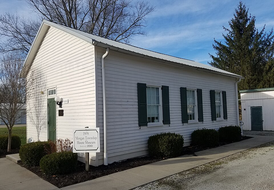
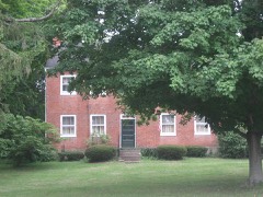
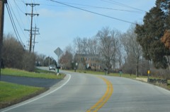
Listed on the National Register of Historic Places in
2016. A historic map-sheet match is not published yet. The record needs a coordinate-quality review before it can be joined to a sheet boundary.
From the record
“Among the first residents of the village were the sons of Benjamin Lloyd, Samuel, William, and Alexander, the latter of whom was a storekeeper on the corner where J. Charles Shields was a storekeeper here in 1845, in the house now occupied by James Applegate.”
A History and Biographical Cyclopædia of Butler County, Ohio : with Illustrations and Sketches of Its Representative Men and Pioneers (1882). Machine-read text.
one of 63 National Register listings in Butler County · listed in 2016 · category: Building · one of 3 National Historic Landmarks in Butler County.
Before this village was regularly laid out it went by the name of the Tariff Post-office. Some of the early settlers, disliking the name, had it changed, by petition, to Okeana. Okeana was the name of the daughter of the Indian chief, Kiatta. The Rev. Benjamin Lloyd, a native of Wales, and a son of Rev. Rees Lloyd, platted the village on land which he owned at that time, and gave the place its name. The town, as it now is, stands mostly in School Section No. 16, which was bought by Charles Shields, but who in turn sold a portion of the section to Mr. Lloyd.
Among the first residents of the village were the sons of Benjamin Lloyd, Samuel, William, and Alexander, the latter of whom was a storekeeper on the corner where J. E. Boze now resides. Charles Shields was a storekeeper here in 1845, in the house now occupied by James Applegate. Jenkins & Evans were here as commercial men in the Boze residence before Lloyd. William Wright was another business man in Okeana, in a one-story house which stood in the forks of the road. The building was removed, and afterwards was occupied for a dwelling, but is now deserted. Henry Brandenburg, one of the noted storekeepers of the place, bought the store goods and real estate of Samuel Lloyd, and in 1873 or 1874, erected the present fine building where the Phellis Brothers keep. William Mercer was a storekeeper here at one time; he was followed by Samuel Gwaltney. Thomas and Charles Jones were here also for some time, in the old Shields property. William De Armond had'a little store in the yard of the Shields estate. Then came Jeremiah Day in the same house. In 1850, or thereabouts, Alexander De Armond and Joseph Smith were here engaged in selling dry goods and groceries. The present. storekeepers are J. W. Phellis and Perry Clawson.
Regional context, not property-specific
evidence. Museums hold 83 specimens
collected within 10 miles of Morgan Township House between 1891 and
1974: 68 Animalia, 10 Plantae, 3 Fungi, 2 Protozoa. 12 distinct Species records are shown.
Collected by A. R. Gaufin, A.R. Gaufin, H.H. Ross, Arden R. Gaufin and others. Each is a
physical object with a catalogue
number, and each entry opens the museum's record. This is what was
collected and kept, not a survey of what lives here - nothing can be
concluded from a species being absent.
Regional context, not property-specific
evidence. The National Weather Service names
Okeana, the town this property stands in, in 14 storm reports between 1996 and 2024: 7 thunderstorm wind, 2 hail, 2 flash flood, 2 flood.
No death or injury is recorded in these reports. Each account below is quoted exactly as the forecast office
filed it, from the NOAA Storm Events Database, and each date
opens the federal record of that event.
No historic map-sheet match is published
for this property yet. That does not mean no map exists. This record needs
a coordinate-quality review before it can be joined to a sheet boundary.
Browse the county's mapped places while that work is
pending.
Listed places nearby
6 within 8 miles
Other National Register properties close
enough to walk or drive between, ordered by distance from this one. Both
positions come from the same geocoding pass that matched these properties
to their map sheets.
Listing record. National Park Service National Register of Historic Places, listed-properties dataset, current to 2026-05-22.
Map join. Address geocoded through the United States Census geocoder, then tested against the published boundary of every sheet in the USGS Historical Topographic Map Collection.
How this page is made. Listing fields come from federal records; map-sheet coverage is a labelled coordinate-to-boundary calculation, not a source-field claim.
Specimens. Global Biodiversity Information Facility (GBIF), https://www.gbif.org/. Only records licensed CC0 or CC BY are used. Records licensed CC BY-NC are excluded because this site carries advertising. Images are checked individually and any whose licence is non-commercial, no-derivatives or unreadable is refused.
Storms. NOAA National Centers for Environmental Information, Storm Events Database https://www.ncei.noaa.gov/stormevents/ A work of the United States government, no copyright under 17 U.S.C. 105. Narratives are quoted verbatim from the National Weather Service report and are not edited or summarised.
 Block
Block