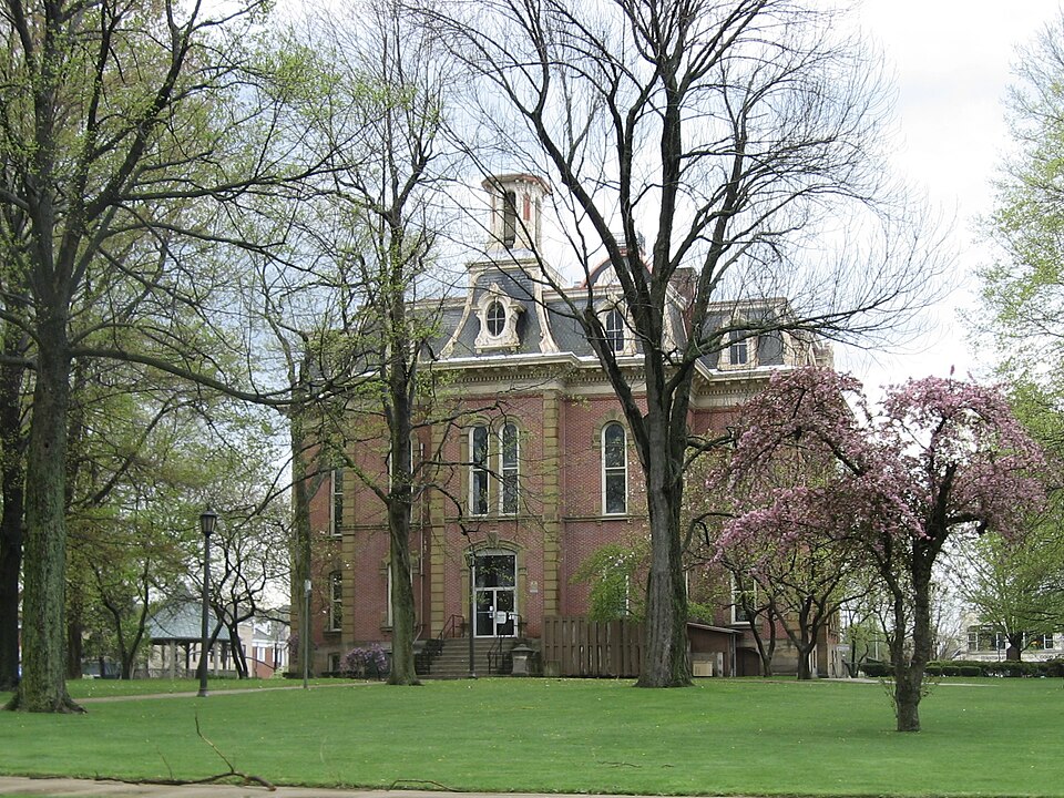
Built in 1873. Listed on the National Register of Historic Places in
1973. A historic map-sheet match is not published yet. The record needs a coordinate-quality review before it can be joined to a sheet boundary.
From the record
“The Coshocton County Courthouse, designed in Second Empire style, is a historic courthouse building located at 349 Main Street in Coshocton, Ohio. It was added to the National Register of Historic Places on May 22, 1973.”
Wikipedia article Coshocton County Courthouse, CC BY-SA 4.0.
one of 16 National Register listings in Coshocton County · listed in 1973 · category: Building · built in 1873.
National Register reference number.73001402- the number the National Park Service assigned this property when it was listed, and the key its nomination file is catalogued under at the National Archives.
What happened here
An account from the chapter on Coshocton city, The inset identifies its exact
source book and publication year.
Miscellaneous Matters - 1. The Pre-Historic Race. 2. Ancient Burial Grounds. 3. Meaning of the names Muskingum, Tuscarawas, and Walhonding. 4. Prose Legend of the Walhonding. 5. Heckwelder's Famous Ride. 6. Temperance Crusade among the Indians. 7. The Gnadenhutten Massacre. 8. Curious Stories Touching Captives Reclaimed by Boquet.
The tastes of the preparer of this volume disposed him to undertake it ; a residence in Coshocton of twenty years, and peculiar relations and associations of favorable sort, gave hira, as friends claimed, at least a certain fitness to do it ; and the Centennial year seemed to be the proper occasion. Amid illhealth and other hindrances wholly unanticipated when the work was begun, the book has been written. If it does not meet all expectations, it is hoped it will not disappoint any reasonable ones. It could scarcely be expected that a work of the sort should be entirely free from errors, but great care has been taken to make it at least correct as far as it goes. Of course, in the line of personal history, regard must be had to the limits and scope of the work. It only purports to be a panorama - not a series of finished portraits, with every shadow and light. Mere mention of every person and thing not amiss in such a volume would indefinitely extend it and add to cost. To those who have kindly assisted in its preparation, I shall ever feel grateful ; and I can confidently say that if there had been on the part of some others such help as those kind friends rendered, and as a little public spirit, local fame and denominational interest might well prompt, the book would be a better one. As it is, I respectfully submit it as at least an honest endeavor to put in convenient and permanent form something of the record of a locality of classic (American) interest, and to trace the steps whereby we have reached our
Miscellaneous Matters - 1. The Pre-Historic Race. 2. Ancient Burial Grounds. 3. Meaning of the names Muskingum, Tuscarawas, and Walhonding. 4. Prose Legend of the Walhonding. 5. Heckwelder's Famous Ride. 6. Temperance Crusade among the Indians. 7. The Gnadenhutten Massacre. 8. Curious Stories Touching Captives Reclaimed by Boquet. 9. Description of the Hunting-Shirt. 10. The Houses and Furniture of the Pioneers in Coshocton County. 11. Louis Philippe at Coshocton. 12. How to Raise a Large Family. 13. Indian Stories. 14. Backwoods Sports 159-177 ored People in Coshocton County. 4. Fires in Eoscoe - An Incident and a Joke. 5. A Bundle of First Things. 6. Relics and Curiosities in Personal Possession. 7. Coshocton Wags in Early Days. 8. The Treasury Robbery. 9. Humors of the Crusade 178-191
Regional context, not property-specific
evidence. The
federal wildfire occurrence database
lists 19 fires within 5 miles of Coshocton County Courthouse between
2007 and 2020, burning about 20 acres in total. None started naturally. None was recorded as arson.
Distance is straight-line from the map coordinates, so a fire counted
here may appear on a neighbouring settlement's page as well.
Reported cause
Fires
Debris and open burning
11
Missing data/not specified/undetermined
4
Smoking
2
Power generation/transmission/distribution
1
Recreation and ceremony
1
The most recent of
them, most recent first, with the day each was reported and the service
that recorded it.
Regional context, not property-specific
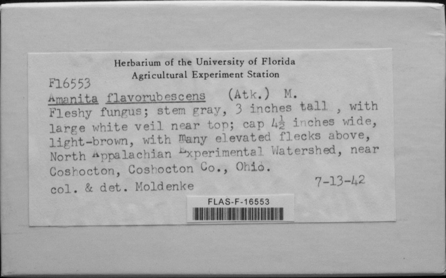
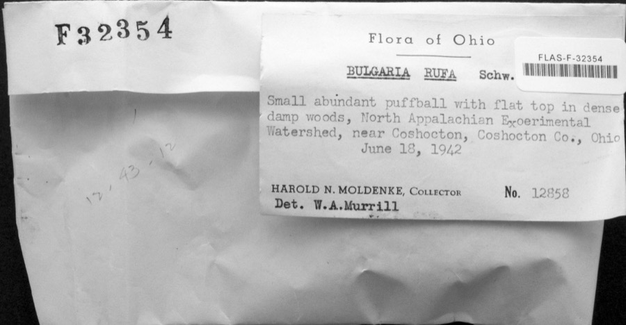
evidence. Museums hold 1,666 specimens
collected within 10 miles of Coshocton County Courthouse between 1846 and
1974: 877 Animalia, 655 Plantae, 124 Fungi, 4 Bacteria, 4 Protozoa, 2 Unrecorded. 12 distinct Species records are shown.
Collected by A. D. Huryn, A. Spreitzer, Albaugh, W. F. and others. Each is a
physical object with a catalogue
number, and each entry opens the museum's record. This is what was
collected and kept, not a survey of what lives here - nothing can be
concluded from a species being absent.
Regional context, not property-specific
evidence. The federal mineral resources record lists
4 workings within 5 miles of Coshocton County Courthouse: 2 past producers, 2 producers.
2 still produce. What was taken out: Sand and Gravel, Construction. Distance is straight-line from the
map coordinates, so a quarry counted here may appear on a neighbouring
settlement's page as well.
Regional context, not property-specific
evidence. The National Weather Service names
Coshocton, the town this property stands in, in 117 storm reports between 1994 and 2025: 71 thunderstorm wind, 25 hail, 16 flash flood, 4 flood.
No death or injury is recorded in these reports. Each account below is quoted exactly as the forecast office
filed it, from the NOAA Storm Events Database, and each date
opens the federal record of that event.
Local emergency manager reports trees and wires down across the county; 3 utility poles were snapped from the bottom in a row laying the same direction along Magnolia Street.
Trees and power lines blown down in Nellie, Coshocton, and Warsaw. Some fell on 12th St in Coshocton. 10 large trees fell in the Warsaw-West Lafayette area.
No historic map-sheet match is published
for this property yet. That does not mean no map exists. This record needs
a coordinate-quality review before it can be joined to a sheet boundary.
Browse the county's mapped places while that work is
pending.
From the nomination file
1,426 words on record
When this property was proposed for the
National Register, someone wrote the case for it: what the building is,
and why it matters. That document is a federal record in the public domain.
It is quoted below word for word, never summarised. The text was read off the scanned case file by machine, so the
occasional stray character is the recogniser's and the 1970s
typewriter's.
Description of the property
The two-story, mansard roofed Coshocton County Courthouse was built of this building was Carpenter and Williams of Meadville, Pennsylvania. floor windows are arched, and the frames have stone hood molds. The center bays project from the wall, accenting the entrance and tower. The is a flat topped, round belfry. tuck pointed, sash repaired, the stone cleaned, the roof repaired where APR 2 5 1973 CONDITION The DESCRIPTION NATIONAL Ruins RECEIVED approximately seventy-five feet square.
windows are double-hung sash type.A smooth stone belt course divides have tracery and hood molds.Denticular cornice surrounds the building A major restoration of the courthouse was undertaken by the county in seems most interested in the preservation of this excellent example of tower also has a mansard roof that is four sided.In each side are The exterior walls are accented by smooth stone quoins.The first 1954,and accounts for the building's condition.The brickwork was The interior of the building is straightforward.There are two open tower is topped with ornamental iron cresting.Above the north entrance good condition, and is in constant use. a Second Empire Period courthouse.
cast iron stairways at the north and south ends of the building.Wood- of brick from 1873 to 1875.The building is built on a stone foundation, (Check One) Good work, except for baseboard, is absent.
Coshocton County was organized on April 1, 1811. Coshocton, the and John Matthews, under the name of Tuscarawa, which was changed polls miserably, but the commissioners, undaunted, simply asked the Williams of Meadville, Pennsylvania to design the building. Bids The building has been in constant use as the courthouse, and seems 1873-1875 Conservation Commerce Architecture Communications Engineering Military Transportation building. Aboriginal Music Pre-Columbian Religion/Phi Science Agriculture Theater The commissioners employed the architectural firm of Carpenter and Landscape Invention Industry well-suited to the county's present and future needs.
had outlived its usefulness and was considered a fire hazard.The Political Social/Human- Sculpture county commissioners in 1872 went to the voters for approval of funds to construct a modern building.The measure failed at the the spring, and the building was completed and occupied in July,1875. the winter of 1872,and the county worked up plans for the new SIGNIFICANCE were let early in 1873, and the successful bidder was S.Harold and to its present name in 18ll.Coshocton was generally sparsely county laid out in April,1802 by Ebenezer Buckingham The courthouse cost over $10o,000 to construct. citizens in 1880. state legislature for permission. The legislature complied during Company of beaver Falls, Pennsylvania.
Construction was started in losophy itarian populated during the nineteenth century having only three thousand brick structure with a hipped roof. By the 1870's this building The countys first courthouse was built in1834.It was a sma1l
Quoted from the National Register nomination
for reference 73001402, 10 pages, held by the National Archives in Record
Group 79. See the
catalogue record.
Listed places nearby
6 within 8 miles
Other National Register properties close
enough to walk or drive between, ordered by distance from this one. Both
positions come from the same geocoding pass that matched these properties
to their map sheets.
Listing record. National Park Service National Register of Historic Places, listed-properties dataset, current to 2026-05-22.
Map join. Address geocoded through the United States Census geocoder, then tested against the published boundary of every sheet in the USGS Historical Topographic Map Collection.
How this page is made. Listing fields come from federal records; map-sheet coverage is a labelled coordinate-to-boundary calculation, not a source-field claim.
Wildfire. Short, Karen C. 2022. Spatial wildfire occurrence data for the United States, 1992-2020 [FPA_FOD_20221014]. 6th Edition. Fort Collins, CO: Forest Service Research Data Archive. https://doi.org/10.2737/RDS-2013-0009.6 Collected with United States Government funding and usable without additional permissions or fees.
Specimens. Global Biodiversity Information Facility (GBIF), https://www.gbif.org/. Only records licensed CC0 or CC BY are used. Records licensed CC BY-NC are excluded because this site carries advertising. Images are checked individually and any whose licence is non-commercial, no-derivatives or unreadable is refused.
Mines and quarries. USGS Mineral Resources Data System (MRDS) https://mrdata.usgs.gov/mrds/ A work of the United States government, no copyright under 17 U.S.C. 105.
Storms. NOAA National Centers for Environmental Information, Storm Events Database https://www.ncei.noaa.gov/stormevents/ A work of the United States government, no copyright under 17 U.S.C. 105. Narratives are quoted verbatim from the National Weather Service report and are not edited or summarised.
 Block
Block