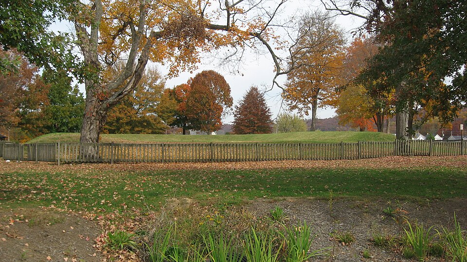
Listed on the National Register of Historic Places in
1974. A historic map-sheet match is not published yet. The record needs a coordinate-quality review before it can be joined to a sheet boundary.
From the record
“Iron and Coal. - Upon these deposits, in their abundance and their superior quality, we might rest our claims to your action, had we no other, as the facility they give for the manufacture of iron over anywhere else in the country, insure us heavy exports by means of our routes to the seaboards, bringing back imports to a like extent. Within an average of less than thirty miles of Portsmouth, and mainly dependent upon it for trade, are fiftyseven furnaces, each manufacturing 2,500 tons annually - an aggregate of 142,500 tons of the best pig iron, known as the Hanging Rock, of which the iron and steel was made, which, in the late war, covered our Mississippi gun- boats, and protected them from Forts Henry and Douelson's Confederate balls.”
An Accurate and Concise Sketch of Portsmouth, Ohio (1876). Machine-read text.
one of 36 National Register listings in Scioto County · listed in 1974 · category: Site.
National Register reference number.74001621- the number the National Park Service assigned this property when it was listed, and the key its nomination file is catalogued under at the National Archives.
Portsmouth is situated on the Ohio river, 116 miles above Cincinnati, at the mouth of the Scioto river, which flows from the centre of this great State through valleys unequalled in fertility, and of such extent as to add largely to our National exports. It is also the southern terminus of the Ohio Canal, thus affording a direct water communication between the South and West, and North and East; also of the Hocking Valley Railroad, long since constructed, and the Scioto Valley Road, now being completed from Columbus to this city. It will also necessarily form an important point in the extension of the Chesapeake and Ohio Railroad, now completed from Norfolk, Virginia, to Huntington, West Virginia, on the Ohio river, forty-five miles above this city, in its connection with the Northwest, and its point of divergence to strike the Southern Pacific Railroad. It is also probable that, either by public or private means, the James River and Kanawha Canal will be completed at no distant day,, and Portsmouth will then be the central point of three great water lines to the sea, and, as we shall proceed to show, naturally and artificially, the best entrepot of the trade, of a large and rich district of country, as it now is.
While, as we have said, Portsmouth is one hundred and sixteen miles nearer than Cincinnati to the Atlantic seaports, the navigation of the river from New Orleans to the former is as good as to the latter, in all stages of water, while there is no important point above to which it is not obstructed by low water, or ice. None, in fact, approaching it in business or population, nearer than Wheeling, two hundred and seventy miles above,
Regional context, not property-specific
evidence. The
federal wildfire occurrence database
lists 129 fires within 5 miles of Horseshoe Mound between
1997 and 2020, burning about 4,089 acres in total. None started naturally. 24 were recorded as arson.
Distance is straight-line from the map coordinates, so a fire counted
here may appear on a neighbouring settlement's page as well.
Reported cause
Fires
Debris and open burning
59
Missing data/not specified/undetermined
37
Arson/incendiarism
24
Recreation and ceremony
7
Equipment and vehicle use
2
The most recent of
them, most recent first, with the day each was reported and the service
that recorded it.
Regional context, not property-specific
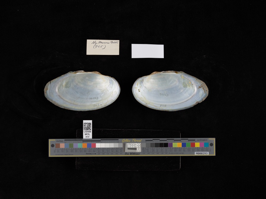
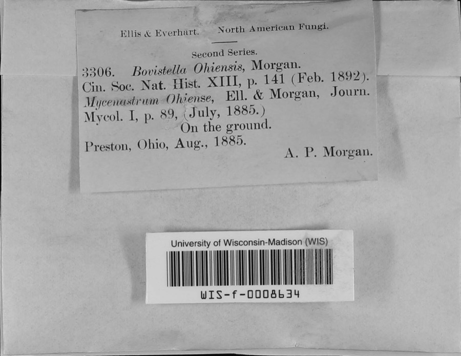
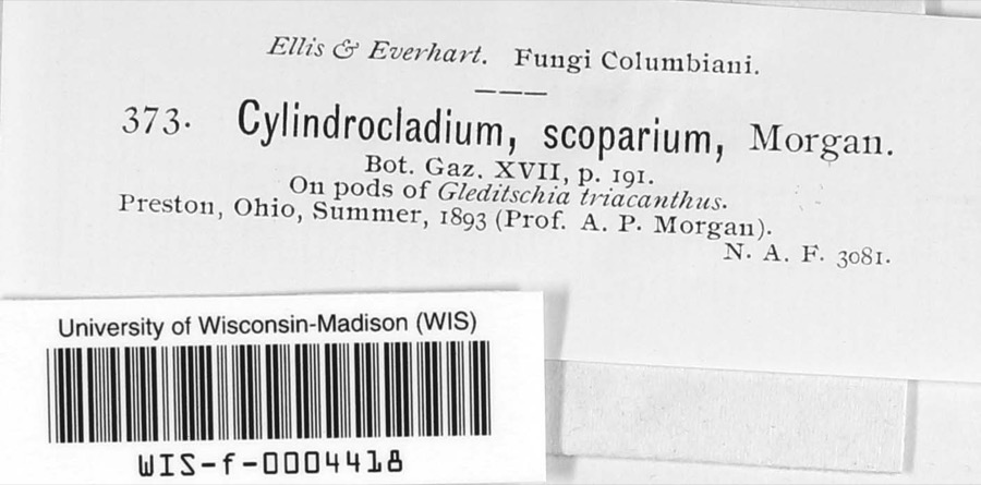
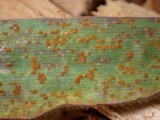
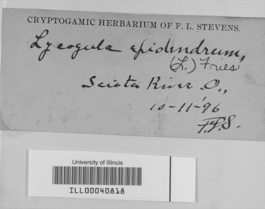
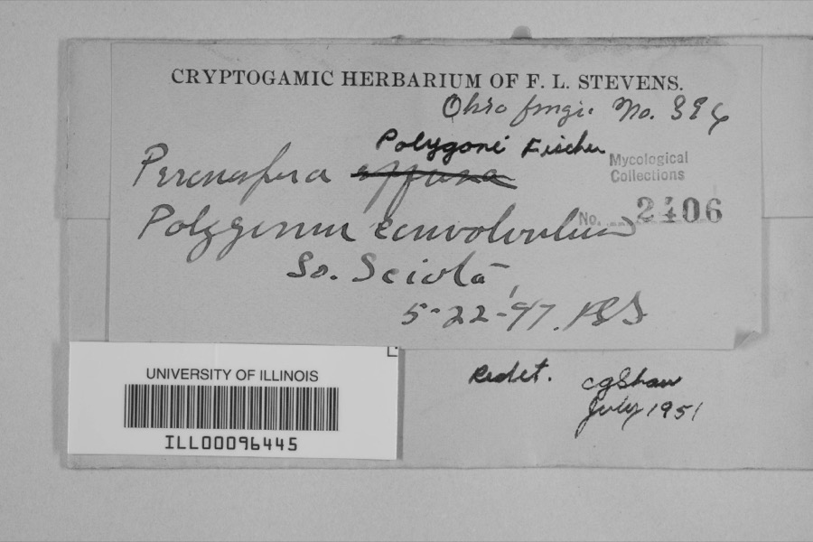
evidence. Museums hold 1,146 specimens
collected within 10 miles of Horseshoe Mound between 1884 and
1975: 1,039 Animalia, 69 Plantae, 32 Fungi, 4 Protozoa, 1 Unrecorded, 1 Chromista. 12 distinct Species records are shown.
Collected by ?, A.P. Morgan, Ahles, H.E. and others. Each is a
physical object with a catalogue
number, and each entry opens the museum's record. This is what was
collected and kept, not a survey of what lives here - nothing can be
concluded from a species being absent.
Regional context, not property-specific
evidence. The federal mineral resources record lists
6 workings within 5 miles of Horseshoe Mound: 3 producers, 2 prospects, 1 plant.
4 still produce. What was taken out: Clay, Sand and Gravel, Construction, Iron, Stone, Crushed/Broken. Distance is straight-line from the
map coordinates, so a quarry counted here may appear on a neighbouring
settlement's page as well.
Regional context, not property-specific
evidence. The National Weather Service names
Portsmouth, the town this property stands in, in 98 storm reports between 1995 and 2024: 44 thunderstorm wind, 27 hail, 14 flash flood, 12 flood.
No death or injury is recorded in these reports. Each account below is quoted exactly as the forecast office
filed it, from the NOAA Storm Events Database, and each date
opens the federal record of that event.
Numerous roads across the county were flooded and closed. Vehicles in Portsmouth were stranded in high water, and portions of Clay and Vernon Townships were also significantly affected by the flooding. A retaining wall collapsed next to a home in Rosemount.
1 paper published in this town,
digitised by the Library of Congress and free to read: 0 issues,
0 pages. Every page is searchable, so a name or a street can be
looked for directly in what the town printed about itself at the time.
No historic map-sheet match is published
for this property yet. That does not mean no map exists. This record needs
a coordinate-quality review before it can be joined to a sheet boundary.
Browse the county's mapped places while that work is
pending.
From the nomination file
1,763 words on record
When this property was proposed for the
National Register, someone wrote the case for it: what the building is,
and why it matters. That document is a federal record in the public domain.
It is quoted below word for word, never summarised. The text was read off the scanned case file by machine, so the
occasional stray character is the recogniser's and the 1970s
typewriter's.
Description of the property
where now florishes the town of Portsmouth, is a wide, fertile, cresents, mounds, and parallel walls placed at random around them. A In general, the entire works, that consisted of three individual AUG 2 2 1973 CONDITION DESCRIPTION REGISTER NATIONAL Moved This unusual mound is a U-shaped or horseshoe-shaped embankment.It southeast and southwest joining two geometric structures in Kentucky. reconstructed and has been well maintained in the park grounds. of two identical horseshoe-shaped embankments side-by-side with circles, avenues which conform to the cardinal points.A large trunkaded mound Ohio River.The general area where the Horseshoe Mound is situated The interior surface area of the horseshoe measures 75 feet across These two works in Kentucky exhibited beautiful order and symmetry.
earthen parallel walls or ways radiated out from the center to the rectangle to the northeast and southwest.Other small embankments circular wall 5 feet in height surrounded the two horseshoe mounds and remains on the Ohio side of the river. this great prehistoric group only one horseshoe-shaped embankment still is presently located in Mound Park within the city limits of Ports- The area surrounding the confluence of the Scioto and Ohio rivers, The other work laid directly opposite the mouth of the Scioto River. parallel walls, and mounds that extended for eight miles along the described and have probably since been destroyed.
and mounds were reported to be in the vicinity but were never well circles placed at irregular intervals to each other and cut by 4 broad beautiful valley.Here once existed a magnificent group of earthworks, was placed in the center with a graded way that lead to the summit. (Check One) Fair - Unexposed earthworks, several miles of parallel walls, and many smaller structures, ment measures 30 to 33 feet across at the base and 7.5 feet in height.
The Portsmouth Group, of which Horseshoe Mound is a part, was one of The Hopewell people, who lived in the Ohio Valley nearly 2,000 years ago, were a sedentary group occupying permanent villages and relying and other types of rigid , formal groups. Great centers, like the Portsmouth Group, were constructed as ceremonial centers and occupied AUG 2 2 1973 Engineering Commerce Conservation SIGNIFICANCE losophy Architecture REGISTER Communications Literature Aboriginal Military NATIONAL Theater Education Religion/Phi Music Agriculture Landscape Art Political the singularly most impressive and interesting prehistoric works in Invention accomodated during seasonal or traditional gatherings. upon horticultural activities and hunting game for their subsistence.
Social/Human- Sculpture and extensively used as a ceremonial center during the Hopewell Phase, ornaments, and offerings.Tombs were built and covered with mounds They most probably had a well-developed social organization with clans been nominated to the National Register of Historic Places in hopes mouth Group.It is in excellent condition and well maintained ina municipal park.Within this park are several rises that could pos- and cremations often accompanied by ceremonial grave implements, prehistoric works was probably constructed over a long period of time of earthworks suggests the great numbers of people which could be and parallel walls, were connected by many miles of embankments.
This that the small remaining portion of once the most splendid Hopewellian sibly be bases of other structures or mounds, as pictured on the ceremonial center will be preserved. including extended inhuma_tions attaired in their finest costumes on the Kentucky side of the Ohio River, with their mounds, circles, 400 B.C.to A.D.700.The general acreage of such an extensive group Industry PERIOD (Check One or More as Appropriate) SPECIFIC DATEIS) (If Applicable and Known) AREAS OF SIGNIFICANCE (Check One or More as Appropriate) This by the ruling class.
Quoted from the National Register nomination
for reference 74001621, 11 pages, held by the National Archives in Record
Group 79. See the
catalogue record.
Listed places nearby
6 within 8 miles
Other National Register properties close
enough to walk or drive between, ordered by distance from this one. Both
positions come from the same geocoding pass that matched these properties
to their map sheets.
Listing record. National Park Service National Register of Historic Places, listed-properties dataset, current to 2026-05-22.
Map join. Address geocoded through the United States Census geocoder, then tested against the published boundary of every sheet in the USGS Historical Topographic Map Collection.
How this page is made. Listing fields come from federal records; map-sheet coverage is a labelled coordinate-to-boundary calculation, not a source-field claim.
Wildfire. Short, Karen C. 2022. Spatial wildfire occurrence data for the United States, 1992-2020 [FPA_FOD_20221014]. 6th Edition. Fort Collins, CO: Forest Service Research Data Archive. https://doi.org/10.2737/RDS-2013-0009.6 Collected with United States Government funding and usable without additional permissions or fees.
Specimens. Global Biodiversity Information Facility (GBIF), https://www.gbif.org/. Only records licensed CC0 or CC BY are used. Records licensed CC BY-NC are excluded because this site carries advertising. Images are checked individually and any whose licence is non-commercial, no-derivatives or unreadable is refused.
Mines and quarries. USGS Mineral Resources Data System (MRDS) https://mrdata.usgs.gov/mrds/ A work of the United States government, no copyright under 17 U.S.C. 105.
Storms. NOAA National Centers for Environmental Information, Storm Events Database https://www.ncei.noaa.gov/stormevents/ A work of the United States government, no copyright under 17 U.S.C. 105. Narratives are quoted verbatim from the National Weather Service report and are not edited or summarised.
 Block
Block