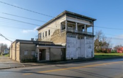
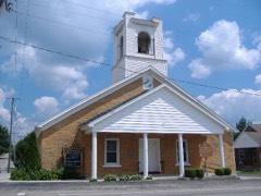
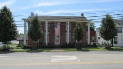
Listed on the National Register of Historic Places in
1992. A historic map-sheet match is not published yet. The record needs a coordinate-quality review before it can be joined to a sheet boundary.
From the record
“Although the schools, after the reorganization of 1856 were known as graded schools, there is no evidence that any measures were taken to establish a course of instruction, or to reduce the general school work to any special system, by which a standard might be fixed for a pupil to reach in one room or department, in order to be transferred to the next higher, until a period of almost twenty years had elapsed. There can be no doubt that one of the chief hindrances to the success of the schools wa9 the frequent change of teacher^,, especially principals.”
Caldwell's Illustrated Historical Atlas of Adams County, Ohio. 1797-1880 (1880). Machine-read text.
one of 12 National Register listings in Adams County · listed in 1992 · category: Building.
National Register reference number.92001352- the number the National Park Service assigned this property when it was listed, and the key its nomination file is catalogued under at the National Archives.
What happened here
An account from the chapter on Manchester township, The inset identifies its exact
source book and publication year.
The first settlers, as before stated, located within the stockade, and their houses were only a few rude cabins. Fear of the Indians prevented them improving the lands adjoining on the outside of the fort. The late Andrew Ellison, who was captured in 1793, while working on his out-lot adjoining the stockade, attests the danger.
Another addition, called the first addition to West Manchester. was made by John Donaldson, May 9, 1849. It contains 23 lots lies west of Pike and north of Main street - opposite, and north of the eastern portion of West Manchester.
The first settlers, as before stated, located within the stockade, and their houses were only a few rude cabins. Fear of the Indians prevented them improving the lands adjoining on the outside of the fort. The late Andrew Ellison, who was captured in 1793, while working on his out-lot adjoining the stockade, attests the danger. They therefore cleared off the lower of the three Islands, which from its isolated position - rendered it a place of greater security. Even with its advantages of situation, guards were kept to watch the approach of any enemy that might attempt to cross over to the Island. Fortunately the unsurpass- I fi utility of the soil produced sufficient abundance to supply the i' garrison with all the necessaries of life. But few additions made to the population or business of Manchester, or settlcnrido in the country, back from the river, until the ernshh'lent of the Indians by Gen. Wayne, in 1794. After the <»f Greenville, which relieved the settlements from nppreii >io n of further trouble from them, settlements began to be made in the interior portions of the county. Manchester did not improve very rapidly for some years.
Regional context, not property-specific
evidence. The
federal wildfire occurrence database
lists 32 fires within 5 miles of The Ridge between
2000 and 2020, burning about 328 acres in total. None started naturally. 12 were recorded as arson.
Distance is straight-line from the map coordinates, so a fire counted
here may appear on a neighbouring settlement's page as well.
Reported cause
Fires
Arson/incendiarism
12
Debris and open burning
11
Missing data/not specified/undetermined
8
Smoking
1
The most recent of
them, most recent first, with the day each was reported and the service
that recorded it.
Regional context, not property-specific
evidence. Museums hold 106 specimens
collected within 10 miles of The Ridge between 1927 and
1975: 77 Animalia, 25 Plantae, 4 Fungi. 12 distinct Species records are shown.
Collected by A JOHN, A. Cronquist, ANSEL JOHN and others. Each is a
physical object with a catalogue
number, and each entry opens the museum's record. This is what was
collected and kept, not a survey of what lives here - nothing can be
concluded from a species being absent.
Regional context, not property-specific
evidence. The federal mineral resources record lists
1 working within 5 miles of The Ridge: 1 producer.
All of them still produce. What was taken out: Calcium. Distance is straight-line from the
map coordinates, so a quarry counted here may appear on a neighbouring
settlement's page as well.
Regional context, not property-specific
evidence. The National Weather Service names
Manchester, the town this property stands in, in 32 storm reports between 1994 and 2024: 24 thunderstorm wind, 4 hail, 3 flash flood, 1 flood.
The reports record 2 deaths. Each account below is quoted exactly as the forecast office
filed it, from the NOAA Storm Events Database, and each date
opens the federal record of that event.
A mobile home was destroyed by high winds, probably from a microburst. The 63-year-old male owner was killed outdoors at the site when he was struck by debris from the roof during the event. He died of head injuries. Trees were downed and large hail also fell.
No historic map-sheet match is published
for this property yet. That does not mean no map exists. This record needs
a coordinate-quality review before it can be joined to a sheet boundary.
Browse the county's mapped places while that work is
pending.
From the nomination file
2,864 words on record
When this property was proposed for the
National Register, someone wrote the case for it: what the building is,
and why it matters. That document is a federal record in the public domain.
It is quoted below word for word, never summarised. The text was read off the scanned case file by machine, so the
occasional stray character is the recogniser's and the 1970s
typewriter's.
Statement of significance
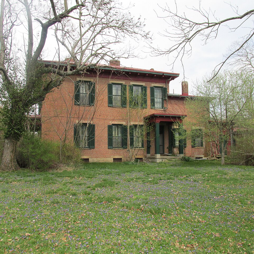
Applicable National Register Criteria Areas of Significance (enter categories from instructions) Period of Significance Significant Dates c.1856 c.1856-1865, 1888-1928 Architect/Builder Ellison, Robert Hamilton State significance of property, and justify criteria, criteria considerations, and areas and periods of significance noted above. "The Ridge", located at 503 East 8th Street, Adams County, Ohio, is eligible for listing in Ellison, and his son, Robert H. Ellison. Both gentlemen were prominent in the political, governmental and social history of Manchester, Ohio.
They were active in the Republican Party, involved with community education, the church and devoted to public and private occupled this landmark house for four generations, and they are well known for their many C as an intact example of transitional Greek Revival/Italianate residential architecture of Revival features Include bold simple molding on the outside and inside, unadorned friezes, flat plain stone lintels and lungsills, horizontal transom above the entrance, and the Itallanate details such as the overhanging cornice with modillions, a hipped roof, and cast Iron fireplaces with arched openings. William Ellison was born In Manchester, Ohio in 1796. He was one of eight surviving Include out bulldings.
His fortune came from his association with the early iron industry in Southern Ohio, and he was considered the wealthiest man in Adams County. During his occupancy of the house, this active Republican was a Delegate to the National Republican Robert Hamilton Ellison, the only son of William, moved back into "The Ridge" in 1888 after the death of his mother, Mary Keyes Ellison.
Quoted from the National Register nomination
for reference 92001352, 27 pages, held by the National Archives in Record
Group 79. See the
catalogue record.
Listed places nearby
6 within 8 miles
Other National Register properties close
enough to walk or drive between, ordered by distance from this one. Both
positions come from the same geocoding pass that matched these properties
to their map sheets.
Listing record. National Park Service National Register of Historic Places, listed-properties dataset, current to 2026-05-22.
Map join. Address geocoded through the United States Census geocoder, then tested against the published boundary of every sheet in the USGS Historical Topographic Map Collection.
How this page is made. Listing fields come from federal records; map-sheet coverage is a labelled coordinate-to-boundary calculation, not a source-field claim.
Wildfire. Short, Karen C. 2022. Spatial wildfire occurrence data for the United States, 1992-2020 [FPA_FOD_20221014]. 6th Edition. Fort Collins, CO: Forest Service Research Data Archive. https://doi.org/10.2737/RDS-2013-0009.6 Collected with United States Government funding and usable without additional permissions or fees.
Specimens. Global Biodiversity Information Facility (GBIF), https://www.gbif.org/. Only records licensed CC0 or CC BY are used. Records licensed CC BY-NC are excluded because this site carries advertising. Images are checked individually and any whose licence is non-commercial, no-derivatives or unreadable is refused.
Mines and quarries. USGS Mineral Resources Data System (MRDS) https://mrdata.usgs.gov/mrds/ A work of the United States government, no copyright under 17 U.S.C. 105.
Storms. NOAA National Centers for Environmental Information, Storm Events Database https://www.ncei.noaa.gov/stormevents/ A work of the United States government, no copyright under 17 U.S.C. 105. Narratives are quoted verbatim from the National Weather Service report and are not edited or summarised.
 Block
Block