BlockBefore
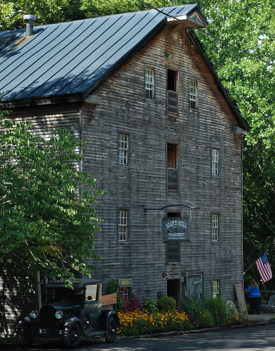
Photograph of Bear's Mill
Photograph by R.P. Piper from Lebanon, Ohio, USA, CC BY 2.0. Via Wikimedia Commons.

Bear's Mill

Listed on the National Register of Historic Places in 1975. A historic map-sheet match is not published yet. The record needs a coordinate-quality review before it can be joined to a sheet boundary.

From the record

“Bear's Mill is a historic gristmill near the city of Greenville in Darke County, Ohio, United States. Built in 1849, this watermill is the oldest existing industrial building in Darke County.”

Wikipedia article Bear's Mill, CC BY-SA 4.0.

one of 25 National Register listings in Darke County · listed in 1975 · category: Building.

Sources: the Wikipedia article · the case file at the National Archives · the National Register database, National Park Service · the Wikipedia article

The listing

  • What is counted as historic. The nomination lists 1 building as contributing to the listing.
  • Address. 6450 Arcanum-Bear's Mill Rd, Greenville, 45331
  • When was it listed? 1975-06-10
  • Category. building
  • Township. Adams township
  • National Register reference number. 75001372 - the number the National Park Service assigned this property when it was listed, and the key its nomination file is catalogued under at the National Archives.

The ground it stands on

63,514 words

The chapter on Adams Township in The History of Darke County, Ohio, Containing a History of the County; Its Cities, Towns, Etc.; General and Local Statistics; Portraits of Early Settlers and Prominent Men;, published 1880 names Greenville. This is what it says, exactly as the scans read.

This township was erected in March, 1819, and contained all the land east of a line running south from the northwest corner of Section 4, Township 10 north, of Bange 3 east, to the southeast corner of Section 28, Township 9. of Bange 3. It was detached from the east end of Greenville Township and the south end of Wayne. In 1820, Sections 3, 4 and 10, of Township 10, Bange 3, were taken into Biehland Township. In June, 1838, all of Township 8, Bange 3, and Township 8. Bange 4, that was in Adams, was taken into a new township, which was entitled Van Buren.

Passage source: The History of Darke County, Ohio, Containing a History of the County; Its Cities, Towns, Etc.; General and Local Statistics; Portraits of Early Settlers and Prominent Men;, published 1880.

The second permanent settlement in Darke County was made in Adams Township. In 1808, Abraham Studabaker, with his wife, settled on the bank of Greenville Creek, opposite the present site of Gettysburg, on Section 25, on land now owned by A. Stoltz. From what the writer can gather. Mr. Studabaker was the first white man that became a permanent settler of Adams Township, as we have no account of any before him. and none other till the close of the Indian war of 1812. Very soon after the cessation of hostilities, Maj. George Adams, who had served in the armies of Harmar and WTayne, came to the township, and, studying the needs of the pioneers and his own interest as well, erected a flouringmill on Section 33. where now stands the mill of Stoltz & Coppess. This was the pioneer mill of the count}*, and became known far and wide ; and there are many of the pioneers now living who have a pleasing recollection of the gallant Major and his old-time mill. Their estimation was shown by the perpetuation of his memory in the name of the township in which he made his home.

Passage source: The History of Darke County, Ohio, Containing a History of the County; Its Cities, Towns, Etc.; General and Local Statistics; Portraits of Early Settlers and Prominent Men;, published 1880.

Machine-read from a century-old scan, so expect the errors a machine makes: misspelled names, dropped words, stray characters.

Read the whole chapter on Adams Township - 63,514 words on its settlement, mills, schools and churches.

Specimens collected near this property

12 of 505 shown

Regional context, not property-specific evidence. Museums hold 505 specimens collected within 10 miles of Bear's Mill between 1838 and 1975: 478 Animalia, 20 Fungi, 7 Plantae. 12 distinct Species records are shown. Collected by A VERWYST, A. F. C.; Stover, W. G., Albrecht, C. and others. Each is a physical object with a catalogue number, and each entry opens the museum's record. This is what was collected and kept, not a survey of what lives here - nothing can be concluded from a species being absent.

Image SpeciesYear Collected by Where, as recorded
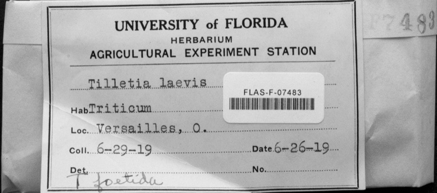
Specimen of Tilletia laevis J.G.KühnTilletia laevis J.G.Kühn1919not recordedVersailles
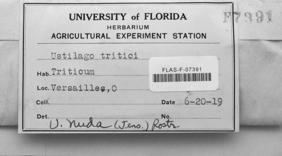
Specimen of Ustilago nuda (C.N.Jensen) Kellerm. & SwingleUstilago nuda (C.N.Jensen) Kellerm. & Swingle1919s.n.Versailles
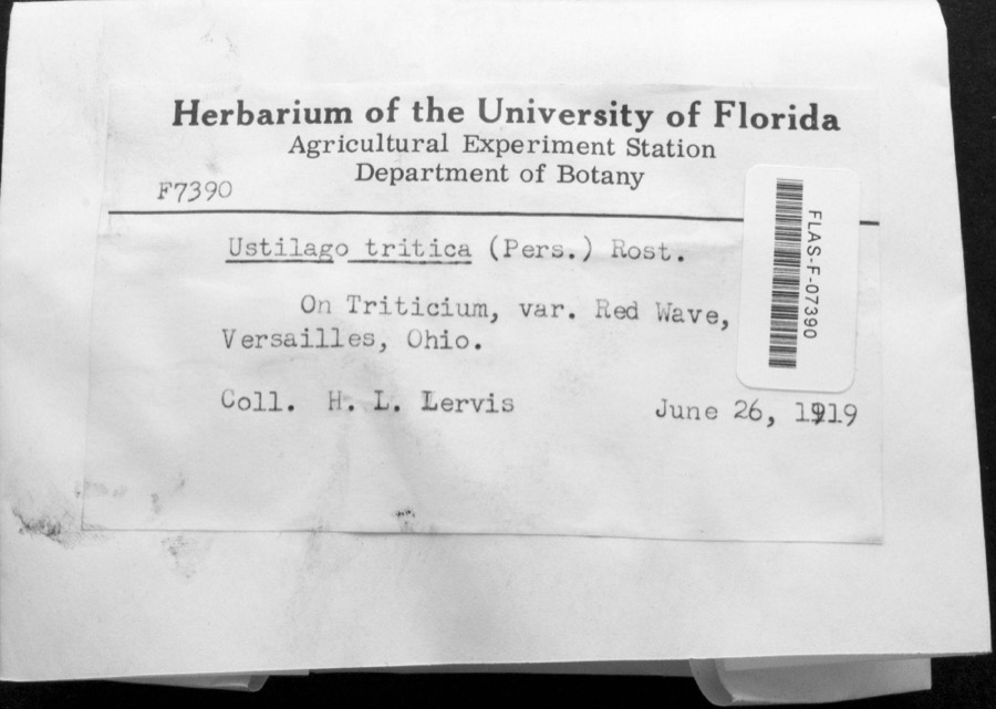
Specimen of Ustilago tritici (Bjerk.) Rostr.Ustilago tritici (Bjerk.) Rostr.1919H.L. LewisVersailles
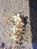
A photograph of the species Callitriche palustris, not of this specimenCallitriche palustris L.1838Short, C.W.Lexington, Kentucky.
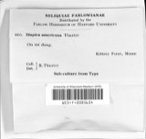
A photograph of the species Dispira americana, not of this specimenDispira americana Thaxt.1895Rush W. H.Greenville
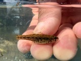
A photograph of the species Etheostoma caeruleum, not of this specimenEtheostoma caeruleum Storer, 18451905Clark, C. F. (Clarence F.)Prairie Outlet, Sec 28 of Neave township, ~0.3 mi NE of Wayne Lakes Park, Neave township
A photograph of the species Etheostoma microperca, not of this specimenEtheostoma microperca Jordan & Gilbert, 18881905Clark, C. F. (Clarence F.)Prairie Outlet, Sec 28 of Neave township, ~0.3 mi NE of Wayne Lakes Park, Neave township
A photograph of the species Clitocybe multiceps, not of this specimenClitocybe multiceps Peck1906H.J. BrememanGreenville
A photograph of the species Peziza vesiculosa, not of this specimenPeziza vesiculosa Bull.1907Lucas, CGreenville
A photograph of the species Amanita phalloides, not of this specimenAmanita phalloides (Vaill. ex Fr.) Secr.1909A. F. C.; Stover, W. G.Greenville
A photograph of the species Clitocybe odora, not of this specimenClitocybe odora (Bull.) P.Kumm.1909Stover, W. G.Greenville
A photograph of the species Panaeolus solidipes, not of this specimenPanaeolus solidipes (Peck) Sacc.1909Stover, W. G.Greenville

All 505 specimens within 10 miles, at the Global Biodiversity Information Facility.

Mines and quarries near this property

2 within 5 miles

Regional context, not property-specific evidence. The federal mineral resources record lists 2 workings within 5 miles of Bear's Mill: 1 past producer, 1 producer. 1 still produces. What was taken out: Sand and Gravel, Construction. Distance is straight-line from the map coordinates, so a quarry counted here may appear on a neighbouring settlement's page as well.

Where SiteCommodity StatusRecorded
Feitshans PitSand and Gravel, ConstructionPast ProducerSedimentary
Feitshans PitSand and Gravel, ConstructionProducer

Every working recorded in Darke County

Storms near this property

60 of 65 shown

Regional context, not property-specific evidence. The National Weather Service names Greenville, the town this property stands in, in 65 storm reports between 1994 and 2026: 31 thunderstorm wind, 18 hail, 9 flood, 4 flash flood. No death or injury is recorded in these reports. Each account below is quoted exactly as the forecast office filed it, from the NOAA Storm Events Database, and each date opens the federal record of that event.

WhenEvent Place namedHarm What the report says
May 2002Thunderstorm WindGreenville$100,000Several mobile homes in the Sherwood Forest Trailer Park suffered severe damage, and a nearby 10' by 12' shed was destroyed. The roof of a home on Hog Path Road was torn off.
July 2003Thunderstorm WindGreenville$25,000Numerous large trees were knocked down. Three homes on Oliver Road sustained structural damage, likely from a microburst.
July 2023Thunderstorm WindGreenville$20,000Numerous trees were downed throughout the county, especially in the Greenville area.
April 2010LightningGreenville$20,000There were several reports of damage and structural fires due to lightning across the county.
June 1995Thunderstorm WindGreenville$15,000Several trees downed, some onto an automobile.
September 2024Thunderstorm WindGreenville$12,000Several trees and power lines were downed in the Greenville area.
July 2013Thunderstorm WindGreenville$10,000A large tree fell on a house due to thunderstorm winds.
September 2011Thunderstorm WindGreenville$10,000Numerous trees were down and a roof was removed from a barn due to damaging thunderstorm winds.
October 2010Thunderstorm WindGreenville$10,000Several trees, power poles, and power lines were reported down across the southern half of the county.
September 2000Thunderstorm WindGreenville$10,000Large limbs and power lined knocked down.
June 1998Tornado (F0)Greenville$10,000A brief tornado touchdown produced downed power lines and damaged a camper. Also, 1 home received minor structural damage.
July 1998Thunderstorm WindGreenville$10,000Numerous trees downed.
January 2017Thunderstorm WindGreenville$8,000Numerous trees and power lines were downed across Darke County, especially in the vicinity of Greenville, New Madison and Pitsburg.
May 2022Thunderstorm WindGreenville$6,000Several trees were downed in the Greenville area.
March 2011FloodGreenville$5,000Roads were flooded due to heavy rainfall.
March 2011FloodGreenville$5,000High water was reported on roads and some roads were closed due to heavy rainfall and previous snow melt. Flooding began around 0749 EST on February 28th and continued until around 1100 EST on March 1st. Damage estimates during February were around five-thousand dollars.
February 2011FloodGreenville$5,000High water was reported on roads and some of the roads were closed due to heavy rainfall and previous snow melt. Flooding began around 0749 EST on February 28th and continued until around 1100 EST on March 1st. Damage estimates during March were around five-thousand dollars.
August 2007Thunderstorm WindGreenville$5,000Numerous large tree limbs were downed.
March 2007FloodGreenville$5,000Several roads were flooded across the county.
March 2007FloodGreenville$5,000Several roads were flooded and closed. Sandbagging was necessary around residences near Gettysburg in the vicinity of Greenville Creek.
May 1994Thunderstorm WindGreenville$5,000Winds measured at 62 mph with some tree limbs downed.
April 2026Thunderstorm WindGreenville$3,000A few trees were downed.
July 2014Thunderstorm WindGreenville$3,000Several trees were downed due to thunderstorm winds.
July 2012Thunderstorm WindGreenville$3,000Trees were reported down in the area due to damaging thunderstorm winds.
December 2006FloodGreenville$3,000Several roads were flooded near the Stillwater River in eastern Darke county.
August 2005Thunderstorm WindGreenville$3,000A circus tent at the county fair was blown over.
June 2004Thunderstorm WindGreenville$3,000Six power poles were knocked down.
April 2003Thunderstorm WindGreenville$3,000Power poles were downed in town.
August 2003Thunderstorm WindGreenville$3,000Trees were knocked down.
June 1998Thunderstorm WindGreenville$3,000Trees downed.
June 2010Flash FloodGreenville$2,000Three feet of water was reported to be over Sater Street due to heavy rainfall.
November 2002Thunderstorm WindGreenville$2,000Numerous trees were downed between Greenville and Ansonia.
March 2026Thunderstorm WindGreenville$1,000A large tree was downed.
August 2014Thunderstorm WindGreenville$1,000One tree was knocked down.
June 2012Thunderstorm WindGreenville$1,000Large limbs were downed due to thunderstorm winds. The wind gust was estimated by the spotter.
April 2011Heavy RainGreenville$1,000A couple of roads were covered with high water.
June 2010Thunderstorm WindGreenville$1,000Two trees were reported down due to damaging thunderstorm winds.
June 2010FloodGreenville$1,000High water was still occurring over area roadways due to earlier flash flooding.
June 2016Thunderstorm WindGreenville$500A couple of large limbs were knocked down.
March 2020Flash FloodGreenville-High water was reported on numerous roads throughout the county.
February 2019FloodGreenville-Numerous roads were flooded throughout the county, specifically near Greenville, Versailles and Gettysburg, as well as north of Palastine.
December 2013FloodGreenville-State Route 502 west of Greenville was closed in both directions due to high water caused by earlier heavy rainfall.
May 2004Flash FloodGreenville-Two roads were flooded and closed in the southern part of the county.
August 2001Flash FloodGreenville-Heavy rainfall flooded roads.
May 2000HailGreenville-Hail as large as baseballs fell across the county for the second time in 90 minutes. This time the hail fell over a populated area causing damage to many cars, including 2 car lots.
May 2024HailGreenville-no account filed
June 2021HailGreenville-no account filed
May 2014HailGreenville-no account filed
September 2012HailGreenville-no account filed
March 2012HailGreenville-no account filed
March 2011HailGreenville-no account filed
May 2011HailGreenville-no account filed
September 2011HailGreenville-no account filed
June 2005HailGreenville-no account filed

Every storm recorded in Darke County

Newspapers printed here

0 digitised pages

1 paper published in this town, digitised by the Library of Congress and free to read: 0 issues, 0 pages. Every page is searchable, so a name or a street can be looked for directly in what the town printed about itself at the time.

NewspaperPublished
The Greenville Journal1850 to 1918

Map coverage status

No historic map-sheet match is published for this property yet. That does not mean no map exists. This record needs a coordinate-quality review before it can be joined to a sheet boundary. Browse the county's mapped places while that work is pending.

From the nomination file

2,510 words on record

When this property was proposed for the National Register, someone wrote the case for it: what the building is, and why it matters. That document is a federal record in the public domain. It is quoted below word for word, never summarised. The text was read off the scanned case file by machine, so the occasional stray character is the recogniser's and the 1970s typewriter's.

Description of the property

of the mill, 44" and 30.5" respectively, that provide 65 a line shaft to transfer power, a generator for lights, and floor has storage bins, transfer machinery, flour purifier, wood in 1922. CONDITION DESCRIPTION cable pulley. recent years to replace stone crumbling from erosion.The tion is in part original stone and part concrete installed in The interior of the mill is functional industrial.The levels serviced by a water powered winch with cable fall from machinery is driven by two water turbines beneath the rear scourers,aspirator and winch are under the roof. The black walnut weatherboard is the first sheathing from Water power on Greenville Creek provides a nine foot (Check One) Bears Mill is a three and one-half story frame industrial few exceptions. horsepower. and sifting machines.

The top line shaft, corn screener dam of 65' and a 160' main dam, both of concrete that replaced head of water at the forebay. Iwo dams connected by levee Excellent The and barrelling aredone on the second floor.The three imported building of the Jacksonian era which faces east. The south side upstream has a gate for the The central bay has grain handling doors on all four The first floor has a small sales store, The founda- hewn timbers some of which are 12"xl6"beams up to50'long.

Statement of significance

Sculpture The younger Cromer set his mill on a new burst of Landscape are standing ready for use today on the second floor. (see continuation sheet) increase in mail rates during the lg50's made business is the oldest manufacturing facility in Darke County and purchased five of the new mills from a Dayton firm in l886 PERIOD (Check One or More as Appropriate) gristmill truly operated in the pre-industrial manner. It abrasive qualities. These stones, installed in 1850, are of partnerships. \Marcellus Cromer bought out John Stoltz purchased the mill in 1946. ground cornmeal, wheat flour, whole rye flour, buckwheat, distant places as Tahiti, Alaska, and Oslo, Norway. The becoming his father's partner in 1884. When the elder Cromer 1849 progress.

Art Roller mill machinery was first patented in Andrews chose to maintain the grinding out flour today.After twelve years Bear sold milling in 1849.Local millstones proved deficient so the and renovated his mill's machinery.T Three of these mills

The whole case file for this property - 2,510 words, 16 pages, reproduced complete.

Quoted from the National Register nomination for reference 75001372, 16 pages, held by the National Archives in Record Group 79. See the catalogue record.

Listed places nearby

6 within 8 miles

Other National Register properties close enough to walk or drive between, ordered by distance from this one. Both positions come from the same geocoding pass that matched these properties to their map sheets.

Photograph PropertyDistance Listed
Lansdowne House4.6 miles1979
Beir, Anna, House4.7 miles1977
Leftwich House4.7 miles1975
Coppess, Benjamin Franklin House4.7 miles1978
Darke County Courthouse, Sheriff's House, And Jail4.7 miles1976
Broadway Bridge4.9 miles1996

Sources for this property

National Archives recordThe nomination case file for reference 75001372 in Record Group 79.
Wikipedia articleCommunity-written account of this property, licensed CC BY-SA.
Darke CountyAll 25 listed properties in this county.

Provenance

  • Listing record. National Park Service National Register of Historic Places, listed-properties dataset, current to 2026-05-22.
  • Map join. Address geocoded through the United States Census geocoder, then tested against the published boundary of every sheet in the USGS Historical Topographic Map Collection.
  • How this page is made. Listing fields come from federal records; map-sheet coverage is a labelled coordinate-to-boundary calculation, not a source-field claim.
  • Specimens. Global Biodiversity Information Facility (GBIF), https://www.gbif.org/. Only records licensed CC0 or CC BY are used. Records licensed CC BY-NC are excluded because this site carries advertising. Images are checked individually and any whose licence is non-commercial, no-derivatives or unreadable is refused.
  • Mines and quarries. USGS Mineral Resources Data System (MRDS) https://mrdata.usgs.gov/mrds/ A work of the United States government, no copyright under 17 U.S.C. 105.
  • Storms. NOAA National Centers for Environmental Information, Storm Events Database https://www.ncei.noaa.gov/stormevents/ A work of the United States government, no copyright under 17 U.S.C. 105. Narratives are quoted verbatim from the National Weather Service report and are not edited or summarised.