Listed on the National Register of Historic Places in
1975. A historic map-sheet match is not published yet. The record needs a coordinate-quality review before it can be joined to a sheet boundary.
From the record
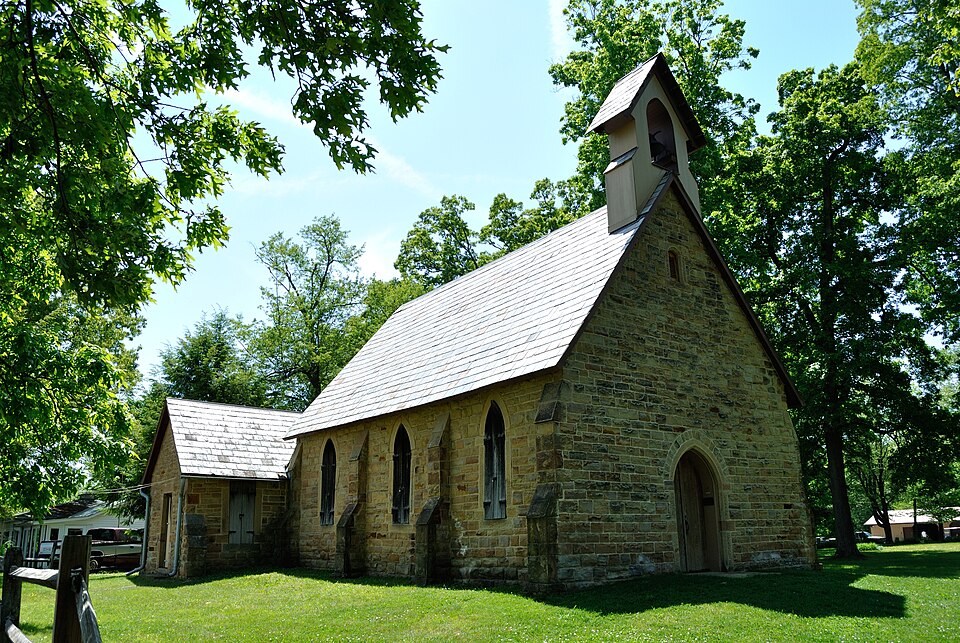
“The Christ Church at the Quarry is a historic church in Gambier, Ohio. It was built in 1863 and added to the National Register of Historic Places in 1975.”
Wikipedia article Christ Church at the Quarry, CC BY-SA 4.0.
one of 35 National Register listings in Knox County · listed in 1975 · category: Building.
National Register reference number.75001446- the number the National Park Service assigned this property when it was listed, and the key its nomination file is catalogued under at the National Archives.
For many years he " ran the machine" of the Acland Press, and now resides at Mt. Yernon. The printing office was the gift of liberal-minded English Protestants to Bishop Chase in 1825, and received its name in lionor of Lady Acland, the fair donor who started the subscription. Upon this has been published various literary and religious articles calculated to advance the cause of learning and religion. The students of the College have at several periods projected publications of a literary character ; the last, the " Kenyon Collegian," a very creditable magazine, was continued for several years. The first store was called the Bishop's store, from having been commenced by Bishop Chase for the purpose of furnishing work hands witli necessary articles, and to supply the boys, so that no excuse could exist for going *' to town." This was carried on until in the fall of 1833 an arrangement was made with Mr. White, of Kew York, by which that business was to be entirely under his control, and M. and G. B. White thereupon located at Gambier. The former remains there, and the latter at this writing is one of the most valued citizens of Mt. Yernon. The Whites are natives of Derby, Ct. The " Bishop's store" was managed for many years by Bobert Burnside, until a short time before its discontinuance ^. W. Putnam had it in charge. The Whites continued in partnership until 1838, when T>. Topping and N. W. Putnam opened a store, and Daniel S. I^orton and A. G. Scott established another. Topping & Co., with A. J. Douglass, kept for a few years, when it was closed, and Mr. T. moved to Illinois ; Mr. P. is yet living on the hill ; Mr. Scott has uninterruptedly resided there, and by his close attention to business, in which for many years has been alone, has acquired a compe- tency. A. B. Norton for several years was engaged in tlie merchandizing and milling business at Gambler. At this time there are the two stores of A. G. Scott & Co., M. White & Co., and a drug in the boot and slioe line ; Russel Clark, Mr. Clements, A. K. Eobes and J. Waugli have carried on the tailoring. Mr. Sharp in early times was the brewer and baker, in a large stone house in the rear of the main College building, now obliterated by time's effacing finger. J. S. Sawer since 1837 lias supplied the students and liberal disposed with ice cream and yarieties, and many of the boys fed under the Dotheby regime gratefully remember the good cookery and pies of Mrs. Sawer. The hotel and boarding-houses have been kept by Douglass, Yore, Johnson, Bell, Witt, Sims, Riley, and Wright, the latter now holding forth in fine style. The old College mill erected by Bp. Chase many years ago went into decay, and at that seat Daniel S. Norton put up one of the finest mills on the river. The " Kenyon Mills" flour acquired a good reputation. The post-office, ui)on Bp. Chase's application, established in 1826, has been the greater part of its existence managed by that excellent public officer, M. T. C. Wing. About 1846, partisan violence, through the machinery of a county convention and central committee, brought about the appointment of Benoni Elliott, a student from the District of Columbia. In 1849, M. T. C. Wing was again appointed ; in 1853, James Young ; in 1857, E. Gr. Biley ; and in 1861, Joseph Leonard. The principal church is Bosse Chapel, bearing the name of its founder, Lady Bosse, eminent for piety and good works. It is a very neat and chaste stone edifice, situated in Harcourt Parish, named for like cause, and in the rear of the church is the beautiful cemetery where rest the dead of Gambler. The
Chilton Craven. The Trustees are T>. L. Fobes, J. T. L. Jacobs, E. Clij)pinger, E. Penhorwood, G. J. W. Pearce. The Cumberland Presbyterians have preaching regularly at their church, one-half mile north of the Public Well. The Kev. Larrimore is the present minister ; J. Bennet and T. Minard, trustees. The various College buildings and matters of interest connected with them will appear under the appropriate head. Gambier is a beautiful little village, where those who desire to withdraw from the noise and bustle, the cares and vexations of the active world, can have a safe retreat. A more quiet and secluded spot cannot be found on this continent ; of the old residents on the hill, it may with truth be said :
Regional context, not property-specific
evidence. The
federal wildfire occurrence database
lists 40 fires within 5 miles of Christ Church At The Quarry between
2005 and 2020, burning about 26 acres in total. None started naturally. 3 were recorded as arson.
Distance is straight-line from the map coordinates, so a fire counted
here may appear on a neighbouring settlement's page as well.
Reported cause
Fires
Debris and open burning
23
Missing data/not specified/undetermined
6
Equipment and vehicle use
5
Arson/incendiarism
3
Recreation and ceremony
2
Power generation/transmission/distribution
1
The most recent of
them, most recent first, with the day each was reported and the service
that recorded it.
Regional context, not property-specific
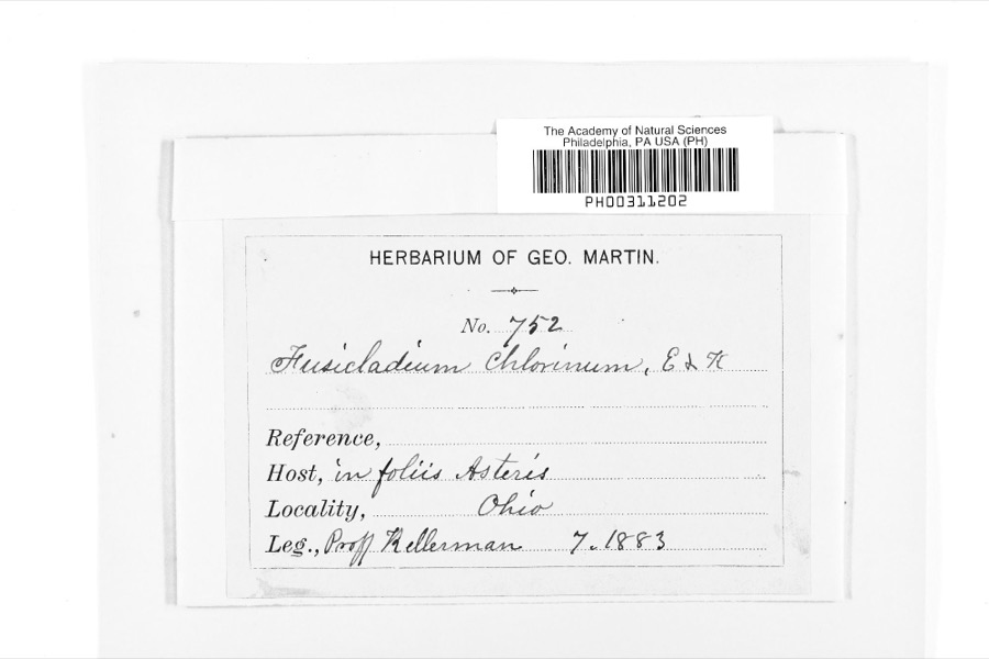
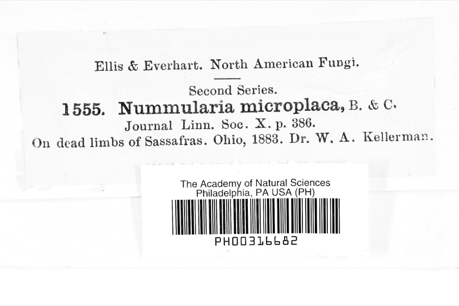
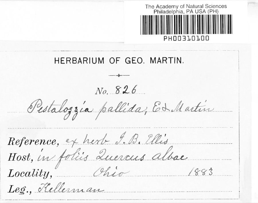
evidence. Museums hold 423 specimens
collected within 10 miles of Christ Church At The Quarry between 1877 and
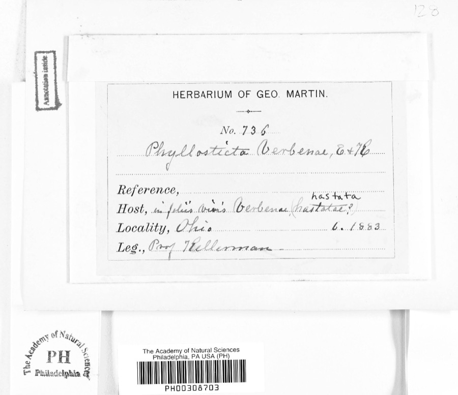
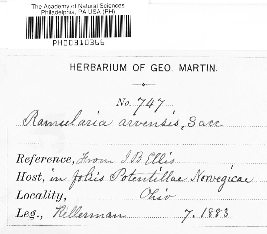
1975: 367 Animalia, 33 Fungi, 22 Plantae, 1 Protozoa. 12 distinct Species records are shown.
Collected by A. P. Morgan, Barker, C. G. Lloyd and others. Each is a
physical object with a catalogue
number, and each entry opens the museum's record. This is what was
collected and kept, not a survey of what lives here - nothing can be
concluded from a species being absent.
Regional context, not property-specific
evidence. The federal mineral resources record lists
3 workings within 5 miles of Christ Church At The Quarry: 2 producers, 1 past producer.
2 still produce. What was taken out: Sand and Gravel, Construction, Flagstone. Distance is straight-line from the
map coordinates, so a quarry counted here may appear on a neighbouring
settlement's page as well.
Regional context, not property-specific
evidence. The National Weather Service names
Gambier, the town this property stands in, in 16 storm reports between 1995 and 2017: 13 thunderstorm wind, 3 hail.
No death or injury is recorded in these reports. Each account below is quoted exactly as the forecast office
filed it, from the NOAA Storm Events Database, and each date
opens the federal record of that event.
Thunderstorm downburst winds downed at least 50 trees across Knox County. Most of the trees were downed in the Gambier and Martinsburg areas. Scattered power outages were reported across the county.
Thunderstorm winds downed several trees and large limbs near Gambier. A home lost large sections of roof and siding. A barn nearby also lost a roof. Debris from the barn damaged a second home.
For the second time in less than 15 hours, severe thunderstorms moved across the Gambier area. Many trees and large limbs were downed in and just south of the town. Scattered power outages resulted from the downed trees.
No historic map-sheet match is published
for this property yet. That does not mean no map exists. This record needs
a coordinate-quality review before it can be joined to a sheet boundary.
Browse the county's mapped places while that work is
pending.
From the nomination file
2,465 words on record
When this property was proposed for the
National Register, someone wrote the case for it: what the building is,
and why it matters. That document is a federal record in the public domain.
It is quoted below word for word, never summarised. The text was read off the scanned case file by machine, so the
occasional stray character is the recogniser's and the 1970s
typewriter's.
Description of the property
This beautiful stone chapel, with both Gothic and Celtic influences, stands The Exterior walls are solid masonry, 18 inches thick, built of stone from a buttresses follow the line of the high pitched roof, The roofing is of grey The main entrance is two doors wide with a wood panel above, all in a pointed arched opening. Above the door, in the gable, a small window gives interior. The belfry has been straightened and strengthered. The Interior has a nave 20 feet wide and 33 feet long, a chancel 12 feet by plaster on wood lath. As the ceiling is carried across at the tie line, half The interior walls, floors, and ceiling will all need attention in the fu- Notable, both in the exterior and interior, are the beautiful proportions, a rarity.
Though the building is only about 1,250 square feet in area, its CONDITION slate. Excellent and simplicity. placed stone was still on the premises.The lost pieces have been replaced plastered areas of the ceiling in panels.A wood wainscot is carried around same shape as those in the side walls. ture, as more funds for reconstruction are donated. design and dignity demand respect. with many missing and broken pieces of slate.Luckily, most of the dis- the nave and chancel opening.A pointed segmental arch frames the chancel were originally plastered directly on the stonework;plans are to remove frame with slate facing.
was partially collapsed, and the roof was open to the sky in some places and masonry work on the exterior is nearly completed.The roof has been There are three pointed arched windows on each side wall, spaced between the access to the crawl space below.
In the late 1850's, a new stone quarry was opened about three miles north- a few years, the people involved in the mission decided to build a church. structure, plans were changed when stone was donated and hauled by William modeled on the one Mr. Fish had known in Warwickshire, England. It is more than probable that the plans for the church were drawn by William Tinsley, architect, who had designed Ascension Hall on the Kenyon College this has not yet been found, Mr.
Tinsley's biographer speaks of the church years, theological students from Kenyon College conducted services at the and people from the surrounding country were paptized, married, confirmed, & 1945, and at the request of the trustees, who expressed interest in the care and upkeep of the building, the chapel itself was deeded to them also started in 1973. Donations between August,1972, and October, 1974, amount to It is hoped to preserve this building as an architectural gem. 1863 Conservation Engineering Commerce Ireland. Music Literature losophy Architecture Communications Aboriginal itarian Prehistoric Education Landscape deteriorating.
Military Art Industry Urban Planning members decided that it should be stripped; the furnishings were given away, were often discontinued.While unused in 1937,the Chapel was broken into $11,031.45. Fish who operated the stone quarry nearby.The church is said to have been Agriculture The cemetary lot was deeded to the Trustees of College Township in April, in 1966.In 1972 a fund drive was begun, and work on the reconstruction to the Chapel.
Quoted from the National Register nomination
for reference 75001446, 18 pages, held by the National Archives in Record
Group 79. See the
catalogue record.
Listed places nearby
5 within 8 miles
Other National Register properties close
enough to walk or drive between, ordered by distance from this one. Both
positions come from the same geocoding pass that matched these properties
to their map sheets.
Listing record. National Park Service National Register of Historic Places, listed-properties dataset, current to 2026-05-22.
Map join. Address geocoded through the United States Census geocoder, then tested against the published boundary of every sheet in the USGS Historical Topographic Map Collection.
How this page is made. Listing fields come from federal records; map-sheet coverage is a labelled coordinate-to-boundary calculation, not a source-field claim.
Wildfire. Short, Karen C. 2022. Spatial wildfire occurrence data for the United States, 1992-2020 [FPA_FOD_20221014]. 6th Edition. Fort Collins, CO: Forest Service Research Data Archive. https://doi.org/10.2737/RDS-2013-0009.6 Collected with United States Government funding and usable without additional permissions or fees.
Specimens. Global Biodiversity Information Facility (GBIF), https://www.gbif.org/. Only records licensed CC0 or CC BY are used. Records licensed CC BY-NC are excluded because this site carries advertising. Images are checked individually and any whose licence is non-commercial, no-derivatives or unreadable is refused.
Mines and quarries. USGS Mineral Resources Data System (MRDS) https://mrdata.usgs.gov/mrds/ A work of the United States government, no copyright under 17 U.S.C. 105.
Storms. NOAA National Centers for Environmental Information, Storm Events Database https://www.ncei.noaa.gov/stormevents/ A work of the United States government, no copyright under 17 U.S.C. 105. Narratives are quoted verbatim from the National Weather Service report and are not edited or summarised.
 Block
Block