Listed on the National Register of Historic Places in
1976. A historic map-sheet match is not published yet. The record needs a coordinate-quality review before it can be joined to a sheet boundary.
From the record
“Among the first Catholic families who settled in and around Mount Vernon were the brother's, Timothy and William Colopy, (1814), John P. McArdle, David Morton, William Brophy, Charles Colerick, and at a later date the families of Michael Boyle, (1835), Thomas McMullen, (1840), and Probably the earliest Catholics in this section of the State were those who settled at or near Napoleon, Holmes county, the settlement being known in early times as the "French Settlement;" and those who settled around what is now known as Danville in Union township.”
A History of Knox County, Ohio, from 1779 to 1862 Inclusive; Comprising Biographical Sketches, Anecdotes .. (1862). Machine-read text.
one of 35 National Register listings in Knox County · listed in 1976 · category: Building.
National Register reference number.76001460- the number the National Park Service assigned this property when it was listed, and the key its nomination file is catalogued under at the National Archives.
The town it stands in
16,802 words
This property is in Mount Vernon, which the
county-history sources cover in 1 chapter of its own rather than as
part of a township. All are public domain and reproduced here complete.
Regional context, not property-specific
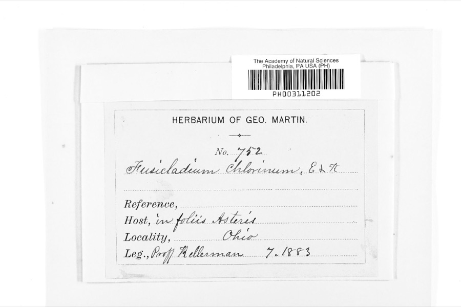
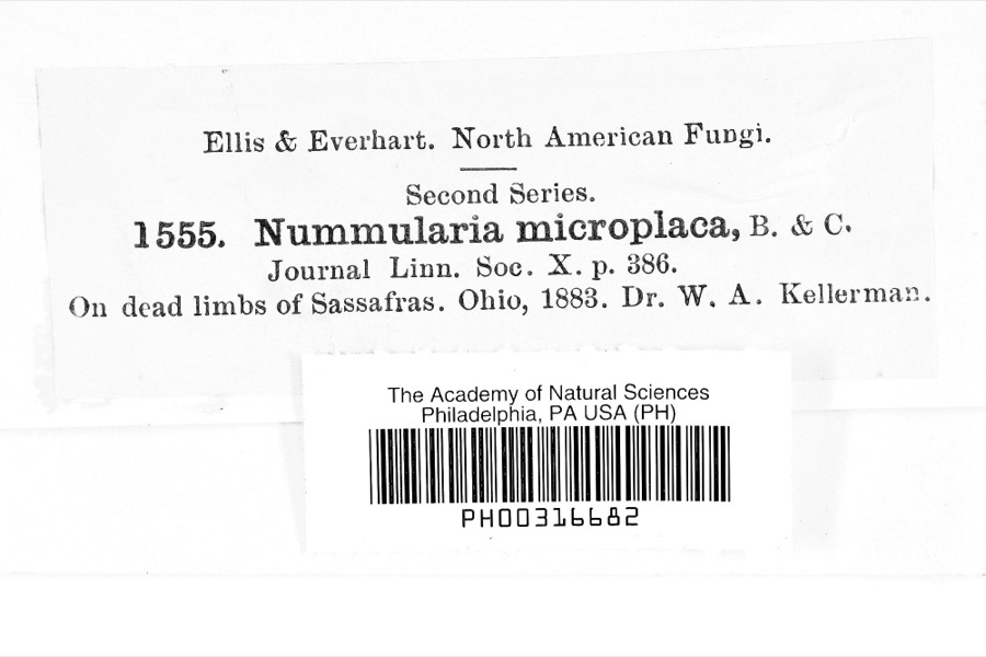
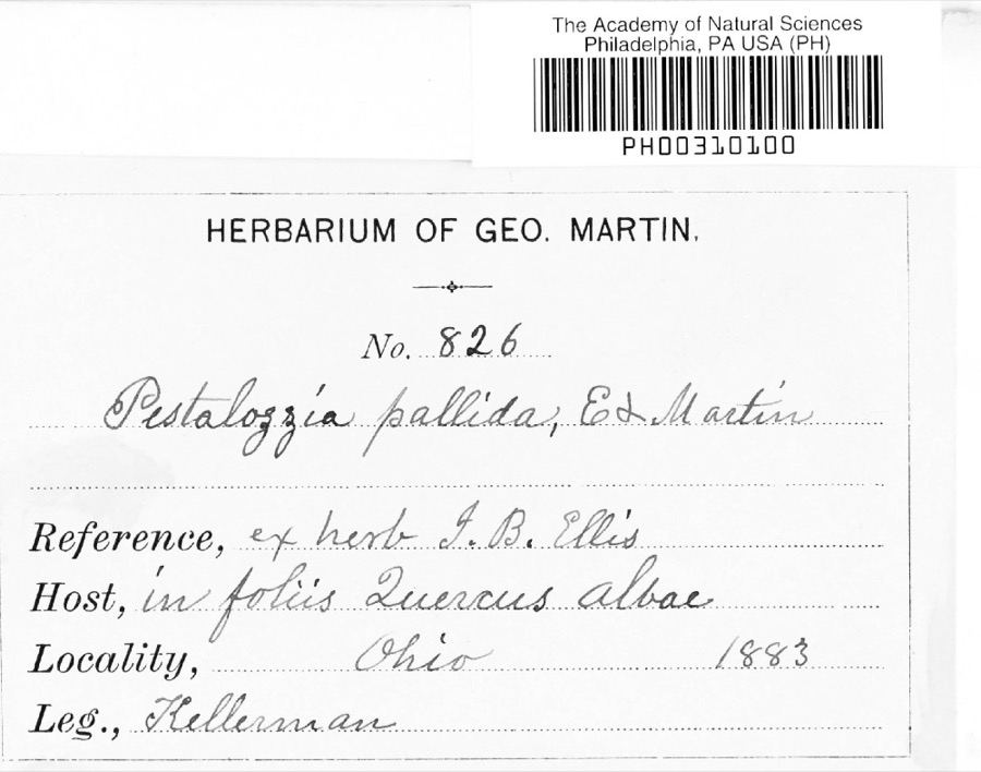
evidence. Museums hold 637 specimens
collected within 10 miles of Round Hill between 1837 and
1975: 574 Animalia, 37 Fungi, 25 Plantae, 1 Protozoa. 12 distinct Species records are shown.
Collected by A. Hall, A. P. Morgan, Andriessen, H. and others. Each is a
physical object with a catalogue
number, and each entry opens the museum's record. This is what was
collected and kept, not a survey of what lives here - nothing can be
concluded from a species being absent.
Regional context, not property-specific
evidence. The federal mineral resources record lists
4 workings within 5 miles of Round Hill: 2 past producers, 2 producers.
2 still produce. What was taken out: Sand and Gravel, Construction. Distance is straight-line from the
map coordinates, so a quarry counted here may appear on a neighbouring
settlement's page as well.
Regional context, not property-specific
evidence. The National Weather Service names
Mount Vernon, the town this property stands in, in 2 storm reports between 1995 and 1995: 1 thunderstorm wind, 1 hail.
The reports record 1 injury. Each account below is quoted exactly as the forecast office
filed it, from the NOAA Storm Events Database, and each date
opens the federal record of that event.
A downburst with winds as high as 90 mph downed hundreds of trees, some on structures and vehicles. Signs were blown down and some windows were broken and minor roof damage occurred to several buildings. A dog was electrocuted when a live power line fell onto the dogbox. A man was injured by a falling tree limb and another man, sleeping in his bedroom, escaped injury when a large limb crashed through his ceiling missing him by inches. Three state highways where closed until storm debris could be removed, one for over 24 hours.
Large hail fell. A 41-year-old man was struck by lightning while working inside his new home which was under construction. The house appears to have been struck first and the charge passed through the man causing minor burns.
No historic map-sheet match is published
for this property yet. That does not mean no map exists. This record needs
a coordinate-quality review before it can be joined to a sheet boundary.
Browse the county's mapped places while that work is
pending.
From the nomination file
1,781 words on record
When this property was proposed for the
National Register, someone wrote the case for it: what the building is,
and why it matters. That document is a federal record in the public domain.
It is quoted below word for word, never summarised. The text was read off the scanned case file by machine, so the
occasional stray character is the recogniser's and the 1970s
typewriter's.
Description of the property
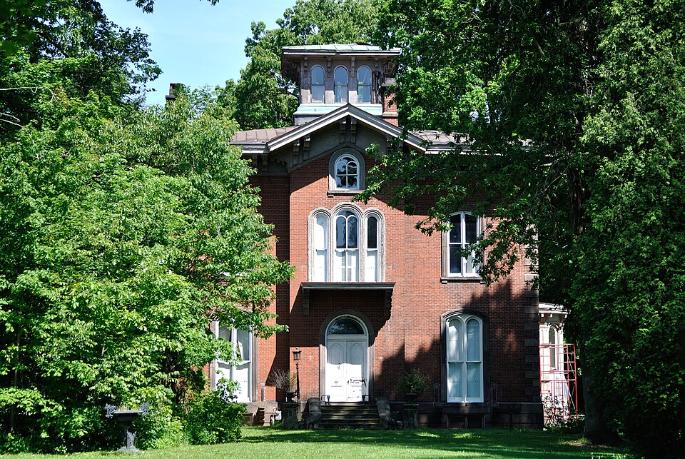
The facade (west) features a center entrance bay. The doorway, approached by four The roof is a flattened hip with an enclosed, flat-roofed square belvedere. The Wood lattice frames a series of arches across the porch. The wood railing done. In additon, a part of the original dining room wall was removed to install CONDITION UNALTERED XEXCELLENT FAIR supported by carved wood brackets.Frieze boards are wide and are pierced by CHECK ONE rectangular lights.Paired wood brackets support the cornice.The entablature To either side of the entrance bay there are segmental arched windows.The with wood molding. H.B.Curtis stipulated in his will that the furnishings of the first floor remain Introduction of electrical wiring and remodeling of baths and kitchen have been There are stone quoins.
in the house.This is shown to great advantage in the great parlor which stretches rail forms a balcony outside another three-arch window. matches that of the front verandas. covered with standing seam metal. The detailing of the entablature matches that Round Hill is a magnificent Italian Villa which dominates the north side of Mount The south and east elevation follow the detailing of the facade.The east side - DETERIORATED forms a gablet over each of the projecting center bays. building.The center bay on each elevation of the main portion of the building Vernon.The L-shaped brick structure features a 2-1/2 story, square central projects about 24". -UNEXPOSED -GOOD -RUINS The second story of the center bay has a tall, three-part, round-arched window.
Above the second story window is a small, round-arched window which is also framed left it. The woodwork, most of the windows, and most of the furniture are original. portion and a 2 story wing extending north from the northeast corner of the the full 50' of the south side of the house.
1850's at the beginning of the Italian Villa style, the design shows remarkable attributed to John Plimpton of New York, a son-in-law of H.B. Curtis. The house personality. Public servant, banker, one of the founders of Kenyon College, rail- road director, arbiter of public a private architecture, he represented the best type of Victorian. As a lawyer, he soon became affluent and eventually rose to positions of high public branch of the State Bank of Ohio, with a capital stock of $100,000; during the Aside from his endeavors in the legal profession, Mr. Curtis was appointed by Gambier, Ohio which lies just five miles east of the Curtis home at Round Hill. Further, he was an active member in the betterment of Mount Vernon.
He drew up the city charter, secured its passage through the legislature, and filled various enabled him to give shape to many of the public buildings, notably the two successive Henry L., a Kenyon College graduate, was a man respected for his honesty and 1897 and the property was willed to his children, Henry B. Curtis 11, Walter Curtis CONSERVATION COMMERCE ARCHEOLOGY-HISTORIC BUILDER/ARCHITECT RELIGION INVENTION THEATER EDUCATION PERIOD SIGNIFICANCE EXPLORATION/SETTLEMENT ARCHEOLOGY-PREHISTORIC SCIENCE INDUSTRY MILITARY AGRICULTURE ENGINEERING PREHISTORIC LITERATURE _COMMUNICATIONS SOCIAL/HUMANITARIAN _PHILOSOPHY Round Hill is beyond doubt the grandest house in the county.Built in the early twenty years of its existence, Mr.Curtis served as its president.
instrumental in aiding Bishop Philander Chase in the founding of Kenyon College in courthouses.He was an advocate of the railroad system and was a director of the _TRANSPORTATION maturity.The sophistication of design and choice of style can possibly be L.Curtis and Walter C. Curtis the present owners.
Quoted from the National Register nomination
for reference 76001460, 12 pages, held by the National Archives in Record
Group 79. See the
catalogue record.
Listed places nearby
6 within 8 miles
Other National Register properties close
enough to walk or drive between, ordered by distance from this one. Both
positions come from the same geocoding pass that matched these properties
to their map sheets.
Listing record. National Park Service National Register of Historic Places, listed-properties dataset, current to 2026-05-22.
Map join. Address geocoded through the United States Census geocoder, then tested against the published boundary of every sheet in the USGS Historical Topographic Map Collection.
How this page is made. Listing fields come from federal records; map-sheet coverage is a labelled coordinate-to-boundary calculation, not a source-field claim.
Specimens. Global Biodiversity Information Facility (GBIF), https://www.gbif.org/. Only records licensed CC0 or CC BY are used. Records licensed CC BY-NC are excluded because this site carries advertising. Images are checked individually and any whose licence is non-commercial, no-derivatives or unreadable is refused.
Mines and quarries. USGS Mineral Resources Data System (MRDS) https://mrdata.usgs.gov/mrds/ A work of the United States government, no copyright under 17 U.S.C. 105.
Storms. NOAA National Centers for Environmental Information, Storm Events Database https://www.ncei.noaa.gov/stormevents/ A work of the United States government, no copyright under 17 U.S.C. 105. Narratives are quoted verbatim from the National Weather Service report and are not edited or summarised.
 Block
Block