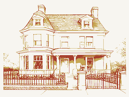
Listed on the National Register of Historic Places in
1978. A historic map-sheet match is not published yet. The record needs a coordinate-quality review before it can be joined to a sheet boundary.
From the record
one of 117 National Register listings in Montgomery County · listed in 1978 · category: Building · one of 4 National Historic Landmarks in Montgomery County.
National Register reference number.78002148- the number the National Park Service assigned this property when it was listed, and the key its nomination file is catalogued under at the National Archives.
Regional context, not property-specific
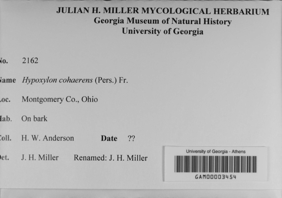
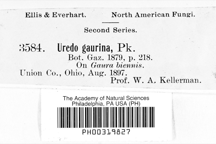
evidence. Museums hold 660 specimens
collected within 10 miles of Martindale, Samuel, House between 1835 and
1972: 641 Animalia, 9 Plantae, 7 Fungi, 3 Unrecorded. 12 distinct Species records are shown.
Collected by A. Moldenke, A. R. Gaufin, A.R. Gaufin, H.H. Ross and others. Each is a
physical object with a catalogue
number, and each entry opens the museum's record. This is what was
collected and kept, not a survey of what lives here - nothing can be
concluded from a species being absent.
Regional context, not property-specific
evidence. The federal mineral resources record lists
9 workings within 5 miles of Martindale, Samuel, House: 4 past producers, 4 producers, 1 plant.
5 still produce. What was taken out: Sand and Gravel, Construction. Distance is straight-line from the
map coordinates, so a quarry counted here may appear on a neighbouring
settlement's page as well.
Regional context, not property-specific
evidence. The National Weather Service names
Englewood, the town this property stands in, in 25 storm reports between 1997 and 2022: 15 thunderstorm wind, 8 hail, 1 flash flood, 1 heavy rain.
No death or injury is recorded in these reports. Each account below is quoted exactly as the forecast office
filed it, from the NOAA Storm Events Database, and each date
opens the federal record of that event.
A light pole was snapped and fell onto a pickup truck. Several trees were toppled or snapped off. Siding and gutters were pulled off apartments with several chimneys damaged as well.
No historic map-sheet match is published
for this property yet. That does not mean no map exists. This record needs
a coordinate-quality review before it can be joined to a sheet boundary.
Browse the county's mapped places while that work is
pending.
From the nomination file
1,857 words on record
When this property was proposed for the
National Register, someone wrote the case for it: what the building is,
and why it matters. That document is a federal record in the public domain.
It is quoted below word for word, never summarised. The text was read off the scanned case file by machine, so the
occasional stray character is the recogniser's and the 1970s
typewriter's.
Description of the property
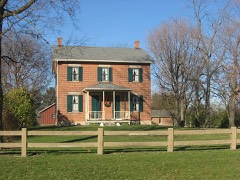
is a dummy original to the house of 1868. An interior chimney is at bracketed frontispiece. The common bond brick facade has the main doorway in the left bay. is Greek Revival. The original basement kitchen opening out the The windows on the lst floor are casement style, tion with tooled water table on the facade. Greek Revival.The rectangular house sits on a coursed stone founda- The eaves project about 12 inches. DATE. The house has two rear of post 1875 vintage.The rear wing has a recessed porch in -GOOD AREAS OF
Statement of significance
is located nearby as is the site of a saw-oil mill, a gravel pit 1400-1499 1700-1799 1600-1699 ENGINEERING 1918. ARCHEOLOGY-HISTORIC ART CONSERVATION PREHISTORIC PERIOD SIGNIFICANCE EDUCATION AGRICULTURE ECONOMICS LITERATURE BUILDER/ARCHITECT THEATER RELIGION INDUSTRY SCULPTURE farmer's home. XARCHITECTURE rear of the building, these alterations do not significantly with Patterson and his industrial policy is an important part of the detract from the architectural integrity of the structure.It _EXPLORATION/SETTLEMENT _COMMUNICATIONS Victorian structure built on a hill overlooking the Stillwater a Vice President of the National Cash Register and the personal _TRANSPORTATION _PHILOSOPHY entreprenurial history of the county, state and nation.
The life of the original owner of the home was significant remains a fine example of a post Civil War, prosperous gentleman completed, he was elected Montgomery County Commissioner and served _SOCIAL/HUMANITARIAN vast interpretive potential as it is owned by the -SCIENCE The land surrounding the Martindale home, as well as the home _COMMERCE in the 35th Ohio Volunteer Infantry and was discharged in 1864 when -1900- -MUSIC _COMMUNITY PLANNING The Martindale home, built circa 1868, is a stately early there have been a few minor changes and a wooden addition in the ARCHEOLOGY-PREHISTORIC valley.
natural and the historical interpretation of the original Martindale meadows conducive to the development of nature trails.Both the The house, clearly showing the Greek Revival influence, physician of John H. Patterson.A man who was intimately involved property will be a tremendous cultural asset to the area. Englewood complex.One of the earliest cemeteries in the township to Butler township and Montgomery County.His family was among through 1875.The property stayed in the Martindale family until In 1926 Dr.Frederick Barr bought the Martindale home.He was _INVENTION Samuel Martindale was a captain is inhabited and is in an excellent state of repair.Although the early settlers of the area.
Quoted from the National Register nomination
for reference 78002148, 12 pages, held by the National Archives in Record
Group 79. See the
catalogue record.
Listed places nearby
6 within 8 miles
Other National Register properties close
enough to walk or drive between, ordered by distance from this one. Both
positions come from the same geocoding pass that matched these properties
to their map sheets.
Listing record. National Park Service National Register of Historic Places, listed-properties dataset, current to 2026-05-22.
Map join. Address geocoded through the United States Census geocoder, then tested against the published boundary of every sheet in the USGS Historical Topographic Map Collection.
How this page is made. Listing fields come from federal records; map-sheet coverage is a labelled coordinate-to-boundary calculation, not a source-field claim.
Specimens. Global Biodiversity Information Facility (GBIF), https://www.gbif.org/. Only records licensed CC0 or CC BY are used. Records licensed CC BY-NC are excluded because this site carries advertising. Images are checked individually and any whose licence is non-commercial, no-derivatives or unreadable is refused.
Mines and quarries. USGS Mineral Resources Data System (MRDS) https://mrdata.usgs.gov/mrds/ A work of the United States government, no copyright under 17 U.S.C. 105.
Storms. NOAA National Centers for Environmental Information, Storm Events Database https://www.ncei.noaa.gov/stormevents/ A work of the United States government, no copyright under 17 U.S.C. 105. Narratives are quoted verbatim from the National Weather Service report and are not edited or summarised.
 Block
Block