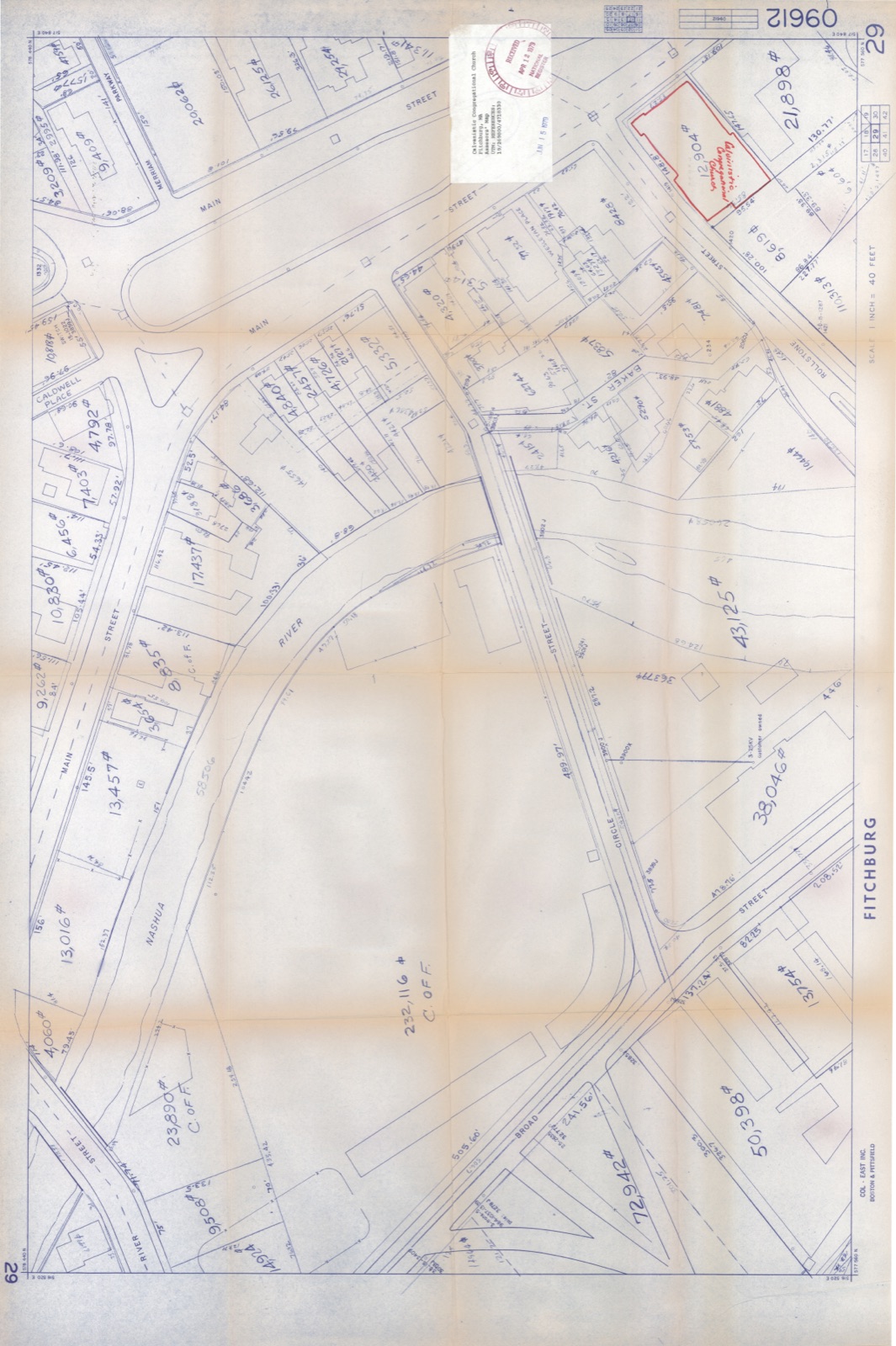
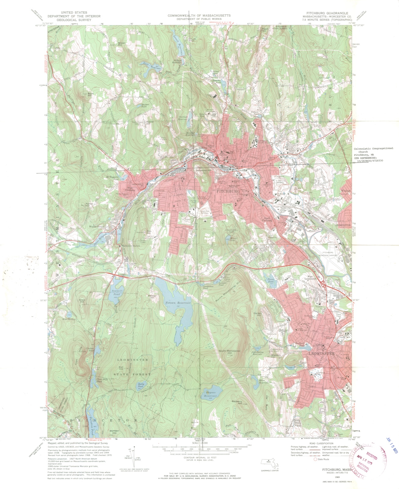
Photographs from the nomination case file, National Park Service records.
Calvinistic Congregational Church
Listed on the National Register of Historic Places in
1979. A historic map-sheet match is not published yet. The record needs a coordinate-quality review before it can be joined to a sheet boundary.
From the record
“The writer feels that this article would be incomplete, and subject to just criticism should no mention be made of some of those good men who have passed on, to whose integrity and farsightedness is due, to such a large extent, the honorable place occupied by our banks in the financial world today. Within a decade there have been many changes among the officials of the banks.”
Fitchburg : a Quality City : a Manufacturing and Mercantile Review (1912). Machine-read text.
one of 500 National Register listings in Worcester County · listed in 1979 · category: Building · one of 1 National Historic Landmarks in Worcester County.
National Register reference number.79000371- the number the National Park Service assigned this property when it was listed, and the key its nomination file is catalogued under at the National Archives.
In this respect an old saw comes to mind, "the exception proves the rule;" for whatever may be the state of affairs in some municipalities, it is certain that since the Tenney interests took control of the Fitchburg Gas Electric Light Co. no community has received better service or been afforded accommodations superior to what Fitchburg is receiving.
The original gas company in Fitchburg was formed in 1853, and electricity was introduced in 1890. The Tenney interests, controlling gas or electric companies in sixteen cities, came into possession in 1909, and the officers are C. H. Tenney, Springfield, president; A. B. Tenney, first vice-president; D. E. Manson, second vice-president; Palmer York, treasurer; H. T. Sands, general manager; and Clifton R. Hayes, local manager.
Regional context, not property-specific
evidence. The
federal wildfire occurrence database
lists 165 fires within 5 miles of Calvinistic Congregational Church between
2015 and 2020, burning about 110 acres in total. 1 started naturally. 1 was recorded as arson.
Distance is straight-line from the map coordinates, so a fire counted
here may appear on a neighbouring settlement's page as well.
Reported cause
Fires
Debris and open burning
71
Missing data/not specified/undetermined
59
Smoking
22
Recreation and ceremony
5
Power generation/transmission/distribution
3
Fireworks
3
Arson/incendiarism
1
Natural
1
The most recent of
them, most recent first, with the day each was reported and the service
that recorded it.
Regional context, not property-specific
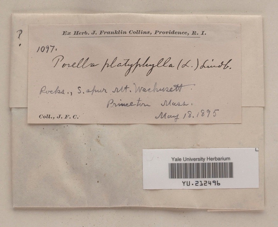
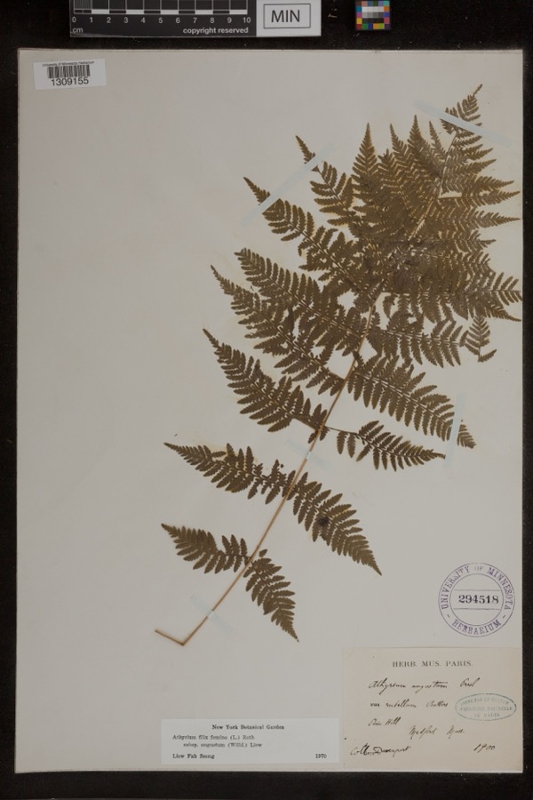
evidence. Museums hold 689 specimens
collected within 10 miles of Calvinistic Congregational Church between 1870 and
1974: 297 Animalia, 221 Plantae, 156 Fungi, 6 Unrecorded, 6 Chromista, 3 Protozoa. 12 distinct Species records are shown.
Collected by A. B. Seymour, A. Ferrett, A. H. Allen and others. Each is a
physical object with a catalogue
number, and each entry opens the museum's record. This is what was
collected and kept, not a survey of what lives here - nothing can be
concluded from a species being absent.
Regional context, not property-specific
evidence. The federal mineral resources record lists
6 workings within 5 miles of Calvinistic Congregational Church: 4 past producers, 1 producer, 1 occurrence.
1 still produces. What was taken out: Sand and Gravel, Construction, Tin, Lithium, Geothermal. Distance is straight-line from the
map coordinates, so a quarry counted here may appear on a neighbouring
settlement's page as well.
Regional context, not property-specific
evidence. The National Weather Service names
Fitchburg, the town this property stands in, in 26 storm reports between 1995 and 2024: 16 thunderstorm wind, 5 flash flood, 2 hail, 2 flood.
No death or injury is recorded in these reports. Each account below is quoted exactly as the forecast office
filed it, from the NOAA Storm Events Database, and each date
opens the federal record of that event.
Major flooding occurred along the North Nashua River in Fitchburg. A crest of 8.6 feet was recorded at 530 am on the 16th (flood stage is 6.5 feet). This may have surpassed the previous record high crest which occurred in April, 2007. Widespread flooding was reported along the river in Fitcburg, where several roads were impassable. Minor flooding occurred along the Blackstone River in Northbridge, where the river crested at 10.3 feet at 315 pm on the 16th (flood stage is 9 feet).
Three to five inches of rain fell within the matter of a few hours during the evening of October 21 which resulted in prolific urban flash flooding in Worcester and surrounding areas. ||In Worcester, flash flooding made roads impassable and there were many reports of cars stuck in floodwaters and people needing rescue. Roads flooded included Cambridge, Chandler, Bancroft, Park, Harding, Hammond, Highland, Summer, Lincoln, Green, Grove, Bridge, Irving and Ellsworth Streets, as well as Goldthwaite Road, Pleasant Terrace, Major Taylor Boulevard, Shore Drive, and Park Avenue. One portion of Cambridge Street near Kansas Street was reported to be flooded with water 7 feet deep! MLK Boulevard flooded up to an underpass bridge in a low lying area. Several other streets were reported to have floodwaters over 4 feet deep, including Country Club Boulevard. Over 20 cars were reported stuck in floodwaters at the intersection of Highland Street and Park Avenue. Plantation Street from Oakhurst Street to I-290 was flooded with water up to 4 feet deep. Significant flooding was also reported on 122A as well as I-290, with floodwaters up to SUV tire height reported. Several vehicles were stuck in floodwaters on I-290.||In Fitchburg, flash flooding closed a section of the John Fitchburg Highway and a car was stuck in flood waters on Shelley Avenue. In Leominster, flash flooding closed the intersection of Washington Street and Grove Avenue as well as McKay Street entering the hospital. In Lancaster, Main Street was flooded and impassable while in Shrewsbury, Route 9 at Oak Street was flooded up to the tops of car tires.||No injuries were reported due to the flash flooding.||Due to the ongoing drought conditions, stream and river flows were well below average and the excessive amount of rainfall did not produce flooding.
Multiple trees in Fitchburg and Leominster were downed by thunderstorm winds. Ringer and Prospect Streets in Leominster were blocked by fallen trees and one tree fell on a car in Fitchburg.
A peak wind gust to 62 mph was recorded by the automated weather station at Fitchburg during a severe thunderstorm. Quite a few power lines were reported down throughout the city of Fitchburg, but power outages were brief.
No historic map-sheet match is published
for this property yet. That does not mean no map exists. This record needs
a coordinate-quality review before it can be joined to a sheet boundary.
Browse the county's mapped places while that work is
pending.
From the nomination file
2,595 words on record
When this property was proposed for the
National Register, someone wrote the case for it: what the building is,
and why it matters. That document is a federal record in the public domain.
It is quoted below word for word, never summarised. The text was read off the scanned case file by machine, so the
occasional stray character is the recogniser's and the 1970s
typewriter's.
Description of the property
The Calvinistic Congregational Church occupies a prominent lot in downtown Fitchburg at the corner of Main and Rollstone Streets. Designed in 1897 in the Romanesque Revival style, it consists of a rectangular nave oriented with its gable end toward Main street and a chapel placed at cross-axis to the rear elevation. The building is constructed of rough-faced reddish standstone blocks with light tan sandstone trim. It stands on a high basement of larger sandstone blocks, separated from the main floors by a water table. The roof is covered with purple slate with decorative green bands and copper cresting. The facade, which faces north east on Main Street, is centered around a triple arched entrance portico.
It consists of three projecting pointed arch canopies with carved finials and crockets, containing round arch openings with sandstone voisseurs and molded archivolts. Both the canopies and arches are supported by paired shortened columns and the whole ensemble is approached by a flight of broad, granite steps. The entrance is surmounted by a huge rose window contained within a round arch opening springing from a carved stringcourse which demarcates the roof line. A trabeated opening divided by a central colum lights the gable which is embelished with crockets and a A large square tower rises approximately 158 feet from the northern end of This is, pierced at the ground floor level by a pair of narrow windows and at the tower level by one elongated window.
The belfry rises above a carved sandstone band and is framed by clasping buttresses at each corner which terminate in copper clad pinnacles. Clock faces are found on all four sides. Above this the tower is opened by triple arches which echo the entrance motif. The spire is clad with copper.
/ARCHITECT Henry M. Francis The Calvinistic CongregationalChurchin Fitchburg retains integrity of location, design, materials and workmanship. It is a prominent local landmark, and one of the finest examples of Romanesque Revival design in Fitchburg. Its growth parallels that of Fitchburg as a whole and its parishoners have included some of the city's most prominent citizens. The history of the Church began with a general gathering of the people of Fitchburg in 1768, four years after the town had been incorporated. During the early nineteenth century a schism developed in the church between those who held Calvinistic views and those who held Unitarian views.
On June 14, 1805 the General Court granted an Act of Incorporation to the religious body to be called the Calvinistic Congregational Society in Fitchburg. The Church formally split in 1823 when the First Parish Unitarian-Universalist Church was established. The Calvinists built their first church on the site of the present structure in 1806. This building, about which little is known, was sold in 1844 and moved to another site where it was used for commercial purposes. The second church was built in 1845 in the currently popular Greek Revival style. It was constructed of red brick with a granite basement and first floor. It is believed that the granite was quarried at the Rollstone Quarry across the River. The first floor was rented for commercial purposes and was known as Granite Row.
Quoted from the National Register nomination
for reference 79000371, 12 pages, held by the National Archives in Record
Group 79. See the
catalogue record.
Listed places nearby
6 within 8 miles
Other National Register properties close
enough to walk or drive between, ordered by distance from this one. Both
positions come from the same geocoding pass that matched these properties
to their map sheets.
Listing record. National Park Service National Register of Historic Places, listed-properties dataset, current to 2026-05-22.
Map join. Address geocoded through the United States Census geocoder, then tested against the published boundary of every sheet in the USGS Historical Topographic Map Collection.
How this page is made. Listing fields come from federal records; map-sheet coverage is a labelled coordinate-to-boundary calculation, not a source-field claim.
Wildfire. Short, Karen C. 2022. Spatial wildfire occurrence data for the United States, 1992-2020 [FPA_FOD_20221014]. 6th Edition. Fort Collins, CO: Forest Service Research Data Archive. https://doi.org/10.2737/RDS-2013-0009.6 Collected with United States Government funding and usable without additional permissions or fees.
Specimens. Global Biodiversity Information Facility (GBIF), https://www.gbif.org/. Only records licensed CC0 or CC BY are used. Records licensed CC BY-NC are excluded because this site carries advertising. Images are checked individually and any whose licence is non-commercial, no-derivatives or unreadable is refused.
Mines and quarries. USGS Mineral Resources Data System (MRDS) https://mrdata.usgs.gov/mrds/ A work of the United States government, no copyright under 17 U.S.C. 105.
Storms. NOAA National Centers for Environmental Information, Storm Events Database https://www.ncei.noaa.gov/stormevents/ A work of the United States government, no copyright under 17 U.S.C. 105. Narratives are quoted verbatim from the National Weather Service report and are not edited or summarised.
 Block
Block