BlockBefore
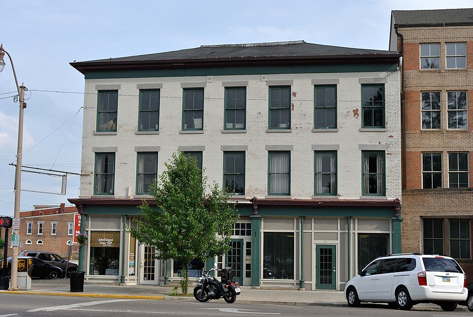
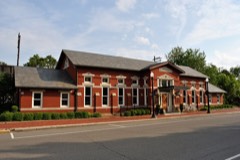
Photograph of Courthouse Center
Photograph by Wdzinc, CC BY-SA 3.0. Via Wikimedia Commons.

Courthouse Center

Listed on the National Register of Historic Places in 1979. A historic map-sheet match is not published yet. The record needs a coordinate-quality review before it can be joined to a sheet boundary.

From the record

one of 52 National Register listings in Licking County · listed in 1979 · category: Building.

Sources: the case file at the National Archives · the National Register database, National Park Service

The listing

  • What is counted as historic. The nomination lists 2 buildingss as contributing to the listing.
  • Address. 35--37 S. Park Pl. and jct. of S. Park and S. 2nd St., Newark, 43055
  • When was it listed? 1979-11-29
  • Category. building
  • Township. Newark city
  • National Register reference number. 79001879 - the number the National Park Service assigned this property when it was listed, and the key its nomination file is catalogued under at the National Archives.

Fires near this property

4 since 2014

Regional context, not property-specific evidence. The federal wildfire occurrence database lists 4 fires within 5 miles of Courthouse Center between 2014 and 2020, burning about 7 acres in total. None started naturally. None was recorded as arson. Distance is straight-line from the map coordinates, so a fire counted here may appear on a neighbouring settlement's page as well.

Reported cause Fires
Debris and open burning4

The most recent of them, most recent first, with the day each was reported and the service that recorded it.

DateCause SizeReported by Name on the report
5 April 2015Debris and open burningunder an acreOhio Department of Natural Resources842
15 March 2014Debris and open burning2.5 acresOhio Department of Natural Resourcesnot named
17 February 2017Debris and open burning3.5 acresOhio Department of Natural Resources6865
10 November 2020Debris and open burningunder an acreOhio Department of Natural Resources15953

Every fire recorded in Licking County

Specimens collected near this property

12 of 2,548 shown

Regional context, not property-specific evidence. Museums hold 2,548 specimens collected within 10 miles of Courthouse Center between 1843 and 1975: 2,223 Animalia, 238 Fungi, 58 Plantae, 26 Protozoa, 3 Chromista. 12 distinct Species records are shown. Collected by A. Gray; W. S. Sullivant, A. P. M., A. P. Morgan and others. Each is a physical object with a catalogue number, and each entry opens the museum's record. This is what was collected and kept, not a survey of what lives here - nothing can be concluded from a species being absent.

Image SpeciesYear Collected by Where, as recorded
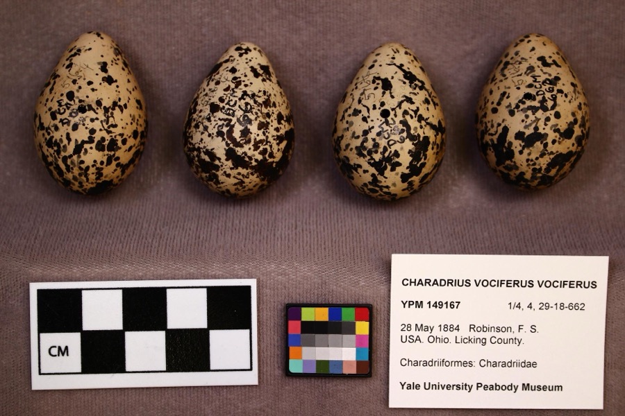
Specimen of Charadrius vociferus vociferus Linnaeus, 1758Charadrius vociferus vociferus Linnaeus, 17581884F. S. Robinson
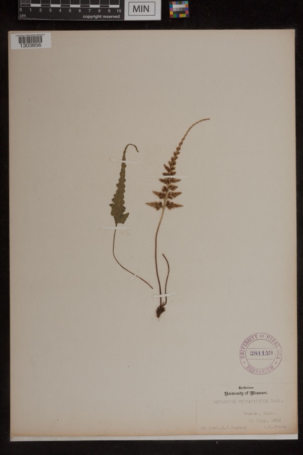
Specimen of Asplenium pinnatifidum Nutt.Asplenium pinnatifidum Nutt.1893Jones, H.L.Toboso
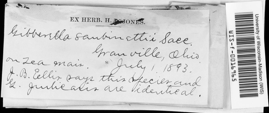
Specimen of Gibberella saubinetii (Durieu & Mont.) Sacc.Gibberella saubinetii (Durieu & Mont.) Sacc.1893J.B. EllisGranville
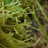
A photograph of the species Helodium paludosum, not of this specimenHelodium paludosum (Austin) Austin ex Broth.1843Asa Gray; W. S. Sullivantin Cranberry Marsh, northern Ohio
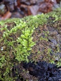
A photograph of the species Hypnum paludosum, not of this specimenHypnum paludosum (Hedw.) P.Beauv.1843A. Gray; W. S. Sullivantin Cranberry Marsh, northern Ohio
A photograph of the species Bonasa umbellus, not of this specimenBonasa umbellus (Linnaeus, 1766)1853Mack, D. (Don)Eden Twp, Licking, Ohio, USA
A photograph of the species Philomachus pugnax, not of this specimenPhilomachus pugnax (Linnaeus, 1758)1872Jasper, T. (Theodore)Buckeye Lake, Ohio, USA
A photograph of the species Pelecanus erythrorhynchos, not of this specimenPelecanus erythrorhynchos Gmelin, 17891874not recordedLicking Reservoir, Licking, Ohio, USA
A photograph of the species Calidris canutus, not of this specimenCalidris canutus rufa (A.Wilson, 1813)1878Savage, E. (Ed)Buckeye Lake Reservoir, Licking, Ohio, USA
A photograph of the species Lophodytes cucullatus, not of this specimenLophodytes cucullatus (Linnaeus, 1758)1878not recordedLicking Reservoir, Licking, Ohio, USA
A photograph of the species Aix sponsa, not of this specimenAix sponsa (Linnaeus, 1758)1880not recordedLicking Reservoir, Licking, Ohio, USA
A photograph of the species Anas americana, not of this specimenAnas americana J.F.Gmelin, 17891880not recordedBuckeye Lake Reservoir, Licking, Ohio, USA

All 2,548 specimens within 10 miles, at the Global Biodiversity Information Facility.

Mines and quarries near this property

5 within 5 miles

Regional context, not property-specific evidence. The federal mineral resources record lists 5 workings within 5 miles of Courthouse Center: 2 past producers, 2 plants, 1 producer. 3 still produce. What was taken out: Sand and Gravel, Construction. Distance is straight-line from the map coordinates, so a quarry counted here may appear on a neighbouring settlement's page as well.

Where SiteCommodity StatusRecorded
Dry Creek Crushed Gravel CoSand and Gravel, ConstructionPlant
Dry Creek PitSand and Gravel, ConstructionPast ProducerSedimentary
Dry Creek Pit No 2Sand and Gravel, ConstructionProducer
Jones Gravel PitSand and Gravel, ConstructionPast Producer
Newark No. 214 Dredge & PlantSand and Gravel, ConstructionPlant

Every working recorded in Licking County

Storms near this property

60 of 69 shown

Regional context, not property-specific evidence. The National Weather Service names Newark, the town this property stands in, in 69 storm reports between 1994 and 2026: 39 thunderstorm wind, 21 hail, 5 flood, 2 lightning. The reports record 1 death and 1 injury. Each account below is quoted exactly as the forecast office filed it, from the NOAA Storm Events Database, and each date opens the federal record of that event.

WhenEvent Place namedHarm What the report says
September 1994Thunderstorm WindNewark1 killed, 1 hurt,,,,,,,,Lightning Winds of 60 mph were reported in Newark. Large hail fell in Hebron where lightning killed a 46-year-old man as he attempted to untie a dog from under a tree to get it to shelter from the hail storm. A 33-year-old woman at the scene was also struck and injured. The dog was unharmed.
March 2020Flash FloodNewark$50,000A sinkhole developed on Spring Street.
July 2003Thunderstorm WindNewark$50,000Numerous trees downed. One tree fell on a home, and two other trees severely damaged two automobiles.
November 2020Thunderstorm WindNewark$30,000A large portion of an old building undergoing renovation collapsed along Union Street.
July 1997LightningNewark$20,000Lightning struck the Modern financing building sparking a fire the caused substantial damage.
June 1997LightningNewark$20,000Lightning struck a house which caused a fire that damaged the shed and a storage room.
July 1995Thunderstorm WindNewark$15,000A roof was blown off a small building.
April 2006HailNewark$15,000no account filed
April 2023Thunderstorm WindNewark$10,000Several trees and powerlines were downed in the Newark area.
July 2023Thunderstorm WindNewark$10,000A few trees and wires were downed.
June 2005Thunderstorm WindNewark$10,000A 30-foot by 30-foot section of a roof was ripped off of a building on the southeast side of town. A construction trailer was turned on its side, and a steel overhang was pulled off of a home, causing minor damage to a wall.
August 2000Thunderstorm WindNewark$10,000Numerous trees downed around Newark. Also, quarter size hail fell at Kirkersville.
January 2005Thunderstorm WindNewark$8,000A roof was torn off of a home.
April 2026Thunderstorm WindNewark$6,000Several trees were downed along Griffith Road. A barn and trailer were also damaged.
August 2003Thunderstorm WindNewark$6,000Trees were downed, including a few that fell on a house and on a vehicle.
July 2024Thunderstorm WindNewark$5,000A tree fell onto a house.
November 2017Thunderstorm WindNewark$5,000A few trees were downed across eastern Licking County.
July 2000Thunderstorm WindNewark$5,000Trees and power lines downed to the northwest of Newark.
May 2018Thunderstorm WindNewark$4,000Numerous trees were downed along with a utility pole in the Newark area.
August 2017Thunderstorm WindNewark$4,000Trees were knocked down in the Granville and Newark areas.
May 1999Thunderstorm WindNewark$4,000Large trees were blown down as well as power lines.
July 2022Thunderstorm WindNewark$3,000A few trees were downed on East Main Street.
July 2017Thunderstorm WindNewark$3,000A few trees were downed in the Newark and Heath areas.
May 2008Thunderstorm WindNewark$3,000Trees were downed.
June 2008Thunderstorm WindNewark$3,000Several trees were knocked down near the intersection of State Route 158 and Arlington Avenue.
June 2007Thunderstorm WindNewark$3,000Trees were knocked down.
June 2006Thunderstorm WindNewark$3,000Several trees and large limbs were downed.
July 2006Thunderstorm WindNewark$3,000Large tree limbs and powerlines were downed.
March 2002Thunderstorm WindNewark$3,000Trees were blown down in town.
April 2026Thunderstorm WindNewark$1,000A tree fell onto a roadway.
July 2022Thunderstorm WindNewark$1,000A tree was downed on Hudson Avenue between Oak and St Clair Streets.
May 2015Thunderstorm WindNewark$1,000A 24 inch diameter tree was blown over.
June 2015Thunderstorm WindNewark$1,000One tree knocked down on Hull Road.
July 2013Thunderstorm WindNewark$1,000One tree was reported down on Milner Road due to thunderstorm winds.
September 2010Thunderstorm WindNewark$1,000Trees were reported down due to damaging thunderstorm winds.
October 2010Thunderstorm WindNewark$1,000Large tree limbs were reported down due to damaging thunderstorm winds.
May 2018Thunderstorm WindNewark$250Numerous large limbs were downed.
August 2021Thunderstorm WindNewark$100A large limb was downed near State Routes 16 and 79.
August 2020FloodNewark-High water was reported on OH-16 between Church Street and 21st Street.
April 2018FloodNewark-High water and multiple road closures were reported at several locations throughout Licking County.
September 2016Flash FloodNewark-A passenger was stuck in a vehicle on Moull Street due to high water.
July 2013FloodNewark-Some roads were reported to have high water on them due to heavy rainfall.
July 2013FloodNewark-Street flooding was occurring in the Newark and Heath areas due to heavy rainfall.
June 2012Thunderstorm WindNewark-The spotter estimated the magnitude of the wind gust.
March 2012FloodNewark-High water due to heavy rain was reported across some of the streets in southern Newark.
June 2010Thunderstorm WindNewark-The wind gust was an estimate.
May 2025HailNewark-no account filed
March 2020HailNewark-no account filed
March 2017HailNewark-no account filed
June 2017HailNewark-no account filed
May 2015Thunderstorm WindNewark-no account filed
May 2014HailNewark-no account filed
May 2012HailNewark-no account filed
June 2012Thunderstorm WindNewark-no account filed
June 2012HailNewark-no account filed
April 2010HailNewark-no account filed
September 2010HailNewark-no account filed
June 2010HailNewark-no account filed

Every storm recorded in Licking County

Newspapers printed here

0 digitised pages

1 paper published in this town, digitised by the Library of Congress and free to read: 0 issues, 0 pages. Every page is searchable, so a name or a street can be looked for directly in what the town printed about itself at the time.

NewspaperPublished
Newark Leader1917 to 1946

Map coverage status

No historic map-sheet match is published for this property yet. That does not mean no map exists. This record needs a coordinate-quality review before it can be joined to a sheet boundary. Browse the county's mapped places while that work is pending.

From the nomination file

1,296 words on record

When this property was proposed for the National Register, someone wrote the case for it: what the building is, and why it matters. That document is a federal record in the public domain. It is quoted below word for word, never summarised. The text was read off the scanned case file by machine, so the occasional stray character is the recogniser's and the 1970s typewriter's.

Description of the property

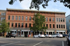
The building at 35-37 S. Park Place is known locally as the "oldest 1853 of brick on a stone foundation with a truncated hip asphalt roof. punctuates the skyline. The storefront has been altered. The two buildings are flanked by parking lots but occupy a key CONDITION UNEXPOSED DETERIORATED UNALTERED EXCELLENT XALTERED frieze and slightly projecting cornice complete the design.The CHECK ONE second floor windows are round arched while the remainder are rectangular County Courthouse across the street. storefront has been altered, although the bracketed entablature remains.

The buildings are representative of the nineteenth century commercial The flat roof is built up.The facade measures four bays.The central is already listed on the National Register as is the Second Empire structure which adjoins it to the south.This building was built corner on the Square.The Shield's Block immediately to the west brick commercial block on the Square'.It was constructed prior to It measures 7 by 5 bays and rises three stories in height.The building some of the original 2 over 2 windows are intact. An undecorated -RUINS The building provides a striking contrast to the more ornate Italianate is rather simple in design.T The stone lintels and sills are plain and double hung 1 over 1 and 2 over 2 sashes.An elaborate bracketed cornice AREAS OF

Statement of significance

The two commercial buildings located on the southeast corner of the Courthouse, then the Ohio Canal and the Railroads nearby assured 1700-1799 1400-1499 1600-1699 ART LAW ECONOMICS ENGINEERING ARCHEOLOGY-HISTORIC EDUCATION RELIGION PERIOD AGRICULTURE SIGNIFICANCE EXPLORATION/SETTLEMENT INDUSTRY historically. ARCHITECTURE LITERATURE PHILOSOPHY PREHISTORIC commercial use.

SOCIAL/HUMANITARIAN MUSIC _COMMUNICATIONS Courthouse Square in Newark are significant architecurally and provides a contrast to the richly ornamented Italianate structures _CONSERVATION These two buildings are important examples of Newark's commercial Most of the early buildings were replaced around the square during MILITARY INVENTION _SCULPTURE -THEATER -1900- _COMMUNITY PLANNING prior to 1853, between 1866-1875 The Courthouse Square has been the governmental and commercial the importance of this area throughout the nineteenth century. around the square.

It blends well with similar scale, materials, BUILDER/ARCHITECT ARCHEOLOGY-PREHISTORIC new owners are in the process of rehabilitating them for continued an unusual survivor from the earlier days.Its simple design center of Newark since_ the town was platted in 1802.First the X1800-1899

The whole case file for this property - 1,296 words, 12 pages, reproduced complete.

Quoted from the National Register nomination for reference 79001879, 12 pages, held by the National Archives in Record Group 79. See the catalogue record.

Listed places nearby

6 within 8 miles

Other National Register properties close enough to walk or drive between, ordered by distance from this one. Both positions come from the same geocoding pass that matched these properties to their map sheets.

Photograph PropertyDistance Listed
Shield's Blockunder 500 feet1978
Licking County Courthouseunder 500 feet1973
Home Building Association Bankunder 500 feet1973
Pennsylvania Railway Station0.1 miles1979
Newark High School0.4 miles2015
McNamar-McLure-Miller Residence0.4 miles1982

Sources for this property

National Archives recordThe nomination case file for reference 79001879 in Record Group 79.
Licking CountyAll 52 listed properties in this county.

Provenance

  • Listing record. National Park Service National Register of Historic Places, listed-properties dataset, current to 2026-05-22.
  • Map join. Address geocoded through the United States Census geocoder, then tested against the published boundary of every sheet in the USGS Historical Topographic Map Collection.
  • How this page is made. Listing fields come from federal records; map-sheet coverage is a labelled coordinate-to-boundary calculation, not a source-field claim.
  • Wildfire. Short, Karen C. 2022. Spatial wildfire occurrence data for the United States, 1992-2020 [FPA_FOD_20221014]. 6th Edition. Fort Collins, CO: Forest Service Research Data Archive. https://doi.org/10.2737/RDS-2013-0009.6 Collected with United States Government funding and usable without additional permissions or fees.
  • Specimens. Global Biodiversity Information Facility (GBIF), https://www.gbif.org/. Only records licensed CC0 or CC BY are used. Records licensed CC BY-NC are excluded because this site carries advertising. Images are checked individually and any whose licence is non-commercial, no-derivatives or unreadable is refused.
  • Mines and quarries. USGS Mineral Resources Data System (MRDS) https://mrdata.usgs.gov/mrds/ A work of the United States government, no copyright under 17 U.S.C. 105.
  • Storms. NOAA National Centers for Environmental Information, Storm Events Database https://www.ncei.noaa.gov/stormevents/ A work of the United States government, no copyright under 17 U.S.C. 105. Narratives are quoted verbatim from the National Weather Service report and are not edited or summarised.