Listed on the National Register of Historic Places in
1979. A historic map-sheet match is not published yet. The record needs a coordinate-quality review before it can be joined to a sheet boundary.
From the record
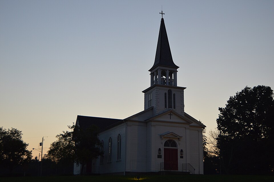
“James Meeting House is a historic church building at 375 Boardman-Poland Road in Boardman, Ohio, United States. James Episcopal Church in 1828, deconsecrated in 1971, relocated to Boardman Park in 1972, and added to the National Register of Historic Places in 1979.”
Wikipedia article St. James Episcopal Church (Boardman, Ohio), CC BY-SA 4.0.
one of 59 National Register listings in Mahoning County · listed in 1979 · category: Building.
National Register reference number.79001892- the number the National Park Service assigned this property when it was listed, and the key its nomination file is catalogued under at the National Archives.
Fires near this property
4 since 2010
Regional context, not property-specific
evidence. The
federal wildfire occurrence database
lists 4 fires within 5 miles of St. James Episcopal Church between
2010 and 2019, burning about 2 acres in total. None started naturally. None was recorded as arson.
Distance is straight-line from the map coordinates, so a fire counted
here may appear on a neighbouring settlement's page as well.
Reported cause
Fires
Debris and open burning
2
Recreation and ceremony
1
Equipment and vehicle use
1
The most recent of
them, most recent first, with the day each was reported and the service
that recorded it.
Regional context, not property-specific
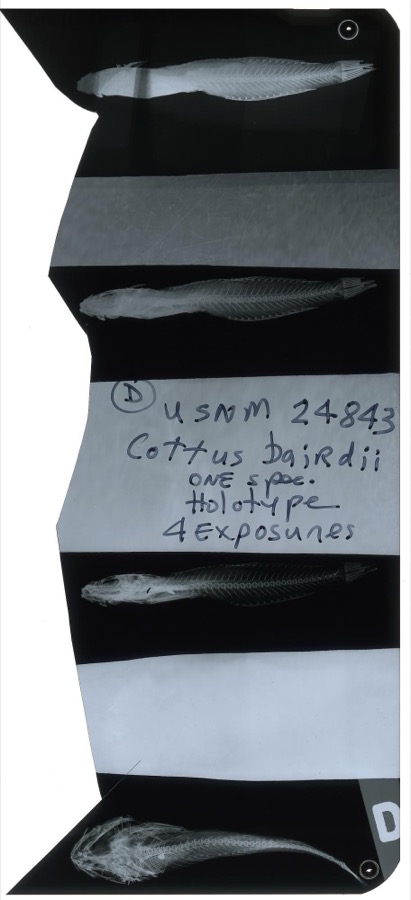
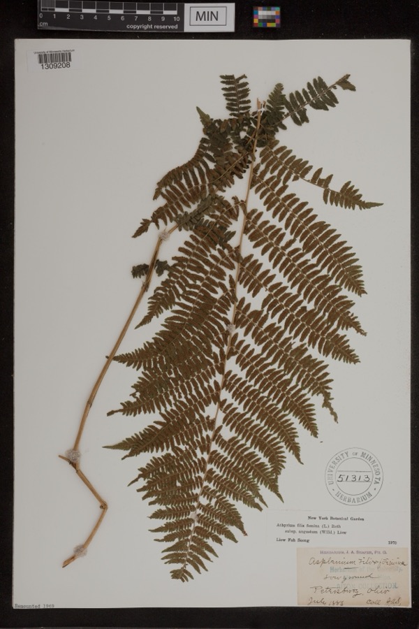
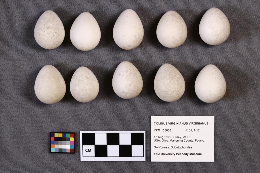
evidence. Museums hold 440 specimens
collected within 10 miles of St. James Episcopal Church between 1853 and
1974: 269 Animalia, 165 Plantae, 5 Fungi, 1 Chromista. 12 distinct Species records are shown.
Collected by A.E. Daugherty, Armbruster, D. C. (Daniel C.), B Withers and others. Each is a
physical object with a catalogue
number, and each entry opens the museum's record. This is what was
collected and kept, not a survey of what lives here - nothing can be
concluded from a species being absent.
Regional context, not property-specific
evidence. The federal mineral resources record lists
2 workings within 5 miles of St. James Episcopal Church: 1 past producer, 1 producer.
1 still produces. What was taken out: Sand and Gravel, Construction, Iron. Distance is straight-line from the
map coordinates, so a quarry counted here may appear on a neighbouring
settlement's page as well.
Regional context, not property-specific
evidence. The National Weather Service names
Boardman, the town this property stands in, in 26 storm reports between 1996 and 2020: 14 thunderstorm wind, 10 hail, 1 flash flood, 1 flood.
No death or injury is recorded in these reports. Each account below is quoted exactly as the forecast office
filed it, from the NOAA Storm Events Database, and each date
opens the federal record of that event.
Heavy rainfall of 1.5 to 2.5 inches of rain fell across mainly central Mahoning County during the morning of June 23rd. Lowellville received significant damage to McGill Street between Walnut and Wood Streets with the road considered to be a total loss. The drainage system could not handle the flow of water and caused the road to buckle in several locations. Several streets were flooded in Lowellville, Struthers, and Boardman. Numerous retention ponds, back yards, and basements were also flooded. The Yellow Creek in Struthers overflowed it's banks. In Poland Township the Canterbury Creek also flooded some 13 homes on their first floor. An unofficial rain gauge in the area recorded near 5 inches of rainfall from the event. Another housing development prone to flooding saw 100 homes inundated with water up to the electric boxes.
Thunderstorm downburst winds estimated to be in excess of 70 mph caused extensive damage in Boardman. The worst of the damage was from near the intersection of U.S. Highway 224 and Market Street east to near Interstate 680. A few businesses on Market Street lost sections of roofing. Several storage trailers in the area were also knocked over. Just to the east of Market Street many trees were downed along Crestline Place and Marinthana Avenue. Homes along these streets lost sections of roofing as well. The damage extended as far east as the Applewood Acres neighborhood. Downed trees and minor home damage were reported in that area as well. A couple of billboards were also damaged. Widespread power outages were reported in Boardman. It took more than a day for power to be fully restored.
Thunderstorm downburst winds estimated to be as much as 70 mph downed many trees in Boardman. Some of the worst damage was on Cherrywood Drive on the northwest side of the city. A home in the that neighborhood was damaged by a fallen tree. There were also dozens of trees reported down in nearby Mill Creek Park. Scattered power outages were reported throughout Boardman.
A cluster of thunderstorms with heavy rain moved over southern Mahoning County on the 4th. Rainfall estimates were between 1 and 2 inches, most of which fell between 3 and 345 PM. Minor flooding was reported across Southern Ave and in the Home Depot parking lot. Flooding was also reported on Indianola and Shields Roads.
No historic map-sheet match is published
for this property yet. That does not mean no map exists. This record needs
a coordinate-quality review before it can be joined to a sheet boundary.
Browse the county's mapped places while that work is
pending.
From the nomination file
1,493 words on record
When this property was proposed for the
National Register, someone wrote the case for it: what the building is,
and why it matters. That document is a federal record in the public domain.
It is quoted below word for word, never summarised. The text was read off the scanned case file by machine, so the
occasional stray character is the recogniser's and the 1970s
typewriter's.
Description of the property
form plan, each wing extending beyond the main body of the building six feet and 15 feet wide, containing the chancel. The facade includes a projection 16 feet wide and 4 feet 6 inches deep, which forms part of the narthex or vestibule. This front bay is topped by a pediment which repeats the roof gable, molding, belfry, and its base has a concave curve. The top is approximately 74 feet above the ground and is topped by a metal cross nearly 4 feet tall. The chancel is elevated two steps above the floor of the nave, beyond which is setting. CONDITION DETERIORATED XALTERED FAIR XEXCELLENT Victorian fretwork trim at the eaves and roof peaks of the wings.The open the arched ceiling.
CHECK ONE belfry was constructed later than the large square tower base, and the pre- and has a composition of three slender arched windows similar to those in the flat ceiling over the side aisles.Clustered columns support the base of doors is a semi-circular transom light with mullions making two pointed arches.Above the transom is a small pediment on brackets.
chancel.The belfry consists of eight square columns.The four corner ones and trim details, and which forms the base for the front portion of the bell approximates the feeling and association of the original 19th century have small Ionic capitals.The steeple extends 28 feet 4 inches above the In 188l the cruciform wings on each side at the rear were added.There is sent steeple was probably added in the l88l remodeling.The stained glass St.James Church is a small wood-frame church building, approximately 60 feet by 4o feet, including small projecting wings near the back which give a cruci- original.The ceiling over the nave is a continuous barrel a windows, including three on each side wall, were installed.
man, a Revolutionary soldier, United States Senator from Connecticut, and a member of was brought from the Episcopal Church in New Milford, Connecticut.
The New Milford Church, erected in 1837 and enlarged in 1860, had just been taken down in 1880 in citizens of Boardman, the Boardman Historical Society, the Boardman Rotary and others and historical importance, it has been relocated in a suitable setting, and it is the 1500-1599 1700-1799 1400-1499 1600-1699 X1800-1899 ARCHEOLOGY-HISTORIC SCIENCE ECONOMICS EDUCATION PERIOD ENGINEERING THEATER AGRICULTURE EXPLORATION/SETTLEMENT SIGNIFICANCE BUILDER/ARCHITECT MILITARY INDUSTRY SCULPTURE PREHISTORIC ART LITERATURE _COMMUNICATIONS POLITICS/GOVERNMENT XARCHITECTURE surviving structure most importantly associated with the early history of Boardman and St.James Episcopal Church was among the earliest Episcopal Churches in Ohio.The St.James Episcopal Church derives its primary significance from architectural distinction the commercial strip development.
The church is still a center of community activity in a natural setting separated from of the Connecticut Western Reserve.It is a significant work of architecture from two _PHILOSOPHY -CONSERVATION SOCIAL/HUMANITARIAN tion was overseen by his son Henry Mason Boardman.The church was consecrated in In 1972 St.James Church was threatened by the construction of a shopping mall.The in Gambier in 1829. Boardman as early as 1807.St.James Church was organized in 1809,and this building -TRANSPORTATION August,1828,by Bishop Philander Chase, the first Episcopal in Ohio.The first pastor the Episcopal Church in Ohio. order to build a new one.
In 188l,St.James Church was remodeled ata cost of $3,000.When the chancel was re- -1900- -LAW building was erected by the family of Elijah Boardman, one of the original landholders INVENTION building in the township of Boardman. was begun in l827.Land and money toward its construction were given by Elijah Board-
Quoted from the National Register nomination
for reference 79001892, 10 pages, held by the National Archives in Record
Group 79. See the
catalogue record.
Listed places nearby
6 within 8 miles
Other National Register properties close
enough to walk or drive between, ordered by distance from this one. Both
positions come from the same geocoding pass that matched these properties
to their map sheets.
Listing record. National Park Service National Register of Historic Places, listed-properties dataset, current to 2026-05-22.
Map join. Address geocoded through the United States Census geocoder, then tested against the published boundary of every sheet in the USGS Historical Topographic Map Collection.
How this page is made. Listing fields come from federal records; map-sheet coverage is a labelled coordinate-to-boundary calculation, not a source-field claim.
Wildfire. Short, Karen C. 2022. Spatial wildfire occurrence data for the United States, 1992-2020 [FPA_FOD_20221014]. 6th Edition. Fort Collins, CO: Forest Service Research Data Archive. https://doi.org/10.2737/RDS-2013-0009.6 Collected with United States Government funding and usable without additional permissions or fees.
Specimens. Global Biodiversity Information Facility (GBIF), https://www.gbif.org/. Only records licensed CC0 or CC BY are used. Records licensed CC BY-NC are excluded because this site carries advertising. Images are checked individually and any whose licence is non-commercial, no-derivatives or unreadable is refused.
Mines and quarries. USGS Mineral Resources Data System (MRDS) https://mrdata.usgs.gov/mrds/ A work of the United States government, no copyright under 17 U.S.C. 105.
Storms. NOAA National Centers for Environmental Information, Storm Events Database https://www.ncei.noaa.gov/stormevents/ A work of the United States government, no copyright under 17 U.S.C. 105. Narratives are quoted verbatim from the National Weather Service report and are not edited or summarised.
 Block
Block