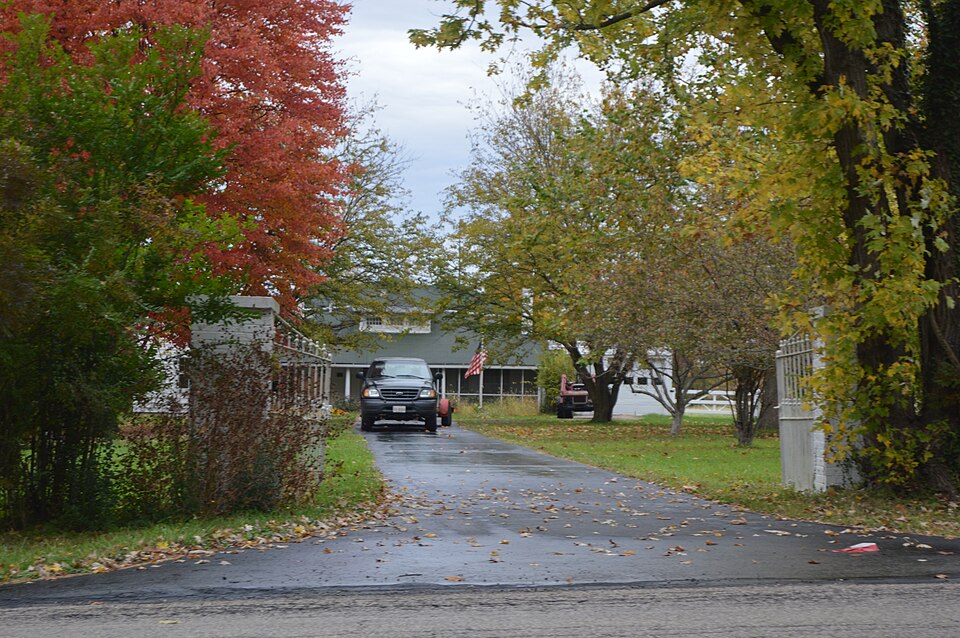
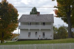
Listed on the National Register of Historic Places in
1986. A historic map-sheet match is not published yet. The record needs a coordinate-quality review before it can be joined to a sheet boundary.
From the record
one of 59 National Register listings in Mahoning County · listed in 1986 · category: Building.
National Register reference number.86001564- the number the National Park Service assigned this property when it was listed, and the key its nomination file is catalogued under at the National Archives.
Fires near this property
4 since 2010
Regional context, not property-specific
evidence. The
federal wildfire occurrence database
lists 4 fires within 5 miles of Southern Park Stable between
2010 and 2019, burning about 2 acres in total. None started naturally. None was recorded as arson.
Distance is straight-line from the map coordinates, so a fire counted
here may appear on a neighbouring settlement's page as well.
Reported cause
Fires
Debris and open burning
2
Recreation and ceremony
1
Equipment and vehicle use
1
The most recent of
them, most recent first, with the day each was reported and the service
that recorded it.
Regional context, not property-specific
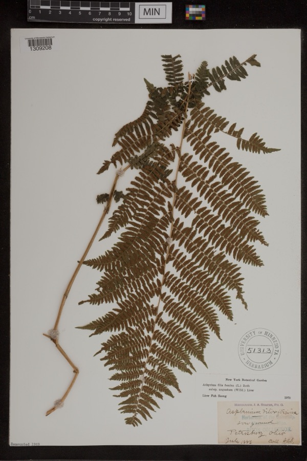
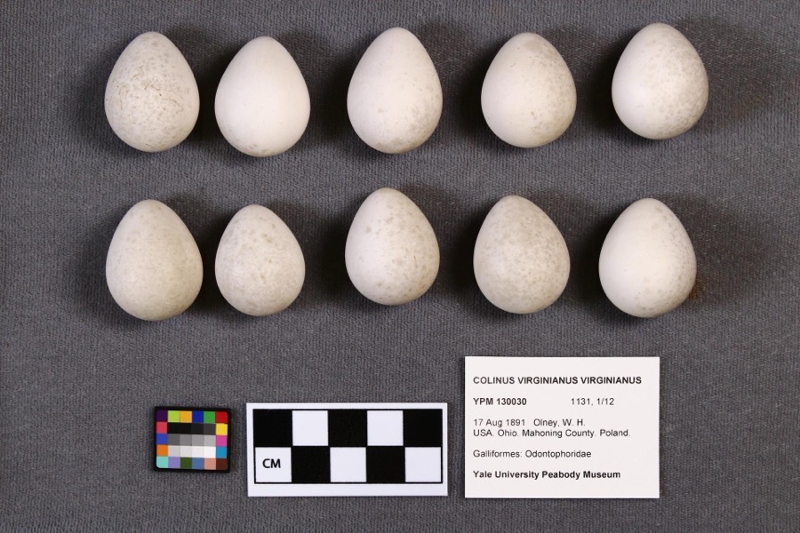
evidence. Museums hold 456 specimens
collected within 10 miles of Southern Park Stable between 1853 and
1974: 277 Animalia, 173 Plantae, 5 Fungi, 1 Chromista. 12 distinct Species records are shown.
Collected by A.E. Daugherty, Armbruster, D. C. (Daniel C.), B Withers and others. Each is a
physical object with a catalogue
number, and each entry opens the museum's record. This is what was
collected and kept, not a survey of what lives here - nothing can be
concluded from a species being absent.
Regional context, not property-specific
evidence. The federal mineral resources record lists
3 workings within 5 miles of Southern Park Stable: 2 past producers, 1 producer.
1 still produces. What was taken out: Clay, Clay, Coal, Sand and Gravel, Construction. Distance is straight-line from the
map coordinates, so a quarry counted here may appear on a neighbouring
settlement's page as well.
Regional context, not property-specific
evidence. The National Weather Service names
Boardman, the town this property stands in, in 26 storm reports between 1996 and 2020: 14 thunderstorm wind, 10 hail, 1 flash flood, 1 flood.
No death or injury is recorded in these reports. Each account below is quoted exactly as the forecast office
filed it, from the NOAA Storm Events Database, and each date
opens the federal record of that event.
Heavy rainfall of 1.5 to 2.5 inches of rain fell across mainly central Mahoning County during the morning of June 23rd. Lowellville received significant damage to McGill Street between Walnut and Wood Streets with the road considered to be a total loss. The drainage system could not handle the flow of water and caused the road to buckle in several locations. Several streets were flooded in Lowellville, Struthers, and Boardman. Numerous retention ponds, back yards, and basements were also flooded. The Yellow Creek in Struthers overflowed it's banks. In Poland Township the Canterbury Creek also flooded some 13 homes on their first floor. An unofficial rain gauge in the area recorded near 5 inches of rainfall from the event. Another housing development prone to flooding saw 100 homes inundated with water up to the electric boxes.
Thunderstorm downburst winds estimated to be in excess of 70 mph caused extensive damage in Boardman. The worst of the damage was from near the intersection of U.S. Highway 224 and Market Street east to near Interstate 680. A few businesses on Market Street lost sections of roofing. Several storage trailers in the area were also knocked over. Just to the east of Market Street many trees were downed along Crestline Place and Marinthana Avenue. Homes along these streets lost sections of roofing as well. The damage extended as far east as the Applewood Acres neighborhood. Downed trees and minor home damage were reported in that area as well. A couple of billboards were also damaged. Widespread power outages were reported in Boardman. It took more than a day for power to be fully restored.
Thunderstorm downburst winds estimated to be as much as 70 mph downed many trees in Boardman. Some of the worst damage was on Cherrywood Drive on the northwest side of the city. A home in the that neighborhood was damaged by a fallen tree. There were also dozens of trees reported down in nearby Mill Creek Park. Scattered power outages were reported throughout Boardman.
A cluster of thunderstorms with heavy rain moved over southern Mahoning County on the 4th. Rainfall estimates were between 1 and 2 inches, most of which fell between 3 and 345 PM. Minor flooding was reported across Southern Ave and in the Home Depot parking lot. Flooding was also reported on Indianola and Shields Roads.
No historic map-sheet match is published
for this property yet. That does not mean no map exists. This record needs
a coordinate-quality review before it can be joined to a sheet boundary.
Browse the county's mapped places while that work is
pending.
From the nomination file
2,784 words on record
When this property was proposed for the
National Register, someone wrote the case for it: what the building is,
and why it matters. That document is a federal record in the public domain.
It is quoted below word for word, never summarised. The text was read off the scanned case file by machine, so the
occasional stray character is the recogniser's and the 1970s
typewriter's.
Description of the property
Running along the peak.of the gable.roof are two ventilation cupolas with miniature original stable.The impact of the changes wasto convert it from a stable toa The pitches of the roof face east/west, with the top of the "T facing Areas of Significance-Check and justify below - prehistoric - archeology-prehistoric - community planning - archeology-historic - conservation _law . science _ economics _ literature - sculpture - social/ .music .
exploration/settlement - philosophy _ theater X 1900- - transportation _ invention 4other (specify) Criterion A the Southern Park Race Track of Boardman, Ohio, which was one of the finest race tracks stable is also significant as the last piece of local history remaining in a community The sports complex, built in 1908, covered 55 acres and included at least five stables, cool down houses for ithe horses, watering ponds, a race track, grandstand, and The race track was also the site of dog races, motor cycle races, and school that, after running and winning five consecutive races at this facility, the thoroughbred Cashtown collapsed and died, prompting the establishment of a limit to the number of Of the original five stables, only the stable of David Tod Arrel survives. It integrity.
The stable, complete with stalls, tack, and horses remains intact. Senator David Tod, Ohio State Senator from 1909 to 1913, was a skillful amateur 1500-1599 1700-1799 1600-1699 1400-1499 1800-1899 architecture politics/government industry commerce Period education humanitarian Social/Sports/Entertainment agriculture communications 8.
Statement of significance
(in one paragraph) done so as to maintain a symetrical balance allowing only minimal impact on its original little time, and he spent nearly all of it developing the racing center and enjoying often inadequate because of the number of people who came to view the scheduled events. -engineering suburban area.It remains their only significant link.to the Boardman community.u The in the world in 19o8 and because it was developed by three outstanding leaders in the of 98 mph was established at Southern Park race track by Barnie Levin. military famousrwas buried in the track oval.In 19l4, the world land speed auto record -art - landscape architecture. - religion Ohio Senator David Tod, David Tod Arrel, and at that time, making a day at Southern Park a real social occasion.
half-mile track in the world, "a veritable gem of a spot". It was praised as "one Builder/Architect Unknown These men helped to shape the new and growing township of Boardman in the early twentieth century, transforming it dramatically from a farming community to a heavily populated of the most tasteful and best equipped (stables) to be found anywhere, every convenience housed his horses (one of which was the fastest four-year old trotter on record in the sport.A coveted prize known as the Tod Cup was awarded to the winner of the races.
Quoted from the National Register nomination
for reference 86001564, 24 pages, held by the National Archives in Record
Group 79. See the
catalogue record.
Listed places nearby
6 within 8 miles
Other National Register properties close
enough to walk or drive between, ordered by distance from this one. Both
positions come from the same geocoding pass that matched these properties
to their map sheets.
Listing record. National Park Service National Register of Historic Places, listed-properties dataset, current to 2026-05-22.
Map join. Address geocoded through the United States Census geocoder, then tested against the published boundary of every sheet in the USGS Historical Topographic Map Collection.
How this page is made. Listing fields come from federal records; map-sheet coverage is a labelled coordinate-to-boundary calculation, not a source-field claim.
Wildfire. Short, Karen C. 2022. Spatial wildfire occurrence data for the United States, 1992-2020 [FPA_FOD_20221014]. 6th Edition. Fort Collins, CO: Forest Service Research Data Archive. https://doi.org/10.2737/RDS-2013-0009.6 Collected with United States Government funding and usable without additional permissions or fees.
Specimens. Global Biodiversity Information Facility (GBIF), https://www.gbif.org/. Only records licensed CC0 or CC BY are used. Records licensed CC BY-NC are excluded because this site carries advertising. Images are checked individually and any whose licence is non-commercial, no-derivatives or unreadable is refused.
Mines and quarries. USGS Mineral Resources Data System (MRDS) https://mrdata.usgs.gov/mrds/ A work of the United States government, no copyright under 17 U.S.C. 105.
Storms. NOAA National Centers for Environmental Information, Storm Events Database https://www.ncei.noaa.gov/stormevents/ A work of the United States government, no copyright under 17 U.S.C. 105. Narratives are quoted verbatim from the National Weather Service report and are not edited or summarised.
 Block
Block