Listed on the National Register of Historic Places in
1984. A historic map-sheet match is not published yet. The record needs a coordinate-quality review before it can be joined to a sheet boundary.
From the record
one of 59 National Register listings in Mahoning County · listed in 1984 · category: Structure.
National Register reference number.84003774- the number the National Park Service assigned this property when it was listed, and the key its nomination file is catalogued under at the National Archives.
Fires near this property
11 since 2010
Regional context, not property-specific
evidence. The
federal wildfire occurrence database
lists 11 fires within 5 miles of Lake Hamilton Dam between
2010 and 2020, burning about 6 acres in total. None started naturally. None was recorded as arson.
Distance is straight-line from the map coordinates, so a fire counted
here may appear on a neighbouring settlement's page as well.
Reported cause
Fires
Debris and open burning
9
Equipment and vehicle use
1
Missing data/not specified/undetermined
1
The most recent of
them, most recent first, with the day each was reported and the service
that recorded it.
Regional context, not property-specific
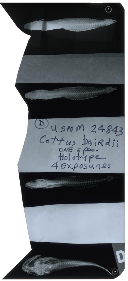
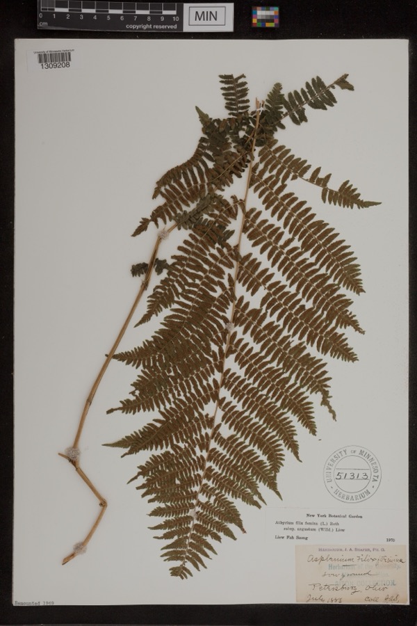
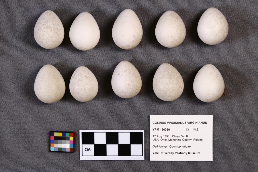
evidence. Museums hold 404 specimens
collected within 10 miles of Lake Hamilton Dam between 1853 and
1974: 237 Animalia, 161 Plantae, 5 Fungi, 1 Chromista. 12 distinct Species records are shown.
Collected by A.E. Daugherty, B Withers, Baird, S. F. and others. Each is a
physical object with a catalogue
number, and each entry opens the museum's record. This is what was
collected and kept, not a survey of what lives here - nothing can be
concluded from a species being absent.
Regional context, not property-specific
evidence. The federal mineral resources record lists
4 workings within 5 miles of Lake Hamilton Dam: 3 past producers, 1 producer.
1 still produces. What was taken out: Stone, Crushed/Broken, Sand and Gravel, Construction, Limestone, General. Distance is straight-line from the
map coordinates, so a quarry counted here may appear on a neighbouring
settlement's page as well.
Regional context, not property-specific
evidence. The National Weather Service names
Struthers, the town this property stands in, in 12 storm reports between 1999 and 2024: 9 thunderstorm wind, 3 hail.
No death or injury is recorded in these reports. Each account below is quoted exactly as the forecast office
filed it, from the NOAA Storm Events Database, and each date
opens the federal record of that event.
Thunderstorm downburst winds downed several large trees along Midlothian Boulevard. A vehicle parked along Midlothian Boulevard just west of Market Street was crushed by a tree. Several trees were also reported down along Hillman Street. An automobile dealership along Oak Street lost a large section of roofing. A second building was damaged on Marshall Street. Scattered power outages were reported in the area.
No historic map-sheet match is published
for this property yet. That does not mean no map exists. This record needs
a coordinate-quality review before it can be joined to a sheet boundary.
Browse the county's mapped places while that work is
pending.
Named in the fire insurance atlases
Sanborn surveyors printed an index of the
town's establishments at the front of each atlas. This property is named in
one, read straight off the scanned sheet.
When this property was proposed for the
National Register, someone wrote the case for it: what the building is,
and why it matters. That document is a federal record in the public domain.
It is quoted below word for word, never summarised. The text was read off the scanned case file by machine, so the
occasional stray character is the recogniser's and the 1970s
typewriter's.
Description of the property
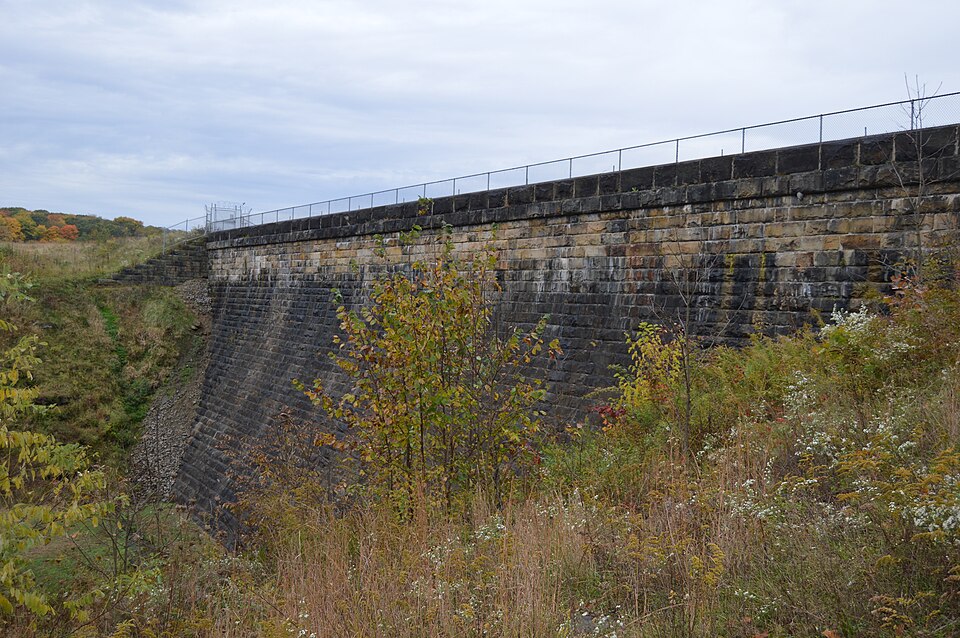
The dam is a cyclopean concrete gravity dam with Ashlar gallons can be discharged every 24 hours. coffin valve and gatewheel provide the means to drain the lake NPS Form 10-900-a OMB No. 1024-0018 Exp. 10-31-84 Lake Hamilton Dam, Mahoning County, Ohio upstream of the original, resulting in a 2-tiered configuration. which 4 Ludlow gate valves,24x24 inches, are placed. These are At the bottom of the gorge, extending east, from the gatehouse, point 1200 feet downstream of the dam. Within this tunnel lies 18" pipelines are blanked from the 30" line. A 24" line has been The pipeline, as it leaves the tunnel, crosses the ravine feet. (3-82) Inventory-Nomination Form Continuation sheet received ordinary pipeline.
THE AQUEDUCT THE GATEHOUSE date entered Little reason exists to include the entire hydraulic on the It is an Ogee concrete gravity-type structure. National Register as it amounts to what is nothing more than an The outflow hydraulic system consists of an iron main 48 dozen manholes or culverts were observed along its length.There National Park Service National Register of Historic Places staggered across the width of the gatehouse.
They extend from the inches in diameter that extends northeast from the gatehouse over the gorge to its crest.It has a partition in the center in were no other weirs or waste weirs.This pipeline is capable of United States Department of the Interior of the dam.Itiis constructedof Ashlar cut sandstone..It is The older stone spillway provides a stilling pool for the tunnel was bored through solid bedrock and terminates at a of 1.3 miles where it terminates at Lowellville Road.One half newer one.The difference in height between the two tiers is 12.5 connected to the 30"line and this extends through the remaining base of the gate house to the bottom of the lake gorge.
(in ohd Paragraph) Mahoning Valley Water Co. stone masonry dam construction in the state of Ohio and, by extension, in the United States. It is also significant from an of cyclopean or concrete rubble fill usage in masonry dam Designed in 1904 by civil engineer David M. Wise, Hamilton quarried near New Castle, Pennsylvania. The face or finish of the is straight, parallel, and continuous; a type of course called 1600-1699 1400-1499 1500-1599 1800-1899 1700-1799 commerce communications military archeology-historic humanitarian Period politics/government social/ exploration/settlement invention agriculture laid. engineering perspective as it represents oneof the finest examples and squared.This cut stone is then classed according to the bond method. _economics 8.
Significance is an artistic structural work only made obsolete through further technological advances in dam building. Hamilton Dam is significant with respect to the engineering law masonry construction or it would not have lasted this long.It (not to exceed one half inch),and the arrangement of the courses modifications or alterations have been placed upon the dam to The joints do not exceed one half inch.The course of the stone configuration or design in the state.Experts have been unanimous in pronouncing the dam to be one of the finest examples of "architecture conservation the present time attestingto its strength and stability. Tube Co.which opened the city of Youngstown and the entire squared precisely.
Quoted from the National Register nomination
for reference 84003774, 29 pages, held by the National Archives in Record
Group 79. See the
catalogue record.
Listed places nearby
6 within 8 miles
Other National Register properties close
enough to walk or drive between, ordered by distance from this one. Both
positions come from the same geocoding pass that matched these properties
to their map sheets.
Listing record. National Park Service National Register of Historic Places, listed-properties dataset, current to 2026-05-22.
Map join. Address geocoded through the United States Census geocoder, then tested against the published boundary of every sheet in the USGS Historical Topographic Map Collection.
How this page is made. Listing fields come from federal records; map-sheet coverage is a labelled coordinate-to-boundary calculation, not a source-field claim.
Wildfire. Short, Karen C. 2022. Spatial wildfire occurrence data for the United States, 1992-2020 [FPA_FOD_20221014]. 6th Edition. Fort Collins, CO: Forest Service Research Data Archive. https://doi.org/10.2737/RDS-2013-0009.6 Collected with United States Government funding and usable without additional permissions or fees.
Specimens. Global Biodiversity Information Facility (GBIF), https://www.gbif.org/. Only records licensed CC0 or CC BY are used. Records licensed CC BY-NC are excluded because this site carries advertising. Images are checked individually and any whose licence is non-commercial, no-derivatives or unreadable is refused.
Mines and quarries. USGS Mineral Resources Data System (MRDS) https://mrdata.usgs.gov/mrds/ A work of the United States government, no copyright under 17 U.S.C. 105.
Storms. NOAA National Centers for Environmental Information, Storm Events Database https://www.ncei.noaa.gov/stormevents/ A work of the United States government, no copyright under 17 U.S.C. 105. Narratives are quoted verbatim from the National Weather Service report and are not edited or summarised.
 Block
Block