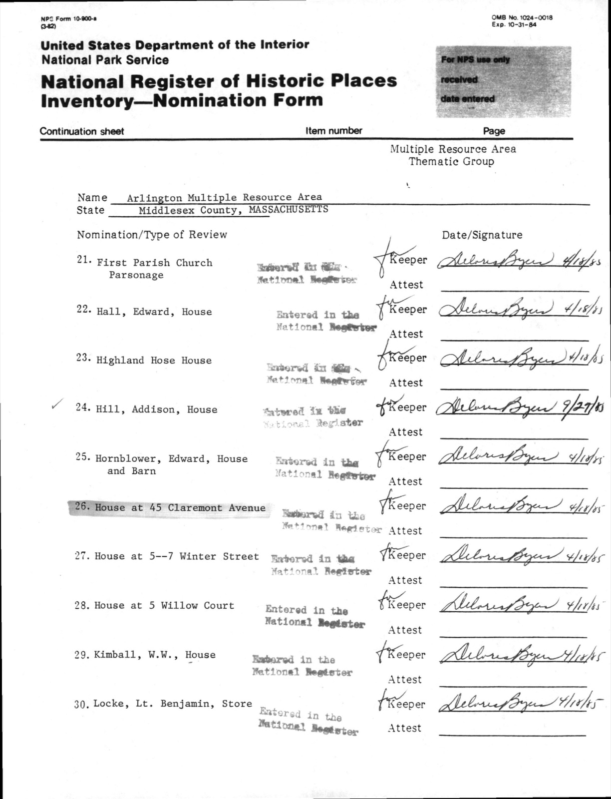
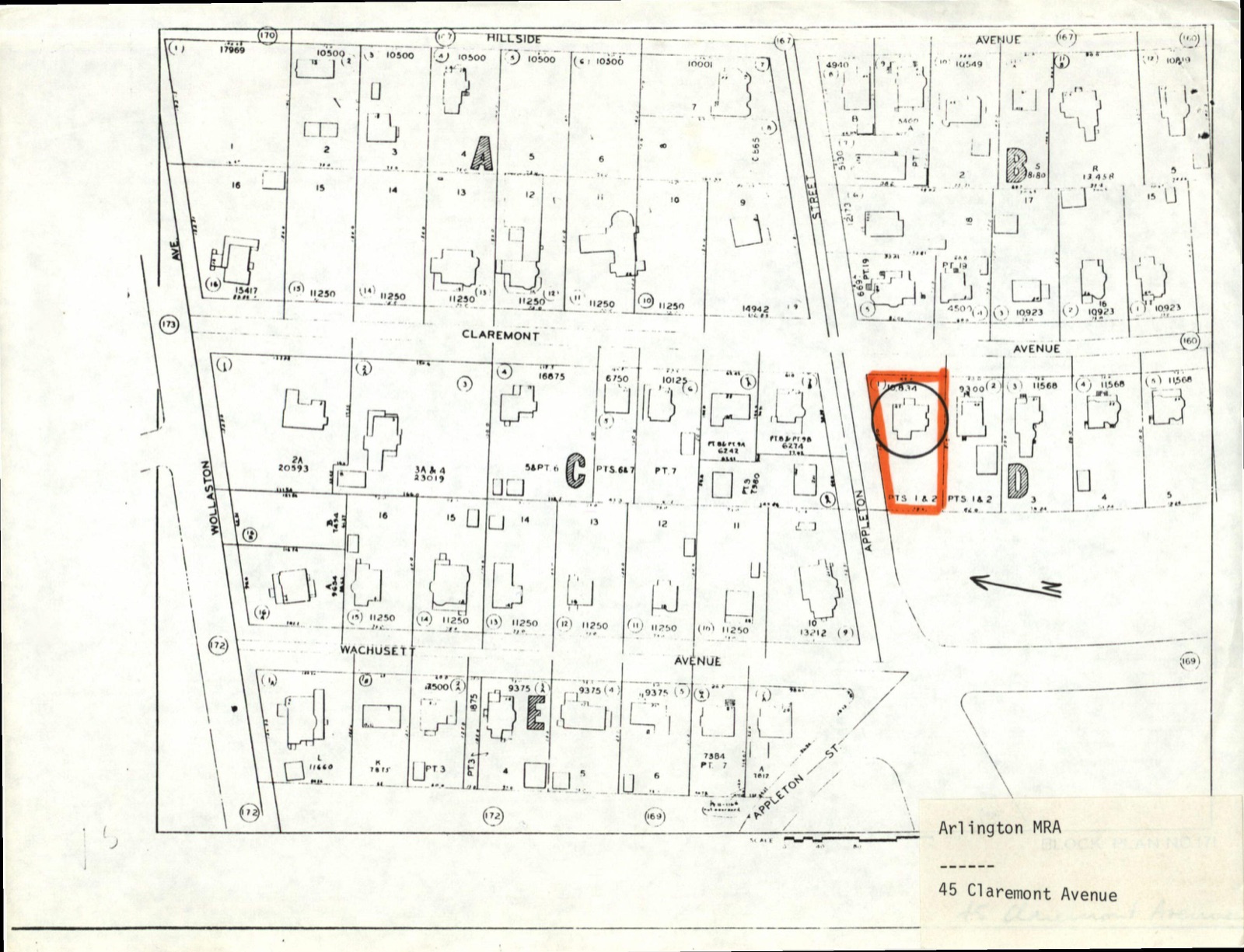
Photographs from the nomination case file, National Park Service records.
House at 45 Claremont Avenue
Listed on the National Register of Historic Places in
1985. A historic map-sheet match is not published yet. The record needs a coordinate-quality review before it can be joined to a sheet boundary.
From the record
“rounded, lie made no further attempt to check his pursuers, but gave himself up to inglorious flight. It consisted of eleven hundred men, and two pieces of artillery, under the command of Ixinl I'erey.”
History of Middlesex County, Massachusetts (1880). Machine-read text.
one of 1100 National Register listings in Middlesex County · listed in 1985 · category: Building · one of 3 National Historic Landmarks in Middlesex County.
National Register reference number.85001036- the number the National Park Service assigned this property when it was listed, and the key its nomination file is catalogued under at the National Archives.
What happened here
An account from the chapter on Lexington town, The inset identifies its exact
source book and publication year.
He was first taxed in 1748< He was a member of Capt. Parker's company on the morning of 19 April 1775, and was severely wounded by a bullet which struck his right arm, and so fractured the bone that he was not only disabled for a long time, but pieces of bone were extracted from it for several months afterward.
Southwesterly of Francis Whitmore, and near the present Arlington and Belmont lines, was the Bowman family. Nathaniel Bowman, of Watertown, purchased land of Edward Goffee, in Cambridge Farms, to which he removed. He died in 1682, leaving his real estate to liis son Francis, by will, dated 1679. Francis died in 1687, leaving, among other children, Francis and Joseph, who became very prominent men in Lexington. They resided on or near Watertown street, in the neighborhood of the present residence of the Lawrences.
In the meantime the Committees of Safety and of Supplies, which generally met together, were in session almost daily, using the most efficient means in their power to put the Province in a proper state of defence. On the 14th of March, being in session at the house of Captain Stedman, in Cambridge, and anticipating some movement on the part of General Gage, they voted " That watches be kept constantly at places where the ^Provincial magazines are kept." They also requested the Committees of Charlestown, Cambridge, and Roxbury, " to procure at least two men for a watch every night, to be placed in each of these towns, and that the said members be in readiness to send couriers forward to the towns where the magazines are placed, when sallies are made from the army by night." Pursuant to this request, on the day following, the committees directed Colonel Barrett of Concord, " to engage a sufficient number of faithful men to guard the colony magazines in that town, and to keep a suitable number of teams in constant readiness by day and by night, on the shortest notice to remove the stores ; and also to provide couriers to alarm the neigliboring towns, on receiving any information of any movement of the king's troops." The committees were in session at Concord on the 17th of April, and adjourned to meet at Menotomy, now Arlington, at Witherby's tavern the next day.^
Regional context, not property-specific
evidence. The
federal wildfire occurrence database
lists 50 fires within 5 miles of House at 45 Claremont Avenue between
1992 and 2020, burning about 101 acres in total. 1 started naturally. 24 were recorded as arson.
Distance is straight-line from the map coordinates, so a fire counted
here may appear on a neighbouring settlement's page as well.
Reported cause
Fires
Arson/incendiarism
24
Missing data/not specified/undetermined
12
Debris and open burning
10
Other causes
1
Misuse of fire by a minor
1
Natural
1
Recreation and ceremony
1
The most recent of
them, most recent first, with the day each was reported and the service
that recorded it.
Regional context, not property-specific
evidence. Museums hold 2,152 specimens
collected within 10 miles of House at 45 Claremont Avenue between 1898 and
1975: 943 Animalia, 678 Plantae, 465 Fungi, 30 Protozoa, 17 Bacteria, 10 Chromista, 9 Unrecorded. 12 distinct Species records are shown.
Collected by ?, A B Seymour, A B. Proper and others. Each is a
physical object with a catalogue
number, and each entry opens the museum's record. This is what was
collected and kept, not a survey of what lives here - nothing can be
concluded from a species being absent.
Regional context, not property-specific
evidence. The federal mineral resources record lists
12 workings within 5 miles of House at 45 Claremont Avenue: 9 past producers, 3 producers.
3 still produce. What was taken out: Sand and Gravel, Construction, Stone, Crushed/Broken, Peat, Clay. Distance is straight-line from the
map coordinates, so a quarry counted here may appear on a neighbouring
settlement's page as well.
Regional context, not property-specific
evidence. The National Weather Service names
Arlington, the town this property stands in, in 11 storm reports between 1998 and 2022: 7 thunderstorm wind, 2 hail, 1 flash flood, 1 flood.
No death or injury is recorded in these reports. Each account below is quoted exactly as the forecast office
filed it, from the NOAA Storm Events Database, and each date
opens the federal record of that event.
A microburst occurred in Arlington, downing numerous trees. Most of these trees were downed in an approximately 1 square mile section of eastern Arlington, between the intersection of Massachusetts Avenue and Broadway and Route 16 around the Cambridge/Arlington line. Numerous houses and vehicles were damaged by downed trees. Traffic signals and street lights were also damaged or downed by falling trees/wind.
Several trees and branches were downed at the corner of Washington and Arnold by thunderstorm winds. A tree was downed onto a car on Howard Street. A large branch on Dudley Street was downed onto wires.
In Arlington, a tree fell into a house on Hamlet Street. A tree was down on Quincy Street. |A tree was down on Allen Street near Broadway. A tree and wires were down on Sunnyside Avenue. A tree limb fell into the side of a house on Davis Avenue.
No historic map-sheet match is published
for this property yet. That does not mean no map exists. This record needs
a coordinate-quality review before it can be joined to a sheet boundary.
Browse the county's mapped places while that work is
pending.
From the nomination file
975 words on record
When this property was proposed for the
National Register, someone wrote the case for it: what the building is,
and why it matters. That document is a federal record in the public domain.
It is reproduced in full on its own page, word for word and never summarised. The text was read off the scanned case file by machine, so the
occasional stray character is the recogniser's and the 1970s
typewriter's.
Quoted from the National Register nomination
for reference 85001036, 7 pages, held by the National Archives in Record
Group 79. See the
catalogue record.
Listed places nearby
6 within 8 miles
Other National Register properties close
enough to walk or drive between, ordered by distance from this one. Both
positions come from the same geocoding pass that matched these properties
to their map sheets.
Listing record. National Park Service National Register of Historic Places, listed-properties dataset, current to 2026-05-22.
Map join. Address geocoded through the United States Census geocoder, then tested against the published boundary of every sheet in the USGS Historical Topographic Map Collection.
How this page is made. Listing fields come from federal records; map-sheet coverage is a labelled coordinate-to-boundary calculation, not a source-field claim.
Wildfire. Short, Karen C. 2022. Spatial wildfire occurrence data for the United States, 1992-2020 [FPA_FOD_20221014]. 6th Edition. Fort Collins, CO: Forest Service Research Data Archive. https://doi.org/10.2737/RDS-2013-0009.6 Collected with United States Government funding and usable without additional permissions or fees.
Specimens. Global Biodiversity Information Facility (GBIF), https://www.gbif.org/. Only records licensed CC0 or CC BY are used. Records licensed CC BY-NC are excluded because this site carries advertising. Images are checked individually and any whose licence is non-commercial, no-derivatives or unreadable is refused.
Mines and quarries. USGS Mineral Resources Data System (MRDS) https://mrdata.usgs.gov/mrds/ A work of the United States government, no copyright under 17 U.S.C. 105.
Storms. NOAA National Centers for Environmental Information, Storm Events Database https://www.ncei.noaa.gov/stormevents/ A work of the United States government, no copyright under 17 U.S.C. 105. Narratives are quoted verbatim from the National Weather Service report and are not edited or summarised.
 Block
Block