 Block
South Sioux Falls, South Dakota
9 topographic sheets cover this place, the earliest surveyed in 1955 and the latest in 1985. It stands in Sioux Falls City. It lies in ZIP code area 57105. The Survey maps it on the Sioux Falls East quadrangle. The federal gazetteer marks this settlement historical: it is no longer a populated place, though the surveys that recorded it still are.
On record in South Sioux Falls
Buildings and businesses the archive holds for this place. Each opens its own page, with the source record it came from.
On the National Register within a mile 2 records
The National Register names another town for these. They stand within one mile of this settlement's coordinate.
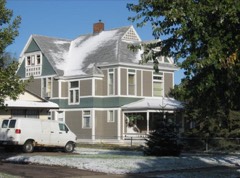 E. J. and Alice Daniels Houselisted 1989 · 1.0 miles away
- Berdahl-Rolvaag Houselisted 1979 · 0.8 miles away
Topographic sheets covering this place
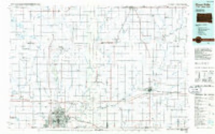
4 surveys from 9 printed sheetsMatched by testing this settlement's coordinate against the published boundary of every sheet in the United States Geological Survey's historical collection. Each opens the scanned sheet at the Survey.
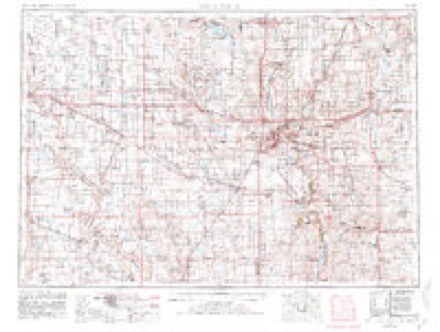
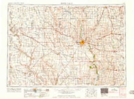
- 1955 USGS Sioux Falls quadrangle1:250000, 3 printings
- 1958 USGS Sioux Falls quadrangle1:250000
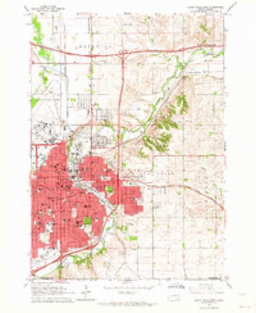
- 1962 USGS Sioux Falls East quadrangle1:24000, 3 printings
- 1985 USGS Sioux Falls quadrangle1:100000, 2 printings
In the county-history sources
79,863 words on this townshipHistory of Minnehaha County, South Dakota. Containing an Account of Its Settlements, Growth, Development and Resources ... Synopsis of Public Records, Biographical Sketches .., published 1899 names this settlement in its chapter on Sioux Falls City. These are the passages that mention it, exactly as the scans read.
During- the years 1888 and 1889 several industries had been established at South Sioux Falls. The South Sioux Falls Railroad and Rapid Transit line of road had been completed to this point, and evervthinof looked prosperous and promising- for a rapid and wonderful growth of the lively little burg- which had sprung- into existence so suddenly.
Passage source: History of Minnehaha County, South Dakota. Containing an Account of Its Settlements, Growth, Development and Resources ... Synopsis of Public Records, Biographical Sketches .., published 1899.
All the prerequisites having- been duly complied wnth for the organization of a town, a petition was presented by the residents and landowners of the southwest quarter of section 28, the south half of sections 29 and 30, sections 31, 32, and the northwest quarter of section 33 in Sioux Falls township, and sections 25 and 36, and the east half of sections 26 and 35 in Wayne township, asking- the board of county commissioners to order an election to determine whether the inhabitants of such territory desired to incorporate as the Town of South Sioux Falls. The prayer of the petitioners was g-ranted, and the board ordered an election held on the 20th day of February, 1890. The election was held at the Woolen Mills, and all the votes cast (thirty-seven) were in favor of incorporation. The territory was divided into three districts, and on the 21st day of March, 1890, J. M. Eley, Fred Frost, Sr., and S. D. Perkins were elected trustees, Fred Spoerl clerk, M. F. Drake assessor, C. S. Law^rence treasurer, J, P. Wilbur marshal and William Ging-erich justice. July 1, S. D. Perkins was elected president of the board, and a corporate seal was ordered procured. July 9, the board, upon the petition of the owners of hve-eig-hts of the property, passed a resolution submitting to the voters the question of bonding- the town in the sum of S7(>,0()() for the purpose of constructing- a system of water works and sewerage, and to defray the expense of a plant for lig-hting- the town. The election was held June 31, and all the votes cast (fifty in number) w^ere in the affirmative. November 3, C. S. Lawrence having- moved away, C.E. Fickes was appointed treasurer; and on the same dav the board allowed bills which had been incurred to the amount of 81,673.08.
Passage source: History of Minnehaha County, South Dakota. Containing an Account of Its Settlements, Growth, Development and Resources ... Synopsis of Public Records, Biographical Sketches .., published 1899.
R. F. Pettig-rew was not only the promoter of the packing- house, but he was the prime mover in establishing- several industrial enter- ])rises at South Sioux Falls. The woolen mill enterprise was one of the first. These mills were in operation in 1889-90. A soap factory was built about the same time, and an axle g-rease factory a little later. A starch factory was built in 1892. A larg-e hotel was erected in 1889, and opened for business in the fall of that year. The foundation for a Presbyterian church building- was laid, but the project went no further. The packing- house plant, the most important of the enterprises, is within the town of South Sioux Falls, and is the only one in operation at the present time. But the other plants onh' require to be set in motion to make South Sioux Falls one of the most active and important manufacturing- points in this part of the state.
Passage source: History of Minnehaha County, South Dakota. Containing an Account of Its Settlements, Growth, Development and Resources ... Synopsis of Public Records, Biographical Sketches .., published 1899.
Machine-read from a century-old scan, so expect the errors a machine makes: misspelled names, dropped words, stray characters.
Read the whole chapter on Sioux Falls City - it names this place 4 more 4 times.
Fires near this place
113 since 1999Regional context, not property-specific evidence. The federal wildfire occurrence database lists 113 fires within 5 miles of South Sioux Falls (historical) between 1999 and 2020, burning about 626 acres in total. 3 started naturally. 2 were recorded as arson. Distance is straight-line from the map coordinates, so a fire counted here may appear on a neighbouring settlement's page as well.
| Reported cause | Fires |
|---|---|
| Missing data/not specified/undetermined | 66 |
| Debris and open burning | 23 |
| Equipment and vehicle use | 5 |
| Fireworks | 5 |
| Smoking | 3 |
| Natural | 3 |
| Misuse of fire by a minor | 3 |
| Arson/incendiarism | 2 |
| Other causes | 1 |
| Recreation and ceremony | 1 |
| Power generation/transmission/distribution | 1 |
The most recent of them, most recent first, with the day each was reported and the service that recorded it.
| Date | Cause | Size | Reported by | Name on the report |
|---|---|---|---|---|
| 19 September 2012 | Missing data/not specified/undetermined | 160 acres | South Dakota Wildland Fire Suppression | CORN FIELD FIRE |
| 4 August 2012 | Missing data/not specified/undetermined | 1.0 acres | South Dakota Wildland Fire Suppression | CLUBHOUSE |
| 4 August 1999 | Smoking | under an acre | Alcester Volunteer Fire Department | LEE Z. |
| 25 August 1999 | Misuse of fire by a minor | under an acre | Sioux Falls Fire Department | 1605 S. SILVER CREEK |
| 2 August 2007 | Missing data/not specified/undetermined | under an acre | South Dakota Wildland Fire Suppression | not named |
| 11 August 1999 | Natural | 1.0 acres | Mound City Volunteer Fire Department | KON THORSTENSON |
| 10 August 2012 | Missing data/not specified/undetermined | under an acre | South Dakota Wildland Fire Suppression | STOCKDAM |
| 9 July 2015 | Missing data/not specified/undetermined | under an acre | South Dakota Wildland Fire Suppression | HCFD10136 |
Settlements close enough to share some of these fires:
Mines and quarries near this place
10 of 14 shownRegional context, not property-specific evidence. The federal mineral resources record lists 14 workings within 5 miles of South Sioux Falls (historical): 6 producers, 6 unknowns, 2 past producers. 6 still produce. What was taken out: Sand and Gravel, Construction, Stone, Crushed/Broken. Distance is straight-line from the map coordinates, so a quarry counted here may appear on a neighbouring settlement's page as well.
| Where | Site | Commodity | Status | Recorded |
|---|---|---|---|---|
| Concrete Materials Co Quarry | Stone, Crushed/Broken | Producer | ||
| Concrete Materials Company Quarry | Stone, Crushed/Broken | Producer | ||
| Quartzite Quarry | Stone, Crushed/Broken | Unknown | ||
| Quartzite Quarry | Stone, Crushed/Broken | Unknown | ||
| Wisconsin Granite Co. | Stone, Crushed/Broken | Past Producer | ||
| Beckman Sand and Gravel Pit | Sand and Gravel, Construction | Producer | ||
| Bill Gage Gravel Pit | Sand and Gravel, Construction | Past Producer | ||
| Eagle Sand and Gravel Co. | Sand and Gravel, Construction | Unknown | ||
| Friessen Sand and Gravel Pit | Sand and Gravel, Construction | Producer | ||
| Friessens West Pit | Sand and Gravel, Construction | Producer |
Nearest settlements
The eight closest, with where each one stands in the county. Distances are straight-line, computed from the Geographic Names Information System coordinates.
| Map | Place | Distance | Sheets |
|---|---|---|---|
| Sioux Falls | 3.1 miles | 9 | |
| Hayward Addition | 3.9 miles | 9 | |
| Split Rock Heights | 4.4 miles | 9 | |
| Silver Valley Addition | 4.4 miles | 9 | |
| Cactus Heights | 4.7 miles | 9 | |
| Norton Acres | 4.7 miles | 9 | |
| Froelich Addition | 5.0 miles | 9 | |
| Webster Grove Addition | 5.1 miles | 9 |
Provenance
This settlement is recorded in the Geographic Names Information System as feature 2647291. The sheet list is computed by point-in-boundary test against the United States Geological Survey's historical topographic inventory. Both are works of the United States government and carry no copyright under 17 U.S.C. 105.
Wildfire. Short, Karen C. 2022. Spatial wildfire occurrence data for the United States, 1992-2020 [FPA_FOD_20221014]. 6th Edition. Fort Collins, CO: Forest Service Research Data Archive. https://doi.org/10.2737/RDS-2013-0009.6 Collected with United States Government funding and usable without additional permissions or fees.
Mines and quarries. USGS Mineral Resources Data System (MRDS) https://mrdata.usgs.gov/mrds/ A work of the United States government, no copyright under 17 U.S.C. 105.