 Block
BlockDoud, Texas
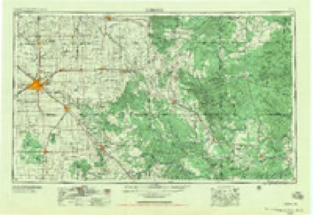
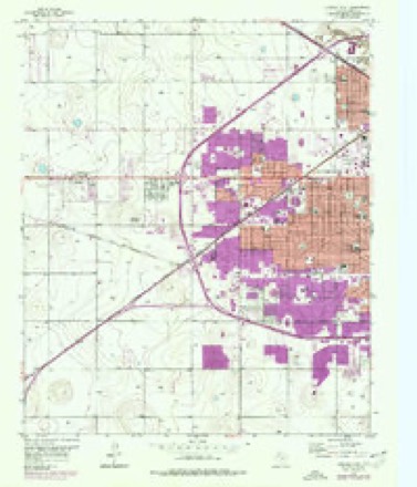
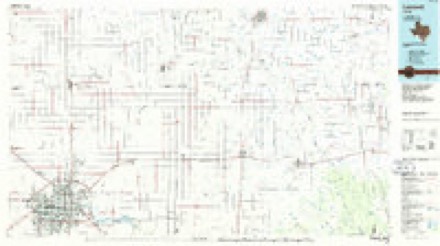
10 topographic sheets cover this place, the earliest surveyed in 1954 and the latest in 1986. It stands in the Lubbock census division. It lies in ZIP code area 79414. The Survey maps it on the Lubbock West quadrangle.
Topographic sheets covering this place
4 surveys from 10 printed sheetsMatched by testing this settlement's coordinate against the published boundary of every sheet in the United States Geological Survey's historical collection. Each opens the scanned sheet at the Survey.
- 1954 USGS Lubbock quadrangle1:250000, 4 printings
- 1957 USGS Lubbock quadrangle1:62500
- 1957 USGS Lubbock West quadrangle1:24000, 3 printings
- 1986 USGS Lubbock quadrangle1:100000, 2 printings

Fires near this place
167 since 2006Regional context, not property-specific evidence. The federal wildfire occurrence database lists 167 fires within 5 miles of Doud between 2006 and 2019, burning about 123 acres in total. 1 started naturally. 6 were recorded as arson. Distance is straight-line from the map coordinates, so a fire counted here may appear on a neighbouring settlement's page as well.
| Reported cause | Fires |
|---|---|
| Missing data/not specified/undetermined | 105 |
| Smoking | 16 |
| Debris and open burning | 12 |
| Power generation/transmission/distribution | 12 |
| Railroad operations and maintenance | 6 |
| Equipment and vehicle use | 6 |
| Arson/incendiarism | 6 |
| Misuse of fire by a minor | 2 |
| Other causes | 1 |
| Natural | 1 |
The most recent of them, most recent first, with the day each was reported and the service that recorded it.
| Date | Cause | Size | Reported by | Name on the report |
|---|---|---|---|---|
| 9 September 2010 | Natural | 1.0 acres | Texas A & M Forest Service | 2010-75 |
| 7 September 2015 | Debris and open burning | 3.0 acres | Texas A & M Forest Service | 2015-106 |
| 6 September 2011 | Missing data/not specified/undetermined | under an acre | Texas A & M Forest Service | 12002 FRANKFORD AVENUE |
| 3 September 2012 | Power generation/transmission/distribution | 1.0 acres | Texas A & M Forest Service | 2012-87 |
| 29 September 2011 | Missing data/not specified/undetermined | under an acre | Texas A & M Forest Service | 1902 56TH STREET |
| 20 September 2008 | Equipment and vehicle use | 1.0 acres | Texas A & M Forest Service | not named |
| 2 September 2015 | Railroad operations and maintenance | 2.0 acres | Texas A & M Forest Service | 2015-102 |
| 9 August 2011 | Arson/incendiarism | under an acre | Texas A & M Forest Service | 6206 KNOXVILLE DR |
Settlements close enough to share some of these fires:
Storms near this place
33 since 2009Regional context, not property-specific evidence. The National Weather Service names Doud in 33 storm reports between 2009 and 2026: 11 hail, 9 thunderstorm wind, 4 heavy rain, 4 flash flood. The reports record 3 injuries. Each account below is quoted exactly as the forecast office filed it, from the NOAA Storm Events Database, and each date opens the federal record of that event.
| When | Event | Place named | Harm | What the report says |
|---|---|---|---|---|
| April 2009 | Hail | Doud | 3 hurt, $20,000,000 | Giant two and a half inch hail stones fell over the South Haven, Sun Ridge, and Lake Ridge subdivisions of southwest Lubbock between Slide Road and Quaker Avenue around 15:40 CST. The hailstones damaged roofs and skylights on over a 1,000 homes in the mentioned subdivisions, and three persons sought medical treatment at local hospitals for minor injuries related to the hail. Hail stones also reportedly killed a number of birds. Well over 600 vehicles were damaged in these subdivisions and adjacent areas of the city. Damages in the mentioned subdivisions were estimated at $20 million, with hail damage across the city of Lubbock estimated to total $40 million. |
| April 2012 | Hail | Doud | $20,000,000 | A destructive high-precipitation supercell exited Hockley County and continued moving southeast across southwest Lubbock County. A significant hailswath accompanied this supercell with hailstones as large as baseballs at times. Reports of baseball size hail were received from the following locations: Slide Rd and 150th St, 120th St and Milwaukee Ave, and also along FM 41 just west and east of Highway 87. Damage to vehicles and homes in this hailswath was severe with many windshields, windows and skylights completely destroyed. Several hundred homes will likely require new roofs. |
| April 2009 | Hail | Doud | $15,000,000 | Multiple reports were received of two inch diameter hail in the Meadow South subdivision and adjacent areas of southwest Lubbock between Frankford Avenue and Slide Road shortly before 15:40 CST. Damage to roofs, skylights, and vehicles was widespread in this section of the city. More than 1,200 homes and approximately 500 vehicles were damaged in the mentioned subdivisions, with an estimated $15 million in economic loss. ||Hail damage across the city of Lubbock is estimated to total $40 million and resulted in three injuries. |
| August 2014 | Hail | Doud | $2,000,000 | A narrow swath of hail up to 1.25 inches in diameter traveled east from the South Plains Mall to near the U.S. Highway 84 exit on South Loop 289. This hailstorm was observed firsthand by NWS employees who stated the hail was very dense and fell for about 10 minutes without much wind. Countless vehicles in south Lubbock received numerous dents from this barrage of hail and some buildings (such as the Pyramid Plaza) suffered broken skylights. Insurance adjusters estimated several hundred homes with shingle roofs would need replacement due to damaged shingles. Combined property damage estimates could exceed $2 million. |
| July 2010 | Flood | Doud | $1,000,000 | Following the excessive rains and flash floods which occurred late on the 3rd and early on the 4th, residual flooding persisted in low lying areas of southern Lubbock County through much of the 6th. The most prolific flooding occurred near playa lakes. ||A number of Lubbock roadways remained closed due to lingering flooding, including: 73rd and Wayne, 74th and Memphis Avenue, Elgin and Flint Avenues south of Loop 289, Canyon Avenue and 70th Street near Trinity Church, North Quaker and Ursuline Streets, Erskine Street and Milwaukee Avenue, East 19th and Guava Avenue, the Broadway Street entrance to Mackenzie Park, Avenue W at 61st and 63rd Streets and University Avenue, 114th Street between Quaker Avenue and Indiana Avenue, and Quaker Avenue between 24th and 27th Streets. Flood waters slowly receeded in and around homes and businesses in these locations through the 6th.||In addition, prolonged standing flood waters caused extensive damages to cotton crops across the southern half of Lubbock County. Local agricultural officials declared that these damages totalled $2.8 million. ||In all, Lubbock County officials estimated that more than 300 homes and businesses sustained damages in the Fourth of July flash floods and floods. It is likely that more than 100 vehicles became stranded or otherwise damaged in the flood waters across the county. Although no serious injuries were reported, total economic losses were estimated at nearly $8.6 million by the Texas Department of Emergency Management and the Federal Emergency Management Agency. For the purposes of this report, these losses were differentiated by heavy rainfall, flash flood, and flood at $250,000, $4.5 million, and $3.8 million respectively. |
| August 2012 | Thunderstorm Wind | Doud | $350,000 | A downburst with winds estimated as high as 70 mph at times traveled northeast from near Frankford Avenue and Spur 327 in southwest Lubbock to the Lubbock International Airport and to just north of Idalou. Peak winds on the periphery of this downburst were officially measured at 63 mph at 2200 CST at a Texas Tech University West Texas Mesonet located 3WNW of the University, 59 mph at 2203 CST at the Lubbock ASOS, and 65 mph at 2223 CST at a KAMC weather station in Idalou. The downburst caused moderate damage to a greenhouse located at Lowe's Home Improvement store. At a nearby Home Depot store, the canopy to a greenhouse was partially damaged and several steel fence posts embedded in concrete were bent. At an apartment complex located near 50th Street and Slide Road, the roof of one unit was blown off. Damage to homes was generally light and consisted of some downed fences, broken rain gutters and torn roofing shingles. Many trees lost limbs of various sizes and in a few cases entire trees were toppled. Power outages were confined mostly to small grids in and around the path of the downburst. Total monetary damage from this downburst is estimated around $350,000; much of which was incurred at the home improvement stores. |
| June 2017 | Lightning | Doud | $50,000 | Lightning struck a two-story single family residence and proceeded to cause several small fires within the electrical wiring in the upstairs of the house. The family of four was uninjured, but displaced as fire crews tended to hot spots above the ceiling. |
| September 2012 | Thunderstorm Wind | Doud | $50,000 | A small bow echo with winds determined to be as high as 75 mph at times caused scattered damage from the western portions of Lubbock northeast to just north of Idalou. At Hays Field (located at Lubbock Christian University), the strongest winds toppled portions of a 15-foot tall center field brick wall. A short while later, approximately 20 vehicles at Texas Tech University lost their side windows from wind-blown gravel and small debris. Also, a nearby bus stop booth had five windows shattered from lofted debris. These winds also downed a light pole on Texas Tech's campus. As this storm continued moving east-northeast, high winds toppled a few vendor tents at the South Plains Fair. Fortunately, prompt warnings allowed attendees to seek appropriate shelter. Several instances of downed trees and power lines also accompanied this storm from the western sections of Lubbock to just north of Idalou where the storm decayed. Additionally, a house located southeast of Lubbock International Airport was struck by lightning; however, the extent of damage, if any, was not reported. |
| July 2016 | Thunderstorm Wind | Doud | $12,000 | A downburst toppled a few power poles, trees and power lines throughout portions of southwest Lubbock. |
| October 2010 | Heavy Rain | Doud | $10,000 | Skywarn storm spotters reported that heavy rainfall which accompanied a severe thunderstorm resulted in minor flooding in some Lubbock city streets. By 19:30 CST, 2.31 inches had been measured by the Automated Surface Observing System at Lubbock's Preston Smith International Airport. The Lubbock Police Department reported that vehicles stalled in ponding water along portions of the Buddy Holly Avenue and Marsha Sharp Freeway underpass, and along Slide Road and Fourth Street. No injuries or major damages were reported. |
| July 2009 | Lightning | Doud | $10,000 | Lightning struck a utility pole at the intersection of Slide Road and 98th Street in southwest Lubbock. As a result of the lightning strike, the top of the pole broke off and utility lines fell across 98th Street. No injuries were reported. |
| September 2010 | Heavy Rain | Doud | $10,000 | no account filed |
| August 2009 | Lightning | Doud | $10,000 | no account filed |
| May 2014 | Thunderstorm Wind | Doud | $2,000 | A power pole was downed on Quaker Avenue south of 82nd Street. |
| April 2013 | Thunderstorm Wind | Doud | $250 | A SKYWARN spotter observed an approximate 65 mph wind gust as a three and a half inch diameter tree limb was snapped west southwest of Lubbock. |
| February 2026 | Flash Flood | Doud | - | A cluster of mostly non-severe thunderstorms moved over the city of Lubbock early in the evening of the 13th. Abundant amounts of moisture in the atmosphere allowed for these storms to produce heavy rainfall over a short period of time. Several Texas Tech University West Texas mesonet sites within the city of Lubbock measured instantaneous rainfall rates of up to four inches per hour. These intense rainfall rates caused flash flooding on city streets for a brief period of time. |
| August 2025 | Flash Flood | Doud | - | Numerous reports were received of flash flooding within the city of Lubbock from law enforcement and members of the public. An intense thunderstorm slowly moved from southeast to northwest across the city of Lubbock producing heavy rainfall. Texas Tech University West Texas mesonet sites in the city of Lubbock recorded over an inch of rainfall in less than 20 minutes. |
| August 2025 | Flash Flood | Doud | - | Numerous reports were received of flash flooding within the city of Lubbock from law enforcement and members of the public. An intense thunderstorm slowly moved from southeast to northwest across the city of Lubbock producing heavy rainfall. Texas Tech University West Texas mesonet sites in the city of Lubbock recorded over an inch of rainfall in less than 20 minutes. |
| October 2023 | Flash Flood | Doud | - | Several rounds of heavy precipitation occurred from late on the first through the morning hours on the second. A number of roadways in the city of Lubbock became flooded. The heavy rain also caused the North Fork Double Mountain fork Brazos River to rise above flood stage on the southeast side of Lubbock. Farm to Market Road 835 west of Buffalo Springs Lake became inundated with flood waters and resulted in the closure of the road for a brief period on the second. |
| March 2020 | Hail | Doud | - | Numerous reports of penny size hail were reported across the western portion of the city of Lubbock with one report of quarter size hail near the intersection of Slide Road and US Highway 62/82. No damage was known. |
| July 2020 | Thunderstorm Wind | Doud | - | Local broadcast media relayed a picture of a power pole blown over near the intersection of 34th Street and South Loop 289. |
| March 2019 | Hail | Doud | - | Nickel size hail reported near 105th Street and Indiana Avenue. Damage information, if any, was not available. |
| May 2019 | Hail | Doud | - | A picture on social media showed mostly quarter sized hail with some half dollar size hail on the northwest side of the city of Lubbock. |
| May 2015 | Thunderstorm Wind | Doud | - | A traveling microburst downed several tree branches of two to three inches in diameter and snapped a power pole near 4th Street and Quaker Avenue. |
| May 2015 | Thunderstorm Wind | Doud | - | Estimated wind gust. |
| May 2015 | Hail | Doud | - | Multiple reports of hail of dime to quarter size occurred in an area centered around 4th Street and Slide Road. Damage, if any, was unknown. |
| June 2013 | Flood | Doud | - | A trained spotter reported minor street flooding at the intersection of 4th Street and Slide Road. |
| May 2011 | Hail | Doud | - | A NWS storm spotter reported penny size hail in west Lubbock. No damage was reported. |
| March 2010 | Heavy Rain | Doud | - | Local officials reported that ponding of water from heavy rainfall resulted in the temporary closure of 114th Street near Indiana, and North Flint between Harvard and U.S. Highway 84. No damages were reported. |
| September 2009 | Thunderstorm Wind | Doud | - | A local construction company reported that thunderstorm winds caused minor roof damage to a structure in northwest Lubbock. The winds were accompanied by small hail. No injuries were reported. |
| June 2009 | Hail | Doud | - | The broadcast media and trained storm spotters reported penny to quarter size hail in west Lubbock. |
| May 2019 | Hail | Doud | - | no account filed |
| September 2010 | Heavy Rain | Doud | - | no account filed |
Nearest settlements
The eight closest, with where each one stands in the county. Distances are straight-line, computed from the Geographic Names Information System coordinates.
| Map | Place | Distance | Sheets |
|---|---|---|---|
| West End Place | 1.6 miles | 10 | |
| West Carlisle | 2.6 miles | 10 | |
| Carlisle | 2.7 miles | 10 | |
| Lubbock | 4.6 miles | 11 | |
| Wolfforth | 5.1 miles | 9 | |
| Reese Village | 5.3 miles | 9 | |
| Hurlwood | 5.6 miles | 9 | |
| Broadview | 5.7 miles | 10 |
Provenance
This settlement is recorded in the Geographic Names Information System as feature 1356208. The sheet list is computed by point-in-boundary test against the United States Geological Survey's historical topographic inventory. Both are works of the United States government and carry no copyright under 17 U.S.C. 105.
Wildfire. Short, Karen C. 2022. Spatial wildfire occurrence data for the United States, 1992-2020 [FPA_FOD_20221014]. 6th Edition. Fort Collins, CO: Forest Service Research Data Archive. https://doi.org/10.2737/RDS-2013-0009.6 Collected with United States Government funding and usable without additional permissions or fees.
Storms. NOAA National Centers for Environmental Information, Storm Events Database https://www.ncei.noaa.gov/stormevents/ A work of the United States government, no copyright under 17 U.S.C. 105. Narratives are quoted verbatim from the National Weather Service report and are not edited or summarised.