 Block
Attica, Wisconsin
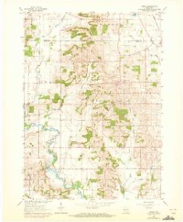
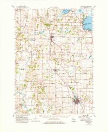
18 topographic sheets cover this place, the earliest surveyed in 1889 and the latest in 1981. It stands in Brooklyn town. It lies in ZIP code area 53502. The Survey maps it on the Attica quadrangle.
On record in Attica
Buildings and businesses the archive holds for this place. Each opens its own page, with the source record it came from.
On the National Register within a mile 1 record
The National Register names another town for these. They stand within one mile of this settlement's coordinate.
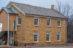 Cleveland's Hall and Blacksmith Shoplisted 2010 · 0.0 miles away
Topographic sheets covering this place
10 surveys from 18 printed sheetsMatched by testing this settlement's coordinate against the published boundary of every sheet in the United States Geological Survey's historical collection. Each opens the scanned sheet at the Survey.
- 1889 USGS Evansville quadrangle1:62500
- 1894 USGS Evansville quadrangle1:62500, 2 printings
- 1906 USGS Evansville quadrangle1:62500, 3 printings
- 1954 USGS Rockford quadrangle1:250000
- 1955 USGS Rockford quadrangle1:250000
- 1958 USGS Rockford quadrangle1:250000, 4 printings
- 1961 USGS Attica quadrangle1:24000, 2 printings
- 1961 USGS Evansville quadrangle1:62500, 2 printings
- 1963 USGS Rockford quadrangle1:250000
- 1981 USGS Monroe quadrangle1:100000





In the county-history sources
15,113 words on this townshipHistory of Green County, Wisconsin, published 1877 names this settlement in its chapter on Brooklyn Town. These are the passages that mention it, exactly as the scans read.
While the prairie in the eastern part was filling up, another settlement was growing in the south-east corner of the town, where in 1S43, Major Downer (so generally called Major that his Christian name is forgotten) built a saw mill on Sugar river. One or two log houses were built there about the same time. In November, '44, Chester Witter removed from Monticello to Downer's saw mill, as the place was called, and a few months later he and John S. Litchfield, of Exeter, built the first grist mill in Brooklyn. At the raisins' Mr. Geo. Durgin climbed to the ridge pole, and made a speech, in the course of which he gave the place the name of Winnesheek - a name rendered familiar to the earliest settlers of the countv by an Indian village where Freeport is now, and bv a Winnebago chief. Nearly ten years later, Connecticut people with more love of home than good taste changed the name to Milford. This name not proving satisfactory, but two or three years passed before the village was dubbed Attica.
Passage source: History of Green County, Wisconsin, published 1877.
W. W. Day had a store in Attica. At the present time the principle points of interest in Attica are Joseph Bartlett's saw and grist mills, J. Crampton's carding machine, a cheese factory, owned by a company, the stores of C. D. W. Leonard and Wm. Young, and a hotel. The southern part of Attica was originally included in the township of Albany, but was transferred to Brooklyn in answer to petitions from the village, the first of which was presented to the Countv Commissioners in November, 1851.
Passage source: History of Green County, Wisconsin, published 1877.
Across the town, diagonally from Attica, on land entered by Chas. Sutherland, is Brooklyn, the youngest village in the county. The necessity for this village began with the building of the Madison division of the Chicago & Northwestern Railway in 1864, and the first house was built that year by H. Capwell. Beginning in the corner of the county, on the east side of the railroad, the village was afterwards extended on the west side by Alonzo Melvin, whose farm', lying in the three counties of Dane, Rock, and Green, bounds it on the south and west. The village has also spread over into Dane. The leading business interests of the village are represented by E. G. Andrews and Son, produce merchants, whose elevator is the largest between Madison and Beloit; Melvin, Blair & Co., manufacturers of 140,000 pounds of American cheese per annum; Johnson & Gliddin, proprietors of a feed and planing mill and cheese box factory; L. J. Wilder, B. S. Axtell, Marvin Bros., merchants; Lovejoy and Richards, lumber dealers, and D. H. Glidden, proprietor of the hotel. One of the largest granges in the county is that which has a store in the village of Brooklyn. It numbers about a hundred members, and its weekly meetings, which are varied by debates, essays, and dramatic representations, are largely attended. Its members carry home books from their circulating library, and feel repaid for their long rides by the recreation, the general information, and the ability to conduct public meetings gained at the regular gatherings of the association. ,
Passage source: History of Green County, Wisconsin, published 1877.
Machine-read from a century-old scan, so expect the errors a machine makes: misspelled names, dropped words, stray characters.
Read the whole chapter on Brooklyn Town - it names this place 18 more 18 times.
Fires near this place
9 since 2014Regional context, not property-specific evidence. The federal wildfire occurrence database lists 9 fires within 5 miles of Attica between 2014 and 2020, burning about 74 acres in total. None started naturally. None was recorded as arson. Distance is straight-line from the map coordinates, so a fire counted here may appear on a neighbouring settlement's page as well.
| Reported cause | Fires |
|---|---|
| Debris and open burning | 7 |
| Missing data/not specified/undetermined | 2 |
The most recent of them, most recent first, with the day each was reported and the service that recorded it.
| Date | Cause | Size | Reported by | Name on the report |
|---|---|---|---|---|
| 29 May 2018 | Missing data/not specified/undetermined | under an acre | Wisconsin Department of Natural Resources | 201829 |
| 5 April 2018 | Debris and open burning | 2.0 acres | Wisconsin Department of Natural Resources | 3366 |
| 30 April 2018 | Debris and open burning | under an acre | Wisconsin Department of Natural Resources | 201826 |
| 30 April 2018 | Missing data/not specified/undetermined | 1.0 acres | Wisconsin Department of Natural Resources | 201825 |
| 28 April 2018 | Debris and open burning | 2.0 acres | Wisconsin Department of Natural Resources | 201823 |
| 23 April 2014 | Debris and open burning | 65 acres | Wisconsin Department of Natural Resources | DODGEVILLE CO-OP 8 |
| 1 April 2020 | Debris and open burning | 4.0 acres | Wisconsin Department of Natural Resources | 3661 |
| 31 March 2019 | Debris and open burning | under an acre | Wisconsin Department of Natural Resources | 201925 |
Settlements close enough to share some of these fires:
Mines and quarries near this place
5 within 5 milesRegional context, not property-specific evidence. The federal mineral resources record lists 5 workings within 5 miles of Attica: 3 past producers, 1 unknown, 1 producer. 1 still produces. What was taken out: Stone, Crushed/Broken, Sand and Gravel, Construction. Distance is straight-line from the map coordinates, so a quarry counted here may appear on a neighbouring settlement's page as well.
| Where | Site | Commodity | Status | Recorded |
|---|---|---|---|---|
| Schlapbach Pit | Sand and Gravel, Construction | Producer | ||
| Schlapback Pit | Sand and Gravel, Construction | Unknown | ||
| Kauk Quarry | Stone, Crushed/Broken | Past Producer | ||
| Thickpenny Quarry | Stone, Crushed/Broken | Past Producer | ||
| Waelchli | Stone, Crushed/Broken | Past Producer |
Storms near this place
7 since 1997Regional context, not property-specific evidence. The National Weather Service names Attica in 7 storm reports between 1997 and 2025: 4 hail, 1 thunderstorm wind, 1 tornado, 1 flood. No death or injury is recorded in these reports. Each account below is quoted exactly as the forecast office filed it, from the NOAA Storm Events Database, and each date opens the federal record of that event.
| When | Event | Place named | Harm | What the report says |
|---|---|---|---|---|
| February 2018 | Flood | Attica | $10,000 | The Sugar River reached moderate flood stage, cresting at 13.88 feet in Albany. Floodwaters cover a low spot on Highway EE near Albany Wildlife Area about 2 miles north of Albany. Floodwaters get into the basements of some homes along South Water Street and in the basements of a few businesses on North Water Street in downtown Albany. Floodwaters affect the back yards of a few homes along South Mill Street. Floodwaters are into Village Park. |
| June 1997 | Thunderstorm Wind | Attica | $2,000 | no account filed |
| April 2025 | Hail | Attica | - | Measured baseball sized hail. |
| June 2008 | Tornado (EF0) | Attica | - | This weak tornado resulted in only minor tree damage (large branches broken). It spun up near a ridge top just south of Nye Road about 3/4 mile east of CTH D, and moved east-northeast and dissipated about 1/3 mile northeast of the intersection of CTH X and Nye Road near the Sugar River. The starting and ending locations, with respect to lat/long pairs of numbers, were 42.77474/-89.50520 and 42.78138/-89.48163. DI#28 (TS), DOD2. Wind speed estimated at 65 knots (75 mph). Average path width was about 30 yards. |
| April 2025 | Hail | Attica | - | no account filed |
| April 2024 | Hail | Attica | - | no account filed |
| March 2007 | Hail | Attica | - | no account filed |
Nearest settlements
The eight closest, with where each one stands in the county. Distances are straight-line, computed from the Geographic Names Information System coordinates.
| Map | Place | Distance | Sheets |
|---|---|---|---|
| Exeter | 2.0 miles | 14 | |
| Mineral Point (historical) | 4.1 miles | 17 | |
| Dayton | 4.3 miles | 14 | |
| Albany | 4.9 miles | 17 | |
| Ross Crossing | 5.6 miles | 14 | |
| Monticello | 6.3 miles | 15 | |
| Brooklyn | 8.2 miles | 19 | |
| Schultz | 8.5 miles | 15 |
Provenance
This settlement is recorded in the Geographic Names Information System as feature 1560998. The sheet list is computed by point-in-boundary test against the United States Geological Survey's historical topographic inventory. Both are works of the United States government and carry no copyright under 17 U.S.C. 105.
Wildfire. Short, Karen C. 2022. Spatial wildfire occurrence data for the United States, 1992-2020 [FPA_FOD_20221014]. 6th Edition. Fort Collins, CO: Forest Service Research Data Archive. https://doi.org/10.2737/RDS-2013-0009.6 Collected with United States Government funding and usable without additional permissions or fees.
Mines and quarries. USGS Mineral Resources Data System (MRDS) https://mrdata.usgs.gov/mrds/ A work of the United States government, no copyright under 17 U.S.C. 105.
Storms. NOAA National Centers for Environmental Information, Storm Events Database https://www.ncei.noaa.gov/stormevents/ A work of the United States government, no copyright under 17 U.S.C. 105. Narratives are quoted verbatim from the National Weather Service report and are not edited or summarised.