 Block
Dayton, Wisconsin
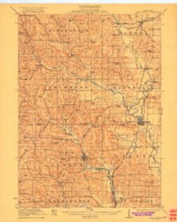
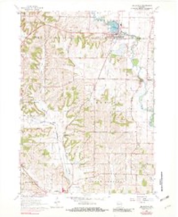
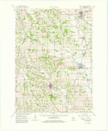
14 topographic sheets cover this place, the earliest surveyed in 1923 and the latest in 1981. It stands in Exeter town. It lies in ZIP code area 53508. It stands on Ross Crossing Creek. The Survey maps it on the Belleville quadrangle. It stands 899 feet above sea level.
Topographic sheets covering this place
8 surveys from 14 printed sheetsMatched by testing this settlement's coordinate against the published boundary of every sheet in the United States Geological Survey's historical collection. Each opens the scanned sheet at the Survey.
- 1923 USGS New Glarus quadrangle1:62500, 2 printings
- 1954 USGS Rockford quadrangle1:250000
- 1955 USGS Rockford quadrangle1:250000
- 1958 USGS Rockford quadrangle1:250000, 4 printings
- 1962 USGS Belleville quadrangle1:24000, 2 printings
- 1962 USGS New Glarus quadrangle1:62500, 2 printings
- 1963 USGS Rockford quadrangle1:250000
- 1981 USGS Monroe quadrangle1:100000





In the county-history sources
24,195 words on this townshipHistory of Green County, Wisconsin, published 1877 names this settlement in its chapter on Exeter Town. These are the passages that mention it, exactly as the scans read.
In the beginning were the lead mines. The Sauk, or Sugar River, diggings were situated a little over a mile southwest of the present village of Exeter. The squaws were the first miners, but they had neither the knowledge nor the tools to make their labor very profitable. With such instruments as they could make, they picked out the surface or float mineral ; and when their excavations became too deep to step into, they threw in a dead tree on which they climbed up and down. When a vein ran under the rock, they dug it out as far as they could reach, built a fire in the hole thus made, and, when the rock was heated, cracked it by pouring on water.
Passage source: History of Green County, Wisconsin, published 1877.
In 1842, Exeter had her first dance. It was at one of the taverns, for there were two taverns at that time, kept respectively by Ezra Durgin and Brainard Blodgfett. People were in attendance from Beloit and Illinois. They ate supper in the kitchen, and then took out the table and danced, two sets at a time, till morning.
Passage source: History of Green County, Wisconsin, published 1877.
In 1843, Exeter was platted, and, at the same time, transformed into the proudest of all little villages. She cherished the hope of becoming the metropolis of the county. Her pride was fed by Tom Somers, who said that though Monroe might fill her public square with court houses, she could not keep the county seat away from Exeter. For a number of years there were two furnaces, high hopes, a great deal of money, and mouths enough to drink five tons of coffee in a year, at Exeter. Then, lead grew less abundant; and, though Exeter would not see it, it was evident that the heyday of her youth and pleasure was ended. Her oldest friends left her, one by one, for California, and Tom Somers, her truest admirer, died ; there were none to sing her praises, and Dayton, her irrepressible younger sister, hinted that she was passe , and had better retire. The hint was received as a belle of acknowledged position is likely to receive such a hint from one who first disputes her sway. But, in the rivalry that ensued, the advantages of wealth and natural fitness for the desired pre-eminence were all with Dayton, and Exeter soon gave up the struggle. Yet Exeter has not now the appearance of a defrauded sister. Unlike Decatur, she makes no show of having known better days. All traces of the old life have passed away, leaving her, instead of the bitterness of disappointment, untroubled quiet and content.
Passage source: History of Green County, Wisconsin, published 1877.
Machine-read from a century-old scan, so expect the errors a machine makes: misspelled names, dropped words, stray characters.
Read the whole chapter on Exeter Town - it names this place 30 more 30 times.
Fires near this place
5 since 2007Regional context, not property-specific evidence. The federal wildfire occurrence database lists 5 fires within 5 miles of Dayton between 2007 and 2020, burning about 69 acres in total. None started naturally. None was recorded as arson. Distance is straight-line from the map coordinates, so a fire counted here may appear on a neighbouring settlement's page as well.
| Reported cause | Fires |
|---|---|
| Debris and open burning | 2 |
| Recreation and ceremony | 2 |
| Equipment and vehicle use | 1 |
The most recent of them, most recent first, with the day each was reported and the service that recorded it.
| Date | Cause | Size | Reported by | Name on the report |
|---|---|---|---|---|
| 25 August 2012 | Equipment and vehicle use | under an acre | Wisconsin Department of Natural Resources | TRACTOR FIRE |
| 5 April 2020 | Recreation and ceremony | 1.0 acres | Wisconsin Department of Natural Resources | 40 |
| 28 April 2018 | Debris and open burning | 2.0 acres | Wisconsin Department of Natural Resources | 1806349 |
| 23 April 2014 | Debris and open burning | 65 acres | Wisconsin Department of Natural Resources | DODGEVILLE CO-OP 8 |
| 3 November 2007 | Recreation and ceremony | under an acre | Wisconsin Department of Natural Resources | not named |
Settlements close enough to share some of these fires:
Mines and quarries near this place
2 within 5 milesRegional context, not property-specific evidence. The federal mineral resources record lists 2 workings within 5 miles of Dayton: 2 past producers. None of them still produces. What was taken out: Stone, Crushed/Broken. Distance is straight-line from the map coordinates, so a quarry counted here may appear on a neighbouring settlement's page as well.
| Where | Site | Commodity | Status | Recorded |
|---|---|---|---|---|
| Barteld Quarry | Stone, Crushed/Broken | Past Producer | ||
| Thickpenny Quarry | Stone, Crushed/Broken | Past Producer |
Storms near this place
23 since 1999Regional context, not property-specific evidence. The National Weather Service names Dayton in 23 storm reports between 1999 and 2025: 13 thunderstorm wind, 6 hail, 3 flash flood, 1 funnel cloud. No death or injury is recorded in these reports. Each account below is quoted exactly as the forecast office filed it, from the NOAA Storm Events Database, and each date opens the federal record of that event.
| When | Event | Place named | Harm | What the report says |
|---|---|---|---|---|
| August 2000 | Thunderstorm Wind | Dayton | $1,500,000 | no account filed |
| August 2007 | Flash Flood | Dayton | $400,000 | Flash flooding occurred in scattered locations between the northeast corner around Dayton down to the Brodhead area. Fast-flowing water of depths to 1 to 2 feet covered several roads in this area. In the Civil Town of Decatur, CTH F and CTH E were closed. In the Civil Town of Albany, Tin Can road between Zurfluh and CTH EE, CTH X at River Bridge, and River Road were closed. Some mudslides, soil erosion, and crop losses were also noted. At least 100 homes had some water damage to basement contents. WSR-88D Doppler overnight rainfall estimates ranged from around 3 inches over the southwest corner of the county to 5 to 6 inches over the northeast corner. |
| May 2001 | Thunderstorm Wind | Dayton | $100,000 | no account filed |
| May 2012 | Thunderstorm Wind | Dayton | $30,000 | A trained spotter reported trees and power lines downed by powerful thunderstorm wind gusts estimated at 80 mph (74 knots) in a swath from from 2 miles north of Dayton to Dayton. Roof shingles were blown off several homes. |
| July 1999 | Thunderstorm Wind | Dayton | $25,000 | no account filed |
| August 2007 | Thunderstorm Wind | Dayton | $20,000 | Powerful thunderstorm wind gusts to an estimated 61 knots (70 mph) toppled many large trees and damaged several power-lines. |
| July 2024 | Flash Flood | Dayton | $10,000 | Many roads closed due to high water on the east side of the county with some shoulder washouts. More specifically, there was scouring of pavement and shoulder material on County Road E just south of the Norwegian Creek bridge. |
| May 2012 | Thunderstorm Wind | Dayton | $10,000 | The Green County Emergency Manager reported shingles were blown off several homes by severe thunderstorm winds 2 miles north of Dayton. |
| July 2006 | Thunderstorm Wind | Dayton | $10,000 | Strong winds at minimum hurricane-force caused trees to topple onto roads. Some power-lines down. Some cars then crashed into fallen trees in Brooklyn. |
| May 2000 | Thunderstorm Wind | Dayton | $10,000 | no account filed |
| July 2023 | Thunderstorm Wind | Dayton | $6,000 | Multiple trees down in Brooklyn and along state road 104. |
| June 2013 | Flash Flood | Dayton | $6,000 | Law enforcement officials reported roads in the Dayton and Brooklyn areas closed due to flooding from heavy rains, with 1 to 3 feet of water cover the roadways. |
| July 2004 | Thunderstorm Wind | Dayton | $5,000 | no account filed |
| July 2004 | Hail | Dayton | $5,000 | no account filed |
| March 2005 | Thunderstorm Wind | Dayton | $500 | Large trees and a road sign were damaged. |
| June 2011 | Thunderstorm Wind | Dayton | - | Dozens of large trees were uprooted by powerful thunderstorm winds and broken tree branches in a 3-mile wide swath from 3 miles southeast of Dayton to the Albany area. Near the intersection of STH 59 and CTH F, a barn, built in the 1940s, was pushed over by the winds. A hanger at the Albany Airport on STH 59 was damaged by the winds. A few miles north-northwest of Albany the winds damaged some siding and the roof of a barn. |
| June 2008 | Thunderstorm Wind | Dayton | - | Powerful thunderstorm winds gusts knocked down several large trees. |
| April 2025 | Hail | Dayton | - | no account filed |
| April 2023 | Hail | Dayton | - | no account filed |
| June 2008 | Hail | Dayton | - | no account filed |
| April 2006 | Hail | Dayton | - | no account filed |
| April 2005 | Hail | Dayton | - | no account filed |
| June 1999 | Funnel Cloud | Dayton | - | no account filed |
Nearest settlements
The eight closest, with where each one stands in the county. Distances are straight-line, computed from the Geographic Names Information System coordinates.
| Map | Place | Distance | Sheets |
|---|---|---|---|
| Ross Crossing | 2.1 miles | 14 | |
| Exeter | 3.2 miles | 14 | |
| Attica | 4.3 miles | 18 | |
| New Glarus | 6.5 miles | 13 | |
| Monticello | 7.1 miles | 15 | |
| Brooklyn | 7.8 miles | 19 | |
| Mineral Point (historical) | 8.3 miles | 17 | |
| Albany | 9.2 miles | 17 |
Elsewhere
Matched on this settlement's Geographic Names Information System number rather than its name, so it cannot be a different place of the same name in another state.
| Wikipedia article on Dayton | An encyclopaedic summary. Its text is share-alike, so it is linked here rather than copied. |
| Wikidata item Q5243472 | The structured record the population and elevation above come from. Public domain (CC0). |
Provenance
This settlement is recorded in the Geographic Names Information System as feature 1563749. The sheet list is computed by point-in-boundary test against the United States Geological Survey's historical topographic inventory. Both are works of the United States government and carry no copyright under 17 U.S.C. 105.
Wildfire. Short, Karen C. 2022. Spatial wildfire occurrence data for the United States, 1992-2020 [FPA_FOD_20221014]. 6th Edition. Fort Collins, CO: Forest Service Research Data Archive. https://doi.org/10.2737/RDS-2013-0009.6 Collected with United States Government funding and usable without additional permissions or fees.
Mines and quarries. USGS Mineral Resources Data System (MRDS) https://mrdata.usgs.gov/mrds/ A work of the United States government, no copyright under 17 U.S.C. 105.
Storms. NOAA National Centers for Environmental Information, Storm Events Database https://www.ncei.noaa.gov/stormevents/ A work of the United States government, no copyright under 17 U.S.C. 105. Narratives are quoted verbatim from the National Weather Service report and are not edited or summarised.