 Block
Monticello, Wisconsin
15 topographic sheets cover this place, the earliest surveyed in 1920 and the latest in 1981. It stands in Monticello Village. It lies in ZIP code area 53570. It stands on West Branch Little Sugar River. The Survey maps it on the Monticello quadrangle. 1,192 people lived here at the 2020 count. It stands 837 feet above sea level.
On record in Monticello
Buildings and businesses the archive holds for this place. Each opens its own page, with the source record it came from.
On the National Register 1 record
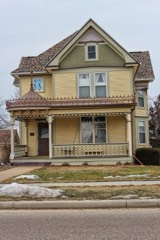 John C. and Barbara Steinman Houselisted 2003
Population over time
2 figuresMonticello fell from 1,217 to 1,192 between 2010 and 2020. These are the recorded population figures Wikidata holds for this place, reached through the Geographic Names Information System number this page is keyed on rather than by name, so they belong to this place and not to another of the same name. Most are census counts, but not all are: an early figure may be a founding or settlement estimate, and an estimate published within five years of a census is left out. The change column is computed, and is left blank where more than 20 years separate a figure from the one before it, because a gap that long is not a change between two counts.
| Year | People | Change |
|---|---|---|
| 2010 | 1,217 | |
| 2020 | 1,192 | -25 (-2%) |
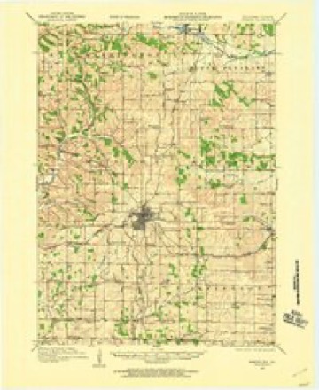
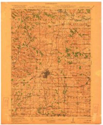
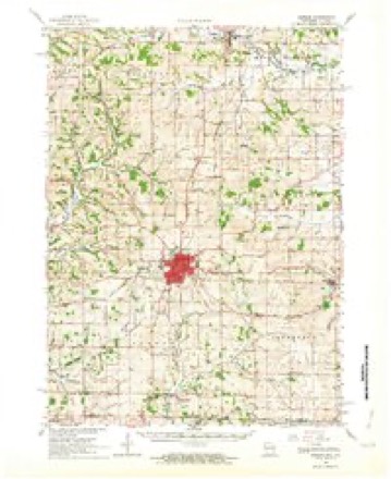
Topographic sheets covering this place
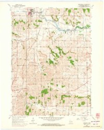
9 surveys from 15 printed sheetsMatched by testing this settlement's coordinate against the published boundary of every sheet in the United States Geological Survey's historical collection. Each opens the scanned sheet at the Survey.
- 1920 USGS Monroe quadrangle1:62500
- 1922 USGS Monroe quadrangle1:62500
- 1954 USGS Rockford quadrangle1:250000
- 1955 USGS Rockford quadrangle1:250000
- 1958 USGS Rockford quadrangle1:250000, 4 printings
- 1962 USGS Monroe quadrangle1:62500, 2 printings
- 1962 USGS Monticello quadrangle1:24000, 3 printings
- 1963 USGS Rockford quadrangle1:250000
- 1981 USGS Monroe quadrangle1:100000





In the county-history sources
15,892 words on this townshipHistory of Green County, Wisconsin, published 1884 names this settlement in its chapter on Monticello Village. These are the passages that mention it, exactly as the scans read.
The Marty Bros., wlio were prominent among the pioneers of Monticello, were natives of Switzerland. They were well educated and good business men. Mathias was married to a daughter of Josiah Pierce, and is now a resi- dent of California, whither he went on account of his health. He is also a large property holder in Kansas City, Mo. Jacob Marty married a daughter of Sylvester Hills, and is now a resident of Paola, Kansas.
Passage source: History of Green County, Wisconsin, published 1884.
Thomas Mitchell, blacksmith and wagon maker, began business in Monticello in 1877. In 1878, he erected the shop which he now occupies, a commodious building, 26x32 feet. He is engaged in the manufacture of wagons and carriages, and does shoeing and general blacksmith work. He is a first-class workman, and is liberally patronized. He is a native of Bohemia, born Dec. 9, 1838. At the age of eleven he was apprenticed to a blacksmith to learn the trade. He served three and a half years. When he was sixteen years old, he left his native land and came to America. He first located at Rock River, Dodge county, where he worked at his trade until 1856, then went to Bad Axe, now Vernon county, and oj)ened a shop at Liberty Pole. He remained there one and a half years, then went to Madison, where he worked as journeyman one year, then to Minnesota, where he stopped a short time in Nininger City. In 1858, he located in New Glarus, Green county, and in the fall of that years, was married to Catharine Schindier, a native of canton Glarus, Switzerland. In 1861, he enlisted in the service as blacksmith, and served six months. He then established himself in business at Rockport, Atchison Co., Mo., continuing there until 1873, when he sold out and returned to Wisconsin. He opened a shop at Junction House, three miles west of Monroe. Six months later he went to Adauisville, Iowa county, and remained until 1^75, then went to Dane county and remained two years, and, as before stated, came to Monticello in 1877. He owns a residence here, besides two store buildings, one of which he rents, and in the other has a stock of groceries. Mr. and Mrs. Mitchell are the parents of seven children - Elizabeth, May, Agnes, Clara, Katie, Edith and Thomas.
Passage source: History of Green County, Wisconsin, published 1884.
IraT. Humiston, senior deacon of Monticello Union Lodge of A. F. & A. M., was born in Allegany (. o., N. Y., Dec. 19, 1824. His parents removed to Chautauqua county when he was four years old. He obtained his education in a sul)scri|)tion scliool, and at the age of fourteen years was apprenticed to a blacksmith, to lea«ii the trade. He served five years, then opened a shop in Chautauqua county, where he continued business until 1856. He then came to Wisconsin, and established himself in business at the village of Monticello, and remained there until 1861. In November, of that year, lie enlisted in company I, of the 2d Wisconsin Cavalry. He went to Milwaukee and in February following went south. He served until April 18, 1863, when he was discharged on account of disability, and returned home with an impaired constitution. He has never recovered sufficiently to perform any manual labor. He purchased a farm in 1864, located on section 3, to which he removed, living there until 1882, when he came to Monticello, which is his home at the present time. He was married in 1849 o Helen M. Woodworth, who was born in Caj^- uga Co., N. Y., March 31, 1826. They have two children - Robert and Fred W. Fred W., the youngest son, was born Aug. 31, 1855. His early education was received in the district school, and advanced by one years attendance at Cedar Valley Seminary, at Osage, Iowa. After this he engaged in teaching. He was married Dec, 31, 1879, to Kate Hayden, born at Attica, Green Co., Wis. They have two children - Myrtie T. and Ivan R. He now occupies the old homestead.
Passage source: History of Green County, Wisconsin, published 1884.
Machine-read from a century-old scan, so expect the errors a machine makes: misspelled names, dropped words, stray characters.
Read the whole chapter on Monticello Village - it names this place 26 more 26 times.
Fires near this place
13 since 2018Regional context, not property-specific evidence. The federal wildfire occurrence database lists 13 fires within 5 miles of Monticello between 2018 and 2020, burning about 20 acres in total. None started naturally. None was recorded as arson. Distance is straight-line from the map coordinates, so a fire counted here may appear on a neighbouring settlement's page as well.
| Reported cause | Fires |
|---|---|
| Debris and open burning | 10 |
| Missing data/not specified/undetermined | 2 |
| Smoking | 1 |
The most recent of them, most recent first, with the day each was reported and the service that recorded it.
| Date | Cause | Size | Reported by | Name on the report |
|---|---|---|---|---|
| 5 May 2019 | Debris and open burning | under an acre | Wisconsin Department of Natural Resources | 19198 |
| 5 May 2018 | Debris and open burning | 2.0 acres | Wisconsin Department of Natural Resources | 3387 |
| 7 April 2018 | Debris and open burning | 2.0 acres | Wisconsin Department of Natural Resources | 3368 |
| 29 April 2018 | Smoking | 3.0 acres | Wisconsin Department of Natural Resources | 1806351 |
| 27 April 2018 | Debris and open burning | under an acre | Wisconsin Department of Natural Resources | 3380 |
| 19 April 2020 | Debris and open burning | 2.0 acres | Wisconsin Department of Natural Resources | 3668 |
| 18 April 2020 | Missing data/not specified/undetermined | under an acre | Wisconsin Department of Natural Resources | 3667 |
| 1 April 2020 | Debris and open burning | 4.0 acres | Wisconsin Department of Natural Resources | 3661 |
Settlements close enough to share some of these fires:
Mines and quarries near this place
7 within 5 milesRegional context, not property-specific evidence. The federal mineral resources record lists 7 workings within 5 miles of Monticello: 5 past producers, 1 producer, 1 unknown. 1 still produces. What was taken out: Stone, Crushed/Broken, Stone. Distance is straight-line from the map coordinates, so a quarry counted here may appear on a neighbouring settlement's page as well.
| Where | Site | Commodity | Status | Recorded |
|---|---|---|---|---|
| Chesebro Quarry | Stone | Unknown | ||
| Cheseboro Quarry | Stone, Crushed/Broken | Producer | ||
| Freitag Quarry | Stone, Crushed/Broken | Past Producer | ||
| Goebeli Quarry | Stone, Crushed/Broken | Past Producer | ||
| P.W. Ryan Sons, Inc. | Stone, Crushed/Broken | Past Producer | ||
| Waelchli | Stone, Crushed/Broken | Past Producer | ||
| Wirth Quarry | Stone, Crushed/Broken | Past Producer |
Storms near this place
21 since 1995Regional context, not property-specific evidence. The National Weather Service names Monticello in 21 storm reports between 1995 and 2025: 7 hail, 6 thunderstorm wind, 4 funnel cloud, 2 flood. No death or injury is recorded in these reports. Each account below is quoted exactly as the forecast office filed it, from the NOAA Storm Events Database, and each date opens the federal record of that event.
| When | Event | Place named | Harm | What the report says |
|---|---|---|---|---|
| July 2017 | Heavy Rain | Monticello | $10,000 | The west branch of the Little Sugar River and the Little Sugar River flooded during the afternoon of July 20th after several inches of overnight rain. A small number of roads near the river were closed and the parking lot for the Badger and Sugar River Bike Trails was flooded. In downtown Monticello, basement flooding occurred at a cafe, the village hall, and a chemical LLC. A portion of Fahey Road, south of Belleville, was washed out during the morning hours. |
| August 2007 | Thunderstorm Wind | Monticello | $10,000 | Powerful thunderstorm wind gusts up to 56 knots (65 mph) toppled several large trees and damaged a couple power-lines. |
| September 2000 | Hail | Monticello | $10,000 | no account filed |
| June 1997 | Thunderstorm Wind | Monticello | $3,000 | no account filed |
| May 2024 | Thunderstorm Wind | Monticello | $2,000 | Tree damage including flying debris. |
| September 1997 | Thunderstorm Wind | Monticello | $2,000 | no account filed |
| September 2011 | Funnel Cloud | Monticello | - | A trained spotter reported a funnel cloud northwest of Monticello in north-central Green County. |
| June 2006 | Thunderstorm Wind | Monticello | - | Trees down. |
| April 2025 | Hail | Monticello | - | no account filed |
| April 2025 | Hail | Monticello | - | no account filed |
| April 2024 | Hail | Monticello | - | no account filed |
| June 2008 | Funnel Cloud | Monticello | - | no account filed |
| June 2007 | Funnel Cloud | Monticello | - | no account filed |
| June 2006 | Funnel Cloud | Monticello | - | no account filed |
| August 2006 | Hail | Monticello | - | no account filed |
| August 2003 | Hail | Monticello | - | no account filed |
| May 2000 | Hail | Monticello | - | no account filed |
| July 1999 | Flood | Monticello | - | no account filed |
| March 1998 | Flood | Monticello | - | no account filed |
| July 1996 | Flash Flood | Monticello | - | no account filed |
| May 1995 | Thunderstorm Wind | Monticello | - | no account filed |
Nearest settlements
The eight closest, with where each one stands in the county. Distances are straight-line, computed from the Geographic Names Information System coordinates.
| Map | Place | Distance | Sheets |
|---|---|---|---|
| Schultz | 3.9 miles | 15 | |
| Exeter | 4.8 miles | 14 | |
| New Glarus | 5.2 miles | 13 | |
| Stearns | 6.2 miles | 15 | |
| Ross Crossing | 6.2 miles | 14 | |
| Attica | 6.3 miles | 18 | |
| Dayton | 7.1 miles | 14 | |
| Mineral Point (historical) | 7.2 miles | 17 |
Elsewhere
Matched on this settlement's Geographic Names Information System number rather than its name, so it cannot be a different place of the same name in another state.
| Wikipedia article on Monticello | An encyclopaedic summary. Its text is share-alike, so it is linked here rather than copied. |
| Wikidata item Q2222015 | The structured record the population and elevation above come from. Public domain (CC0). |
Provenance
This settlement is recorded in the Geographic Names Information System as feature 1581562. The sheet list is computed by point-in-boundary test against the United States Geological Survey's historical topographic inventory. Both are works of the United States government and carry no copyright under 17 U.S.C. 105.
Wildfire. Short, Karen C. 2022. Spatial wildfire occurrence data for the United States, 1992-2020 [FPA_FOD_20221014]. 6th Edition. Fort Collins, CO: Forest Service Research Data Archive. https://doi.org/10.2737/RDS-2013-0009.6 Collected with United States Government funding and usable without additional permissions or fees.
Mines and quarries. USGS Mineral Resources Data System (MRDS) https://mrdata.usgs.gov/mrds/ A work of the United States government, no copyright under 17 U.S.C. 105.
Storms. NOAA National Centers for Environmental Information, Storm Events Database https://www.ncei.noaa.gov/stormevents/ A work of the United States government, no copyright under 17 U.S.C. 105. Narratives are quoted verbatim from the National Weather Service report and are not edited or summarised.