 Block
Emerald Grove, Wisconsin
18 topographic sheets cover this place, the earliest surveyed in 1893 and the latest in 1980. It stands in Bradford town. It lies in ZIP code area 53546. The Survey maps it on the Janesville East quadrangle. It stands 899 feet above sea level.
On record in Emerald Grove
Buildings and businesses the archive holds for this place. Each opens its own page, with the source record it came from.
On the National Register within a mile 1 record
The National Register names another town for these. They stand within one mile of this settlement's coordinate.
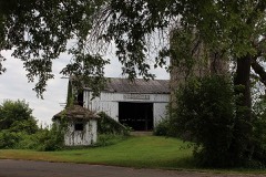 Erastus Dean Farmsteadlisted 1978 · 0.0 miles away
Topographic sheets covering this place
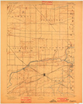
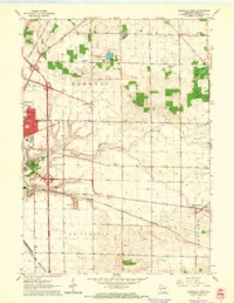
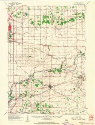
8 surveys from 18 printed sheetsMatched by testing this settlement's coordinate against the published boundary of every sheet in the United States Geological Survey's historical collection. Each opens the scanned sheet at the Survey.
- 1893 USGS Shopiere quadrangle1:62500, 5 printings
- 1954 USGS Rockford quadrangle1:250000
- 1955 USGS Rockford quadrangle1:250000
- 1958 USGS Rockford quadrangle1:250000, 4 printings
- 1961 USGS Janesville East quadrangle1:24000, 3 printings
- 1961 USGS Shopiere quadrangle1:62500, 2 printings
- 1963 USGS Rockford quadrangle1:250000
- 1980 USGS Lake Geneva quadrangle1:100000





In the county-history sources
14,060 words on this townshipHistory of Rock County, and Transactions of the Rock County Agricultural Society and Mechanics' Institute, published 1856 names this settlement in its chapter on Bradford Town. These are the passages that mention it, exactly as the scans read.
Although the gi-eater part of its surface is prairie, yet the Turtle which passes through the southern part of the town is skirted by fine bur and white oak openings. Also a small oak grove is situated on the West line, mostly in this town, on sections 18 and 19. In addition to the above is that gem of the prairie, " Emerald Grove," situated on section 7 and 8,
Passage source: History of Rock County, and Transactions of the Rock County Agricultural Society and Mechanics' Institute, published 1856.
The Turtle enters the town about the center-east line of section 13, runs west of South, through that and section 24, through the comer of section 26 into 35, then takes a turn back into 26, thence pursues a Westerly couree, passing through sections 26, 21, 28, 29, 32 and 31.
Passage source: History of Rock County, and Transactions of the Rock County Agricultural Society and Mechanics' Institute, published 1856.
The population in 1850, was 703; in 185S, it was 1,002, There are 12 school districts, 11 school houses, and 356 scholars; They receive this year from the state school fund $266,45. There are one hundred and eigth-one farms in town.
Passage source: History of Rock County, and Transactions of the Rock County Agricultural Society and Mechanics' Institute, published 1856.
Machine-read from a century-old scan, so expect the errors a machine makes: misspelled names, dropped words, stray characters.
Read the whole chapter on Bradford Town - it names this place 25 more 25 times.
Mines and quarries near this place
5 within 5 milesRegional context, not property-specific evidence. The federal mineral resources record lists 5 workings within 5 miles of Emerald Grove: 4 past producers, 1 producer. 1 still produces. What was taken out: Sand and Gravel, Construction, Stone, Crushed/Broken. Distance is straight-line from the map coordinates, so a quarry counted here may appear on a neighbouring settlement's page as well.
| Where | Site | Commodity | Status | Recorded |
|---|---|---|---|---|
| Bjoin Quarry | Stone, Crushed/Broken | Producer | ||
| Dunn Trucking & Limestone Quarry | Stone, Crushed/Broken | Past Producer | ||
| Bradford Township Pit | Sand and Gravel, Construction | Past Producer | ||
| Rye Pit | Sand and Gravel, Construction | Past Producer | ||
| Wheeler Pit | Sand and Gravel, Construction | Past Producer |
Storms near this place
7 since 1996Regional context, not property-specific evidence. The National Weather Service names Emerald Grove in 7 storm reports between 1996 and 2026: 4 thunderstorm wind, 3 tornado. No death or injury is recorded in these reports. Each account below is quoted exactly as the forecast office filed it, from the NOAA Storm Events Database, and each date opens the federal record of that event.
| When | Event | Place named | Harm | What the report says |
|---|---|---|---|---|
| April 2026 | Tornado (EF1) | Emerald Grove | $215,000 | Brief tornado went through Emerald Grove, destroying a barn and causing damage to an antique store. Significant tree damage along the path as well with debris lofted well to the ENE from the structures. |
| May 1999 | Thunderstorm Wind | Emerald Grove | $75,000 | no account filed |
| May 2024 | Tornado (EF0) | Emerald Grove | $60,000 | Tornado went through mainly rural areas of Rock county with some tree damage noted along the way. |
| November 2020 | Thunderstorm Wind | Emerald Grove | $9,000 | Barn roof blown off. |
| June 1996 | Thunderstorm Wind | Emerald Grove | $2,000 | no account filed |
| July 2023 | Tornado (EF0) | Emerald Grove | - | Minimal damage from a tornado that mainly stayed over farmland, but did hit a couple trees. Tornado was filmed by a storm chaser via a drone. |
| March 2002 | Thunderstorm Wind | Emerald Grove | - | no account filed |
Nearest settlements
The eight closest, with where each one stands in the county. Distances are straight-line, computed from the Geographic Names Information System coordinates.
| Map | Place | Distance | Sheets |
|---|---|---|---|
| Avalon | 1.8 miles | 17 | |
| Johnstown Center | 3.5 miles | 17 | |
| Johnstown | 5.0 miles | 17 | |
| Tiffany | 5.6 miles | 18 | |
| Shopiere | 6.5 miles | 18 | |
| Clinton | 6.8 miles | 16 | |
| Turtleville | 7.4 miles | 18 | |
| Janesville | 7.5 miles | 17 |
Elsewhere
Matched on this settlement's Geographic Names Information System number rather than its name, so it cannot be a different place of the same name in another state.
| Wikipedia article on Emerald Grove | An encyclopaedic summary. Its text is share-alike, so it is linked here rather than copied. |
| Wikidata item Q5370439 | The structured record the population and elevation above come from. Public domain (CC0). |
Provenance
This settlement is recorded in the Geographic Names Information System as feature 1564611. The sheet list is computed by point-in-boundary test against the United States Geological Survey's historical topographic inventory. Both are works of the United States government and carry no copyright under 17 U.S.C. 105.
Mines and quarries. USGS Mineral Resources Data System (MRDS) https://mrdata.usgs.gov/mrds/ A work of the United States government, no copyright under 17 U.S.C. 105.
Storms. NOAA National Centers for Environmental Information, Storm Events Database https://www.ncei.noaa.gov/stormevents/ A work of the United States government, no copyright under 17 U.S.C. 105. Narratives are quoted verbatim from the National Weather Service report and are not edited or summarised.