 Block
Clinton, Wisconsin
16 topographic sheets cover this place, the earliest surveyed in 1893 and the latest in 1980. It stands in Clinton town. It lies in ZIP code area 53525. The Survey maps it on the Clinton quadrangle. 2,221 people lived here at the 2020 count.
On record in Clinton
Buildings and businesses the archive holds for this place. Each opens its own page, with the source record it came from.
On the National Register 11 records
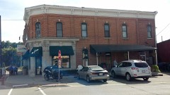 Citizens Banklisted 1985
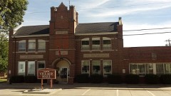 Clinton Village Halllisted 1985
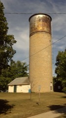 Clinton Water Towerlisted 1985
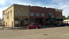 Crosby Blocklisted 1985
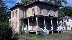 Homer B. DeLong Houselisted 1985
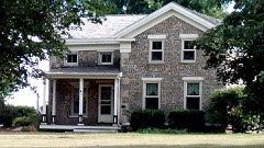 Samuel S. Jones Cobblestone Houselisted 1978
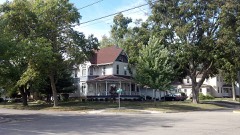 J. L. Pangborn Houselisted 1985
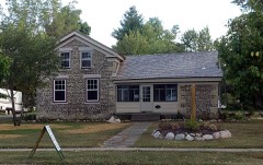 Richardson-Brinkman Cobblestone Houselisted 1977
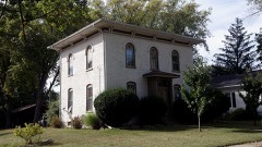 John Smith Houselisted 1985
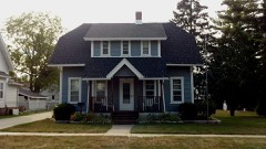 A. E. Taylor Houselisted 1985
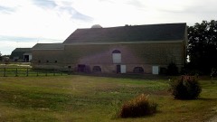 Wyman-Rye Farmsteadlisted 1977
Population over time
2 figuresClinton grew from 2,154 to 2,221 between 2010 and 2020. These are the recorded population figures Wikidata holds for this place, reached through the Geographic Names Information System number this page is keyed on rather than by name, so they belong to this place and not to another of the same name. Most are census counts, but not all are: an early figure may be a founding or settlement estimate, and an estimate published within five years of a census is left out. The change column is computed, and is left blank where more than 20 years separate a figure from the one before it, because a gap that long is not a change between two counts.
| Year | People | Change |
|---|---|---|
| 2010 | 2,154 | |
| 2020 | 2,221 | +67 (+3%) |
Topographic sheets covering this place
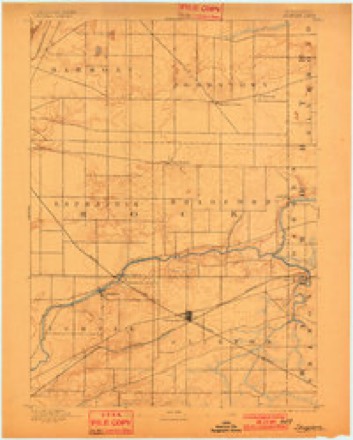
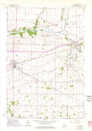
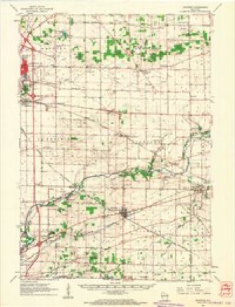
8 surveys from 16 printed sheetsMatched by testing this settlement's coordinate against the published boundary of every sheet in the United States Geological Survey's historical collection. Each opens the scanned sheet at the Survey.
- 1893 USGS Shopiere quadrangle1:62500, 5 printings
- 1954 USGS Rockford quadrangle1:250000
- 1955 USGS Rockford quadrangle1:250000
- 1958 USGS Rockford quadrangle1:250000, 4 printings
- 1961 USGS Clinton quadrangle1:24000
- 1961 USGS Shopiere quadrangle1:62500, 2 printings
- 1963 USGS Rockford quadrangle1:250000
- 1980 USGS Lake Geneva quadrangle1:100000





In the county-history sources
20,295 words on this townshipThe History of Rock County, Wisconsin; Its Early Settlement, Growth, Development, Resources, Etc., published 1879 names this settlement in its chapter on Clinton Town. These are the passages that mention it, exactly as the scans read.
The town of Clinton was organized by an act of the Territorial Legislature, approved February 17, 1842, and comprised the territory of the present town, the south half of Bradford and portions of Turtle and La Prairie. By an act approved March 23, 1843, five sections in the present town of Turtle were annexed and made a part of it. These boundaries were subsequently changed, and at present it comprises the whole of Township 1, north of Range 14 east, being the southeastern township in the county.
Passage source: The History of Rock County, Wisconsin; Its Early Settlement, Growth, Development, Resources, Etc., published 1879.
In the month of June, 1836, Robert and Daniel Stone started from the State of Michigan and came to the Territory of Wisconsin. Continuing their course westward until they reached the valley of the Rock River, they saw at a glance that the stream, with its abundant waterpower, and the clean, smooth prairies, with their rich soil, possessed advantages which needed only the stalwart arms and resolute hearts of hardy men to develop into excellent homes. They followed an Indian trail up the river, until they came to the mouth of the Yahara (Catfish), where they made their claim, and became the first settlers of the town of Fulton. In 1837, they plowed the first furrow, broke seven acres of land and planted it with corn and beans. The seed corn cost them $5 a bushel. In the spring of 1838, they built the first log house, and were now ready to offer their hospitalities to all who came. Robert and Daniel Stone came from Parishville, St. Lawrence Co., N. Y.
Passage source: The History of Rock County, Wisconsin; Its Early Settlement, Growth, Development, Resources, Etc., published 1879.
In 1837, George R. Ramsay came from the State of Vermont to Chicago; remained there for a time and worked upon the harbor ; he then went to Milwaukee, and from there to Rock River and made a claim in the town of Fulton, where he is still living. William B. Foster came in 1837, and located upon the river in the south part of the town. His place became a prominent landmark in consequence of a ferry which he established and run for a time, known as Foster's Ferry. Elijah True and family came in 1838 ; bought a part of Foster's claim and settled upon it. Lyman Morse, George E. Cowan, Silas Hurd, Anson Goodrich and William Squires settled in 1838. Morse located upon the river at a point afterward known as Morse's Landing and Morse's Prairie: Hurd and Cowan settled upon the farm now owned and occupied by Mr. Hurd. Afterward, they divided their property, and Cowan settled upon Morse's Prairie, where he became closely identified with the organization and political interests of the town, and its first Chairman of the Board of Supervisors. Goodrich located near the foot of Lake Koshkonong, where he established and run a ferry, known as Goodrich's Ferry. A bridge now occupies the site. William M. Squires settled in the eastern part of the town, where he still lives, a friend to everybody, especially to all old settlers. In 1841, Messrs. Gould and Young built the dam across the Yahara (Catfish), and began to build a saw-mill. He died, and the property was bought by Peck & Tripp, of Whitewater, who completed the mill. Emanuel Canker bought out the interest of Tripp. The new firm, Canker & Peck, commenced preparations to build a grist-mill, which they completed in 1846. The mill, after passing through various hands, is now owned by the White Brothers.
Passage source: The History of Rock County, Wisconsin; Its Early Settlement, Growth, Development, Resources, Etc., published 1879.
Machine-read from a century-old scan, so expect the errors a machine makes: misspelled names, dropped words, stray characters.
Read the whole chapter on Clinton Town - it names this place 72 more 72 times.
Fires near this place
6 since 2018Regional context, not property-specific evidence. The federal wildfire occurrence database lists 6 fires within 5 miles of Clinton between 2018 and 2019, burning about 26 acres in total. None started naturally. None was recorded as arson. Distance is straight-line from the map coordinates, so a fire counted here may appear on a neighbouring settlement's page as well.
| Reported cause | Fires |
|---|---|
| Debris and open burning | 3 |
| Missing data/not specified/undetermined | 3 |
The most recent of them, most recent first, with the day each was reported and the service that recorded it.
| Date | Cause | Size | Reported by | Name on the report |
|---|---|---|---|---|
| 22 June 2019 | Debris and open burning | under an acre | Wisconsin Department of Natural Resources | 2019137 |
| 22 May 2018 | Missing data/not specified/undetermined | under an acre | Wisconsin Department of Natural Resources | 1800001 |
| 3 April 2019 | Debris and open burning | under an acre | Wisconsin Department of Natural Resources | 19126 |
| 5 March 2018 | Debris and open burning | under an acre | Wisconsin Department of Natural Resources | 18067 |
| 18 March 2018 | Missing data/not specified/undetermined | under an acre | Wisconsin Department of Natural Resources | 18075 |
| 11 March 2018 | Missing data/not specified/undetermined | 25 acres | Wisconsin Department of Natural Resources | 2018049 |
Settlements close enough to share some of these fires:
Mines and quarries near this place
10 within 5 milesRegional context, not property-specific evidence. The federal mineral resources record lists 10 workings within 5 miles of Clinton: 5 producers, 5 past producers. 5 still produce. What was taken out: Stone, Crushed/Broken, Sand and Gravel, Construction, Stone. Distance is straight-line from the map coordinates, so a quarry counted here may appear on a neighbouring settlement's page as well.
| Where | Site | Commodity | Status | Recorded |
|---|---|---|---|---|
| Little Quarry | Stone | Producer | ||
| Bradford Township Pit | Sand and Gravel, Construction | Past Producer | ||
| Rye Pit | Sand and Gravel, Construction | Producer | ||
| Rye Pit | Sand and Gravel, Construction | Past Producer | ||
| Skunk Hollow Pit Number 2 | Sand and Gravel, Construction | Past Producer | ||
| Boutelle Quarry | Stone, Crushed/Broken | Producer | ||
| Braukoff Quarry | Stone, Crushed/Broken | Past Producer | ||
| Dunn Quarry | Stone, Crushed/Broken | Producer | ||
| Dunn Trucking & Limestone Quarry | Stone, Crushed/Broken | Past Producer | ||
| Little Quarry | Stone, Crushed/Broken | Producer |
Storms near this place
25 since 1996Regional context, not property-specific evidence. The National Weather Service names Clinton in 25 storm reports between 1996 and 2026: 17 thunderstorm wind, 4 hail, 1 flash flood, 1 funnel cloud. The reports record 3 injuries. Each account below is quoted exactly as the forecast office filed it, from the NOAA Storm Events Database, and each date opens the federal record of that event.
| When | Event | Place named | Harm | What the report says |
|---|---|---|---|---|
| August 1998 | Flash Flood | Clinton | 2 hurt, $250,000 | no account filed |
| July 2009 | Lightning | Clinton | 1 hurt | A 44-year-old woman was struck by lightning while standing in the doorway of a barn holding the reins of a horse. She was taken to Beloit Memorial Hospital and treated in the emergency department. |
| June 1998 | Thunderstorm Wind | Clinton | $57,000 | no account filed |
| March 2004 | Thunderstorm Wind | Clinton | $40,000 | no account filed |
| May 2013 | Thunderstorm Wind | Clinton | $10,000 | Law enforcement officials indicated numerous trees and power lines downed by thunderstorm wind gusts, estimated at 70 mph (61 knots), along a path from 3 miles west-northwest of Clinton to 3 miles southeast of Clinton. |
| July 2003 | Thunderstorm Wind | Clinton | $5,000 | no account filed |
| April 1996 | Thunderstorm Wind | Clinton | $5,000 | no account filed |
| June 2013 | Thunderstorm Wind | Clinton | $4,000 | The Rock County Emergency manager reported many large trees uprooted and branches downed by thunderstorm wind gusts estimated at 65 mph (56 knots) along a path from Clinton to 4 miles south of Clinton. |
| June 2024 | Thunderstorm Wind | Clinton | $2,000 | A couple trees down on powerlines near Clinton. |
| April 2026 | Flood | Clinton | $1,000 | Floodwaters over a portion of highway 140 on the north side of Clinton. |
| March 2004 | Thunderstorm Wind | Clinton | $1,000 | no account filed |
| July 1999 | Thunderstorm Wind | Clinton | $1,000 | no account filed |
| September 1997 | Thunderstorm Wind | Clinton | $300 | no account filed |
| May 2008 | Thunderstorm Wind | Clinton | $100 | Powerful straight-line winds and brief heavy rains uprooted some trees and damaged a mailbox. |
| August 2025 | Hail | Clinton | - | Image of ping-pong ball sized hail. |
| June 2011 | Thunderstorm Wind | Clinton | - | Powerful thunderstorm winds toppled several large trees. |
| June 2008 | Thunderstorm Wind | Clinton | - | Powerful thunderstorms winds knocked down large trees in the Clinton area. |
| August 2025 | Hail | Clinton | - | no account filed |
| July 2016 | Hail | Clinton | - | no account filed |
| May 2004 | Thunderstorm Wind | Clinton | - | no account filed |
| July 2003 | Hail | Clinton | - | no account filed |
| April 2002 | Funnel Cloud | Clinton | - | no account filed |
| June 2002 | Thunderstorm Wind | Clinton | - | no account filed |
| August 2002 | Thunderstorm Wind | Clinton | - | no account filed |
| July 1998 | Thunderstorm Wind | Clinton | - | no account filed |
Nearest settlements
The eight closest, with where each one stands in the county. Distances are straight-line, computed from the Geographic Names Information System coordinates.
| Map | Place | Distance | Sheets |
|---|---|---|---|
| Tiffany | 3.7 miles | 18 | |
| Foxhollow | 3.8 miles | 18 | |
| Shopiere | 4.0 miles | 18 | |
| Bergen | 4.4 miles | 12 | |
| Avalon | 5.2 miles | 17 | |
| Turtleville | 5.3 miles | 18 | |
| Porters | 5.4 miles | 18 | |
| Emerald Grove | 6.8 miles | 18 |
Elsewhere
Matched on this settlement's Geographic Names Information System number rather than its name, so it cannot be a different place of the same name in another state.
| Wikipedia article on Clinton | An encyclopaedic summary. Its text is share-alike, so it is linked here rather than copied. |
| Wikidata item Q2207368 | The structured record the population and elevation above come from. Public domain (CC0). |
Provenance
This settlement is recorded in the Geographic Names Information System as feature 1563193. The sheet list is computed by point-in-boundary test against the United States Geological Survey's historical topographic inventory. Both are works of the United States government and carry no copyright under 17 U.S.C. 105.
Wildfire. Short, Karen C. 2022. Spatial wildfire occurrence data for the United States, 1992-2020 [FPA_FOD_20221014]. 6th Edition. Fort Collins, CO: Forest Service Research Data Archive. https://doi.org/10.2737/RDS-2013-0009.6 Collected with United States Government funding and usable without additional permissions or fees.
Mines and quarries. USGS Mineral Resources Data System (MRDS) https://mrdata.usgs.gov/mrds/ A work of the United States government, no copyright under 17 U.S.C. 105.
Storms. NOAA National Centers for Environmental Information, Storm Events Database https://www.ncei.noaa.gov/stormevents/ A work of the United States government, no copyright under 17 U.S.C. 105. Narratives are quoted verbatim from the National Weather Service report and are not edited or summarised.