 Block
Pewaukee, Wisconsin
22 topographic sheets cover this place, the earliest surveyed in 1892 and the latest in 1991. It stands in Pewaukee Village. It lies in ZIP code area 53072. The Survey maps it on the Hartland quadrangle. 8,238 people lived here at the 2020 count. It stands 873 feet above sea level.
On record in Pewaukee
Buildings and businesses the archive holds for this place. Each opens its own page, with the source record it came from.
On the National Register 1 record
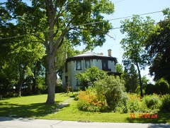 Deacon West Octagon Houselisted 1975
Population over time
2 figuresPewaukee grew from 8,166 to 8,238 between 2010 and 2020. These are the recorded population figures Wikidata holds for this place, reached through the Geographic Names Information System number this page is keyed on rather than by name, so they belong to this place and not to another of the same name. Most are census counts, but not all are: an early figure may be a founding or settlement estimate, and an estimate published within five years of a census is left out. The change column is computed, and is left blank where more than 20 years separate a figure from the one before it, because a gap that long is not a change between two counts.
| Year | People | Change |
|---|---|---|
| 2010 | 8,166 | |
| 2020 | 8,238 | +72 (+1%) |
Topographic sheets covering this place
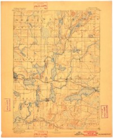
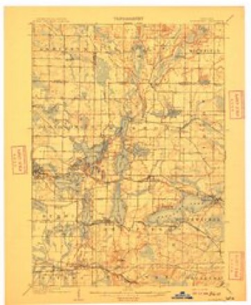
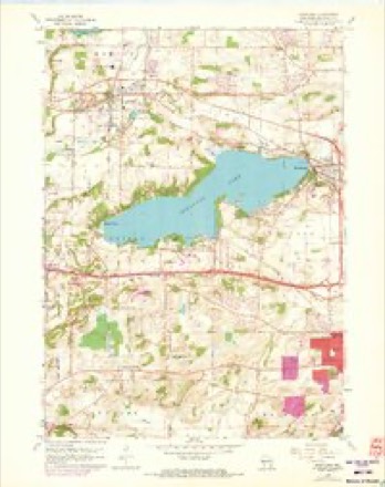
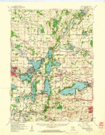
8 surveys from 22 printed sheetsMatched by testing this settlement's coordinate against the published boundary of every sheet in the United States Geological Survey's historical collection. Each opens the scanned sheet at the Survey.
- 1892 USGS Oconomowoc quadrangle1:62500, 4 printings
- 1909 USGS Oconomowoc quadrangle1:62500, 6 printings
- 1957 USGS Madison quadrangle1:250000, 3 printings
- 1959 USGS Hartland quadrangle1:24000, 4 printings
- 1959 USGS Hartland quadrangle1:62500
- 1960 USGS Madison quadrangle1:250000, 2 printings
- 1984 USGS Oconomowoc quadrangle1:100000
- 1991 USGS Oconomowoc quadrangle1:100000


In the county-history sources
38,760 words on this townshipThe History of Waukesha County, Wisconsin. Containing an Account of Its Settlement, Growth, Development and Resources; an Extensive and Minute Sketch of Its Cities, Towns and Villages--their Improvements, Industries, Manufactories, Churches, Schools and Societies; Its War Record, Biographical Sketches, Portraits of Prominent Men and Early Settlers; the Whole Preceded by a History of Wisconsin, Statistics of the State, and an Abstract of Its Laws and Constitution and of the Constitution of the United States, published 1880 names this settlement in its chapter on Pewaukee City. These are the passages that mention it, exactly as the scans read.
Glasgow has 39 to every 1,000; Liverpool, 36; London, 25 ; New Orleans, 54; New York, 32 ; San Francisco, 24; Milwaukee, 21. Among seventeen of the principal cities of the Union, Milwaukee ranks the ninth in rate of mortality. An impression has prevailed that Milwaukee is subject to a large and disproportionate amount of lung and allied diseases. Statistics disprove this, its deaths from consumption being only 6 per cent., while those of Chicago are 7.75 ; of St. Louis, 9.68; of Cincinnati, 11.95; ^^^ °^ Boston, 19.31. But few cases of malarial disease occur in Milwaukee, and fewer cases of intestinal fever than in the interior of the state. The mortality among children is explained by its occurring chiefly among the poor foreign-born population, where all that can incite and aggravate disease is always to be found.
This, (the historical part of the health article), will doubtless call forth from the profession much additional and desirable matter, but excepting what will further appear under the head of Madison it is proper to say that we have exhausted the sources of information on the subject within our reach.
The tendency of these diseases is certainly to amelioration. The sanitary history of Wisconsin does not differ from that of any other state east of us, in this striking particular ; the farther you trace back the history of disease, the worse its type is found to be. It follows, then, that the improvement in public health must progress with the general improvement of the state, as has been the case with the eastern states, and that the consequent amelioration of our malarial diseases especially will tend to mitigate infectious diseases. The ameliorating influences, however, that sanitary science has brought to bear upon disease, of which England is so happy an illustration, has scarcely as yet begun to be known to us. But the time has come at last when this science is moving both the hearts and minds of thinking and humane men in the state, and its voice has been heard in our legislative halls, evoking a law by which we are, as a people, to be governed, as by any other enactment. The organization of a state board of health is a new era in our humanity. In this board is invested all legal power over the state health. To it is committed all the sanitary responsibility of the state, and the greatest good to the people at large must follow the efforts it is making.
Machine-read from a century-old scan, so expect the errors a machine makes: misspelled names, dropped words, stray characters.
Read the whole chapter on Pewaukee City - it names this place 20 more 20 times.
Fires near this place
28 since 2010Regional context, not property-specific evidence. The federal wildfire occurrence database lists 28 fires within 5 miles of Pewaukee between 2010 and 2020, burning about 15 acres in total. 1 started naturally. None was recorded as arson. Distance is straight-line from the map coordinates, so a fire counted here may appear on a neighbouring settlement's page as well.
| Reported cause | Fires |
|---|---|
| Missing data/not specified/undetermined | 17 |
| Debris and open burning | 8 |
| Power generation/transmission/distribution | 1 |
| Natural | 1 |
| Recreation and ceremony | 1 |
The most recent of them, most recent first, with the day each was reported and the service that recorded it.
| Date | Cause | Size | Reported by | Name on the report |
|---|---|---|---|---|
| 16 September 2018 | Debris and open burning | under an acre | Wisconsin Department of Natural Resources | 381 |
| 10 September 2018 | Debris and open burning | under an acre | Wisconsin Department of Natural Resources | 367 |
| 1 July 2020 | Debris and open burning | under an acre | Wisconsin Department of Natural Resources | 222 |
| 1 July 2018 | Power generation/transmission/distribution | 1.0 acres | Wisconsin Department of Natural Resources | 242 |
| 8 May 2018 | Missing data/not specified/undetermined | under an acre | Wisconsin Department of Natural Resources | 1800143 |
| 4 May 2018 | Missing data/not specified/undetermined | under an acre | Wisconsin Department of Natural Resources | 1800812 |
| 28 May 2018 | Debris and open burning | under an acre | Wisconsin Department of Natural Resources | 190 |
| 21 May 2020 | Missing data/not specified/undetermined | under an acre | Wisconsin Department of Natural Resources | 205 |
Settlements close enough to share some of these fires:
Mines and quarries near this place
10 of 13 shownRegional context, not property-specific evidence. The federal mineral resources record lists 13 workings within 5 miles of Pewaukee: 8 producers, 3 unknowns, 2 past producers. 8 still produce. What was taken out: Sand and Gravel, Construction, Stone, Crushed/Broken, Limestone, Dimension, Stone. Distance is straight-line from the map coordinates, so a quarry counted here may appear on a neighbouring settlement's page as well.
| Where | Site | Commodity | Status | Recorded |
|---|---|---|---|---|
| Four Halquist Quarries | Stone | Unknown | ||
| Own Crews | Stone | Unknown | ||
| Burg Limestone Quarry | Limestone, Dimension | Past Producer | ||
| Carlsons Limestone Quarry | Limestone, Dimension | Past Producer | ||
| Main Quarry and Mill | Stone, Crushed/Broken | Producer | ||
| North End Limestone Operation | Limestone, Dimension | Producer | ||
| Vulcan Materials Co Sussex Quarry | Stone, Crushed/Broken | Producer | ||
| Waukesha Lime and Stone Co Quarry | Stone, Crushed/Broken | Producer | ||
| J J Pit | Sand and Gravel, Construction | Producer | ||
| James Pit | Sand and Gravel, Construction | Producer |
Storms near this place
17 since 1993Regional context, not property-specific evidence. The National Weather Service names Pewaukee in 17 storm reports between 1993 and 2024: 10 thunderstorm wind, 3 lightning, 3 hail, 1 flash flood. No death or injury is recorded in these reports. Each account below is quoted exactly as the forecast office filed it, from the NOAA Storm Events Database, and each date opens the federal record of that event.
| When | Event | Place named | Harm | What the report says |
|---|---|---|---|---|
| August 2000 | Lightning | Pewaukee | $210,000 | no account filed |
| August 1993 | Thunderstorm Wind | Pewaukee | $50,000 | no account filed |
| August 2007 | Thunderstorm Wind | Pewaukee | $25,000 | Powerful thunderstorm wind gusts up to 56 knots (65 mph) toppled several large trees and damaged a couple power-lines. One tree landed on a home and damaged the roof and a skylight. |
| July 2006 | Thunderstorm Wind | Pewaukee | $20,000 | Multiple reports of trees and power-lines down. |
| July 1997 | Lightning | Pewaukee | $12,000 | Lightning struck two homes . One sustained a 2' by 2' hole in the roof, followed by burned holes in the ceiling and floors and damage to personal property. The second home had a burned wall, fan burned, and T.V. blew out. |
| June 2013 | Thunderstorm Wind | Pewaukee | $10,000 | Law enforcement officials reported trees and power lines were blown down along a scattered path from Pewaukee to Eagle from damaging thunderstorm wind gusts that were estimated up to 65 mph (56 knots). Tree debris took down a power line in Eagle. |
| July 1999 | Flash Flood | Pewaukee | $10,000 | no account filed |
| July 2019 | Thunderstorm Wind | Pewaukee | $3,000 | Scattered trees and power lines down. |
| May 1998 | Lightning | Pewaukee | $3,000 | no account filed |
| July 2021 | Thunderstorm Wind | Pewaukee | - | Multiple trees and large branched down. |
| August 2010 | Thunderstorm Wind | Pewaukee | - | The peak thunderstorm wind gust of 65 mph (56 knots) measured by a trained spotter. |
| May 2024 | Hail | Pewaukee | - | no account filed |
| June 2017 | Hail | Pewaukee | - | no account filed |
| March 2007 | Hail | Pewaukee | - | no account filed |
| September 2005 | Thunderstorm Wind | Pewaukee | - | no account filed |
| May 2004 | Thunderstorm Wind | Pewaukee | - | no account filed |
| July 2002 | Thunderstorm Wind | Pewaukee | - | no account filed |
Nearest settlements
The eight closest, with where each one stands in the county. Distances are straight-line, computed from the Geographic Names Information System coordinates.
| Map | Place | Distance | Sheets |
|---|---|---|---|
| Edgewood | 2.5 miles | 22 | |
| Duplainville | 3.4 miles | 21 | |
| Pewaukee West | 3.7 miles | 22 | |
| Sussex | 4.2 miles | 20 | |
| Hartland | 4.6 miles | 22 | |
| Buena Vista | 4.9 miles | 22 | |
| Waukesha | 5.0 miles | 21 | |
| Lisbon | 5.1 miles | 20 |
Elsewhere
Matched on this settlement's Geographic Names Information System number rather than its name, so it cannot be a different place of the same name in another state.
| Wikipedia article on Pewaukee | An encyclopaedic summary. Its text is share-alike, so it is linked here rather than copied. |
| Wikidata item Q7179546 | The structured record the population and elevation above come from. Public domain (CC0). |
Provenance
This settlement is recorded in the Geographic Names Information System as feature 1571279. The sheet list is computed by point-in-boundary test against the United States Geological Survey's historical topographic inventory. Both are works of the United States government and carry no copyright under 17 U.S.C. 105.
Wildfire. Short, Karen C. 2022. Spatial wildfire occurrence data for the United States, 1992-2020 [FPA_FOD_20221014]. 6th Edition. Fort Collins, CO: Forest Service Research Data Archive. https://doi.org/10.2737/RDS-2013-0009.6 Collected with United States Government funding and usable without additional permissions or fees.
Mines and quarries. USGS Mineral Resources Data System (MRDS) https://mrdata.usgs.gov/mrds/ A work of the United States government, no copyright under 17 U.S.C. 105.
Storms. NOAA National Centers for Environmental Information, Storm Events Database https://www.ncei.noaa.gov/stormevents/ A work of the United States government, no copyright under 17 U.S.C. 105. Narratives are quoted verbatim from the National Weather Service report and are not edited or summarised.