 Block
Postville, Wisconsin
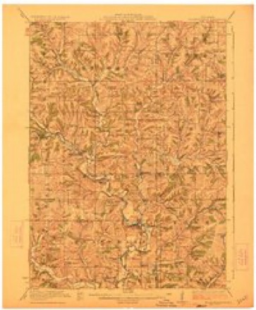
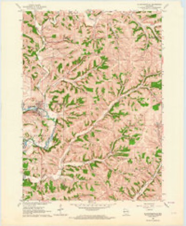
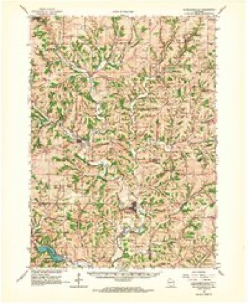
12 topographic sheets cover this place, the earliest surveyed in 1923 and the latest in 1981. It stands in York town. It lies in ZIP code area 53516. The Survey maps it on the Blanchardville quadrangle. It stands 1,043 feet above sea level.
Topographic sheets covering this place
8 surveys from 12 printed sheetsMatched by testing this settlement's coordinate against the published boundary of every sheet in the United States Geological Survey's historical collection. Each opens the scanned sheet at the Survey.
- 1923 USGS Blanchardville quadrangle1:62500, 2 printings
- 1954 USGS Rockford quadrangle1:250000
- 1955 USGS Rockford quadrangle1:250000
- 1958 USGS Rockford quadrangle1:250000, 4 printings
- 1962 USGS Blanchardville quadrangle1:24000
- 1962 USGS Blanchardville quadrangle1:62500
- 1963 USGS Rockford quadrangle1:250000
- 1981 USGS Monroe quadrangle1:100000





In the county-history sources
10,659 words on this townshipHistory of Green County, Wisconsin, published 1877; History of Green County, Wisconsin, published 1884 names this settlement in its chapter on York Town. These are the passages that mention it, exactly as the scans read.
The village of Postville dates its beginning from the arrival of Albro Crowell, who made his home there when he first came to the county. The second and third houses were built by Ira Walker and Edwin Crowell. In 18^8, Gilbert Post built the fourth house, the lower story of which was used as a store. After a time, Mr. Crowell started another store. A drug store, a tailor shop, a harness shop, and more dwellings followed. The Stewart post-office, so called for York's first settler, was moved there from its first place a mile or two west, and the village was recorded as Postville. Through all succeeding changes Postville has prospered. The first store has been transformed into a hotel, and long ago the village was thought large enough to have a saloon; but York has never had a board that would grant a license.
Passage source: History of Green County, Wisconsin, published 1877.
During the summer of 1876 four large cheese factories, all owned by companies, were in operation in York. At Farmers' Grove, at the factory north of the village (where was formerly Eli George's tavern, the first voting place in the town), and at Yankee Hollow Limburger cheese is made. At Postville the cheese is American cheese.
Passage source: History of Green County, Wisconsin, published 1877.
Wisconsin he had five children. One child, John W., died at Wiota, when quite young. His death was caused by a singular accident. He was trying to blow a large tin dinner horn, and fell, driVing the small end of the horn through the roof of his mouth and the side of his head, causing death a few days later. In 1884 only two of the children were living. Decatur lives in Turner Co., Dak.; and Ellen, who was born at Wiota, is the wife of Charles Green, and lives in Nebraska. The others were Adeline, who died when but a child, in 1847; Jerusha, deceased wife of E.N.Thayer; and George who died in California. His wife died Sept. 5, 1844. In 1850, accompanied by his son, George, Mr. Stewart went to California, returning in the winter of 1851-2. A few years later George went back to California where he died. Some years after his wife's death, Mr. Stewart married Mrs. Huldah Brown. Two children was the result of this union - Banks, who lives in Lincoln, Neb.; and Grant, who lives with his widowed mother in Albia, Iowa. John Stewart was one of the best blacksmiths and iron-workers ever known in this country, excelling in handling edged tools. Mr. Stewart is well remembered by the early settlers as an honest, industrious citizen, kind and charitable; genial in his intercourse with all men. He never was a party either as plaintiff or defendant in a lawsuit. His death, which occurred in February, 1867, caused much sorrow among his many friends. His youngest child by his first marriage was John W. Stewart.
Passage source: History of Green County, Wisconsin, published 1884.
Machine-read from a century-old scan, so expect the errors a machine makes: misspelled names, dropped words, stray characters.
Read the whole chapter on York Town - it names this place 10 more 10 times.
Fires near this place
17 since 2018Regional context, not property-specific evidence. The federal wildfire occurrence database lists 17 fires within 5 miles of Postville between 2018 and 2020, burning about 171 acres in total. None started naturally. 1 was recorded as arson. Distance is straight-line from the map coordinates, so a fire counted here may appear on a neighbouring settlement's page as well.
| Reported cause | Fires |
|---|---|
| Debris and open burning | 13 |
| Missing data/not specified/undetermined | 3 |
| Arson/incendiarism | 1 |
The most recent of them, most recent first, with the day each was reported and the service that recorded it.
| Date | Cause | Size | Reported by | Name on the report |
|---|---|---|---|---|
| 2 May 2020 | Debris and open burning | 2.5 acres | Wisconsin Department of Natural Resources | 2020-14 |
| 18 May 2018 | Debris and open burning | under an acre | Wisconsin Department of Natural Resources | 1806345 |
| 8 April 2019 | Debris and open burning | 2.0 acres | Wisconsin Department of Natural Resources | 1904463 |
| 8 April 2018 | Debris and open burning | 2.0 acres | Wisconsin Department of Natural Resources | 2018-17 |
| 7 April 2018 | Debris and open burning | 35 acres | Wisconsin Department of Natural Resources | 2018-16 |
| 5 April 2020 | Missing data/not specified/undetermined | under an acre | Wisconsin Department of Natural Resources | 2006575 |
| 28 April 2018 | Debris and open burning | 15 acres | Wisconsin Department of Natural Resources | 2018018 |
| 26 April 2019 | Debris and open burning | under an acre | Wisconsin Department of Natural Resources | 1904460 |
Settlements close enough to share some of these fires:
Mines and quarries near this place
8 within 5 milesRegional context, not property-specific evidence. The federal mineral resources record lists 8 workings within 5 miles of Postville: 6 past producers, 2 producers. 2 still produce. What was taken out: Stone, Crushed/Broken. Distance is straight-line from the map coordinates, so a quarry counted here may appear on a neighbouring settlement's page as well.
| Where | Site | Commodity | Status | Recorded |
|---|---|---|---|---|
| Deans Quarry | Stone, Crushed/Broken | Past Producer | ||
| Freitag Quarry | Stone, Crushed/Broken | Past Producer | ||
| Goebeli Quarry | Stone, Crushed/Broken | Past Producer | ||
| Hustad Quarry | Stone, Crushed/Broken | Past Producer | ||
| Lingard Quarry | Stone, Crushed/Broken | Producer | ||
| Nybroten Quarry | Stone, Crushed/Broken | Past Producer | ||
| P.W. Ryan Sons, Inc. | Stone, Crushed/Broken | Producer | ||
| Vinger Quarry | Stone, Crushed/Broken | Past Producer |
Storms near this place
11 since 2008Regional context, not property-specific evidence. The National Weather Service names Postville in 11 storm reports between 2008 and 2024: 5 thunderstorm wind, 3 tornado, 2 hail, 1 flood. No death or injury is recorded in these reports. Each account below is quoted exactly as the forecast office filed it, from the NOAA Storm Events Database, and each date opens the federal record of that event.
| When | Event | Place named | Harm | What the report says |
|---|---|---|---|---|
| June 2014 | Tornado (EF1) | Postville | $200,000 | Tornado damage to farmsteads along Hay Hollow Road. Significant damage to farm buildings. 2 homes sustained major damage with 24 homes sustaining minor damage. Numerous large trees down. Estimated wind speed up to 95 mph. |
| February 2018 | Flood | Postville | $50,000 | Widespread flooding of lowland and agricultural land countywide, including numerous road closures. Some damage to roads with repairs necessary. Some basement flooding. Water several inches deep in portions of Monticello. The entire Sugar River State bike trail was closed due to flooding and erosion. The greatest flooding in the county was near the Sugar and Pecatonica Rivers. A State of Emergency was declared for the county. |
| June 2014 | Tornado (EF1) | Postville | $50,000 | Tornado damage to farmsteads along Hay Hollow Road. Significant damage to farm buildings. Numerous large trees down. Estimated wind speed up to 95 mph. |
| June 2015 | Thunderstorm Wind | Postville | $20,000 | Two homes with greater than 20 percent of the roof damaged or removed. Numerous large trees snapped or uprooted. A very large uprooted tree clipped the corner of a house damaging the roof, and also fell on a truck. |
| June 2015 | Thunderstorm Wind | Postville | $20,000 | Numerous large trees snapped and uprooted. A 15 foot trailer was rolled into the side of a garage, damaging a portion of the wall. |
| October 2019 | Thunderstorm Wind | Postville | $10,000 | A swath of scattered tree and crop damage via straight-line winds. |
| July 2022 | Thunderstorm Wind | Postville | $2,000 | Several tree limbs down. A tarp was torn from a carport type structure. |
| August 2009 | Thunderstorm Wind | Postville | - | Damage to trees and power lines was reported in a 6 mile wide swath from the Iowa County border to 5 miles west of New Glarus. This was a continuation of the line of thunderstorms that produced damage in southeast Iowa County. The length of the entire damage swath totaled about 10 miles. |
| June 2008 | Tornado (EF1) | Postville | - | This weak tornado spun up in the rural area roughly mid-way between New Glarus and Postville, just northeast of Zentner Road about 0.8 miles north-northwest of the intersection of CTH H and Zentner Road. It moved northeast, clipping the northwest part of the city of New Glarus, and exited Green County going through the western edge of the city of Belleville. Luckily only uprooted trees or snapped-off tree damage was noted. This tornado finally dissipated about 2 miles south-southeast of the village of Paoli in south-central Dane County near CTH A. The path length was about 7.84 miles in Green County and 4.41 miles in Dane County, for a total path length of about 12.25 miles. The starting and ending locations in Green County, with respect to lat/long pairs of numbers, were 42.80215/-89.69455 and 42.85690/-89.55898. DI#27 (TH), DOD3. Wind speeds estimated at 83-87 knots (95-100 mph). Average path width in Green County was about 75 yards. |
| July 2024 | Hail | Postville | - | no account filed |
| July 2024 | Hail | Postville | - | no account filed |
Nearest settlements
The eight closest, with where each one stands in the county. Distances are straight-line, computed from the Geographic Names Information System coordinates.
| Map | Place | Distance | Sheets |
|---|---|---|---|
| Farmers Grove (historical) | 1.8 miles | 13 | |
| Willet (historical) | 5.7 miles | 13 | |
| New Glarus | 6.3 miles | 13 | |
| Monticello | 9.2 miles | 15 | |
| Ross Crossing | 10.8 miles | 14 | |
| Schultz | 11.0 miles | 15 | |
| Stearns | 12.5 miles | 15 | |
| Exeter | 12.6 miles | 14 |
Elsewhere
Matched on this settlement's Geographic Names Information System number rather than its name, so it cannot be a different place of the same name in another state.
| Wikipedia article on Postville | An encyclopaedic summary. Its text is share-alike, so it is linked here rather than copied. |
| Wikidata item Q7234522 | The structured record the population and elevation above come from. Public domain (CC0). |
Provenance
This settlement is recorded in the Geographic Names Information System as feature 1571821. The sheet list is computed by point-in-boundary test against the United States Geological Survey's historical topographic inventory. Both are works of the United States government and carry no copyright under 17 U.S.C. 105.
Wildfire. Short, Karen C. 2022. Spatial wildfire occurrence data for the United States, 1992-2020 [FPA_FOD_20221014]. 6th Edition. Fort Collins, CO: Forest Service Research Data Archive. https://doi.org/10.2737/RDS-2013-0009.6 Collected with United States Government funding and usable without additional permissions or fees.
Mines and quarries. USGS Mineral Resources Data System (MRDS) https://mrdata.usgs.gov/mrds/ A work of the United States government, no copyright under 17 U.S.C. 105.
Storms. NOAA National Centers for Environmental Information, Storm Events Database https://www.ncei.noaa.gov/stormevents/ A work of the United States government, no copyright under 17 U.S.C. 105. Narratives are quoted verbatim from the National Weather Service report and are not edited or summarised.