 Block
Richmond, Wisconsin
19 topographic sheets cover this place, the earliest surveyed in 1893 and the latest in 1980. It stands in Richmond town. It lies in ZIP code area 53115. The Survey maps it on the Delavan quadrangle. It stands 991 feet above sea level.
On record in Richmond
Buildings and businesses the archive holds for this place. Each opens its own page, with the source record it came from.
On the National Register 1 record
Topographic sheets covering this place
8 surveys from 19 printed sheetsMatched by testing this settlement's coordinate against the published boundary of every sheet in the United States Geological Survey's historical collection. Each opens the scanned sheet at the Survey.
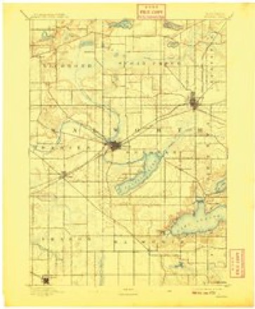
- 1893 USGS Delavan quadrangle1:62500, 6 printings
- 1954 USGS Rockford quadrangle1:250000
- 1955 USGS Rockford quadrangle1:250000
- 1958 USGS Rockford quadrangle1:250000, 4 printings
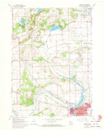
- 1960 USGS Delavan quadrangle1:24000, 3 printings
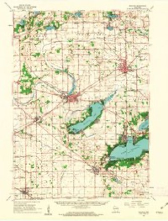
- 1960 USGS Delavan quadrangle1:62500, 2 printings
- 1963 USGS Rockford quadrangle1:250000
- 1980 USGS Lake Geneva quadrangle1:100000





In the county-history sources
1,522 words on this townshipHistory of Walworth County, Wisconsin .., published 1912 names this settlement in its chapter on Richmond Town. These are the passages that mention it, exactly as the scans read.
Town 3 north, range 15 east, was at first included in largest Elkhorn. At an extra session of the territorial Legislature by an act dated August 18, 1840, this town was made a part of Whitewater. Five months later, January 12, 1841, it was set off as the town of Richmond. Among the first-comers to the town were Thomas and T. Perry James and Robert Sherman, from Richmond, Washington county, Rhode Island, and their influence, just then, was sufficient to place another Richmond in the field of American geography.
Passage source: History of Walworth County, Wisconsin .., published 1912.
Glacial action left the town of uneven surface, but not more so than other towns. The high ground of eastern Whitewater is continued through northeastern Richmond and thence irregularly southeastward to the state line in Bloomfield ; but it nowhere becomes hills. A large part of Rock Prairie, its elevation eight hundred and ninety-four feet above sea-level, lies in the southwestern part of the town. Turtle lake, its greatest length about one mile and average width about one-third of a mile, lies at the meeting of sections 11, 12, 13, 14. There are small glacial lakes, or large pot-holes, one each in sections 4, 9, 10. Turtle creek, the only noticeable stream in the town, flows from its lake southwardly with double curvature to Delavan. where it turns west ward and with another sigmoid flexure crosses Darien and thence to the Rock. In its course through Richmond it crosses sections 14, 23, 26, 35. 36. It is bordered by a large marsh, now about to be reclaimed.
Passage source: History of Walworth County, Wisconsin .., published 1912.
There was an incipient village, with postoffice. at the southwest corner of Whitewater, where a town-line road meets a county-line road. It was named I tier's Corner, and its church was and is on the Richmond side of the two highways. There is a church, a well-kept cemetery, a store, and a postoffice - named Richmond, at a meeting of roads in section 17 - but as vet no village there. Not a mile of railway, either steam or electric, touches the town, but the roads to Delavan and Whitewater are excellent, and Richmond trade 1- of appreciable value to both of those cities, - and by deliverv routes >m each it receives mail.
Passage source: History of Walworth County, Wisconsin .., published 1912.
Machine-read from a century-old scan, so expect the errors a machine makes: misspelled names, dropped words, stray characters.
Read the whole chapter on Richmond Town - it names this place 3 more 3 times.
Mines and quarries near this place
3 within 5 milesRegional context, not property-specific evidence. The federal mineral resources record lists 3 workings within 5 miles of Richmond: 2 past producers, 1 producer. 1 still produces. What was taken out: Sand and Gravel, Construction, Stone, Crushed/Broken. Distance is straight-line from the map coordinates, so a quarry counted here may appear on a neighbouring settlement's page as well.
| Where | Site | Commodity | Status | Recorded |
|---|---|---|---|---|
| Ives Department 383 Quarry | Stone, Crushed/Broken | Producer | ||
| Richmond Pit | Sand and Gravel, Construction | Past Producer | ||
| Triebold Pit | Sand and Gravel, Construction | Past Producer |
Storms near this place
17 since 1999Regional context, not property-specific evidence. The National Weather Service names Richmond in 17 storm reports between 1999 and 2026: 8 thunderstorm wind, 4 hail, 3 tornado, 2 flood. No death or injury is recorded in these reports. Each account below is quoted exactly as the forecast office filed it, from the NOAA Storm Events Database, and each date opens the federal record of that event.
| When | Event | Place named | Harm | What the report says |
|---|---|---|---|---|
| April 2026 | Tornado (EF1) | Richmond | $124,000 | Multivortex tornado documented southwest of Richmond. Multiple sheds with sheet metal damage along County Highway M before entering Walworth County. |
| July 2015 | Tornado (EF1) | Richmond | $80,000 | A machine shed was completely destroyed. A roof of a modern pole barn was removed. Visible damage to a shed. A 2 by 4 lodged inside a vehicle with the windows blown out. Trees snapped and fields of corn partially blown over. |
| March 2023 | Tornado (EF0) | Richmond | $50,000 | Several trees toppled and uprooted. Minor fascia damage. Sheet metal roof damage. |
| April 2020 | Flood | Richmond | $50,000 | Portions of Swift Lake, Lake Lorraine, Lake Wandawega, and the village of Walworth flooded after 2-3 inches of rain and resultant runoff into already high lake levels from last autumn. This flooded a small number of homes and other structures. |
| October 2022 | Thunderstorm Wind | Richmond | $6,000 | An uprooted tree on a house and a pier on Turtle Lake ripped up. |
| June 2014 | Thunderstorm Wind | Richmond | $5,000 | Trees down in the vicinity of Northland Park. |
| May 2015 | Thunderstorm Wind | Richmond | $1,000 | Boats and docks damaged and one dead tree knocked over at Whitewater Lake. |
| March 2025 | Thunderstorm Wind | Richmond | - | Report of wind damage to a farm: shingles off roof, horse shed blown over and pushed into field, fencing damage, and multiple trees down. |
| June 2008 | Thunderstorm Wind | Richmond | - | Powerful thunderstorms winds knocked down large trees. |
| July 2008 | Thunderstorm Wind | Richmond | - | Powerful thunderstorm wind gusts toppled large trees. |
| August 2013 | Hail | Richmond | - | no account filed |
| May 2011 | Hail | Richmond | - | no account filed |
| August 2002 | Thunderstorm Wind | Richmond | - | no account filed |
| August 2001 | Thunderstorm Wind | Richmond | - | no account filed |
| May 2000 | Hail | Richmond | - | no account filed |
| July 2000 | Flood | Richmond | - | no account filed |
| June 1999 | Hail | Richmond | - | no account filed |
Nearest settlements
The eight closest, with where each one stands in the county. Distances are straight-line, computed from the Geographic Names Information System coordinates.
| Map | Place | Distance | Sheets |
|---|---|---|---|
| Fairfield | 5.8 miles | 17 | |
| Heart Prairie | 6.7 miles | 32 | |
| Millard | 6.9 miles | 19 | |
| Pioneer Estates | 7.2 miles | 19 | |
| Delavan | 7.9 miles | 19 | |
| Darien | 8.1 miles | 19 | |
| Whitewater | 8.3 miles | 32 | |
| Tibbets | 9.0 miles | 19 |
Elsewhere
Matched on this settlement's Geographic Names Information System number rather than its name, so it cannot be a different place of the same name in another state.
| Wikipedia article on Richmond | An encyclopaedic summary. Its text is share-alike, so it is linked here rather than copied. |
| Wikidata item Q7330755 | The structured record the population and elevation above come from. Public domain (CC0). |
Provenance
This settlement is recorded in the Geographic Names Information System as feature 1572292. The sheet list is computed by point-in-boundary test against the United States Geological Survey's historical topographic inventory. Both are works of the United States government and carry no copyright under 17 U.S.C. 105.
Mines and quarries. USGS Mineral Resources Data System (MRDS) https://mrdata.usgs.gov/mrds/ A work of the United States government, no copyright under 17 U.S.C. 105.
Storms. NOAA National Centers for Environmental Information, Storm Events Database https://www.ncei.noaa.gov/stormevents/ A work of the United States government, no copyright under 17 U.S.C. 105. Narratives are quoted verbatim from the National Weather Service report and are not edited or summarised.