 Block
Whitewater, Wisconsin
32 topographic sheets cover this place, the earliest surveyed in 1892 and the latest in 1980. It stands in Whitewater City. It lies in ZIP code area 53190. It stands on Spring Brook. The Survey maps it on the Whitewater quadrangle. 14,889 people lived here at the 2020 count. It stands 823 feet above sea level.
Research this city
On record in Whitewater
Buildings and businesses the archive holds for this place. Each opens its own page, with the source record it came from.
On the National Register 8 records
 East Wing (Old Main)listed 1984
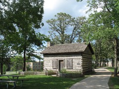 Halverson Log Cabinlisted 1985
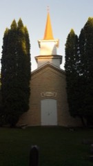 Heart Prairie Lutheran Churchlisted 1974
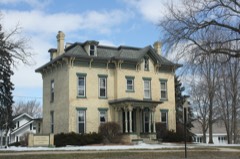 Main Street Historic Districtlisted 1989
 Anson Warner Farmsteadlisted 1998
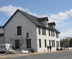 Whitewater Hotellisted 2010
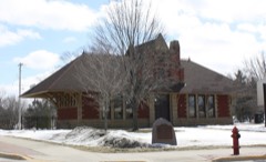 Whitewater Passenger Depotlisted 2013
 Whitewater Post Officelisted 2000
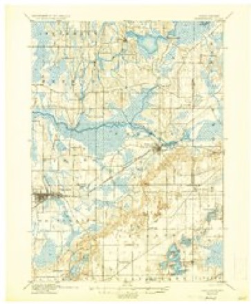
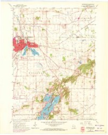
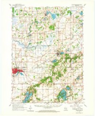
Topographic sheets covering this place
11 surveys from 32 printed sheetsMatched by testing this settlement's coordinate against the published boundary of every sheet in the United States Geological Survey's historical collection. Each opens the scanned sheet at the Survey.
- 1892 USGS Whitewater quadrangle1:62500
- 1893 USGS Whitewater quadrangle1:62500, 7 printings
- 1903 USGS Whitewater quadrangle1:62500, 5 printings
- 1924 USGS Whitewater quadrangle1:62500, 4 printings
- 1954 USGS Rockford quadrangle1:250000
- 1955 USGS Rockford quadrangle1:250000
- 1958 USGS Rockford quadrangle1:250000, 4 printings
- 1960 USGS Whitewater quadrangle1:24000, 3 printings
- 1960 USGS Whitewater quadrangle1:62500, 4 printings
- 1963 USGS Rockford quadrangle1:250000
- 1980 USGS Lake Geneva quadrangle1:100000





In the county-history sources
70,076 words on this townshipHistory of Walworth County, Wisconsin, Containing an Account of Its Settlement, Growth, Development and Resources...its War Record, Biographical Sketches, Portraits of Prominent Men and Early Settlers; the Whole Preceded by a History of Wisconsin...and an Abstract of Its Laws and Constitution.., published 1882 names this settlement in its chapter on Whitewater City. These are the passages that mention it, exactly as the scans read.
The town of Whitewater is in the extreme northwestern portion of the county. The surf acp varies, the southeastern corner of the town being rolling land or hilly. Fully three-fourths the town, however, is comparatively flat, of which one-fom-th consists of swamp land. West of the village of Whitewater is a prairie covering two sections. With the above exceptions, the town originally consisted of openings, with patches of white and black oak and poplar. Its soil is that usually found in a flat country, but is occasionally of a light sandy variety. Near the village are several limestone quaiTies. The tovra is watered by Whitewater Creek, consisting of two branches, one rising in the town of Lima, the other in Richmond; they both flow north into the Bark River. Bass, Whitewater and Round Lakes ai-e all in the southeastern part of the town, and abound in pickerel and bass; there is also the pond south and east of the Tillage. Several mineral springs have been discovered in this latter vicinity, but have not been analyzed. Originally, fom- Indian mounds of quite imposing dimensions existed a short distance from the northeast corner of Section 7 : the largest was sixty -five feet long, twenty feet wide and five and a half feet high. When C. R. Gibbs came into possession of the property, the mound was leveled for the site of his residence. Excavations to unearth its contents have never been made. Northeast of this mound, about V2i) rods, are three other elevations of cone- like form, twenty feet across at the base and seven feet high. Aside from this locality, no other signs of prehistoric life, within the present limits of the town, have been found. Limestone quarries have been discovered near the village.
Passage source: History of Walworth County, Wisconsin, Containing an Account of Its Settlement, Growth, Development and Resources...its War Record, Biographical Sketches, Portraits of Prominent Men and Early Settlers; the Whole Preceded by a History of Wisconsin...and an Abstract of Its Laws and Constitution.., published 1882.
Whitewater is an agi-icultural town, fiilly one-quarter of its population following that pursuit. A quarter of its farms are devoted to dairying, there being several cheese factories in the town. Corn, oats, wheat, barley and buckwheat are the chief grain products. The-first land was broken and the first crop raised by Dr. Edward Brewer, who came from Milwaukee in May, 1837, took up a claim in the southwest (juarter of Section 7, and then co*ntracted for the tilling of ten acres of land during the coming season. He had been accompanied by William and Leander Birge, the three returning in July with Charles Hamilton, bringing with them seven yoke of cattle, one wagon and two breaking plows. The jxirty was five days coming from Milwaukee, and gladdened the heart of their host, Samuel Prince, the first permanent settler, l)y bringing with them all the " solids " of metropolitan fare - pork, potatoes, tea, coffee, flour, etc., etc. Dr. Brewer and Hamilton then went to work to improve the claim on Section 7. The Birges went on to Cold Spring, liiit returned, jumped Norman Pratt's claim to the southeast quarter of Section 2, and commenced to till the soil as the second fanners. The expense of living in those times was simply enormous, but, with the advent of new settlers and the raising of abundant crops in 183'.(, the condition of the pioneers commenced to " look up." The next year, an assessment of property was made, preparatory to raising a tax for a court house and school purposes. The total valuation of the town property was $57,974. From the old Isooks of Benjamin Bosworth, who had opened the first store in Whitewater the previous year, it ap- I)ears that the farmers were not getting wealthy from the sales of their products: Spring wheat, 36 to 40 cents per bushel; winter wheat, 40 to 46 cents; corn, 30 cents; butter, 16 cents per pound; eggs, 8 cents per dozen. The next four years witnessed uiiusual growth in the settlement of Whitewater and in the prosperity of the town. But the Assessors will have to explain the decline in the value of property to $52,863. This figiu-e was based upon 13,540 acres of land, including the village which had been taken up, five-sevenths of which was owned by resi dents. There were over 10,000 acres of Goverment land yet in the market. The harvest of 1844 good, and put the early settlers in splendid spirits. During the winter, the farmers hauled their produce principally to Milwaukee, and returned laden with household provisions, goods or cash. The succeeding eight years passed away, and the country became thickly settled with prosperous farmers, who demanded some easier means of getting their grain to market. The crops for 184(5 to LS51 were poor - the latter year' a total failure. The "pink-eye'" years will long be remembered by all the early farmers of the town and county. The Milwaukee & Mississippi Railroad was completed to Whitewater in September, 1852, and the whole condition of things was changed. Business men and the farmers who had mortgaged then- lands, rejoiced with new hope. Only the dozen tavern-keepers between Whitewater and Milwaukee, who, in past time, had reaped such a harvest fi'om the constant and necessary travel only they put on long faces. In October, 1853, winter wheat was selling at Janesville for 80 cents per bushel, and in Milwaukee, during September, for as high as fl.80.
Passage source: History of Walworth County, Wisconsin, Containing an Account of Its Settlement, Growth, Development and Resources...its War Record, Biographical Sketches, Portraits of Prominent Men and Early Settlers; the Whole Preceded by a History of Wisconsin...and an Abstract of Its Laws and Constitution.., published 1882.
The year 1860 made up for all previous disappointments, however. Then the town passed thi'ough the war and beyond. It is not necessary to detail its growth up to the present time. It is now prosperous and tilled with all that goes to make up comfort. In 1881, there were growing in the town 5,848 acres of grain; 119 of potatoes and root crops; 25'.t of apples (7,835 trees); 3,037 acres of grazing land and grasses and 2,163 acres of timber. Of milch cows, the town possesses 1,378, valued at $22,374. And it must be remembered that the town is but half of its size when the first assessment was made. In 1880, the following crops were grown and products raised: 17,854 bushels of wheat; 142,280 of corn; 39,578 of oats; 1,791 barley; 891 rye; 10,634 potatoes; 1,200 root crops; 10,950 apples; 18 clover seed; 243 timothy seed; 500 pounds tobacco; 3,029 tons grasses; 45,025 pounds butter; 365,430 pounds cheese.
Passage source: History of Walworth County, Wisconsin, Containing an Account of Its Settlement, Growth, Development and Resources...its War Record, Biographical Sketches, Portraits of Prominent Men and Early Settlers; the Whole Preceded by a History of Wisconsin...and an Abstract of Its Laws and Constitution.., published 1882.
Machine-read from a century-old scan, so expect the errors a machine makes: misspelled names, dropped words, stray characters.
Read the whole chapter on Whitewater City - it names this place 225 more 225 times.
Fires near this place
3 since 2018Regional context, not property-specific evidence. The federal wildfire occurrence database lists 3 fires within 5 miles of Whitewater between 2018 and 2020, burning about 3 acres in total. None started naturally. None was recorded as arson. Distance is straight-line from the map coordinates, so a fire counted here may appear on a neighbouring settlement's page as well.
| Reported cause | Fires |
|---|---|
| Missing data/not specified/undetermined | 1 |
| Equipment and vehicle use | 1 |
| Debris and open burning | 1 |
The most recent of them, most recent first, with the day each was reported and the service that recorded it.
| Date | Cause | Size | Reported by | Name on the report |
|---|---|---|---|---|
| 14 June 2020 | Equipment and vehicle use | under an acre | Wisconsin Department of Natural Resources | 20028 |
| 24 April 2018 | Debris and open burning | 3.0 acres | Wisconsin Department of Natural Resources | 18023 |
| 20 April 2020 | Missing data/not specified/undetermined | under an acre | Wisconsin Department of Natural Resources | 20015 |
Settlements close enough to share some of these fires:
Mines and quarries near this place
2 within 5 milesRegional context, not property-specific evidence. The federal mineral resources record lists 2 workings within 5 miles of Whitewater: 1 past producer, 1 producer. 1 still produces. What was taken out: Sand and Gravel, Construction, Stone, Crushed/Broken. Distance is straight-line from the map coordinates, so a quarry counted here may appear on a neighbouring settlement's page as well.
| Where | Site | Commodity | Status | Recorded |
|---|---|---|---|---|
| Draeger Quarry | Stone, Crushed/Broken | Producer | ||
| Triebold Pit | Sand and Gravel, Construction | Past Producer |
Storms near this place
48 since 1995Regional context, not property-specific evidence. The National Weather Service names Whitewater in 48 storm reports between 1995 and 2026: 28 thunderstorm wind, 10 hail, 5 flash flood, 2 lightning. The reports record 1 injury. Each account below is quoted exactly as the forecast office filed it, from the NOAA Storm Events Database, and each date opens the federal record of that event.
| When | Event | Place named | Harm | What the report says |
|---|---|---|---|---|
| September 2005 | Thunderstorm Wind | Whitewater | 1 hurt | Powerful thunderstorm winds toppled a tree, which fell onto a car, injuring one person. |
| June 2008 | Flash Flood | Whitewater | $150,000 | Heavy rains resulted in flash flooding across a good part of Walworth County. Water depths on road surfaces reached 3 feet or more and there were gravel washouts. State Highway 59 was closed in Whitewater. Some farm fields remained flooded into early July. The breakdown for residential home losses were: 10 with minor damage (total of about $50 thousand in damage). There were no business losses. Crop losses were estimated at $1 million. Public sector damage was about $100 thousand. |
| August 2007 | Flash Flood | Whitewater | $150,000 | Several rounds of thunderstorms with heavy rains on top of a saturated ground resulted in scattered flash flood events across the entire county of Walworth. Fast-flowing water reached depths of 6 inches to 2 feet at the following locations: STH 11 just east of STH 89 (about 3N of Darien), Plank Road just northeast of Elkhorn, Highway 12 and Potter Road, CTH L near East Troy, and several roads around Richmond. Johnson Creek and Turtle Creek areas between Richmond and I-43 exceeded flood stage. At least a couple dozen homes had water damage to basement contents, or sewage backups. Two basement walls of a home in the Civil Town of Lafayette, or about 2 miles east-northeast of Elkhorn, collapsed. Some soil erosion and minor crop damage were noted in the county. A couple minor landslides occurred along the shoreline of Geneva Lake.||August, 2007, rainfall totals include: 12.83 in Genoa City, and 12.67 in Whitewater. |
| May 2017 | Thunderstorm Wind | Whitewater | $100,000 | A considerable number of trees and limbs down in Whitewater. Some trees or limbs down on homes and vehicles. Roads were closed due to the large number of trees blocking the roads. No electricity into the next day with schools cancelled. A corn dryer on Howard Road was disconnected from its gas line, thereby causing a fire. |
| April 2008 | Lightning | Whitewater | $100,000 | Lightning struck a home and resulted in a fire that extensively damaged the roof and 2nd story. |
| August 1998 | Flash Flood | Whitewater | $100,000 | no account filed |
| June 2009 | Thunderstorm Wind | Whitewater | $30,000 | A swath of thundersrtorm wind damaged affected northwest Walworth County. The swath was about 4 miles wide. At least 200 trees were uprooted in the Whitewater area, and two vehicles ($estimated $10K in damage) were damaged by tree debris. The tree debris also knocked out a couple feeder power-lines that resulted in 3800 customers losing electrical power. This swath started in northeast Rock County and ended in southeast Jefferson County. |
| August 1998 | Flash Flood | Whitewater | $30,000 | no account filed |
| August 2002 | Lightning | Whitewater | $20,000 | no account filed |
| August 1996 | Thunderstorm Wind | Whitewater | $20,000 | no account filed |
| July 2013 | Thunderstorm Wind | Whitewater | $10,000 | A trained spotter reported trees downed and roof damage caused by thunderstorm wind gusts estimated at 60 mph (52 knots) along a path from Whitewater to 1 mile east of Whitewater. |
| June 2009 | Flash Flood | Whitewater | $10,000 | Some fast moving waters flowing over county roads in the township of Walworth. Water depths of 1 to 2 feet were reported. A couple gravel shoulder washouts were noted. |
| September 2000 | Thunderstorm Wind | Whitewater | $10,000 | no account filed |
| August 1995 | Thunderstorm Wind | Whitewater | $10,000 | no account filed |
| April 2026 | Thunderstorm Wind | Whitewater | $8,000 | Several trees and powerlines down near Whitewater. |
| October 2022 | Thunderstorm Wind | Whitewater | $7,000 | Several trees and power lines down. |
| February 2018 | Flood | Whitewater | $5,000 | Widespread flooding of lowland and agricultural land including some roads. |
| May 2011 | Thunderstorm Wind | Whitewater | $5,000 | A trained spotter reported severe thunderstorm wind gusts that downed trees and tree limbs in Whitewater. |
| July 2008 | Thunderstorm Wind | Whitewater | $5,000 | Powerful thunderstorm wind gusts toppled several large trees and broke branches that brought down some power-lines. |
| June 2004 | Tornado (F1) | Whitewater | $5,000 | This tornado is a continuation of the Jefferson County tornado. Once it crossed the Jefferson/Walworth County line about 7 miles east-northeast of Whitewater, or about 1 mile west of CTH H, this tornado continued east-southeast and dissipated a short time later 3 miles north-northwest of La Grange. Only tree damage was noted. Average path width was about 100 yards. |
| April 1997 | Thunderstorm Wind | Whitewater | $5,000 | no account filed |
| May 1998 | Thunderstorm Wind | Whitewater | $4,000 | no account filed |
| July 2005 | Thunderstorm Wind | Whitewater | $3,000 | no account filed |
| April 2026 | Thunderstorm Wind | Whitewater | $2,000 | A couple trees down on the north side of Whitewater. |
| June 2015 | Thunderstorm Wind | Whitewater | $2,000 | One 12-14 inch diameter tree knocked over. Large tree limbs down. |
| July 2005 | Thunderstorm Wind | Whitewater | $1,000 | no account filed |
| February 1999 | Thunderstorm Wind | Whitewater | $1,000 | no account filed |
| July 2025 | Thunderstorm Wind | Whitewater | $500 | Some minor tree damage. |
| August 2023 | Thunderstorm Wind | Whitewater | $500 | Approximately a 1 foot diameter branch fell onto a sidewalk. |
| September 1997 | Strong Wind | Whitewater | $300 | no account filed |
| July 2010 | Thunderstorm Wind | Whitewater | - | A trained spotter estimated thunderstorm wind gusts up to 52 knots (60 mph) that lasted for eight minutes. |
| June 2009 | Thunderstorm Wind | Whitewater | - | Mesonet at UW Whitewater measured 62 mph wind gust. Several large trees were toppled in the Whitewater area. |
| April 2026 | Hail | Whitewater | - | no account filed |
| April 2026 | Hail | Whitewater | - | no account filed |
| February 2024 | Hail | Whitewater | - | no account filed |
| June 2014 | Hail | Whitewater | - | no account filed |
| May 2011 | Hail | Whitewater | - | no account filed |
| July 2007 | Hail | Whitewater | - | no account filed |
| June 2005 | Thunderstorm Wind | Whitewater | - | no account filed |
| March 2004 | Hail | Whitewater | - | no account filed |
| June 2004 | Thunderstorm Wind | Whitewater | - | no account filed |
| July 2003 | Thunderstorm Wind | Whitewater | - | no account filed |
| September 2002 | Hail | Whitewater | - | no account filed |
| April 2002 | Thunderstorm Wind | Whitewater | - | no account filed |
| March 2000 | Hail | Whitewater | - | no account filed |
| June 1999 | Hail | Whitewater | - | no account filed |
| August 1995 | Thunderstorm Wind | Whitewater | - | no account filed |
| August 1995 | Thunderstorm Wind | Whitewater | - | no account filed |
Nearest settlements
The eight closest, with where each one stands in the county. Distances are straight-line, computed from the Geographic Names Information System coordinates.
| Map | Place | Distance | Sheets |
|---|---|---|---|
| Heart Prairie | 6.7 miles | 32 | |
| La Grange | 7.3 miles | 32 | |
| Richmond | 8.3 miles | 19 | |
| Millard | 9.0 miles | 19 | |
| Lauderdale Shores | 9.8 miles | 32 | |
| Little Prairie | 10.3 miles | 32 | |
| Lauderdale | 10.5 miles | 32 | |
| Tibbets | 10.5 miles | 19 |
Elsewhere
Matched on this settlement's Geographic Names Information System number rather than its name, so it cannot be a different place of the same name in another state.
| Wikipedia article on Whitewater | An encyclopaedic summary. Its text is share-alike, so it is linked here rather than copied. |
| Wikidata item Q1570484 | The structured record the population and elevation above come from. Public domain (CC0). |
Provenance
This settlement is recorded in the Geographic Names Information System as feature 1576690. The sheet list is computed by point-in-boundary test against the United States Geological Survey's historical topographic inventory. Both are works of the United States government and carry no copyright under 17 U.S.C. 105.
Wildfire. Short, Karen C. 2022. Spatial wildfire occurrence data for the United States, 1992-2020 [FPA_FOD_20221014]. 6th Edition. Fort Collins, CO: Forest Service Research Data Archive. https://doi.org/10.2737/RDS-2013-0009.6 Collected with United States Government funding and usable without additional permissions or fees.
Mines and quarries. USGS Mineral Resources Data System (MRDS) https://mrdata.usgs.gov/mrds/ A work of the United States government, no copyright under 17 U.S.C. 105.
Storms. NOAA National Centers for Environmental Information, Storm Events Database https://www.ncei.noaa.gov/stormevents/ A work of the United States government, no copyright under 17 U.S.C. 105. Narratives are quoted verbatim from the National Weather Service report and are not edited or summarised.