Block
From the record
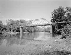
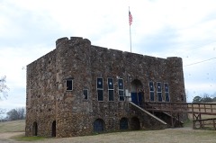
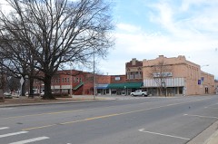
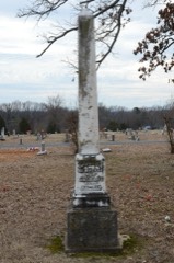
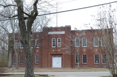
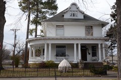
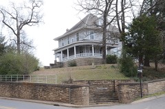
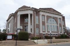
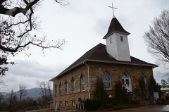
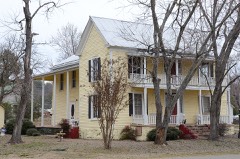
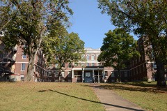
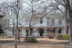
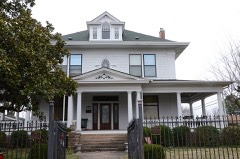
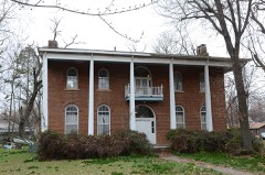
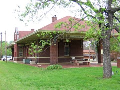
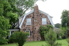
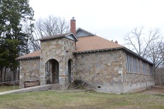
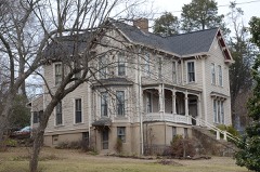
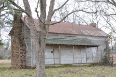
35 National Register listings published here.
Sources: the county history on the Internet Archive · the National Register database, National Park Service
71 topographic sheets cover 55 settlements here, and 35 properties are on the National Register of Historic Places.
35 National Register listings published here.
Sources: the county history on the Internet Archive · the National Register database, National Park Service
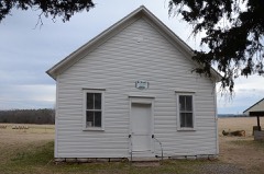
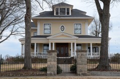
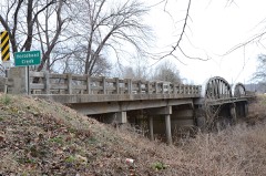
Every property in this county listed on the National Register of Historic Places, with the year it was listed and the federal nomination document.
Every wildfire the federal occurrence database records inside this county: 521 of them, burning about 6,863 acres. 22 started naturally and 124 were recorded as arson. Each settlement page carries the fires within five miles of it.
| Reported cause | Fires |
|---|---|
| Debris and open burning | 146 |
| Missing data/not specified/undetermined | 133 |
| Arson/incendiarism | 124 |
| Equipment and vehicle use | 53 |
| Natural | 22 |
| Recreation and ceremony | 13 |
| Power generation/transmission/distribution | 9 |
| Smoking | 8 |
| Misuse of fire by a minor | 6 |
| Fireworks | 4 |
| Railroad operations and maintenance | 3 |
The five largest, by the area the report gives. Three of them were set deliberately.
| Date | Cause | Size | Reported by | Name on the report |
|---|---|---|---|---|
| 25 November 2017 | Missing data/not specified/undetermined | 2,014 acres | Ozark-St. Francis National Forests | TOMS MILL |
| 1 August 2012 | Natural | 1,435 acres | Ozark-St. Francis National Forests | HESS KNOB |
| 6 July 2012 | Missing data/not specified/undetermined | 91 acres | Arkansas Forestry Commission | not named |
| 14 December 2012 | Arson/incendiarism | 90 acres | Arkansas Forestry Commission | STONER POINT |
| 4 May 2014 | Arson/incendiarism | 80 acres | Ozark-St. Francis National Forests | DUTTON |
| 14 January 2009 | Arson/incendiarism | 75 acres | Ozark-St. Francis National Forests | DRIPPING SPRINGS |
| 24 June 2012 | Equipment and vehicle use | 70 acres | Arkansas Forestry Commission | CLARKSVILLE |
| 16 April 2003 | Power generation/transmission/distribution | 63 acres | Ozark-St. Francis National Forests | RIPTIDE RUSH |
Every settlement page carries the fires within five miles of it - see the settlement index below.
The NOAA Storm Events Database holds 550 reports for this county, causing 5 deaths, 150 injuries and about $31,929,800 in recorded property damage. Each settlement page carries the reports that name it.
| Kind of event | Reports |
|---|---|
| Thunderstorm Wind | 269 |
| Hail | 177 |
| Flash Flood | 53 |
| Tornado | 39 |
| Lightning | 5 |
| Flood | 3 |
| Heavy Rain | 3 |
| Funnel Cloud | 1 |
The most serious of them, by death, then injury, then recorded damage. The accounts are quoted exactly as the forecast office filed them.
| When | Event | Place named | Harm | What the report says |
|---|---|---|---|---|
| March 1961 | Tornado (F2) | not stated | 1 killed, 14 hurt, $250,000 | no account filed |
| May 2011 | Tornado (EF2) | Coal Hill | 1 killed, 11 hurt, $5,500,000 | This is the sixth and final segment of a six-segment tornado. (The first, third, and fifth segments occurred in Franklin County in the Tulsa County Warning Area.) The tornado moved out of Franklin County north of Alix and entered Johnson County northwest of Coal Hill. In Johnson County, the tornado first moved through the Centerpoint community, knocking down trees in the cemetery and badly damaging several residences. The tornado next moved on to the Bethlehem community, where several mobile homes were destroyed and some additional residences were damaged. A 31 year-old woman in one of the mobile homes was killed and approximately 11 other people were injured. The tornado next moved on to Harmony, damaging additional residences, barns, chicken houses, and outbuildings, before continuing into the Ozark National Forest. Damage also occurred near Ozone before the tornado lifted farther to the northeast in the forest. Altogether, at least 65 residences were damaged or destroyed in Johnson County. |
| May 2011 | Tornado (EF3) | New Spadra | 1 killed, 4 hurt, $13,000,000 | This tornado moved through Clarksville, causing extensive damage at the country club and to businesses and residences on the south and east sides of town. Initially, the entire city of Clarksville was without electricity. About 70% of electric customers had power restored by the end of the day on the 25th, but the hardest-hit areas lacked power for a week. In Clarksville, the tornado took a similar path to that of a tornado which occurred on April 7, 1980. After leaving Clarksville, the tornado moved off to the northeast passing between Strawberry and Chronister Store. A 65 year-old man was killed in the area of the Strawberry community when the tornado destroyed a small house on a goat farm. Altogether, at least 150 residences in Johnson County were damaged or destroyed. The tornado continued moving to the northeast, moving into the Ozark National Forest. Many trees were blown down, blocking roads in the forest. The tornado exited Johnson County south-southeast of Dillen and entered Pope County south-southwest of Bertha. |
| November 2001 | Tornado (F2) | Hunt | 1 killed, 4 hurt | An F2 tornado that developed over Franklin County, moved into Johnson County about 3 miles west-southwest of Hunt, on Highway 352. The tornado moved northeastward, passing just northwest of Hunt. The tornado continued on across a portion of Horsehead Lake, tracked several miles east of Catalpa and then crossed into Newton County about one mile west of Salus. The tornado killed a woman in a mobile home on County Road 272, about 1.5 miles northwest of Hunt. Two other people inside the mobile home sustained minor injuries. Two additional injuries occurred on County Road 29, about 1.5 miles north of Hunt, when two people were inside a chicken house when it was destroyed. Six chicken houses were destroyed at this location. Three of the chicken houses contained about 120 thousand chickens, many of which were killed. Other damage in Johnson County included more than a dozen barns destroyed, several mobile homes destroyed, several homes with major damage and a number of homes with lesser damage. A number of vehicles were destroyed and many others were damaged. Many outbuildings were destroyed and thousands of trees were blown down. |
| April 1997 | Flash Flood | Oark | 1 killed | Heavy rains caused flash flooding across parts of Johnson County. A vehicle driving across a low-water bridge was swept off the bridge by the high water. The driver of the vehicle drowned. |
| April 1980 | Tornado (F3) | not stated | 76 hurt, $2,500,000 | no account filed |
| February 1954 | Tornado (F3) | not stated | 24 hurt, $250,000 | no account filed |
| November 1988 | Tornado (F2) | not stated | 9 hurt, $2,500,000 | no account filed |
| November 1973 | Tornado (F1) | not stated | 6 hurt, $25,000 | no account filed |
| May 1960 | Tornado (F2) | not stated | 2 hurt, $25,000 | no account filed |
| November 1985 | Tornado (F2) | not stated | $2,500,000 | no account filed |
| October 2009 | Flash Flood | Oark | $2,000,000 | Flooding on Spadra Creek and Horsehead Creek caused roads to be flooded and culverts washed out. Numerous streets were flooded in Clarksville, as was U.S. Highway 64 around Hartman and Coal Hill. Around 9:20 PM CDT, a washout on a railroad track caused a train derailment in the Coal Hill Bottoms, south of Coal Hill. Nineteen hopper cars carrying soybeans were derailed, spilling the beans and tearing up a section of track. Mudslides occurred on Interstate 40 southwest of Hunt, on Arkansas Highway 103 in the Batson Mountain vicinity, and on a road north of Catalpa. Eight houses were flooded in the western part of the county. Cattle had to be rescued from flooding at the Dirty Creek Bridge on Arkansas Highway 164. Numerous county roads were flooded in the area west of Arkansas Highway 21. Several water rescues were necessary. |
| June 2009 | Thunderstorm Wind | Shady Grove | $500,000 | Numerous trees were blown down, some of which fell on houses. Numerous power lines were blown down, and some power poles were snapped. Business signs were blown down. The roof was blown off a business, and some lumber sheds were damaged at a lumber yard. Shingles were blown off houses. |
| April 2011 | Flood | Oark | $250,000 | Widespread areal flooding occurred. |
| May 2011 | Flood | Oark | $250,000 | no account filed |
| May 1983 | Tornado (F2) | not stated | $250,000 | no account filed |
| August 2011 | Thunderstorm Wind | Clarksville | $125,000 | Several homes were damaged, and trees and power lines were blown down. Two tractor-trailers were blown onto their sides on Interstate 40. |
| October 2007 | Lightning | Clarksville | $125,000 | A fire occurred at the U.S. Forest Service Pleasant Hill District office of the Ozark National Forest. Lightning struck a radio tower and apparently traveled down the tower to a Forest Service office building. The building and equipment inside were destroyed. Siding was melted on an adjacent building. |
| September 1996 | Lightning | Hartman | $120,000 | no account filed |
| March 2017 | Thunderstorm Wind | Zadock | $100,000 | Strong straight line wind damage was surveyed beginning near the intersection of Strawberry Loop Road and Minnow Creek Road and was scattered along a west to east oriented line ending just north of Hagarville at an Adventure Farm just north of town. There were a few outbuildings destroyed within this swath of damage, some of which were well constructed. A wallaby and her baby were killed when a nursery barn was destroyed at the Adventure Farm north of Hagarville. The damage was consistent with thunderstorm winds of 80 to 90 mph. Several trees were also uprooted in between the start and end points of damage. |
| May 2015 | Flash Flood | Hunt | $100,000 | Many roads across the county were washed out due to flash flooding. Two water rescues were performed overnight at homes in the town of Hunt. |
| April 2014 | Thunderstorm Wind | Clarksville | $100,000 | Thunderstorm winds blew down trees and power lines. A few of the trees landed on houses. |
| September 2010 | Flash Flood | Clarksville | $100,000 | Flooding occurred on Arkansas Highways 352 and 103, on Johnson County Roads 3149, 3151, 3355, 3521, 3341, 3315, 3390, and 3329, and on several streets in Clarksville. Heavy rain caused water to enter a house on Arkansas Highway 352 near Horsehead Creek. |
| March 2008 | Flash Flood | Coal Hill | $100,000 | Low water crossings were flooded in many parts of the county. |
| May 2022 | Thunderstorm Wind | Lutherville | $90,000 | A mobile home was destroyed, walls were pushed inward in one direction. Trees were blown over (from west to east) laying over a house. |
| May 2017 | Thunderstorm Wind | Lutherville | $60,000 | A few barns and metal outbuildings were destroyed. |
| April 2014 | Thunderstorm Wind | Hillcrest | $50,000 | Numerous trees and power lines were blown down around Ludwig and Hillcrest as well as other locations in Johnson County. |
| April 2009 | Tornado (EF1) | Clarksville | $50,000 | A weak tornado tore part of the roof off a house and caused shingle damage to a few additional roofs, blew the roof off a farm shed, took tin off the roofs of two turkey houses and one chicken house, broke off a couple of power poles, and blew down several dozen trees. |
| June 1994 | Thunderstorm Wind | Clarksville | $50,000 | Thunderstorm winds downed numerous trees and power lines. |
| June 1994 | Thunderstorm Wind | Clarksville | $50,000 | Thunderstorm winds downed a tree and damaged a storage building roof at a processing plant. |
| November 1994 | Tornado (F0) | Clarksville | $50,000 | An F0 tornado touched down briefly 3 miles east of Clarksville. The tornado damaged two chicken houses. |
| November 1993 | Thunderstorm Wind | Clarksville | $50,000 | Thunderstorm winds downed numerous trees. |
| August 2011 | Thunderstorm Wind | Hunt | $30,000 | A roof was blown off a house and numerous trees were blown down. |
| April 2014 | Thunderstorm Wind | Hickeytown | $25,000 | Falling trees damaged a couple of houses in the Piney Bay area. |
| May 2011 | Thunderstorm Wind | Coal Hill | $25,000 | Trees and power lines were blown down. |
| May 2011 | Thunderstorm Wind | Clarksville | $25,000 | Trees and power lines were blown down. |
| May 2011 | Thunderstorm Wind | Knoxville | $25,000 | Trees and power lines were blown down. |
| May 2009 | Thunderstorm Wind | Clarksville | $25,000 | Trees were down at Arkansas Highway 109, U.S. Highway 64 and along Arkansas Highway 21. |
| June 2009 | Thunderstorm Wind | Coal Hill | $25,000 | Trees were down across the western portion of the county. |
| June 2009 | Thunderstorm Wind | Harmony | $25,000 | Trees were down across western portions of the county. |
| June 2009 | Thunderstorm Wind | Clarksville | $25,000 | Trees were uprooted in the area. |
| June 2009 | Thunderstorm Wind | Clarksville | $25,000 | Trees were down in the area. |
| June 2009 | Thunderstorm Wind | Knoxville | $25,000 | Trees and power lines were blown down. Tin was peeled off an old chicken house. A billboard was blown down. |
| October 2009 | Flood | Edna | $25,000 | A natural gas pipeline was damaged due to debris floating in floodwaters. |
| June 1974 | Tornado (F3) | not stated | $25,000 | no account filed |
| May 1971 | Tornado (F2) | not stated | $25,000 | no account filed |
| March 1965 | Tornado (F2) | not stated | $25,000 | no account filed |
| April 1960 | Tornado (F3) | not stated | $25,000 | no account filed |
| April 1954 | Tornado (F1) | not stated | $25,000 | no account filed |
| May 2019 | Thunderstorm Wind | Knoxville | $20,000 | Numerous trees were downed, with at least one tree on a house. |
| March 2017 | Tornado (EF1) | Lamar | $20,000 | An EF-1 tornado touched down at Lamar, with severe roof damage to a home. |
| March 2016 | Thunderstorm Wind | Mt Levi | $20,000 | Two homes were damaged along highway 123 with one roof removed from one of the homes. Path length was 0.1 miles and patch width was 50 yards. |
| July 2014 | Thunderstorm Wind | Lamar | $20,000 | A tree was blown down onto a car. No one was injured. |
| July 2014 | Flash Flood | Knoxville | $20,000 | Two houses were evacuated due to high water. |
| February 2009 | Thunderstorm Wind | Ozone | $20,000 | Several trees were blown down in north central Johnson County, including one on Arkansas Highway 21 south of Ozone. |
| September 2012 | Thunderstorm Wind | Lutherville | $15,000 | Trees and power lines were blown down. |
| June 2011 | Thunderstorm Wind | Clarksville | $15,000 | Trees and power lines were blown down in Clarksville. |
| September 2010 | Flash Flood | White Oak | $15,000 | Flooding occurred in the Horsehead Lake area, causing roads to be under water. Law enforcement officers found that campers in the area were safe and away from the flood waters. Several other county roads along the bottom of the mountains were flooded. |
| October 2009 | Thunderstorm Wind | Lamar | $15,000 | Large trees and power lines were down in Lamar. |
| January 1998 | Flash Flood | Countywide | $15,000 | Heavy rains resulted in flash flooding across several areas of Johnson County. A number of county roads and bridges suffered damage due to the heavy rainfall. |
The Survey's mineral resources record lists 15 workings inside this county. 2 still produce and 13 are closed or unrecorded. Each settlement page carries the workings within five miles of it.
| Commodity | Workings |
|---|---|
| Stone | 7 |
| Sand and Gravel, Construction | 5 |
| Clay | 3 |
The least common of them first, because a county's hundredth gravel pit says nothing its first ten did not.
| Where | Site | Commodity | Status | Recorded |
|---|---|---|---|---|
| Eureka Brick Co. Clay Pit | Clay | Producer | ||
| Unk | Clay | Past Producer | ||
| Unk | Clay | Past Producer | ||
| Johnson County Pit | Sand and Gravel, Construction | Producer | ||
| Unk | Sand and Gravel, Construction | Past Producer | ||
| Unk | Sand and Gravel, Construction | Past Producer | ||
| Unk | Sand and Gravel, Construction | Past Producer | ||
| Unk Quarries 2 | Sand and Gravel, Construction | Past Producer | ||
| Unk | Stone | Past Producer | ||
| Unk | Stone | Past Producer | ||
| Unk | Stone | Past Producer | ||
| Unk | Stone | Past Producer | ||
| Unk Quarries 2 | Stone | Past Producer | ||
| Unk Quarries 2 | Stone | Past Producer | ||
| Unk Quarries 3 | Stone | Past Producer |
Johnson County, Arkansas, the First Hundred Years devotes a chapter to each township: its boundaries and streams, who settled it and when, the mills, the schools and the churches. The one chapter is reproduced here in full. Each row shows the township's own shape and where it lies in the county, drawn from the Census Bureau's boundary. Which settlements belong to which township is computed from that same boundary, not taken from the book.
| Shape and position in the county | Township | Settlements in it | Length | Sections |
|---|---|---|---|---|
| Spadra 2 Township | Jamestown, Ludwig | 962 words | 0 |
Named settlements recorded in the Geographic Names Information System, each with the topographic sheets covering it. Villages, hamlets and abandoned places alike. Each is shown with the nearest named watercourse or landform and the survey quadrangle it falls on.
Ward township · 72830 · On Burt Creek · Hartman quadrangle
20 sheets, 1887 to 1993
No longer a settlement
King township · 72830 · On Craven Branch · Clarksville quadrangle
20 sheets, 1888 to 1993
Batson township · 72854 · Near Grass Ridge · Harmony quadrangle
10 sheets, 1906 to 1992
No longer a settlement
Batson township · 72830 · On West Fork Horsehead Creek · Hunt quadrangle
10 sheets, 1906 to 1992
Perry township · 72839 · On Haw Creek · Fort Douglas quadrangle
14 sheets, 1889 to 1992
Perry township · 72830 · Near Pullman Hollow · Ozone quadrangle
13 sheets, 1889 to 1992
Perry township · 72846 · Near Lutherville Mountain · Knoxville quadrangle
19 sheets, 1888 to 1993
Spadra 2 township · 72830 · On Spadra Creek · Clarksville quadrangle
20 sheets, 1888 to 1993
Spadra 4 township · 72830 · Near Red Lick Mountain · Ludwig quadrangle
13 sheets, 1889 to 1992
Perry township · 72846 · On Lutherville Mountain · Knoxville quadrangle
19 sheets, 1888 to 1993
Perry township · 72830 · Near Turkey Mountain · Ludwig quadrangle
13 sheets, 1889 to 1992
Perry township · 72830 · Near Turkey Mountain · Ludwig quadrangle
13 sheets, 1889 to 1992
Perry township · 72830 · Near Turkey Mountain · Ludwig quadrangle
13 sheets, 1889 to 1992
Perry township · 72854 · Near Owens Hollow · Hagarville quadrangle
13 sheets, 1889 to 1992
No longer a settlement
Batson township · 72840 · On Dirty Creek · Hunt quadrangle
10 sheets, 1906 to 1992
No longer a settlement
Ward township · 72830 · On Little Spadra Creek · Clarksville quadrangle
20 sheets, 1888 to 1993
King township · 72830 · Near Stillwell Mountain · Harmony quadrangle
10 sheets, 1906 to 1992
Perry township · 72846 · Near Officers Hollow · Hagarville quadrangle
13 sheets, 1889 to 1992
No longer a settlement
The vanished settlements of Johnson County: the places named above that are no longer on the map.