 Block
Almyville, Connecticut
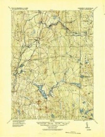
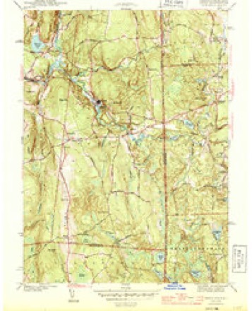
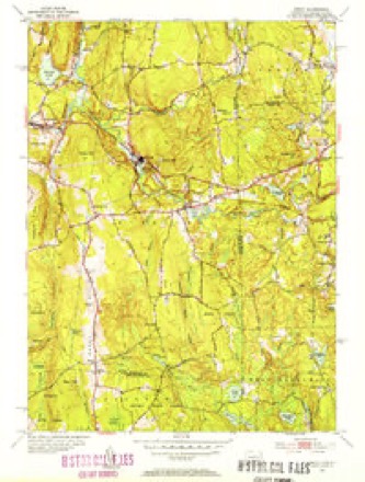
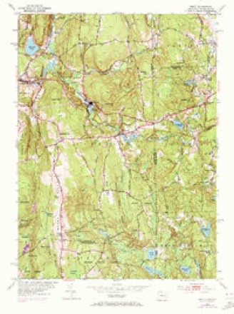
28 topographic sheets cover this place, the earliest surveyed in 1889 and the latest in 1984. It stands in Plainfield town. It lies in ZIP code area 06354. It lies near Withey Hill. The Survey maps it on the Oneco quadrangle.
On record in Almyville
Buildings and businesses the archive holds for this place. Each opens its own page, with the source record it came from.
On the National Register within a mile 2 records
The National Register names another town for these. They stand within one mile of this settlement's coordinate.
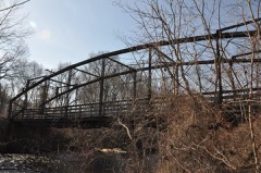 Glen Falls Bridgelisted 1999 · 0.3 miles away
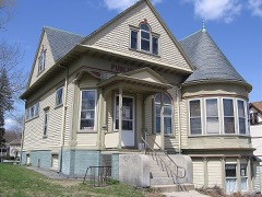 Aldrich Free Public Librarylisted 1994 · 0.5 miles away
Topographic sheets covering this place
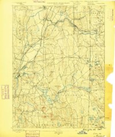
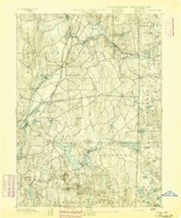
13 surveys from 28 printed sheetsMatched by testing this settlement's coordinate against the published boundary of every sheet in the United States Geological Survey's historical collection. Each opens the scanned sheet at the Survey.
- 1889 USGS Moosup quadrangle1:62500
- 1893 USGS Moosup quadrangle1:62500, 7 printings
- 1920 USGS Moosup quadrangle1:62500
- 1943 USGS Putnam quadrangle1:125000
- 1944 USGS Oneco quadrangle1:31680, 2 printings
- 1947 USGS Providence quadrangle1:250000, 5 printings
- 1948 USGS Providence quadrangle1:250000
- 1953 USGS Oneco quadrangle1:31680, 2 printings
- 1953 USGS Oneco quadrangle1:24000, 4 printings
- 1957 USGS Providence quadrangle1:250000
- 1958 USGS Providence quadrangle1:250000
- 1963 USGS Providence quadrangle1:250000
- 1984 USGS Providence quadrangle1:100000







In the county-history sources
31,302 words on this townshipHistory of Windham County, Connecticut .., published 1889 names this settlement in its chapter on Plainfield Town. These are the passages that mention it, exactly as the scans read.
The Indian war of 1704 subjected Plainfield to new restrictions and outlays. With other frontier towns, it was not to be deserted by any of its inhabitants ; guard houses and scouts were to be maintained, equipped, and supplied with ammunition ; a train band was formed, with Thomas Williams for ensign and Samuel Howe for sergeant. Guards were stationed about the meeting house on Sunday, and watch houses were maintained in exposed parts of the town. Great pains were taken to propitiate the favor of the Quinebaugs, who continued as ever peaceable and friendly.
Passage source: History of Windham County, Connecticut .., published 1889.
During the early years of the present century, manufacturing interests began to develop in Plainfield, and through their influence the town has maintained its position and growth with a healthy degree of progress. About the year 1807 several manufacturing companies embarked in the enterprise of establishing cotton spinning upon the streams of this town. The American Cotton Manufacturing Company was composed of Thomas Rhodes of Providence, Peter B. Remington of Warwick, Messrs. Holden & Lawton of Rehoboth, and Obed Brown, Dyer Ames and others of Sterling. This company secured a privilege ' ' near Ransom Perkins' fulling mill on Quandunk River." The Plainfield Union Manufacturing Company was organized for the purpose of carrying on the manufacture of cotton, and bought valuable privileges and land on the Moosup. This company was composed of Rufus Waterman, S. G. Arnold, Joseph S. Martin, David and Joseph Anthony, of Providence; Peter Cushman, of North Providence; David King, of Newport; and Anthony Bradford, Henry Dow, John Dunlap, Walter Palmer, Christo- pher Deane, Jonathan Gallup, Joseph Parkhurst, Edward Hill, John Lester, Jeremiah Kinsman, James Gordon, Jr., Nathaniel Medbury, James Goff, John Freeman, Elias Deane and Edward Clark, of Plainfield; and Calvin Hibbard and Lemuel Dorrance, of Sterling. Joseph K. Angell, with Nathan Burgess, Humphrey Almy and other non-residents, arranged to occupy the privilege long owned by Nathan Angell, under the name of the Moosup Manufacturing Company. The Plainfield Union Company was ready for work in 1809, and the others within a year or two from that time. The Andrus Factory Company, composed of Abel and Benjamin Andrus, Thomas and Andrew Gibbs, Levi Robinson and Joseph Hutchins, of Plainfield; Charles Townsend, of Norwich; Titus Adams, John Baldwin and Joseph Farnham, of Canterbury, began operations in 1811. They bought land in Plainfield and Canterbury, on the brook south of the grist mill, and put up a small mill, thus beginning the settlement which has since been known as Packerville. Adjoining residents in both towns were much interested in this manufacturing experiment, and freely gave their aid in clearing up land and digging the cellar. Woolen factories were also set in motion in the town by Darius Lawton, of Newport, and Joseph Eaton. Carding machines and fulling mills were run by John Kennedy and others. Mr. John Lester and Doctor Fuller engaged largely in wool raising. The period of depression in the manufacturing industry which followed the war of 1812 occasioned much embarrassment in Plainfield. Several companies were obliged to suspend operations, and many changes took place. The Moosup Company lost its factory by fire, and the company was dissolved. The Central Manufacturing Company in 1827 passed into the hands of Richard and Arnold Fenner, of Cumberland, and Holden Borden, of Smithfield. Buildings, machinery, privileges of land and water, occupied in woolen manufacture by Joseph Eaton, Darius Lawton and company, in 1826 fell into the hands of a Rhode Island Quaker, William Almy. A large new factory building was erected the following year, improved machinery introduced, tenement houses built, adjoining land purchased and brought under cultivation, and soon one of the largest woolen manufactories in Connecticut was under full headway. Another smaller factory, eastward on the Moosup, was built and run by Joseph S. Gladding. The Union Factory, owned mostly in Plainfield, was also flourishing, Henry A. Rogers acting as its agent Providence. Four little manufacturing villages, known as Almyville, Unionville, Centreville and Packerville, were thus growing up in the town. All were managed by good men, ready to promote order and improvement. The first was made the charge of Sampson Almy, nephew of its chief proprietor. A small settlement also grew up around Kennedy's mill, near the mouth of the Moosup.
Passage source: History of Windham County, Connecticut .., published 1889.
It has already been stated that the town of Plainfield is largely dependent upon its manufacturing enterprises for the degree of prosperity which it enjoys. There are in the town several localities of more or less importance which have been built up by this industry. These are Moosup, Central Village, Wauregan, Kennedy City, Almyville, Gladdingville and Packerville, which last is on the Canterbury line.
Passage source: History of Windham County, Connecticut .., published 1889.
Machine-read from a century-old scan, so expect the errors a machine makes: misspelled names, dropped words, stray characters.
Read the whole chapter on Plainfield Town - it names this place 3 more 3 times.
Fires near this place
156 since 1994Regional context, not property-specific evidence. The federal wildfire occurrence database lists 156 fires within 5 miles of Almyville between 1994 and 2020, burning about 174 acres in total. 1 started naturally. 7 were recorded as arson. Distance is straight-line from the map coordinates, so a fire counted here may appear on a neighbouring settlement's page as well.
| Reported cause | Fires |
|---|---|
| Missing data/not specified/undetermined | 108 |
| Recreation and ceremony | 13 |
| Debris and open burning | 9 |
| Smoking | 7 |
| Misuse of fire by a minor | 7 |
| Arson/incendiarism | 7 |
| Power generation/transmission/distribution | 2 |
| Natural | 1 |
| Railroad operations and maintenance | 1 |
| Equipment and vehicle use | 1 |
The most recent of them, most recent first, with the day each was reported and the service that recorded it.
| Date | Cause | Size | Reported by | Name on the report |
|---|---|---|---|---|
| 28 September 2011 | Missing data/not specified/undetermined | under an acre | Connecticut Division of Forestry | PLAINFIELD |
| 6 August 2020 | Power generation/transmission/distribution | 2.0 acres | Connecticut Division of Forestry | not named |
| 5 August 2020 | Missing data/not specified/undetermined | 1.0 acres | Connecticut Division of Forestry | 289 STERLING ROAD |
| 5 August 2020 | Missing data/not specified/undetermined | under an acre | Connecticut Division of Forestry | 91 GIBSON LANE |
| 5 August 2007 | Arson/incendiarism | 1.0 acres | Rhode Island Division of Forest Environment | not named |
| 2 August 2020 | Missing data/not specified/undetermined | under an acre | Connecticut Division of Forestry | OLD FURNACE STATE PARK |
| 2 August 2020 | Missing data/not specified/undetermined | under an acre | Connecticut Division of Forestry | 81 ROSS ROAD |
| 6 July 2010 | Missing data/not specified/undetermined | under an acre | Connecticut Division of Forestry | not named |
Settlements close enough to share some of these fires:
Mines and quarries near this place
10 of 16 shownRegional context, not property-specific evidence. The federal mineral resources record lists 16 workings within 5 miles of Almyville: 10 past producers, 5 producers, 1 unknown. 5 still produce. What was taken out: Granite, Sand and Gravel, Construction, Stone, Crushed/Broken, Flagstone. Distance is straight-line from the map coordinates, so a quarry counted here may appear on a neighbouring settlement's page as well.
| Where | Site | Commodity | Status | Recorded |
|---|---|---|---|---|
| Connecticut Flatstone Quarry | Stone, Dimension | Producer | ||
| Strouse Brothers Quarry | Flagstone | Past Producer | ||
| Strouse Brothers Quarry | Stone, Crushed/Broken | Past Producer | Sedimentary | |
| Wauregan Pit and Quarry | Stone, Crushed/Broken, Sand and Gravel, Construction | Producer | ||
| Danielson Mine | Sand and Gravel, Construction | Producer | ||
| Danielson Pit | Sand and Gravel, Construction | Unknown | ||
| Route 205 Pit | Sand and Gravel, Construction | Producer | ||
| Bennett Quarries | Granite | Past Producer | ||
| Granite Quarries | Granite | Past Producer | ||
| Granite Quarries | Granite | Past Producer |
Storms near this place
2 since 2014Regional context, not property-specific evidence. The National Weather Service names Almyville in 2 storm reports between 2014 and 2021: 1 flood, 1 tornado. No death or injury is recorded in these reports. Each account below is quoted exactly as the forecast office filed it, from the NOAA Storm Events Database, and each date opens the federal record of that event.
| When | Event | Place named | Harm | What the report says |
|---|---|---|---|---|
| November 2021 | Tornado (EF0) | Almyville | $25,000 | Based on definitive radar confirmation of a tornado debris signature and video footage from our media partners, we confirmed that an EF-0 tornado touched down in Plainfield, CT at approximately 4:48 PM EST on Saturday, November 13. Maximum wind speed was estimated at 80 mph and the maximum path width was estimated at 100 yards. The tornado was in contact with the ground for a total of 6.13 miles....approximately 4.7 miles in CT and 1.4 miles in RI. Several hardwood trees were uprooted on a hilltop on Sterling Hill Road near Goshen Road. A tree was reported down on a house on Main Street in Sterling. Also in Sterling, the Fire Department reported trees and wires down on River Road and a transformer fire at the intersection of Gibson Hill Road and Snake Meadow Hill Road. The tornado then tracked northeastward into Rhode Island and ended at the Cucumber Hill Farm in Foster at approximately 5:02 PM EST. Sheared trees and downed hardwood trees were observed on the farm. A heavy, large red trailer also was moved approximately 50 feet. |
| March 2014 | Flood | Almyville | - | Snake Meadow Brook overflowed its banks, flooding and ultimately closing North Sterling Road in Moosup for several hours. |
Nearest settlements
The eight closest, with where each one stands in the county. Distances are straight-line, computed from the Geographic Names Information System coordinates.
| Map | Place | Distance | Sheets |
|---|---|---|---|
| Moosup | 0.9 miles | 32 | |
| Sterling | 2.1 miles | 28 | |
| Central Village | 2.2 miles | 32 | |
| Wauregan Station | 2.3 miles | 32 | |
| Wauregan | 2.9 miles | 32 | |
| West Wauregan | 3.4 miles | 32 | |
| Oneco | 3.5 miles | 28 | |
| Plainfield | 3.9 miles | 32 |
Provenance
This settlement is recorded in the Geographic Names Information System as feature 205076. The sheet list is computed by point-in-boundary test against the United States Geological Survey's historical topographic inventory. Both are works of the United States government and carry no copyright under 17 U.S.C. 105.
Wildfire. Short, Karen C. 2022. Spatial wildfire occurrence data for the United States, 1992-2020 [FPA_FOD_20221014]. 6th Edition. Fort Collins, CO: Forest Service Research Data Archive. https://doi.org/10.2737/RDS-2013-0009.6 Collected with United States Government funding and usable without additional permissions or fees.
Mines and quarries. USGS Mineral Resources Data System (MRDS) https://mrdata.usgs.gov/mrds/ A work of the United States government, no copyright under 17 U.S.C. 105.
Storms. NOAA National Centers for Environmental Information, Storm Events Database https://www.ncei.noaa.gov/stormevents/ A work of the United States government, no copyright under 17 U.S.C. 105. Narratives are quoted verbatim from the National Weather Service report and are not edited or summarised.