 Block
Woodstock, Connecticut
29 topographic sheets cover this place, the earliest surveyed in 1889 and the latest in 1984. It stands in Woodstock town. It lies in ZIP code area 06281. It lies near Bald Hill. The Survey maps it on the Putnam quadrangle.
On record in Woodstock
Buildings and businesses the archive holds for this place. Each opens its own page, with the source record it came from.
On the National Register 5 records
 Henry C. Bowen HouseNational Historic Landmark · listed 1977
 Mathew Bowen Homesteadlisted 1987
 Taylor's Cornerlisted 1989
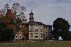 Woodstock Academy Classroom Buildinglisted 1984
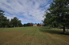 Woodstock Hill Historic Districtlisted 1999
Topographic sheets covering this place
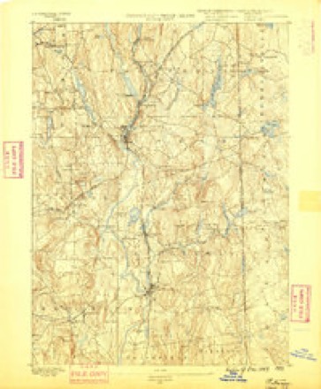
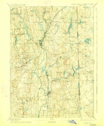
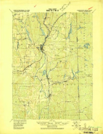
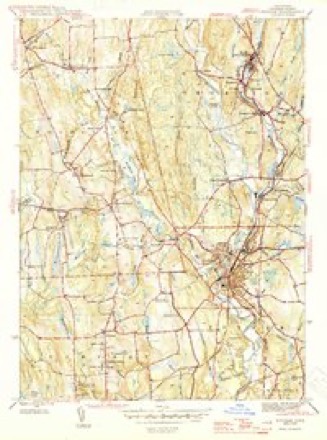
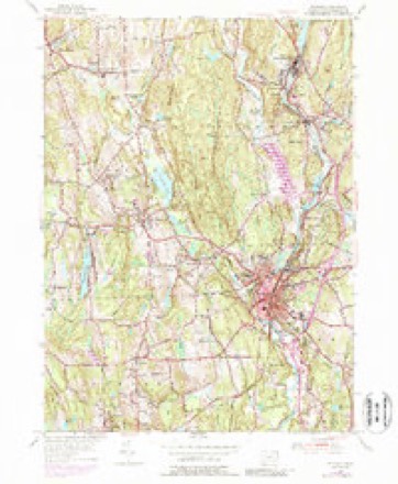
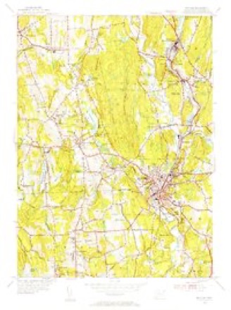
13 surveys from 29 printed sheetsMatched by testing this settlement's coordinate against the published boundary of every sheet in the United States Geological Survey's historical collection. Each opens the scanned sheet at the Survey.
- 1889 USGS Putnam quadrangle1:62500
- 1893 USGS Putnam quadrangle1:62500, 8 printings
- 1919 USGS Putnam quadrangle1:62500
- 1943 USGS Putnam quadrangle1:125000
- 1945 USGS Putnam quadrangle1:31680, 2 printings
- 1947 USGS Providence quadrangle1:250000, 5 printings
- 1948 USGS Providence quadrangle1:250000
- 1955 USGS Putnam quadrangle1:24000, 5 printings
- 1955 USGS Putnam quadrangle1:31680
- 1957 USGS Providence quadrangle1:250000
- 1958 USGS Providence quadrangle1:250000
- 1963 USGS Providence quadrangle1:250000
- 1984 USGS Providence quadrangle1:100000







In the county-history sources
50,238 words on this townshipHistory of Windham County, Connecticut, published 1880 names this settlement in its chapter on Woodstock Town. These are the passages that mention it, exactly as the scans read.
Daniel Iltint. Ilev. A. C. Thompson brought greetings from the mother church of lloxbury, and pleasant reminiscences ami congratulations were given by Reverends C P. Grosvenor, Andrew Dunning and G. N. Webber. Mr. Hunt survived for several years, a great blessing to all who knew him. The honored church father and deacon, Job Williams, died in 1863. Darius Matthewson, Es([., so prominent in ])ublic affairs and temperance work, ha<i preceded him ; and his respected sons, Deacon George and Colonel Charles B. Mattheweon, have lately followed. Not only chmch officers but churches have passed away. The Ponifret Baptist church has been absorbed into the former Branch at Putnam, and Quaker worship li;is died out A Second Advent church is niainUiined in Abington. The Episcopal church is very flourishing and enjoys the ministrations of many distinguished clergymen. Dr. Hiram Holt died in 1H70, alter a successful medical practice of nearly filly years. Pomfret's only remaining physician. Dr. Williams, has held the place many years.
Passage source: History of Windham County, Connecticut, published 1880.
A prophetic instinct would seem to have impelled Judge Sewall to give New Itoxbury the name of Woodstock, *' for the sake of Queen Klizubeth, and the notable meetings that have been held at the place bearing the name in England," for it may be doubted if any rural town in the country has witnessed more remarkable gatherings. From the day that John Eliot proclaimed the Gospel to the assembled Wabbaquasets in the face of a defiant message from King Uncas till the I'resident of the Free Ue[)ublic honored it by his presence, it has witnessed a succession of " notable meetings *' - meetings for town organization an<l secession, of preparation for revolt and adoption of Federal Constitution, martial parades and funerals, spirited raisings and dedications, Anti-masonic and Sabbath school convocations, mighty musterings of Cold Water Armies, and the great inass-meetingrt of the present generation. The first of these latter demonstrations occurred in the Fremont campaign, September, 1850, when thousands of adolescent Republicans, fired with the glow of youthful enthusiasm, met as if by spontaneous im[»ulse on Woodstock Hill to be farther electrified and inspired by t.he stirring words of llaymond and Beecher. Very difiereut was the far greater gathering
Passage source: History of Windham County, Connecticut, published 1880.
M. Lyon of Woodstock waH Major of First Regiment Cavalry, and Andrew B. Bowen captain of Company A, with some thirty men from Woodstock and towns adjacent. The Eleventh Regiment was greatly beloved in Windham County, Charles Matlhewson, Fomfret, lieutenant colonel ; Rev. George Soule, Hampton, chaplain ; Dr. James R. Whitcomb, Brooklyn, surgeon ; George W. Davis, Thompson, quartermaster sergeant The companies of Captain Clapp, Pomfret, and Captain Hyde, Plainfield, wero mostly made up from the County. Many from the south part of the County enlisted in Company G, " the Lyon Guards," Twelfth Regiment, under the veteran Captain Braley, Windham. Alexander Warner of Woodstock, went out as Lieutenant- Colonel of the Thirteenth. Windham's contribution to this regiment were mostly include<l in Company E - E. E. Graves of Thompson, firet lieutenant These soldiers received generous bounties from their respective towns and ample provision for their families, and went out hopefully to their varied post* of duty and service. After six months of military vicissitudes, culminating in the withdrawal from the siege of Richmond, the (owns were again called to raise their proportion of " three hundred thousand more.*' Eastern Connecticut responded with such alacrity that the Eighteenth Regiment raised in New London and Windham C/Ountics, though the last sunnnoned was the first to leave, August 22, 1862.* This was most especially Windham's representative regiment Colonel Ely was of Killingly parentage, Lieutenant-Colonel Nichols, a favored son of Thompson, widely known in other towns; Major Keach, a Killingly veteran. Assistant Surgeons Harrington and Hough, familiar residents of Sterling and Putnam. Captains T. K. Bates, Brooklyn, Joseph Matthewson, Pomfret, G. W. Warner, Woodstock,
Passage source: History of Windham County, Connecticut, published 1880.
Machine-read from a century-old scan, so expect the errors a machine makes: misspelled names, dropped words, stray characters.
Read the whole chapter on Woodstock Town - it names this place 168 more 168 times.
Fires near this place
109 since 1992Regional context, not property-specific evidence. The federal wildfire occurrence database lists 109 fires within 5 miles of Woodstock between 1992 and 2020, burning about 119 acres in total. 1 started naturally. 4 were recorded as arson. Distance is straight-line from the map coordinates, so a fire counted here may appear on a neighbouring settlement's page as well.
| Reported cause | Fires |
|---|---|
| Missing data/not specified/undetermined | 73 |
| Recreation and ceremony | 14 |
| Debris and open burning | 13 |
| Arson/incendiarism | 4 |
| Misuse of fire by a minor | 2 |
| Natural | 1 |
| Railroad operations and maintenance | 1 |
| Power generation/transmission/distribution | 1 |
The most recent of them, most recent first, with the day each was reported and the service that recorded it.
| Date | Cause | Size | Reported by | Name on the report |
|---|---|---|---|---|
| 22 September 2020 | Missing data/not specified/undetermined | under an acre | Connecticut Division of Forestry | 11 HOLMES STREET |
| 20 September 2020 | Missing data/not specified/undetermined | 3.5 acres | Connecticut Division of Forestry | 78 ROCK AVE |
| 19 September 2020 | Missing data/not specified/undetermined | 2.0 acres | Connecticut Division of Forestry | 1017 RIVERSIDE DRIVE |
| 5 August 2020 | Missing data/not specified/undetermined | under an acre | Connecticut Division of Forestry | 631 POMFRET STREET |
| 26 August 1995 | Arson/incendiarism | under an acre | Connecticut Division of Forestry | not named |
| 3 July 2016 | Missing data/not specified/undetermined | under an acre | Connecticut Division of Forestry | 832 ROUTE 169, WOODSTOCK |
| 14 July 1995 | Natural | 3.0 acres | Connecticut Division of Forestry | not named |
| 25 June 2012 | Debris and open burning | under an acre | Connecticut Division of Forestry | PUTNAM |
Settlements close enough to share some of these fires:
Mines and quarries near this place
5 within 5 milesRegional context, not property-specific evidence. The federal mineral resources record lists 5 workings within 5 miles of Woodstock: 4 past producers, 1 producer. 1 still produces. What was taken out: Sand and Gravel, Construction. Distance is straight-line from the map coordinates, so a quarry counted here may appear on a neighbouring settlement's page as well.
| Where | Site | Commodity | Status | Recorded |
|---|---|---|---|---|
| Kappys Gravel Pit | Sand and Gravel, Construction | Past Producer | ||
| Kaprys Gravel Pit | Sand and Gravel, Construction | Past Producer | Sedimentary | |
| Thompson Pit | Sand and Gravel, Construction | Past Producer | Sedimentary | |
| Thompson Pit | Sand and Gravel, Construction | Past Producer | ||
| Townfarm Road Pit | Sand and Gravel, Construction | Producer |
Storms near this place
29 since 1995Regional context, not property-specific evidence. The National Weather Service names Woodstock in 29 storm reports between 1995 and 2025: 19 thunderstorm wind, 6 hail, 1 lightning, 1 flood. The reports record 2 injuries. Each account below is quoted exactly as the forecast office filed it, from the NOAA Storm Events Database, and each date opens the federal record of that event.
| When | Event | Place named | Harm | What the report says |
|---|---|---|---|---|
| August 2004 | Lightning | Woodstock | 2 hurt | no account filed |
| August 2016 | Thunderstorm Wind | Woodstock | $30,000 | A tree on Sprucedale Road was downed onto wires by thunderstorm winds. Trees and a utility pole were downed on East Quasset Road. |
| February 2016 | Thunderstorm Wind | Woodstock | $15,000 | Multiple trees on Route 171 in Woodstock were downed by thunderstorm winds. |
| June 2013 | Flash Flood | West Woodstock | $15,000 | A house on Spring Hill Road has eighteen inches of water in the basement with water still rising. |
| June 2006 | Thunderstorm Wind | Woodstock | $15,000 | no account filed |
| May 2018 | Thunderstorm Wind | Woodstock | $5,000 | At 4:40 PM EST, siding was blown off the Woodstock Academy school building on Academy Road in Woodstock. |
| June 2011 | Thunderstorm Wind | Woodstock | $5,000 | Trees and wires along Harrisville Road were downed by thunderstorm winds. |
| June 2010 | Thunderstorm Wind | Woodstock | $5,000 | Trees along Route 171 were downed by thunderstorm winds. |
| August 2005 | Thunderstorm Wind | Woodstock | $5,000 | no account filed |
| September 2023 | Thunderstorm Wind | East Woodstock | $2,000 | In Woodstock, there were several trees down on Dugg Hill Rd. |
| August 2002 | Thunderstorm Wind | Woodstock | $2,000 | no account filed |
| July 2021 | Thunderstorm Wind | North Woodstock | $1,000 | In Woodstock, multiple trees were down on Brickyard Road. |
| July 2019 | Thunderstorm Wind | South Woodstock | $1,000 | Broadcast media reported trees, limbs, and wires down on East Quasset Road and Route 171 in Woodstock, CT. |
| August 2019 | Thunderstorm Wind | West Woodstock | $1,000 | In Woodstock, a large tree and wires were down near the intersection of Route 197 and Brickyard Road. |
| October 2020 | Thunderstorm Wind | Woodstock | $800 | In Woodstock, a tree and wires were down on Route 169. |
| June 2021 | Thunderstorm Wind | West Woodstock | $500 | In Woodstock, a tree was down on Child Road. |
| July 2025 | Thunderstorm Wind | Woodstock | $50 | In Woodstock, a large tree limb was down on Roseland Park Rd. |
| June 2023 | Hail | North Woodstock | - | In Woodstock at 438 PM EDT (338 PM EST), a trained spotter reported nickel size hail. |
| July 2019 | Hail | West Woodstock | - | Dime size hail was reported in Woodstock near Route 197 and Child Road. |
| August 2018 | Tornado (EF0) | North Woodstock | - | An EF-0 tornado, with wind speeds estimated at 80 mph, touched down on Redhead Hill Road in northern Woodstock and traveled just over 5 miles on a discontinuous path before lifting up in the Quinebaug portion of Thompson. It was only 8 yards wide. It sliced a single, healthy oak tree in half and flattened small portions of two separate corn fields on Redhead Hill Road in Woodstock. The corn was laid down in differenet directions. A woman saw swirling of trees and other debris as it occurred, despite it being enshrouded in rain. Isolated tree damage also was spotted on Watson Road, near Green Acres Lane, in Quinebaug. The tornado lasted from 936 AM EDT to 945 AM EDT. |
| May 2014 | Hail | Woodstock | - | Dime size hail fell from 2:46pm to 2:49pm, then nickel to quarter size hail fell. |
| March 2010 | Flood | Woodstock | - | Four to eight inches of rain fell across Windham County resulting in several small streams rising above flood stage, including the Mount Hope River at Warrenville and the Quinebaug River at Quinebaug. Wappoquia Brook ran over its banks at Route 169 in Pomfret, resulting in flooding near the Connecticut Audubon Society. Also in Pomfret, Mashamoquet Brook flooded. The Moosup River overflowed its banks in Plainfield, closing South Main Street. |
| October 2007 | Thunderstorm Wind | Woodstock | - | In the area of Route 169 and Woodstock Road, numerous trees were downed by thunderstorm winds. |
| July 1995 | Thunderstorm Wind | Woodstock | - | Trees were blown down in several parts of town. |
| May 2013 | Hail | Woodstock | - | no account filed |
| July 2006 | Hail | Woodstock | - | no account filed |
| June 2000 | Thunderstorm Wind | Woodstock | - | no account filed |
| July 1999 | Thunderstorm Wind | Woodstock | - | no account filed |
| May 1997 | Hail | Woodstock | - | no account filed |
Nearest settlements
The eight closest, with where each one stands in the county. Distances are straight-line, computed from the Geographic Names Information System coordinates.
| Map | Place | Distance | Sheets |
|---|---|---|---|
| Roseland Park | 1.0 miles | 29 | |
| South Woodstock | 1.0 miles | 29 | |
| Quasset Lake | 1.9 miles | 29 | |
| East Woodstock | 2.4 miles | 29 | |
| Harrisville | 2.5 miles | 29 | |
| North Woodstock | 3.1 miles | 29 | |
| West Thompson | 3.3 miles | 29 | |
| Massomuck (historical) | 3.6 miles | 29 |
Provenance
This settlement is recorded in the Geographic Names Information System as feature 212261. The sheet list is computed by point-in-boundary test against the United States Geological Survey's historical topographic inventory. Both are works of the United States government and carry no copyright under 17 U.S.C. 105.
Wildfire. Short, Karen C. 2022. Spatial wildfire occurrence data for the United States, 1992-2020 [FPA_FOD_20221014]. 6th Edition. Fort Collins, CO: Forest Service Research Data Archive. https://doi.org/10.2737/RDS-2013-0009.6 Collected with United States Government funding and usable without additional permissions or fees.
Mines and quarries. USGS Mineral Resources Data System (MRDS) https://mrdata.usgs.gov/mrds/ A work of the United States government, no copyright under 17 U.S.C. 105.
Storms. NOAA National Centers for Environmental Information, Storm Events Database https://www.ncei.noaa.gov/stormevents/ A work of the United States government, no copyright under 17 U.S.C. 105. Narratives are quoted verbatim from the National Weather Service report and are not edited or summarised.